Rounds of Storms for the Southeast

In addition to the hot temperatures across the Southern and southeastern United States, there is a consistent threat of severe thunderstorms as we head through the week. On Monday, strong thunderstorms moved across the Gulf Coast, dumping some decent totals. This is in the forecast again on Tuesday.
OVERNIGHT
With the loss of daytime heating, storms will continue to taper off, but as the frontal boundary lingers, we have another chance of storms on Wednesday afternoon. Heavy rain will also be a concern as these storms continue.
WEDNESDAY
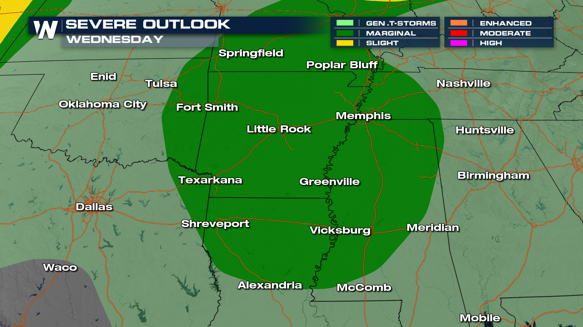
On Wednesday, as the main front starts to push through, portions of Arkansas, Mississippi, and Louisiana along the Mississippi River are under a MARGINAL (level 1 out of 5) risk for severe thunderstorms, mostly a damaging wind threat.
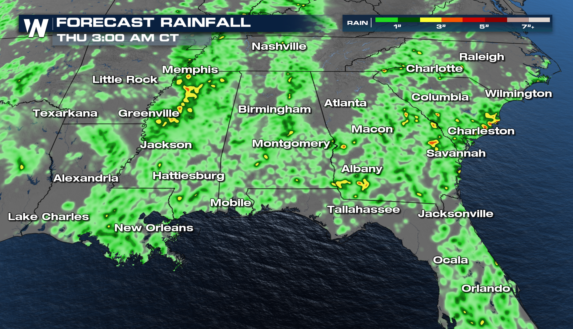
Locally heavy downpours are possible, which could overwhelm some saturated soils. Flash flooding will be possible, with multiple shots at storms.
For more on this forecast, be sure to join us at :10 past the hour during your east regional forecast.


