Multiple Days of Severe Weather For The Plains

WHAT TO EXPECT
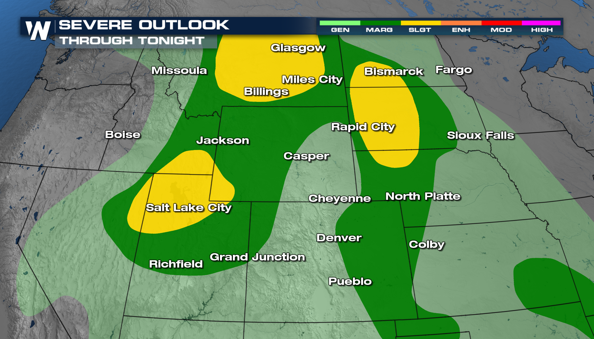
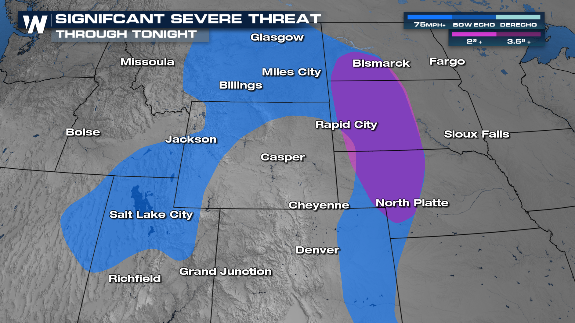
A strong ridge of high pressure is bringing heat to the south. Storms will develop around this ridge, bringing rounds of severe weather across the plains. Daily storm chances will occur, with the main concerns being damaging winds, large hail, and even a few tornadoes. Through tonight, the severe risk continues from Billings to Bismarck and down into Salt Lake City. There is a significant severe threat tonight and on Monday, meaning some storms could produce wind gusts of 75+ mph and hailstones up to 2 inches!
TIMING:
The best timing for severe storms will be in the afternoon and evening hours with diurnal heating. Some storms may have enough fuel to linger into the overnight hours. Some of these storms will also produce localized periods of heavy rain.
CONVECTIVE OUTLOOKS:
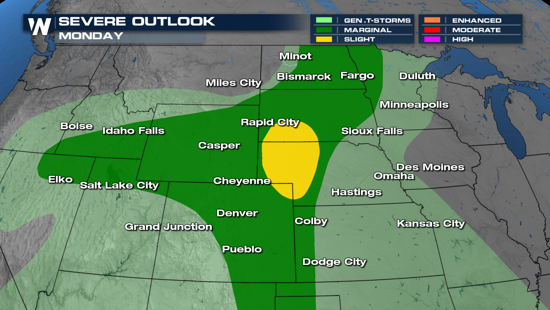
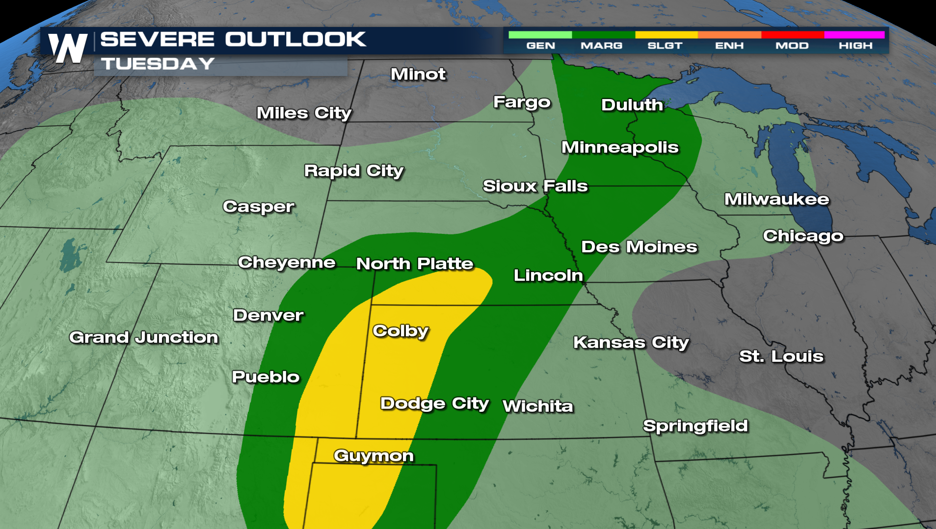
The severe chance continues on Monday and again on Tuesday. Once again, damaging winds and large hail will be the main concerns with anything that develops.
 For more info on the central regional forecast, tune into WeatherNation at :30 past the hour, every hour.


