After Historic Flooding, Flood Risk Moves West Saturday

TEXAS HILL COUNTRY - Life-threatening flooding has been hitting portions of the Edwards Plateau and Texas Hill Country the last several days, amounting to rainfall totals around 2 feet for the region.
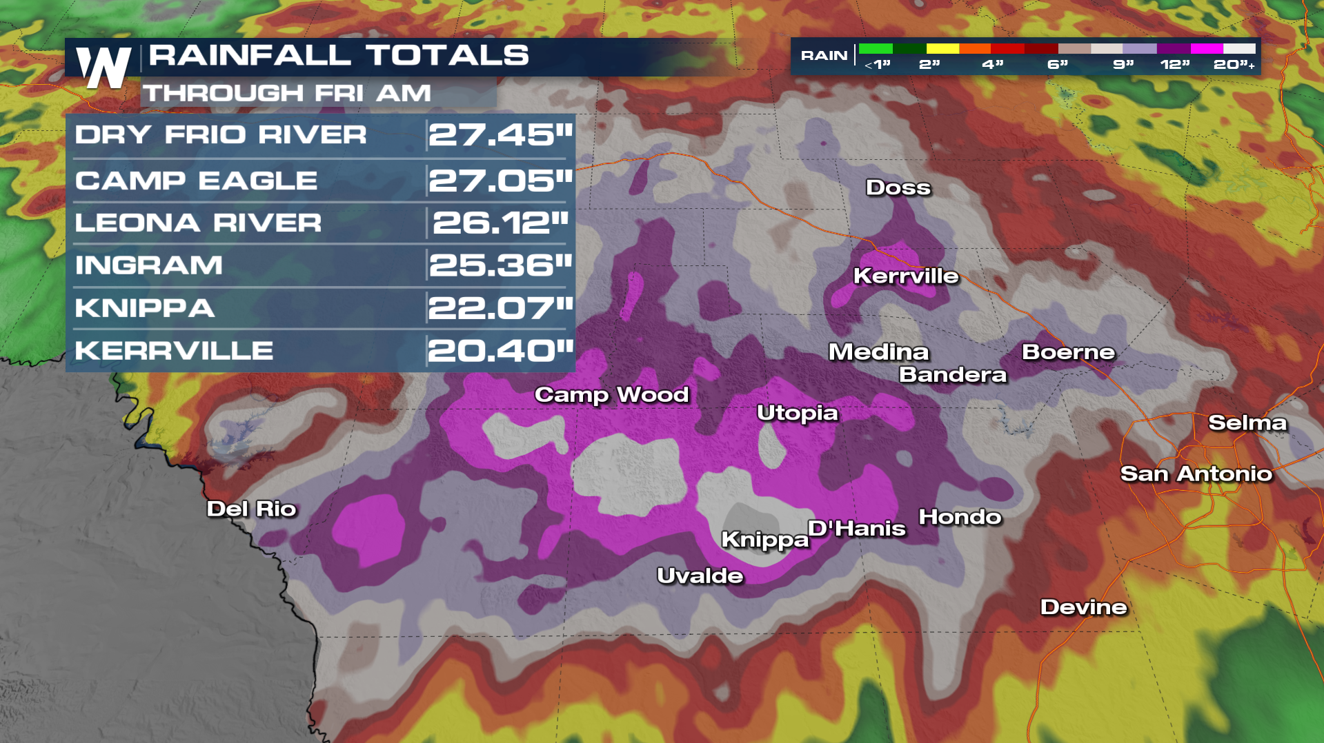
The result of this flooding has caused rivers to crest at major flood stage, including the Cibolo Creek in Boerne on Wednesday, which reached a record crest at 22.63 feet. The previous highest was 19.83 feet in May 2015.
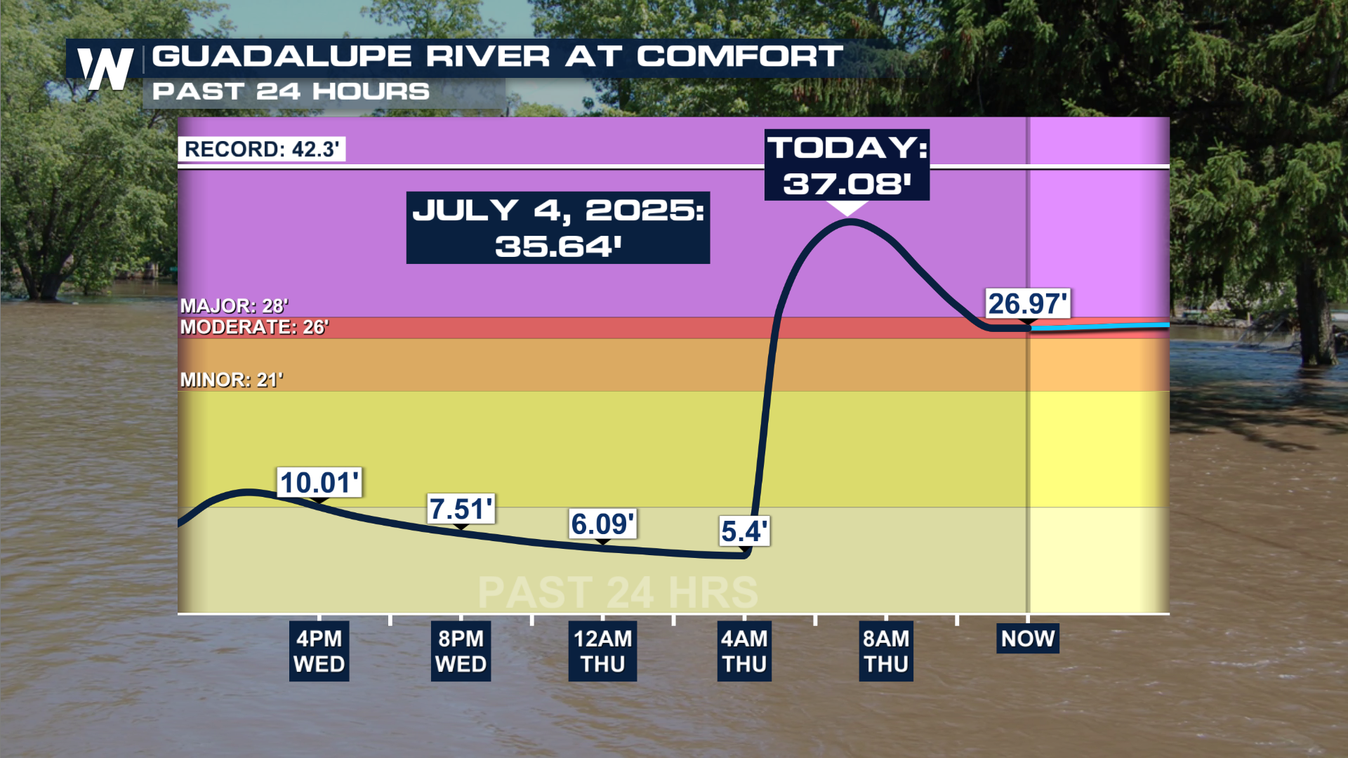
Thursday morning saw a huge jump on the Guadalupe River at Comfort, the same gauge that jumped over 30 feet in an hour on July 4th, 2025. It crested higher in 2026 than in 2025, reaching 37.08', as flash flood emergencies were issued again for Kerrville and the Guadalupe.
What's causing all the rain?
A moisture-rich weather pattern has brought multiple rounds of thunderstorms over many of the same locations. The unsettled pattern has been fueled by a persistent flow of tropical moisture from the Gulf, combined with weak steering currents in the atmosphere. Because winds aloft are relatively light, thunderstorms will move slowly and may repeatedly track over the same areas. This process, known as training, can produce excessive rainfall totals in a short period of time and quickly overwhelm creeks, rivers, and drainage systems.
Who is most vulnerable?
Some of the greatest concerns remain focused on the Texas Hill Country, where steep terrain and fast-responding waterways make the region especially susceptible to flash flooding. Even a few hours of intense rainfall can cause water levels to rise rapidly, creating dangerous conditions for motorists and residents near streams and low-water crossings. Locations that have already received recent rainfall will be more vulnerable because saturated soils have a reduced ability to absorb additional water.
Forecast, Alerts, and Outlooks
Flood Watches will expire this evening across Texas. However, scattered storms are in the forecast for tonight and for Saturday. Thankfully, the flood risk will decrease for the weekend. However, the grounds in Texas are so saturated and it will not take much from pop shower or storm to cause some flooding issues even if it is minor. It is important to remember TURN AROUND AND DON'T DROWN.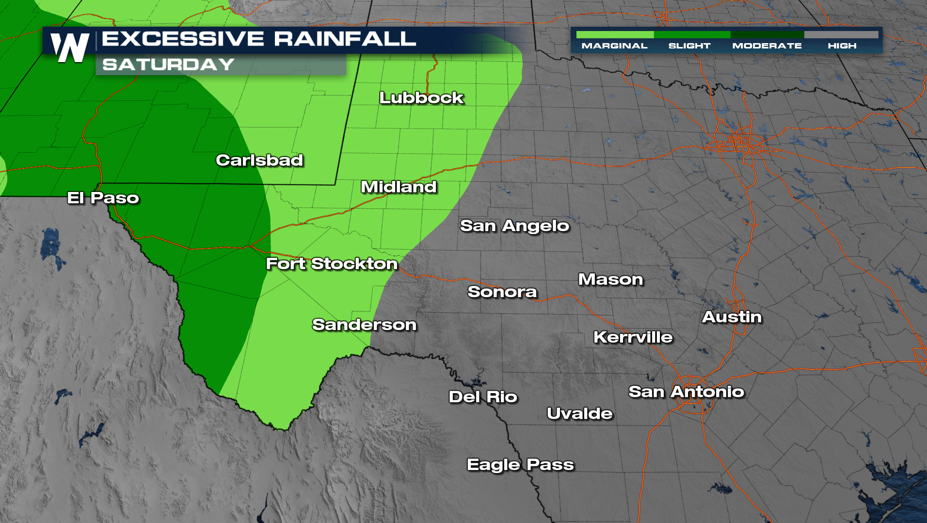
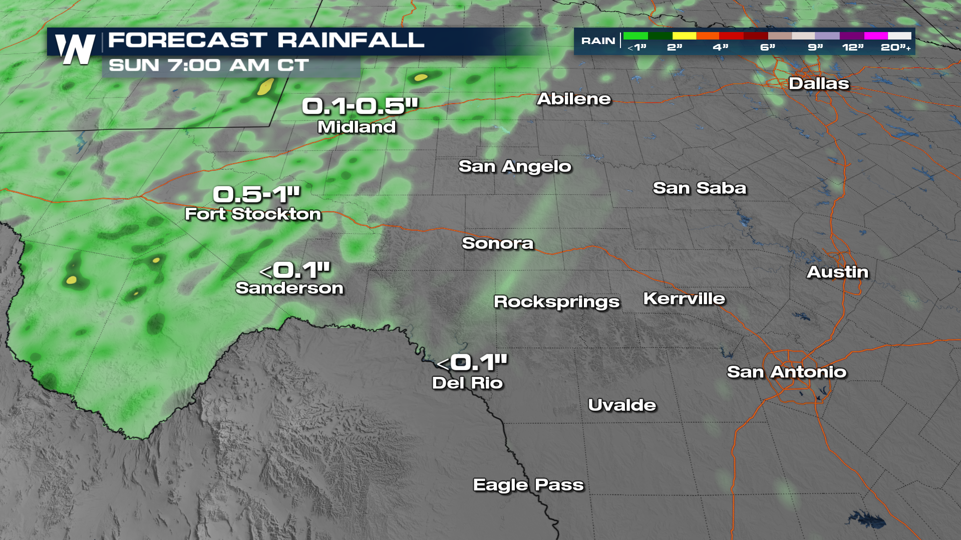
As the flooding threat is ending, the heat is expected to ramp up heading into next week. Something to keep in mind as residents continue to clean up after the catastrophic flooding. 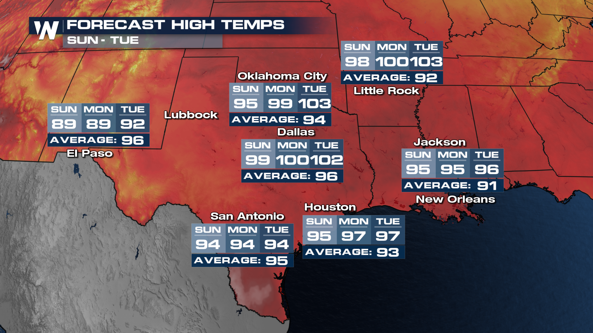
For more info on this forecast, you can tune into the Central Regional Forecast at :30 past the hour.


