Tropical Moisture Brings Increased Flood Risk

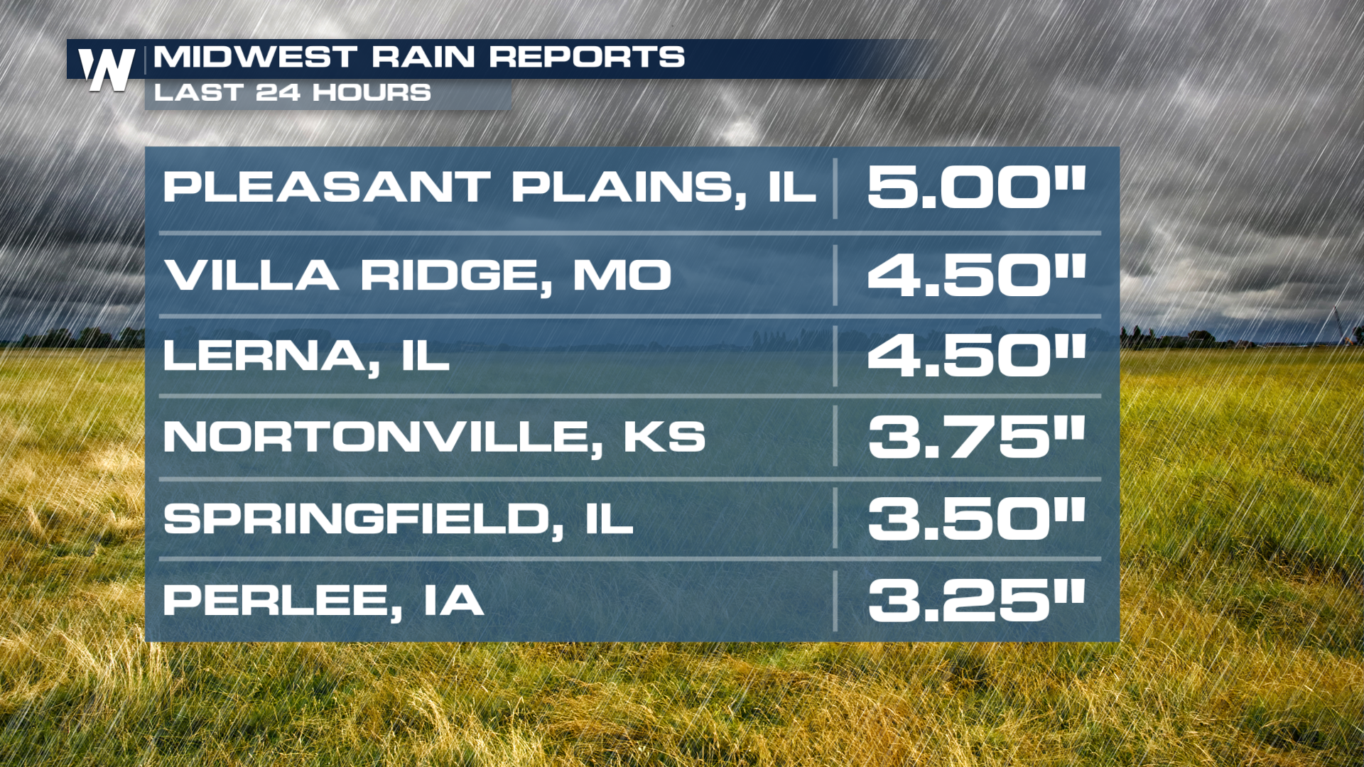
With multiple rounds of heavy downpours across the Plains, we were able to see totals that got up to 5" in 24 hours! These areas have already been inundated with so much rain over the last few days that flooding has played a major role in the forecast.
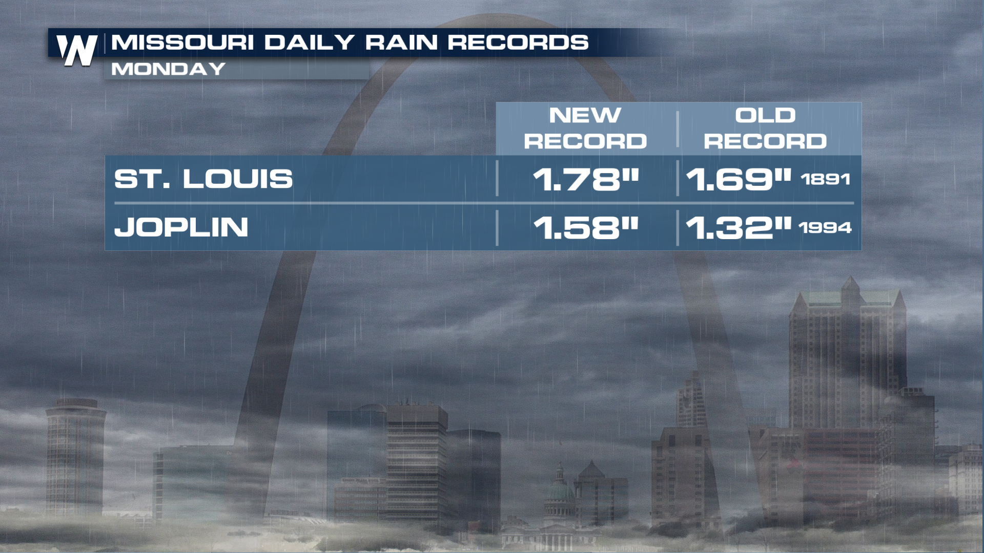
We even broke some daily rainfall records out in Missouri on Monday.
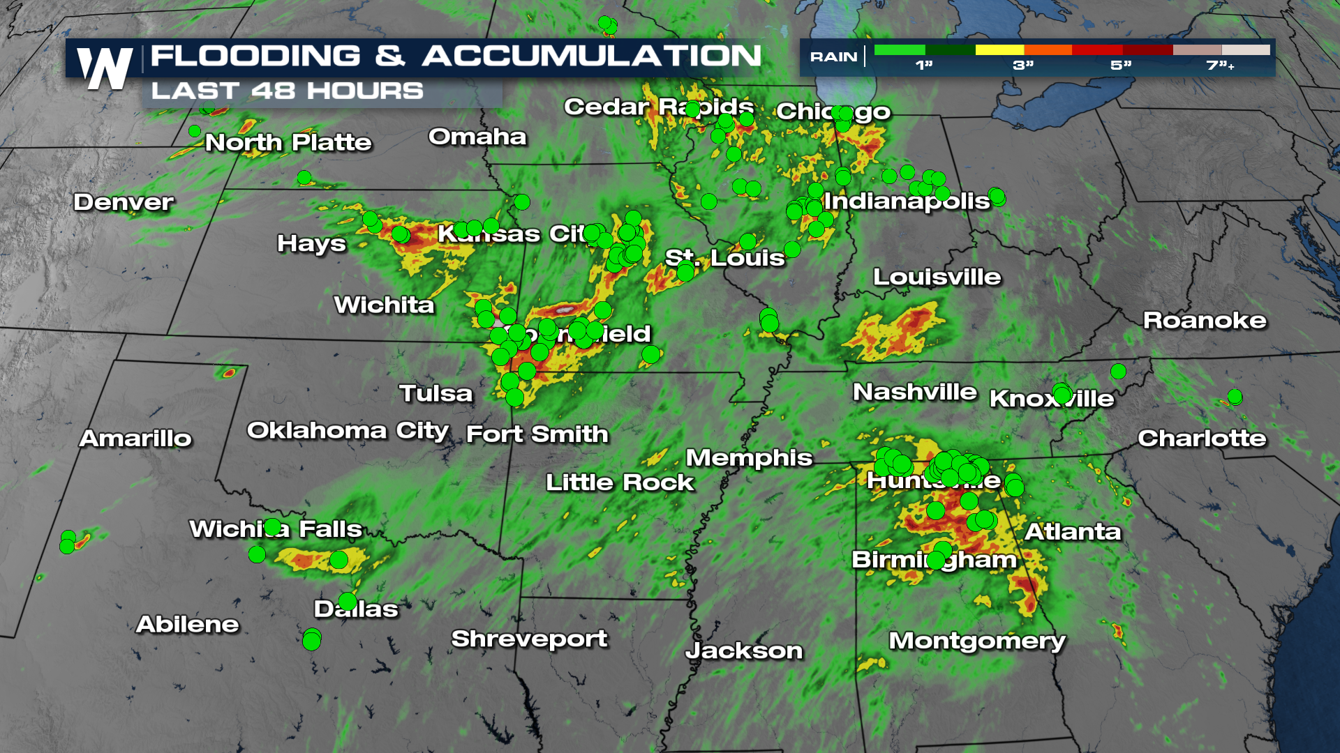
FLOOD THREAT
There were a multitude of flood reports all across the Midwest and even the Deep South. That same tropical moisture is expected to dump out even more rain across these same vulnerable areas. Flash flood watches remain in place over the next few days. (above).
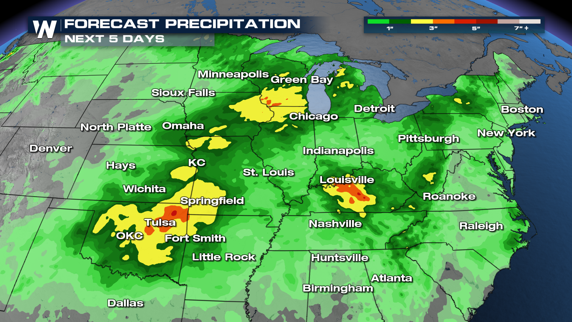
The Weather Prediction Center has issued Excessive Rainfall outlooks through Friday for heavy rain. This graphic means areas highlighted can experience flooding, including torrential downpours and flash flooding. Never attempt to drive through flood waters. Always turn around.
Stay tuned for the latest on your forecast here on WeatherNation! We're streaming live on YouTube so all of the information you need is right at your fingertips! Come on in and join the conversation, we'll keep you weather aware!


