Severe Storms Repeat Daily Across the Plains

Severe storms developed today, as a particularly dangerous situation unfolded across the Northern Plains. The Storm Prediction Center issued this PDS for large hail and damaging winds up to 100 mph. Sunday, there were multiple hail reports of 3-inch hailstones or greater, with Redig, SD, seeing hailstones up to 3.25"!
OVERNIGHT
The Storm Prediction Center (SPC) has issued a Moderate risk for severe weather across the northern plains through the overnight hours. Minot and Hettenger are at moderate risk for storms, meaning these areas will have the best chance of seeing large hail and damaging winds.
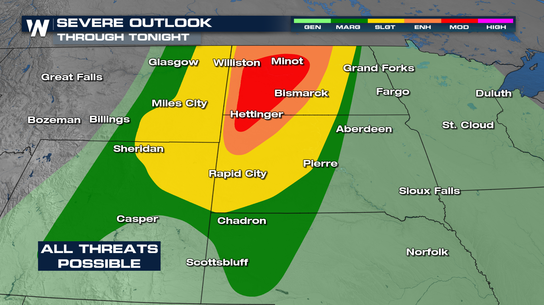 All threats will be possible with these storms. There are even a few areas highlighted for significant winds and significant hailstones.
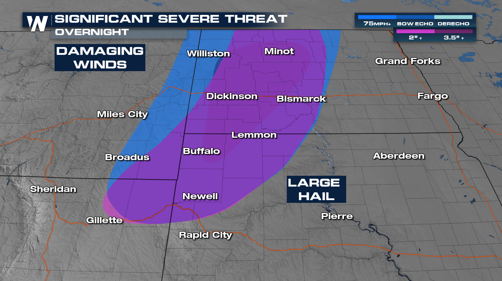 A few storms will hold together through the overnight hours. Damaging winds, large hail, and tornadoes will all be possible. Over the next few days, the severe threat continues across the plains.
Monday
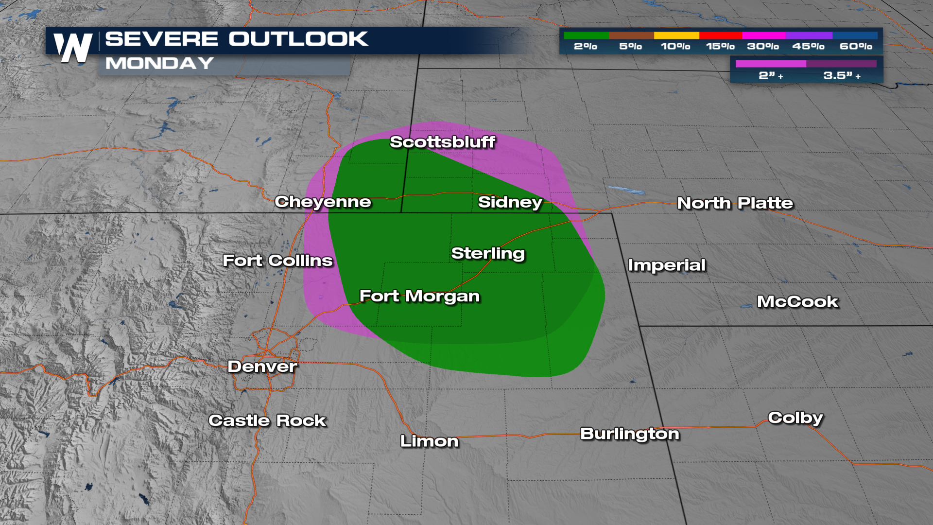
A Marginal to Slight risk has been added for Monday. The main location for these storms is across the central plains, where the storms ride around a ridge of high pressure.
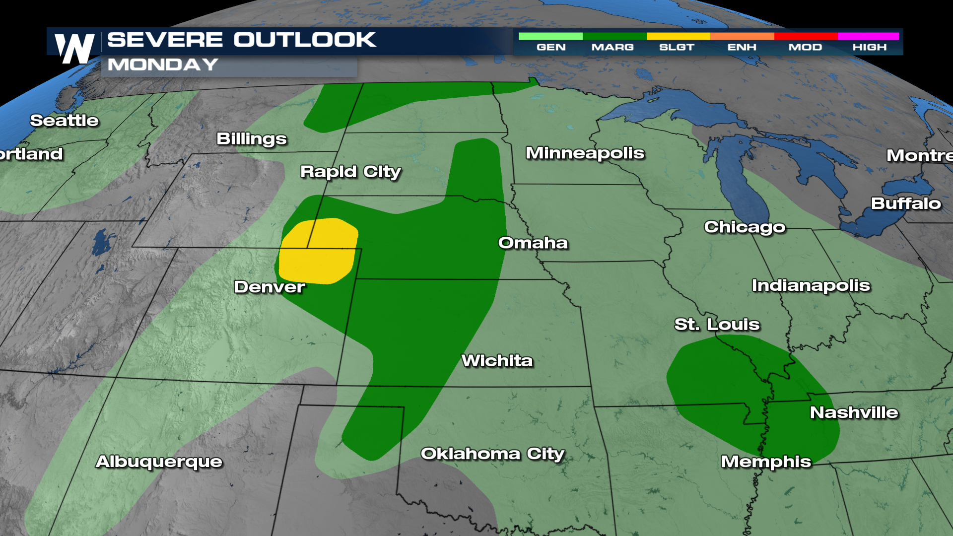 Isolated tornadoes and significant hailstones are possible across Colorado, Wyoming, and Nebraska.
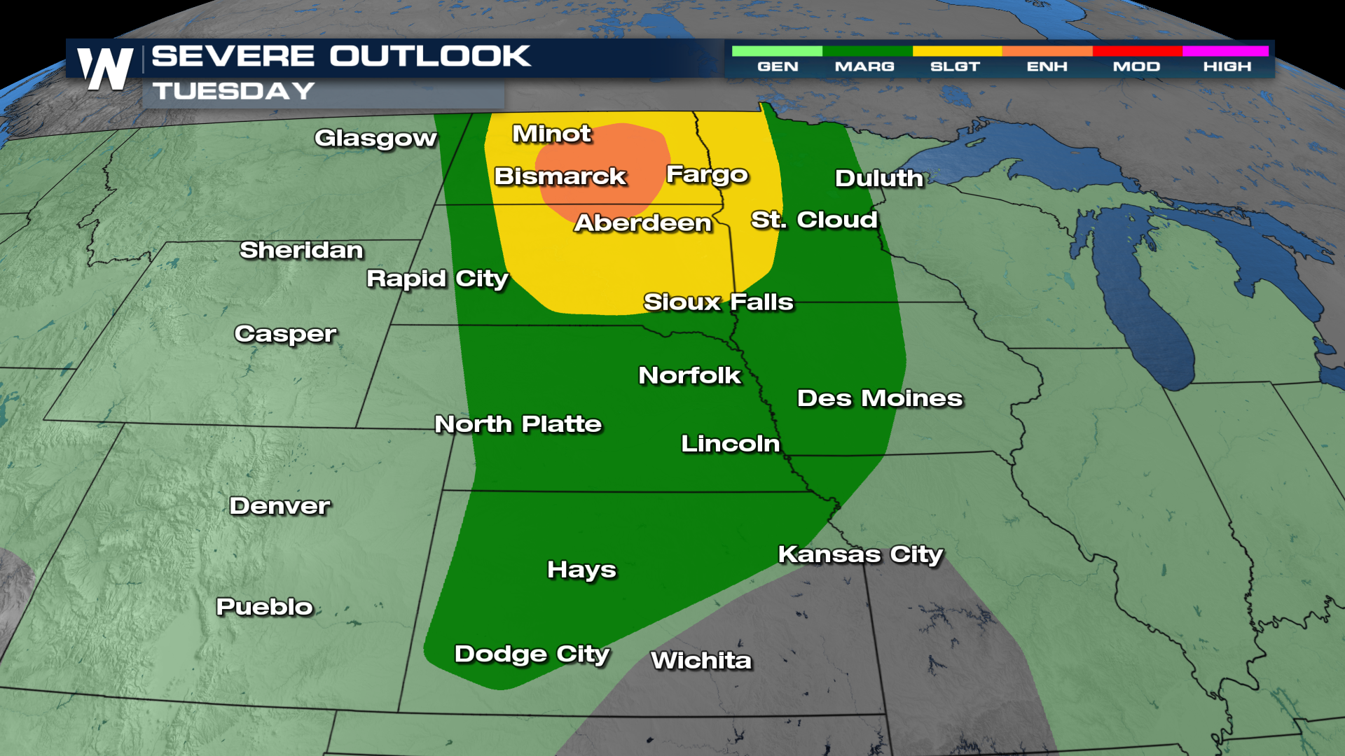
 Tuesday
There is already an enhanced risk for North Dakota on Tuesday.
 More on this forecast can be found :30 past the hour on WeatherNation.


