Tropical Moisture to Raise Flooding and Severe Concerns Across Central and Southern U.S.

A surge of tropical moisture streaming north from the Gulf is expected to bring an increased risk of severe thunderstorms and flooding across parts of the central and southern United States through the weekend and into next week. The combination of hot temperatures, humid air, and a slow-moving weather pattern will create favorable conditions for repeated rounds of showers and thunderstorms, some of which could become severe.
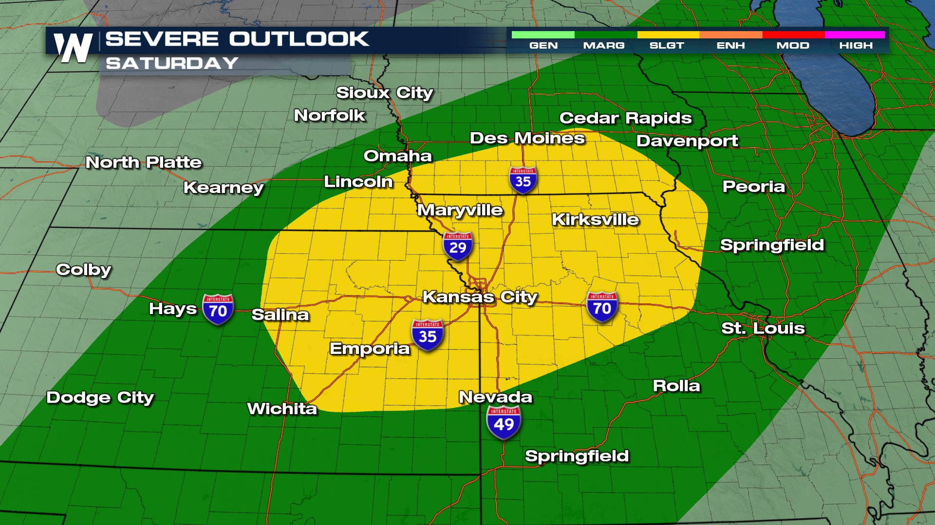
The threat for strong to severe storms is expected to develop across portions of the Plains, Midwest and South. Storms may be capable of producing damaging wind gusts, large hail and a few tornadoes, especially during the afternoon and evening hours when instability is at its peak. The abundant moisture in the atmosphere will provide plenty of fuel for storm development.
While severe weather is a concern, flooding could become the more significant and widespread threat. Slow-moving storms and repeated rounds of heavy rainfall may lead to flash flooding, particularly in areas that have already received recent rain. Rainfall rates could be intense at times, causing water to quickly accumulate on roads, in low-lying areas and near small streams and creeks.
The unsettled weather pattern is expected to persist into the middle of next week as a stalled frontal boundary remains in place across parts of the region. This setup could allow thunderstorms to repeatedly move over the same locations, increasing the potential for several inches of rain to fall in a relatively short period of time.
 Residents across the central and southern U.S. are encouraged to stay weather aware in the coming days, especially in flood-prone areas. With both severe storms and heavy rainfall possible, conditions could change quickly, and additional watches and warnings may be issued as the event unfolds.
Tune into WeatherNation TV on youtube for the lastest!


