Numerous Tornadoes Tear Across the Midwest

The Midwest has been dealing with several rounds of severe storms this week, with widespread damaging winds in Chicago, Illinois, and surrounding areas on Wednesday from a derecho. Thursday was another incredibly active day, starting with a powerful bowing segment in Iowa that produced gusts to 90 mph! By Thursday afternoon, numerous strong tornadoes formed in Illinois before tracking into Indiana.
Thursday
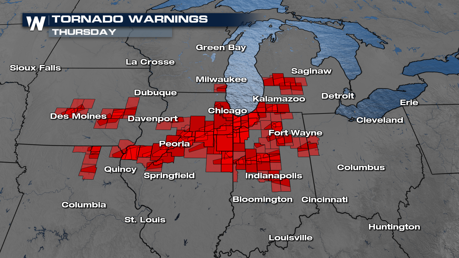
The Storm Prediction Center issued a MODERATE (level 4 out of 5) risk for severe thunderstorms on Thursday, and the forecast appears to have verified with numerous reports of intense winds and tornadoes across Illinois, Indiana, Wisconsin, and Michigan. Tornado warnings are in the image above, with many warnings verified. A loop of the radar from Chicago (KLOT) shows numerous confirmed tornado warnings, and even a tornado emergency (purple polygon).
Storm surveys will need to be completed to determine the strength of these tornadoes, though on appearance and damage alone, it seems like these were intense (EF2 and above). We will keep you updated on damage surveys as they are conducted. A few surveys are now coming in and Streator, Illinois has received a rating of EF-3.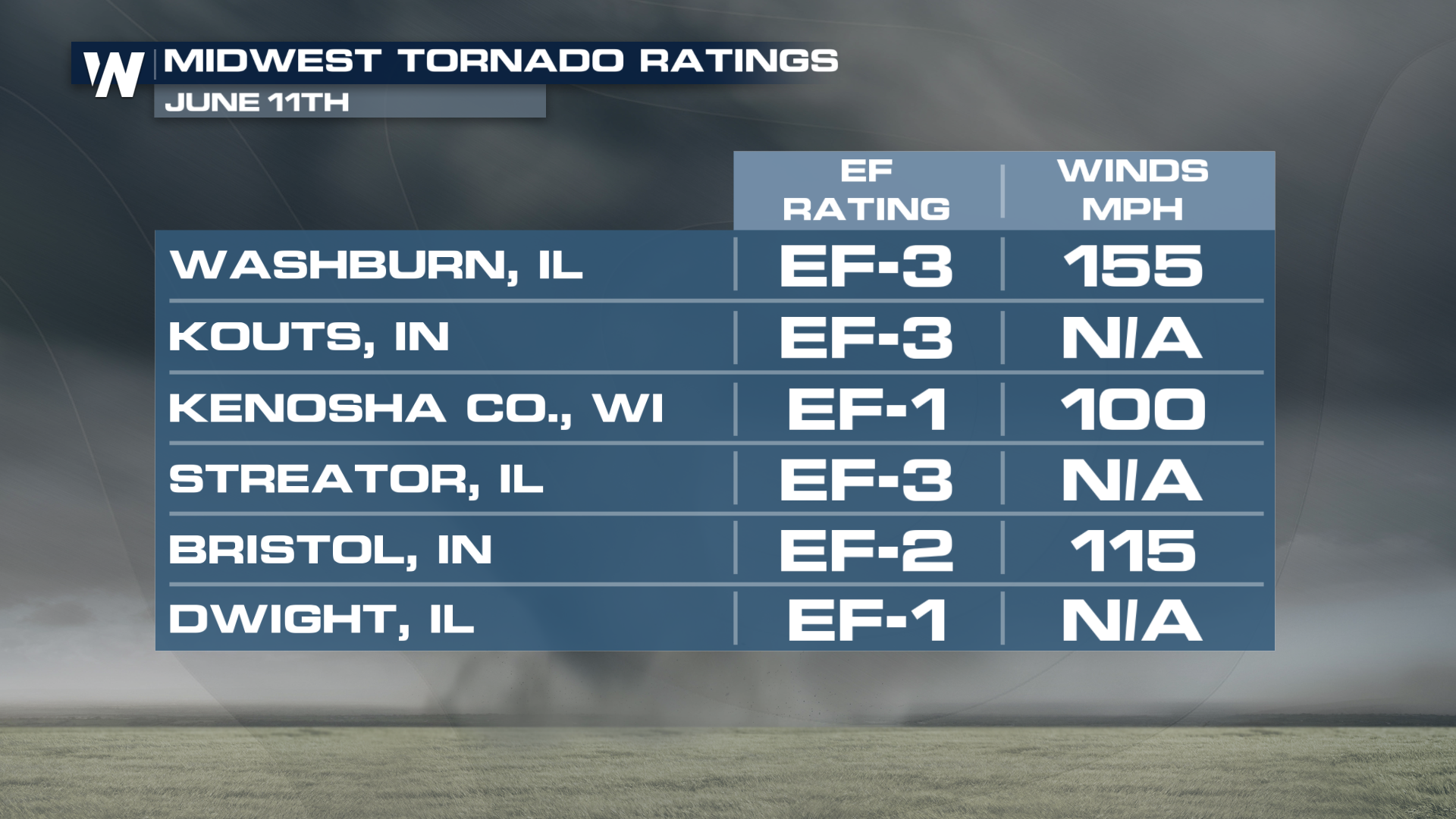
Wednesday
Damaging storms moved through the Chicago area on Wednesday as well, producing winds of up to 70-80 mph. Gusty winds across the Midwest were causing issues on Wednesday, from Iowa through Michigan. The SPC has confirmed this event was a derecho.


