NOAA Releases Summer Outlook, Above Average Temperatures Expected

The National Oceanic and Atmospheric Administration (NOAA) released several important seasonal outlooks today, including their expectations for the upcoming Atlantic Hurricane Season. Hurricane season and summer are expected to be impacted by a burgeoning El Niño, which could be very strong through much of the second half of 2026.
Among the new outlooks issued are the seasonal forecasts for meteorological summer, which runs from June through August. NOAA is expecting much of the lower 48 to experience above-average temperatures (top of page), with higher confidence across the Western U.S. The Midwest and parts of the middle Mississippi Valley have an even chance for above or below-average temperatures.
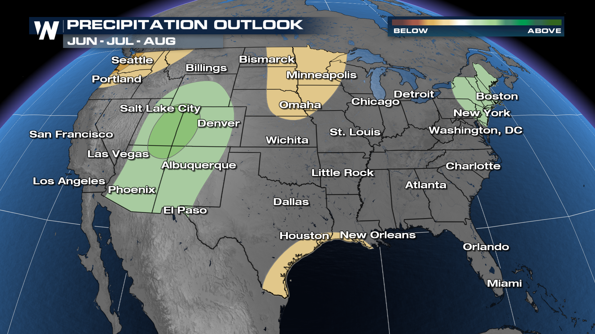
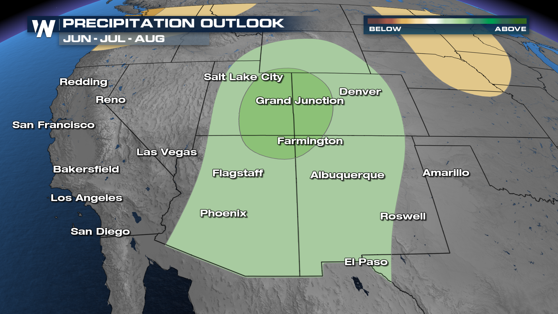
Much of the country is forecast to have near-normal rainfall for meteorological summer, but a few areas are favored for below-average precipitation. These include the Texas Gulf Coast, Upper-Midwest, and the Pacific Northwest. In contrast, the Northeastern U.S. is slightly favored to see above-average precipitation. There is some confidence in parts of the Four Corners region having above-average rainfall, indicating the Climate Prediction Center expects an above-average monsoon season.
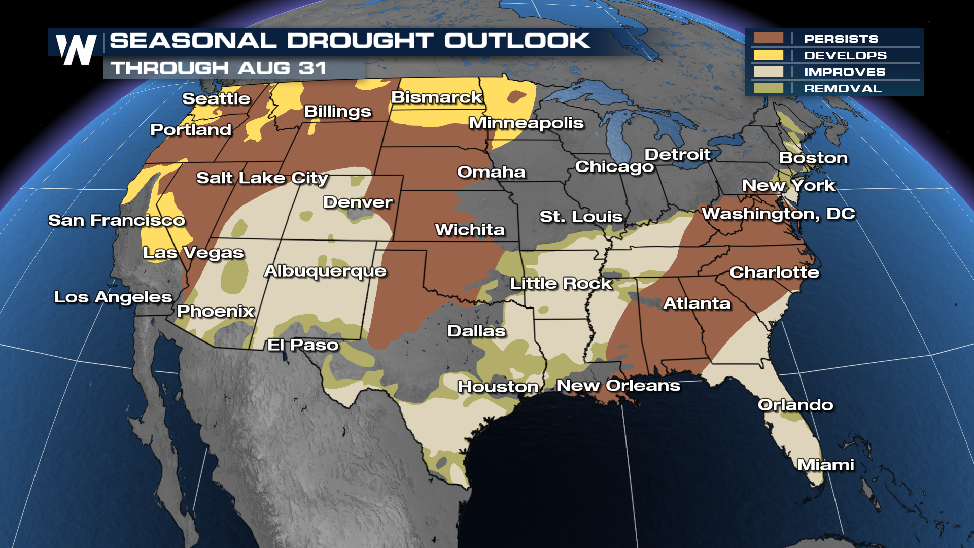
Not surprisingly, the forecast rainfall in the Four Corners could lead to drought improvement, which is expected in the seasonal drought outlook (above). Drought is also expected to improve in Florida, parts of Texas, and the lower Mississippi Valley. Drought is expected to expand or develop from California through Minnesota.
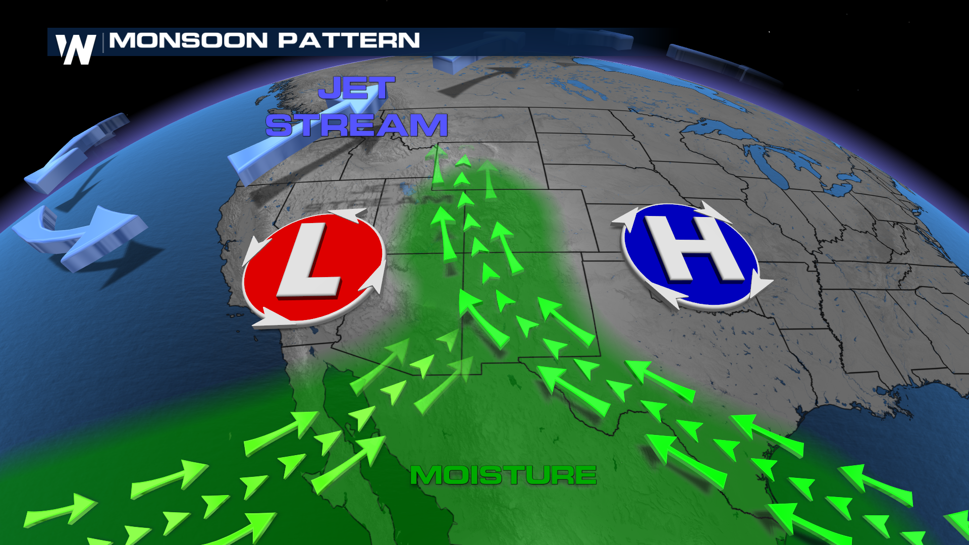
The North American Monsoon (NAM) develops in Mexico in June and shifts north into the Four Corners, Great Basin, and California into July, August, and September. More data is needed to understand any correlation between El Niño and the NAM, but tropical systems tend to be more active in the Eastern Pacific during El Niño years. Remnants of these systems can greatly increase rainfall during the NAM.