Significant Severe Weather Threatens Again Wednesday

On the heels of an active opening week to Meteorological Spring, another threat of severe weather will be in the cards yet again for Wednesday. With plenty of unstable air to tap into, as this system chugs East, the threat for severe weather persists. The Storm Prediction center has issued a SLIGHT (level 2 out of 5) risk for severe weather from the Great Lakes to the Gulf Coast.
Hail is another big concern. More widespread, 1" in diameter hail is possible, but many locations could also encounter 2" in diameter hailstones Tuesday. Some portions of Texas and Illinois have already seen hailstones over 3.5", which is in between the size of a softball and teacup.
RELATED ARTICLE: Destructive Tornadoes, Hail Rip Through Central U.S.
A SLIGHT (level 2 out of 5) risk remains in place following the cold front through tonight.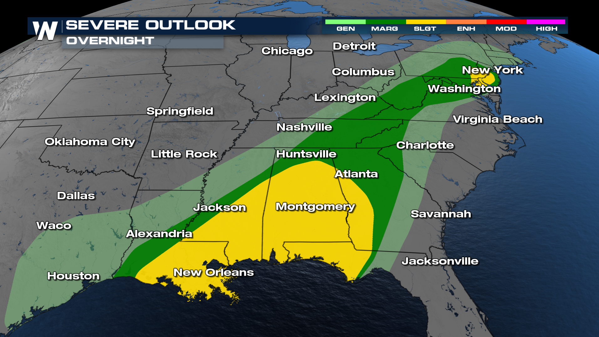
During the overnight, a tornado risk remains in place especially across the Gulf Coast. Have a few ways to receive alerts to wake you up if warnings are issued.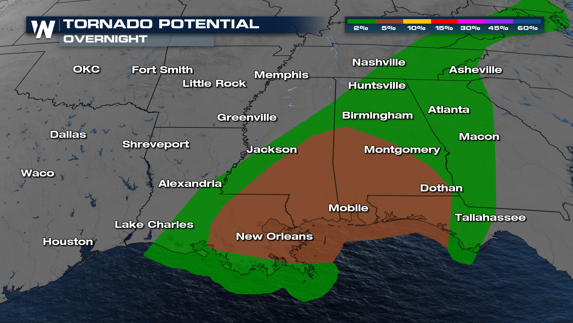
The threat for severe weather continues Thursday morning as the squall line moves through the Carolinas and Georgia. The biggest threat will be damaging winds.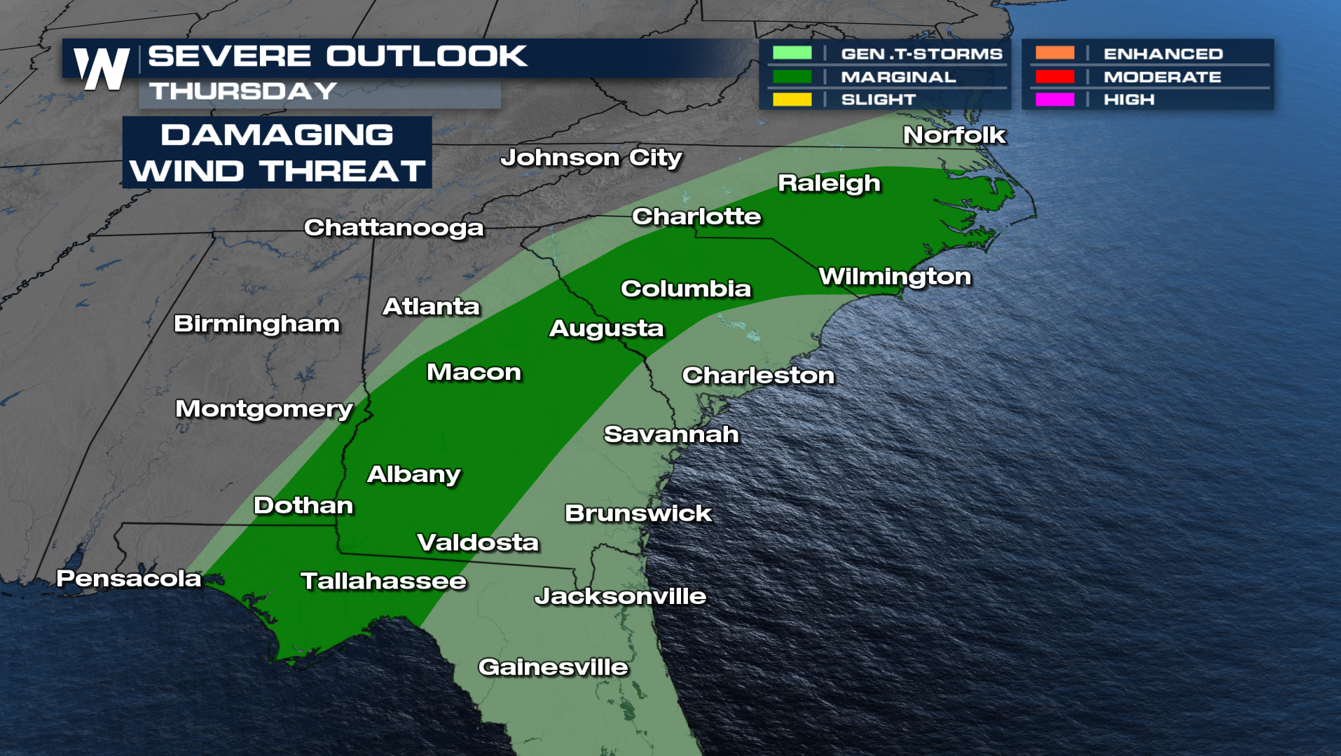
Tune in to WeatherNation live for the very latest.


