Deadly Storm System Moves East, Elevated Tornado Risk Continues

A series of powerful low pressure system has spawned several violent tornadoes over the last few days. Parts of Oklahoma and Michigan, and potentially Arkansas, saw significant impacts form tornadoes, including multiple deaths. More information about these tornadoes and their ratings can be found here.
OVERNIGHT
Storms continues to keep pushing eastward across the South tonight. The biggest threat will be wind and hail especially in Texas. Along with the severe threat will be flash flooding. As the sun has already set, it is very difficult to judge if you can drive through flood waters. Please REMEMBER TURN AROUND AND DON'T DROWN. The atmosphere has lots of moisture to be squeezed out in showers and storms.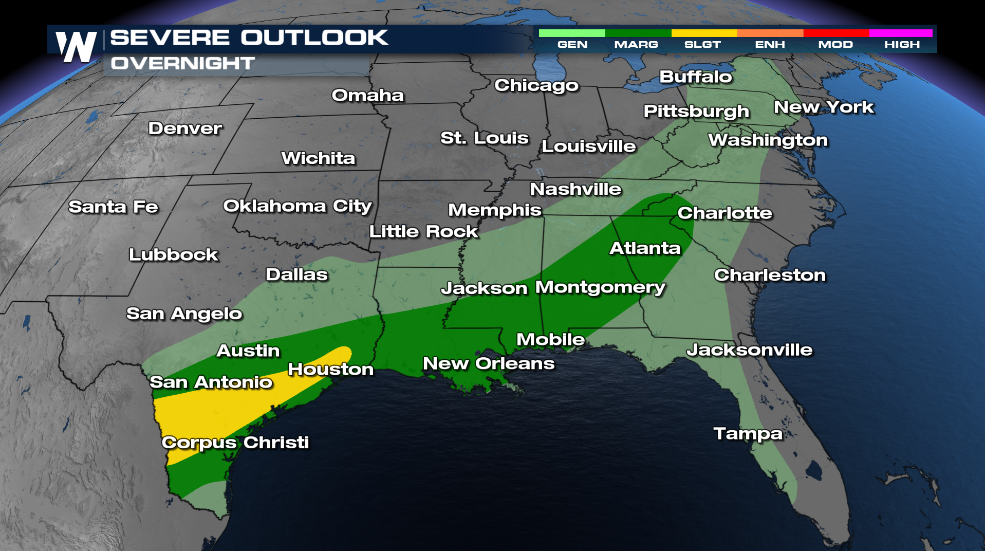
Sunday could also see a few strong storms from North Carolina to the Gulf Coast.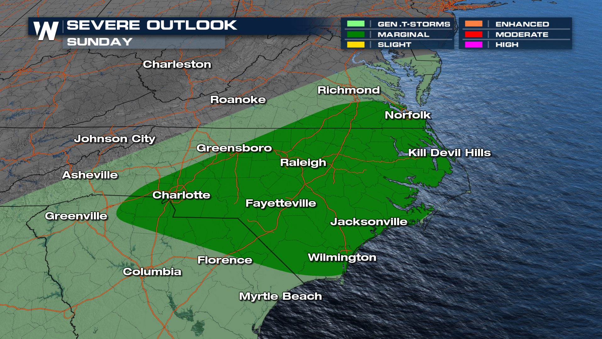
Have multiple ways to get severe weather warnings in the afternoon and evening hours. Brush up on your severe weather plan with SEVERE WEATHER AWARENESS WEEK


