Severe Storms Target the Southeast on Saturday

Top Stories
4 Jan 2026 3:00 AM
After colder air settles into the Southeast earlier this week, warmer temperatures will briefly return ahead of an approaching storm system, setting the stage for severe weather.
Here are some of the hail reports from Saturday's storms along the Gulf Coast.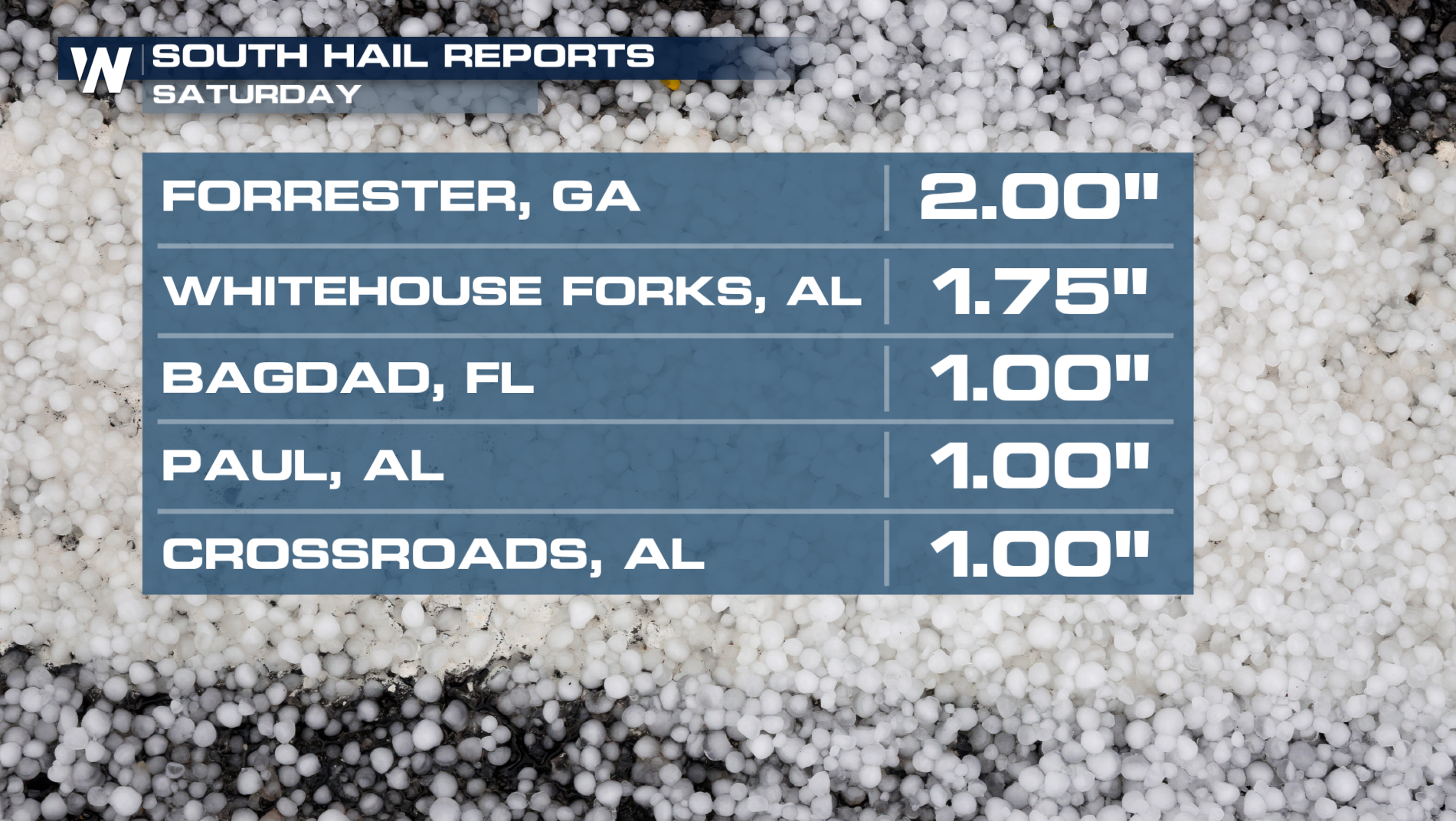
The low diving across the Mississippi Valley today will move through the Carolinas on Saturday, dragging a cold front across the Gulf Coast. As warmer and moist air surges north ahead of the boundary, more thunderstorms are possible tonight. Following the front, temperatures will stay warm and more sunshine will be expected for next week.
All Weather News
More

Severe Storms, Flash Flooding Overnight In Midwest
WHAT TO EXPECTIt was a very active day across
22 Jun 2026 1:50 AM


Summer Solstice Kicks Off Father's Day Sunday
Fathers across the country will have to share
21 Jun 2026 5:20 PM

Flood Risk Continues This Weekend for the Gulf Coast States
Numerous flash flood warnings were issued as
21 Jun 2026 1:15 PM

Dry T-Storms & Fire Danger in the West
A weak low-pressure system moving through the
20 Jun 2026 1:40 PM

Tornadoes Tear Through The Midwest, Isolated Severe Storms in the South
EARLIER THIS WEEKMONTROSE, IL - A dangerous t
20 Jun 2026 1:30 AM