New England Snow & Ice Into Saturday

Snow has become more widespread across Upstate New York and into New England today. As trough of low pressure moves through the region into Saturday, more cold air will wrap into the system allowing for more wintry precipitation. Totals are now reaching up to near a foot in parts of Upstate New York.
TIMING
The heaviest accumulations will continue into the early morning hours of Saturday, before tapering off by late morning. However, the low pressure system will continue to become wrapped up in itself and limit its movement. That means light snow along the surface trough will linger in the Great Lakes and New England through the day on Saturday.
Once this system clears, a coastal low will deepen just off the southeast coast. As it traces north along the northeast coastline, it could bring major snow, wind and coastal impacts into early next week. Stay with WeatherNation for more details on this potential Nor'Easter.
TOTALS
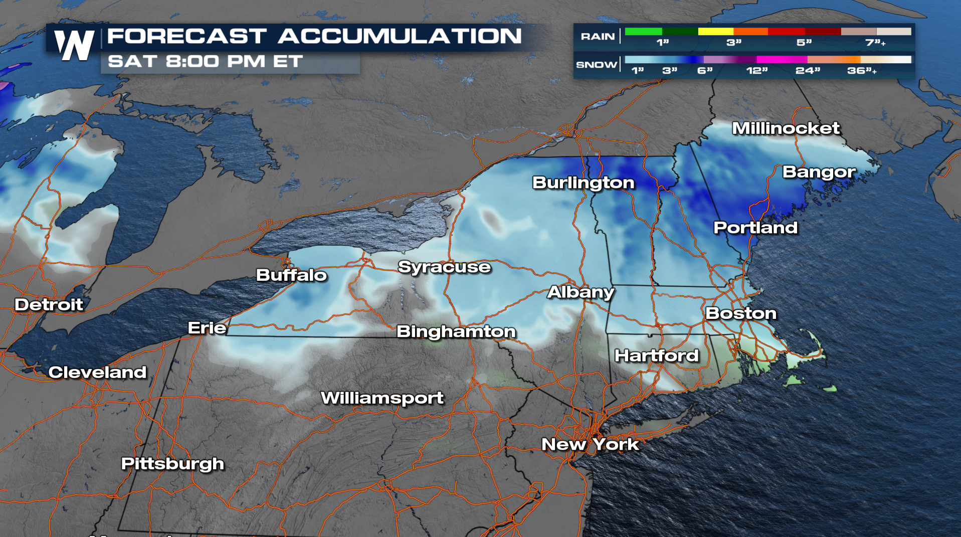 An additional 3-6" of snow will be likely across Northern New England by Saturday. Dangerous driving conditions will stick around through Saturday, so avoid the roads if you can.
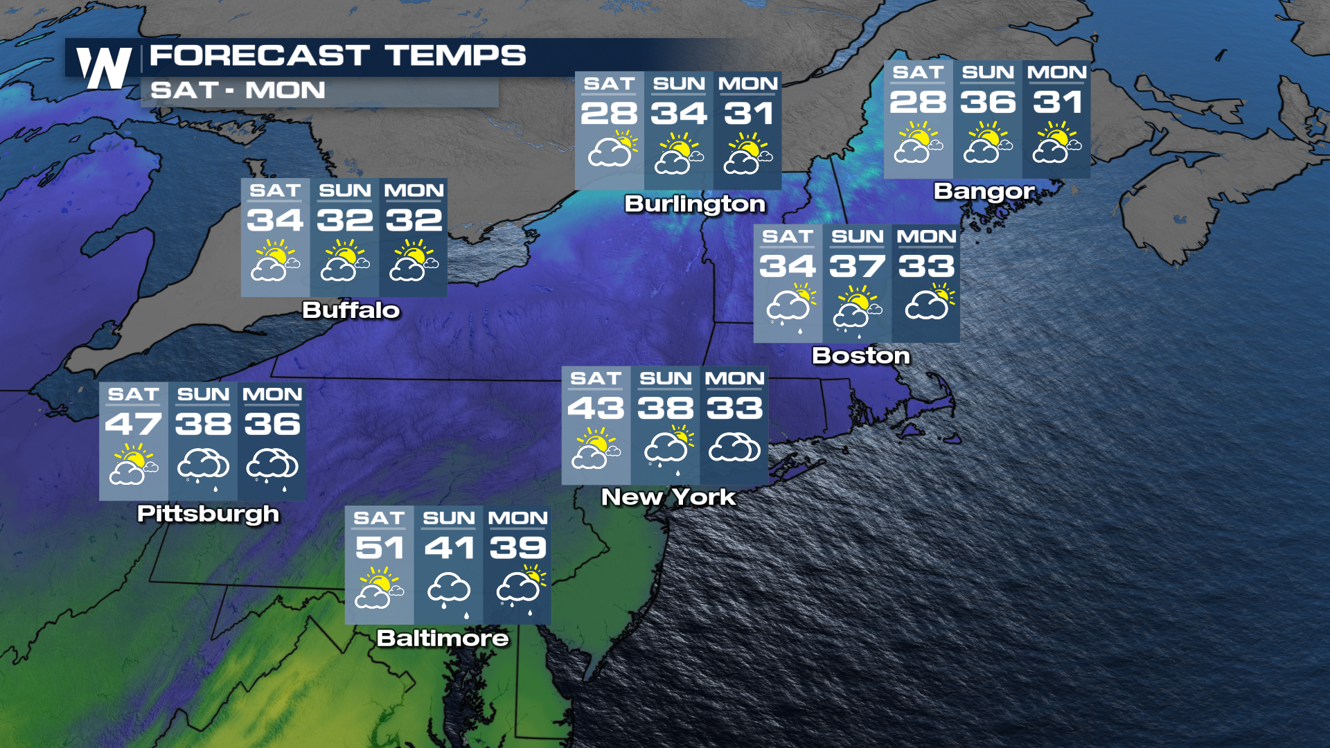
TEMPERATURES
Highs will remain in the 30s through the event and as the next coastal low moves in. This will mean another potential for wintry mix Sunday and early next weeek.