Strong Storms Spawned Tornadoes in Illinois Amid Elevated Severe Threat

A powerful storm system tore through the Ohio Valley on Thursday evening into Friday Morning. Warmer air and increasing moisture led the Storm Prediction Center to highlight the region for an enhanced risk of severe weather, even noting the potential for strong EF2+ tornadoes and widespread damaging winds. The atmosphere responded accordingly, with discrete supercells developing ahead of a larger line of storms, a setup often associated with more intense tornado potential. A few tornado surveys were completed including an update on the EF2 tornado did went through Bloomington, IN.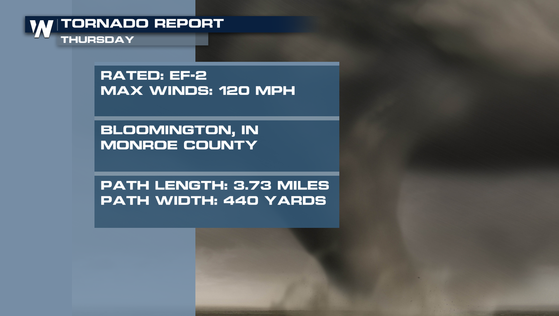
Storms rapidly intensified Thursday afternoon as warm, humid air surged north ahead of a strong cold front. That unstable air mass, combined with increasing wind shear, created an environment favorable for rotating thunderstorms capable of producing tornadoes. By late afternoon and evening, several tornado warnings had been issued across eastern Illinois as storms tracked toward the Indiana state line.
The National Weather Service received reports of tornado touchdowns in Illinois, along with damage to trees, power lines, and structures across several states. In addition to tornadoes, storms produced large hail and wind gusts over 60 mph.
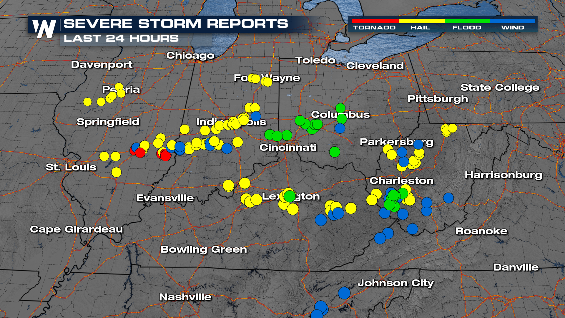
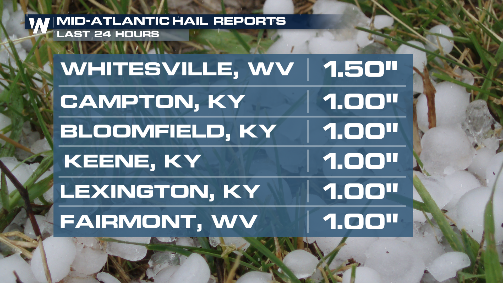
As the cold front pushed east, the severe threat gradually diminished across the Ohio Valley, and even into Friday morning, there were severe thunderstorm warnings in West Virginia and Tennessee. West Virginia saw 1" size hail early Friday morning.
This severe weather event serves as a reminder that when the right ingredients come together, there can be significant severe outbreaks even outside of severe weather season. Reports so far include downed trees, damaged buildings, flipped cars, and power outages.
Tune into WeatherNation TV as storm surveys are expected in the coming days to determine how many tornadoes touched down and how strong they were. Also, join us for Severe Weather Awareness. .scene, Week, March 1st through the 7th, as we get you prepared for the upcoming severe season.


