Blizzard Conditions, Heavy Snow Slamming the Midwest & Northeast

As severe storms are marching from the central U.S. to east Coast, intense wind and extremely heavy snowfall are charging through the Upper Midwest and Great Lakes. On Sunday, blizzard conditions halted traffic in Minnesota, Wisconsin, and Michigan.
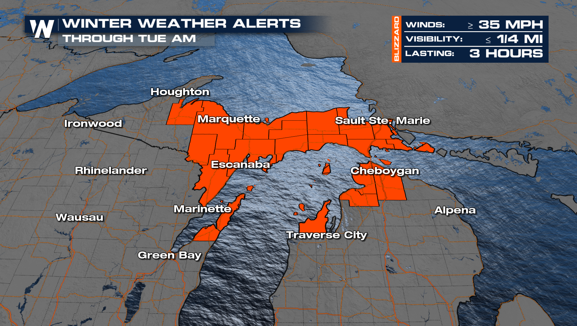
Blizzard Warnings are still in effect for portions of Michigan. As a reminder, a blizzard is primarily about wind! Strong winds will create low visibility as snow blows around. Very difficult travel, if not impossible travel, can be expected in these areas over the next few days.
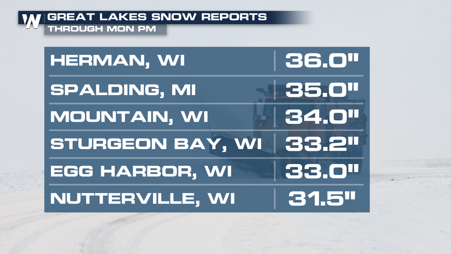
 Snowfall totals across the Great Lakes have reached up to three feet!
TONIGHT
Even as new snow winds down, blowing and drifting snow will remain an issue. So watch out for slick spots on the roads and pockets of limited visibility into Tuesday.
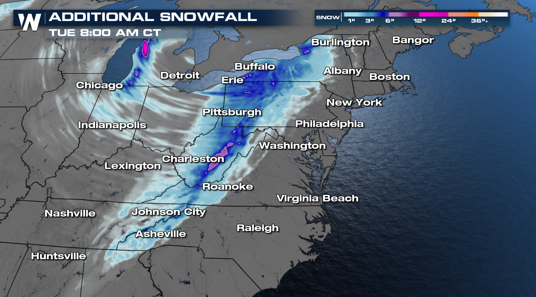
Parts of Wisconsin and the Upper Peninsula of Michigan still have the potential for significant totals. Lake effect snow will stick around into Tuesday, adding an additional 6-12".
 Arctic air will be dragged south behind this storm system with wind chills well below zero for many areas by into Tuesday! Bundle up and make sure your skin is covered to prevent frostbite. Be sure to check back for updates as we fine-tune this forecast!


