East Coast Under Risk of Damaging Winds & Tornadoes

Our intense storm system continues to wreak havoc with severe weather in the warm sector and blizzard conditions in the cold sector, which you can read more about here: MIDWEST SNOW STORM.
Widespread wind damage reports spread from Texas north to Illinois and east into the Carolinas. With multiple severe/tornado watches and warnings in effect, stay up to date LIVE with WeatherNation as the threat heads to the East Coast.
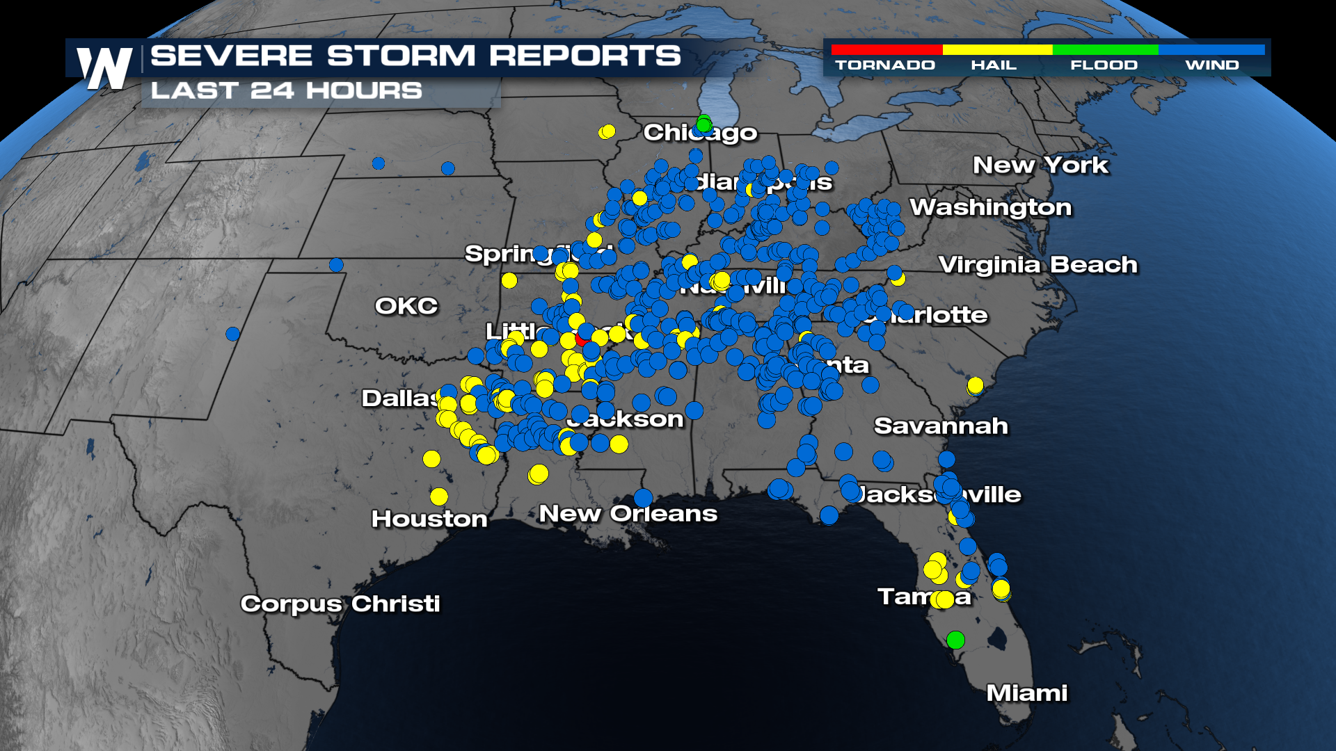 Some of these areas are still picking up the pieces from the last storm system that brought severe weather to Illinois and Indiana on Tuesday. Read more about those storms by clicking here.
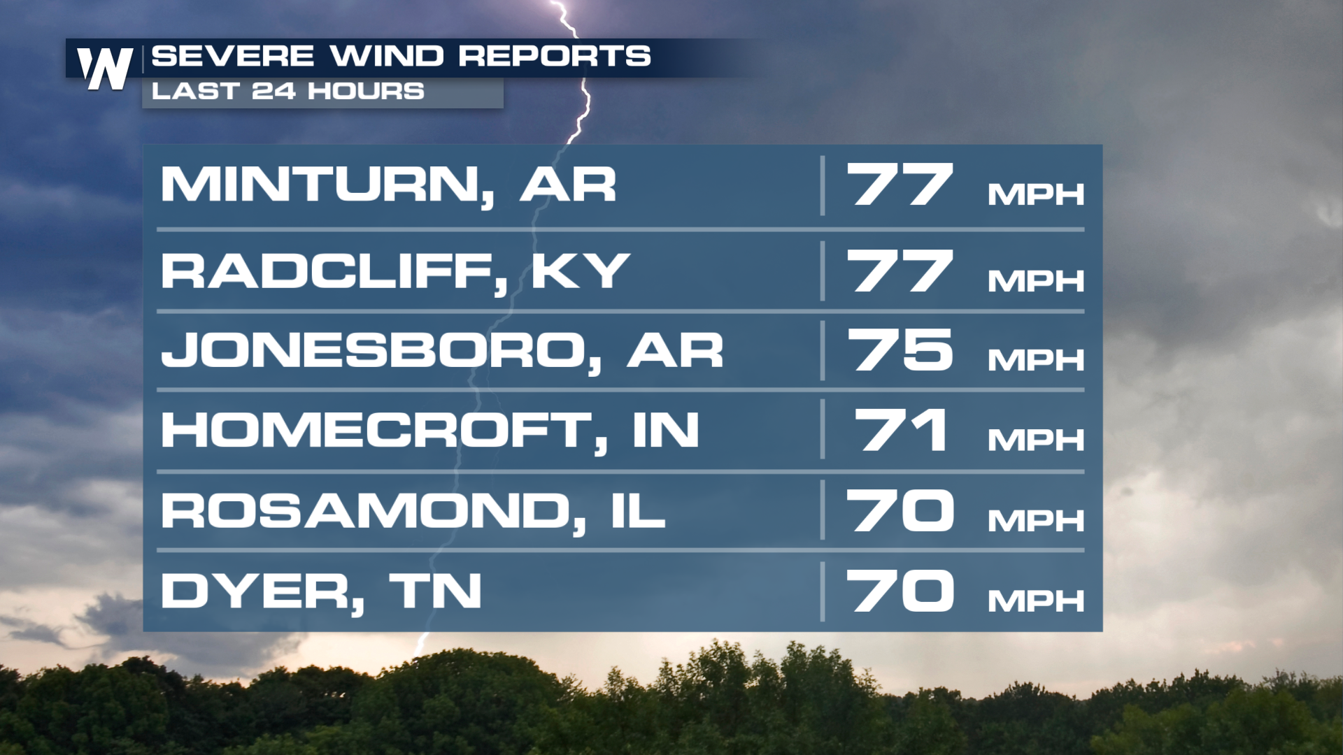
The strongest winds were recorded out of Minturn, AR and Radcliff, KY with speeds of 77 mph.
 There were also large hailstones across the south. The largest recorded was 2.50".
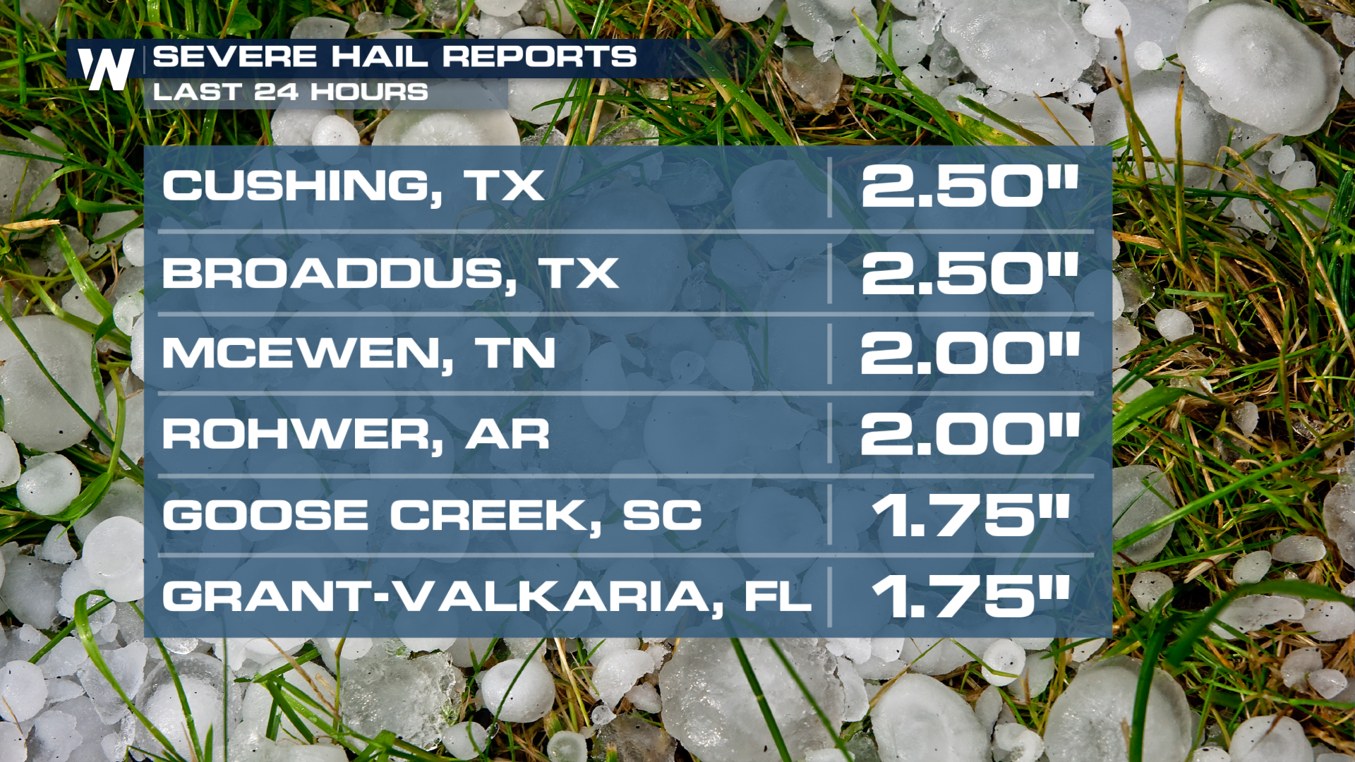
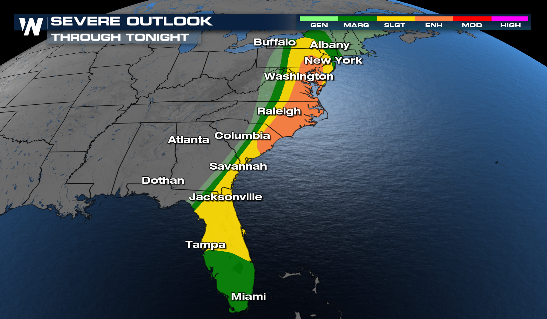
Through Tonight
The risk for intense severe weather continues to the East Coast and increases with an enhanced risk for severe storms (Level 3 out of 5). Once again, multiple squall lines packing intense winds and a few intense tornadoes will be possible.
Latest Timing
The front will continue to move offshore through the overnight hours. Expect drier and colder conditions on Tuesday morning.
This forecast and the outlooks will be updated as warranted, so be sure to check back in!


