Heavy Snow Slams Parts of the Midwest, Lingers This Weekend

A pair of storms dropped feet of snow across the Midwest this week, snarling travel at times, including Thursday evening where traffic in Nebraska and Iowa slowed to a halt. This second system is expected to slowly move through the Great Lakes into the weekend, with light to moderate snow on the way.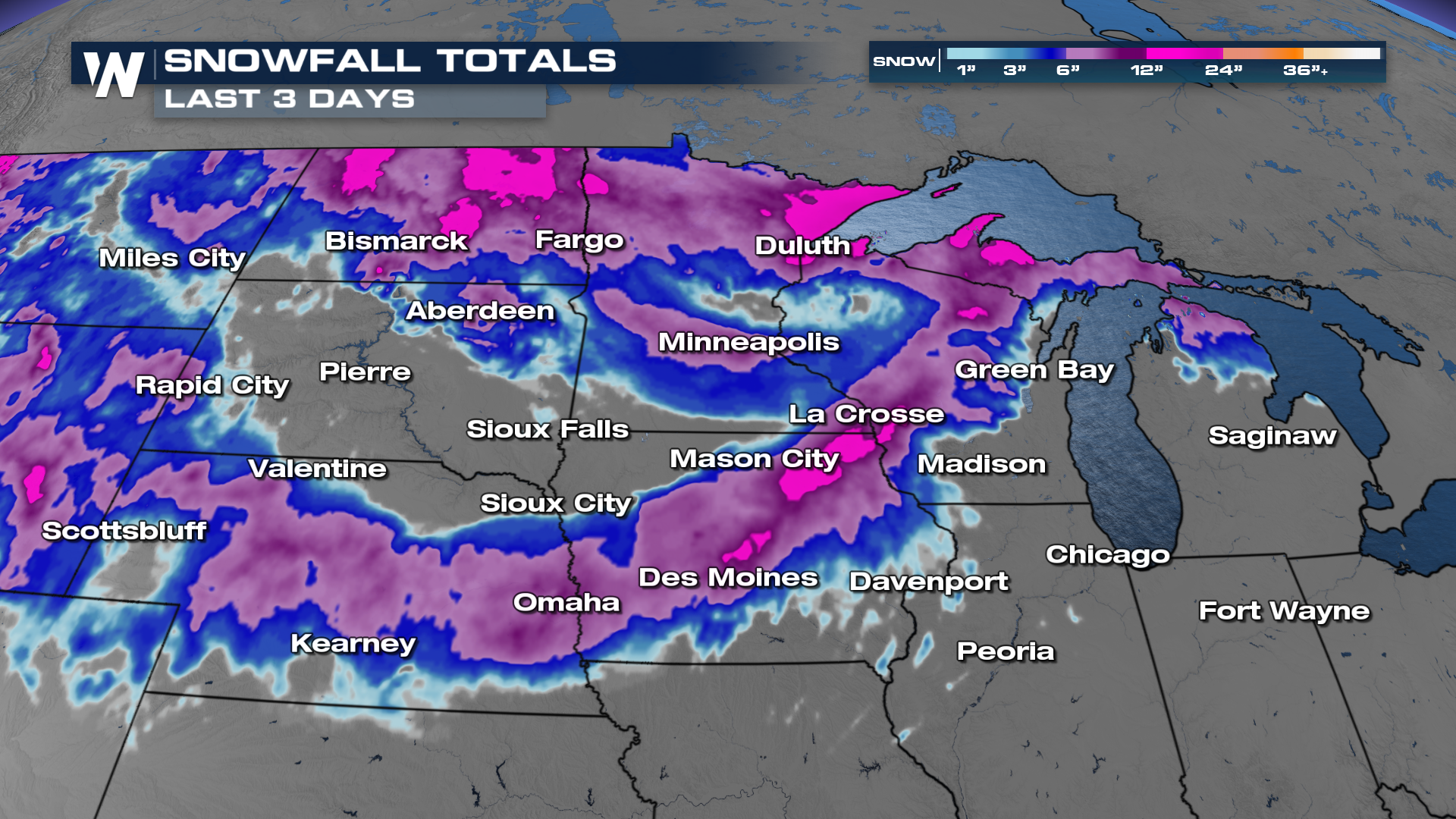
The first system brought heavy snow and blizzard conditions to areas of North Dakota and Minnesota, with over two feet of snow on the west side of Lake Superior. The trailing system tracked along I-80 on Thursday, bringing heavy snow from Nebraska to Central Iowa before it began shifting north. Parts of central and eastern Iowa measured over 15" of snow Thursday night into early Friday.
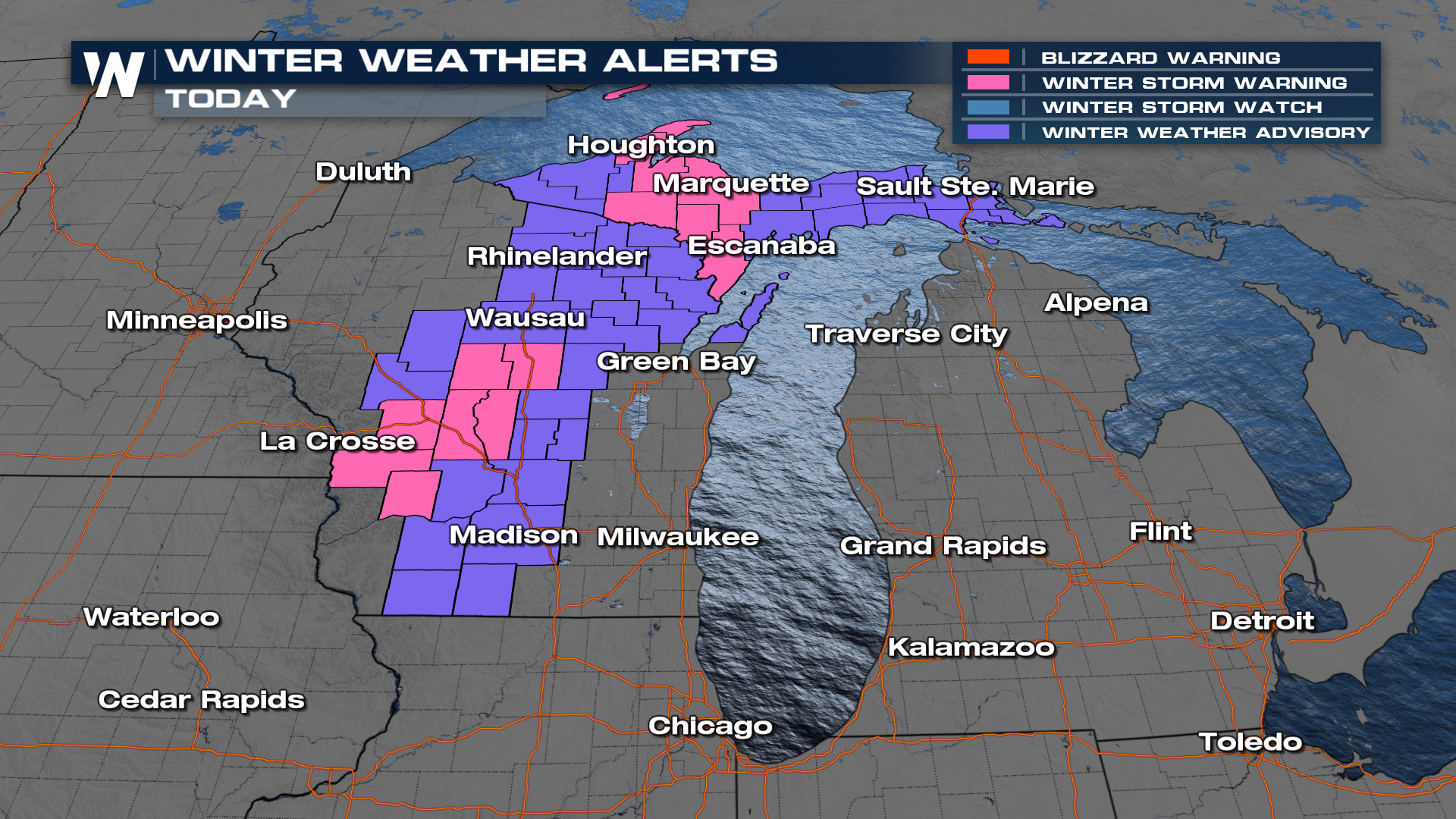
Winter alerts remain in effect on Friday, but are set to expire through the evening and overnight as heavy snow turns to lighter snow.
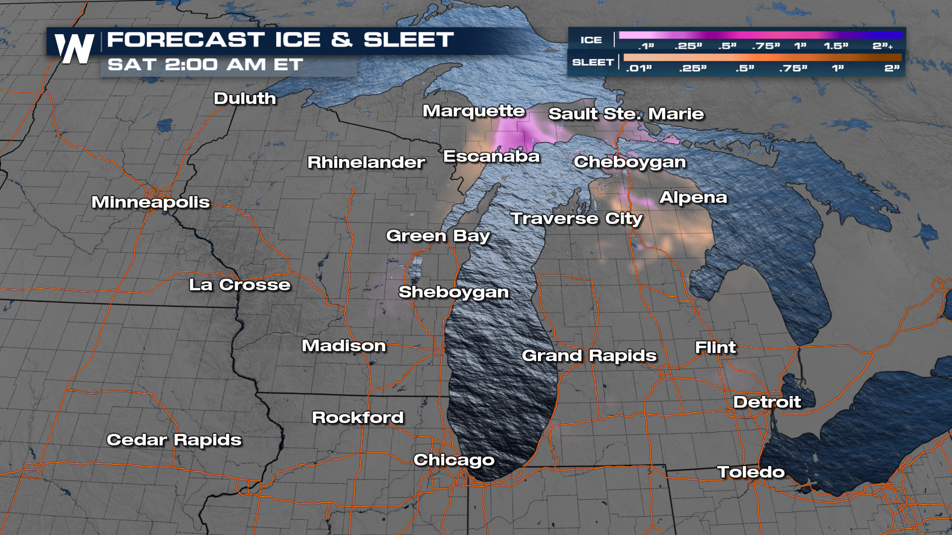
Snow will continue to wrap around the low on Friday, bringing moderate snowfall to portions of Wisconsin and northern Michigan. Light snow lingers Saturday as the low nearly stalls, inching its way across Lake Huron before it eventually brings light snow to the Northeastern US.

Additional snow and ice totals are enough to cause some significant impacts, especially between Green Bay and Houghton. This is where 6-12" of snow is still possible.
Tune in at :30 past each hour for the latest Central Regional forecast, or access our regional forecasts on demand, anytime, with the WeatherNation app.


