Tornadoes Cause Damage in Mississippi, Strong Storms Linger in the South

Wednesday
A cyclic supercell produced a damaging tornado across a large swath of southwestern Mississippi on Wednesday afternoon. The tornado caused damaged to homes in several towns, including Purvis and Brookhaven. WeatherNation field correspondent Brandon Clement was in the town of Brookhaven shortly after the tornado went through, showing significant damage to one neighborhood. The Brookhaven tornado was given a preliminary rating of EF-3, but surveys are expected to be finalized on Friday so check back for the final report.
Two supercells raced across Southern Mississippi Wednesday. These cells both took on the classic supercell appearance at times, including showcasing hook echoes and a donut signature. Both cells produced damaging tornadoes.
Friday- Sunday
The severe weather risk will persist along the Gulf coast through at least Sunday as multiple fronts move across the region and stall. Wind and hail are expected to be the primary threats, but a tornado or two will be possible.
Storms look to have the greatest severe weather potential in the afternoon and evening hours. However, some strong storms could linger into the overnight hours through the Mother's Day weekend.
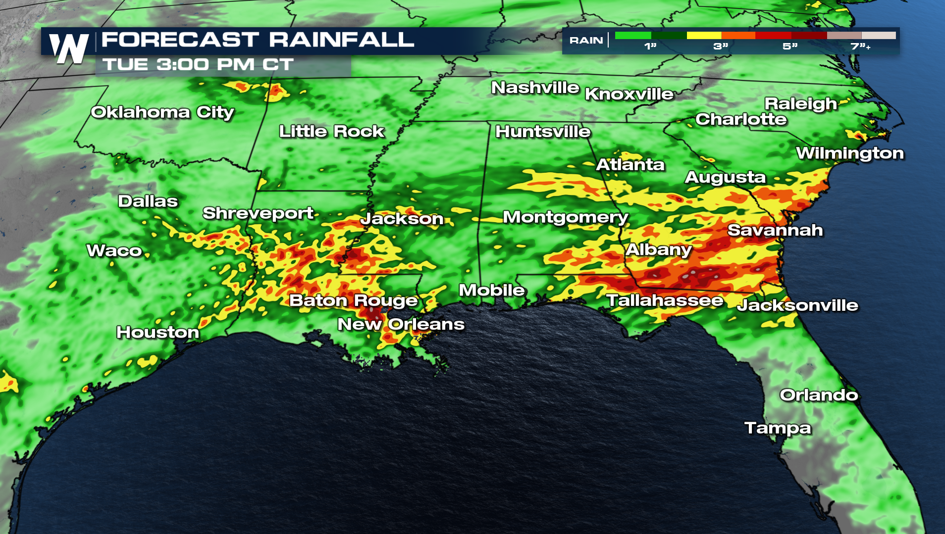
Along with the severe weather chances, heavy rain is likely across the Deep South. The forecast is calling for 2-4" of rain with some locally higher amounts up to 7". Flash flooding is possible as rainfall rates will be quite high, over 2" per hour at times. We are slowly trying to put a dent in the drought for the South, as it will take more consistent rains over the next few months to make some significant changes.