CO May Snowstorm Could Lead to Icy Thursday Roads

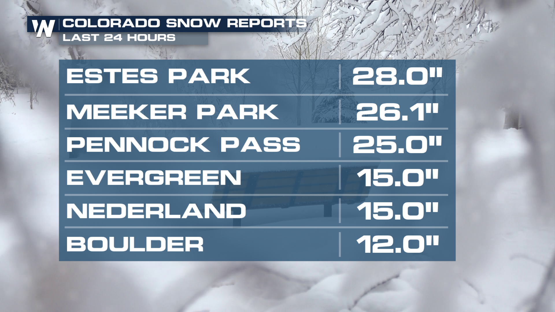
Parts of Colorado and Wyoming received up to two feet of snowfall since yesterday, with Estes Park receiving some of the highest amounts at 28" so far.
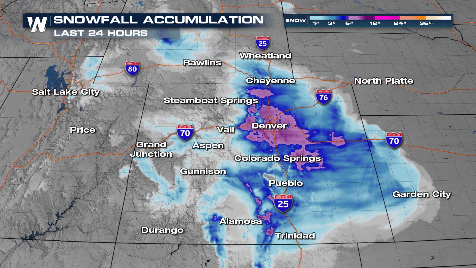
 The Denver International Airport accumulated 5.8" of snowfall, which was the 12th highest 2-day May snow total.
 Our Meteorologist Rob Bradley had some fun in the Denver area during this snow day, before we start to warm back up through the end of the week.
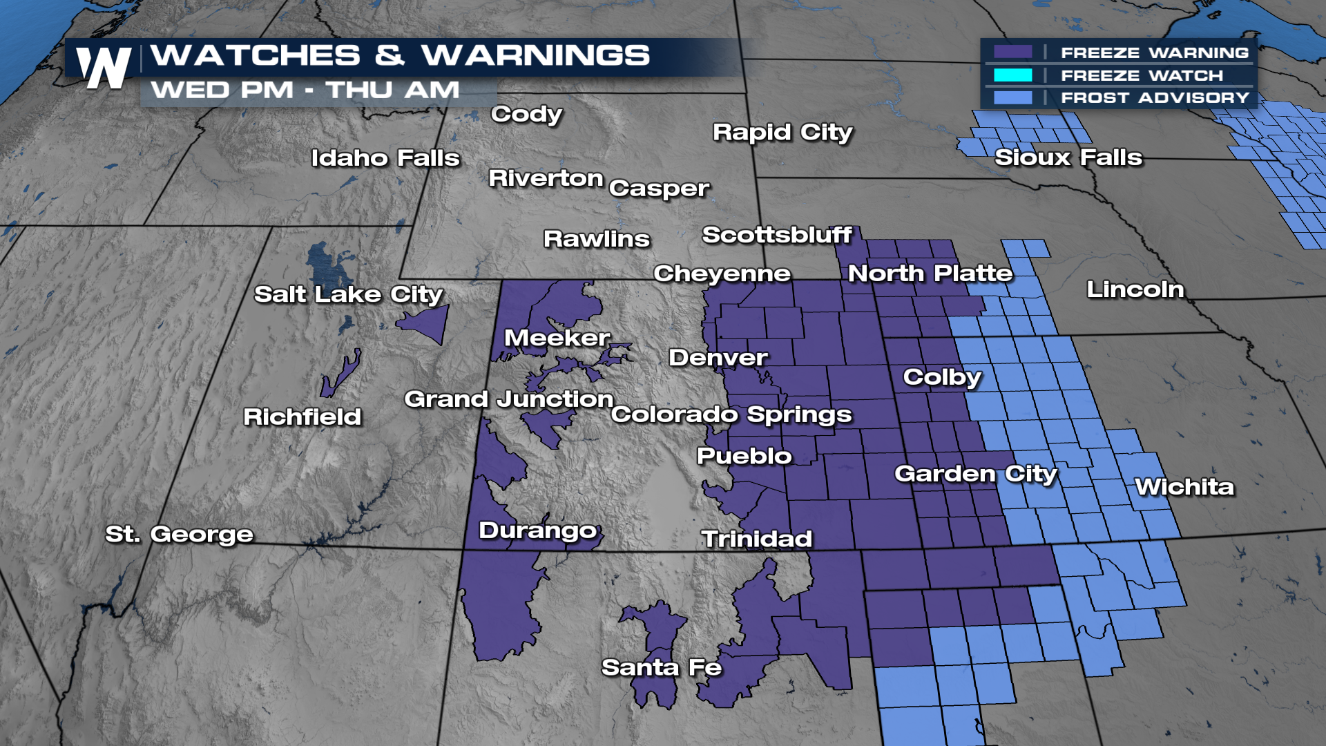
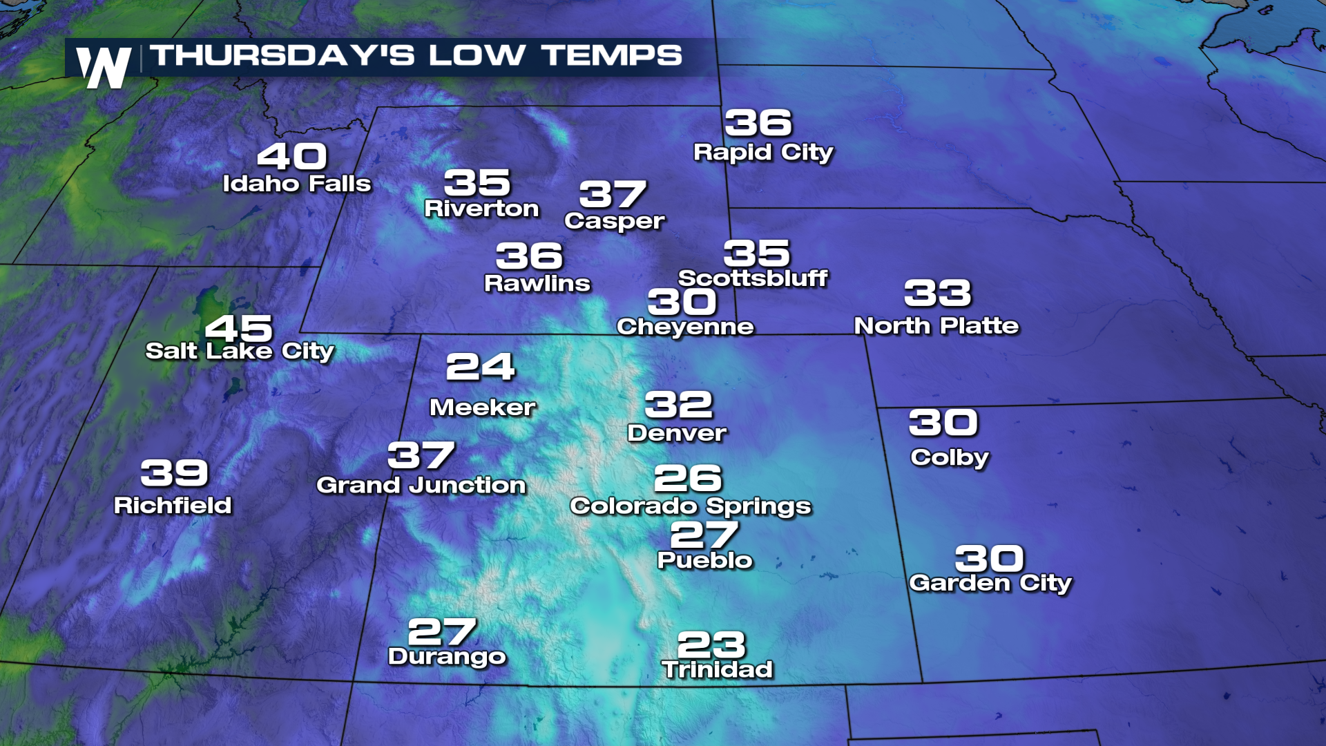
Watch the roads tonight, as freeze warnings have been issued for the I-25 corridor. Roads that are wet could be frozen in the morning which could cause difficult travel for the morning drive.
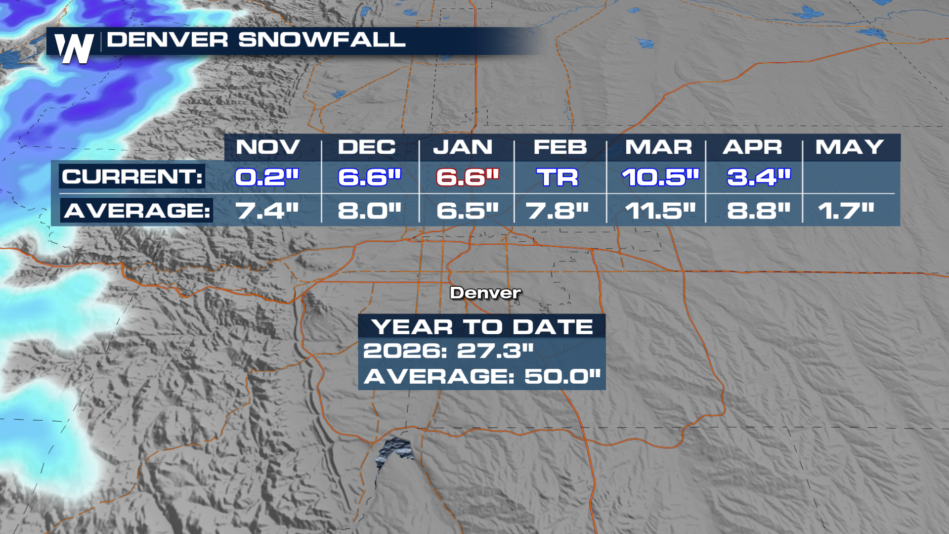
For Denver, only 33.1 inches of snow have accumulated so far this season. On average, year-to-date snowfall totals should be around 50 inches. This is much-needed moisture for the Mile High City.
 Follow along for more information this week, @WeatherNation!


