Next System Lining Up in the Northeast

Wash. Rinse. Repeat. Each week there's been a storm system that ridges from the Plains into the northeast and we've got another one headed our way. Each wave has brought severe chances and renewed flooding concerns - this one's not much different.
FLOODING
Repeated rounds of storms has lead to swolen riverways in areas around the Midwest, like Indiana, in recent week. This week, the concern is more centered around flash flooding, when it simply rains too hard for too long.
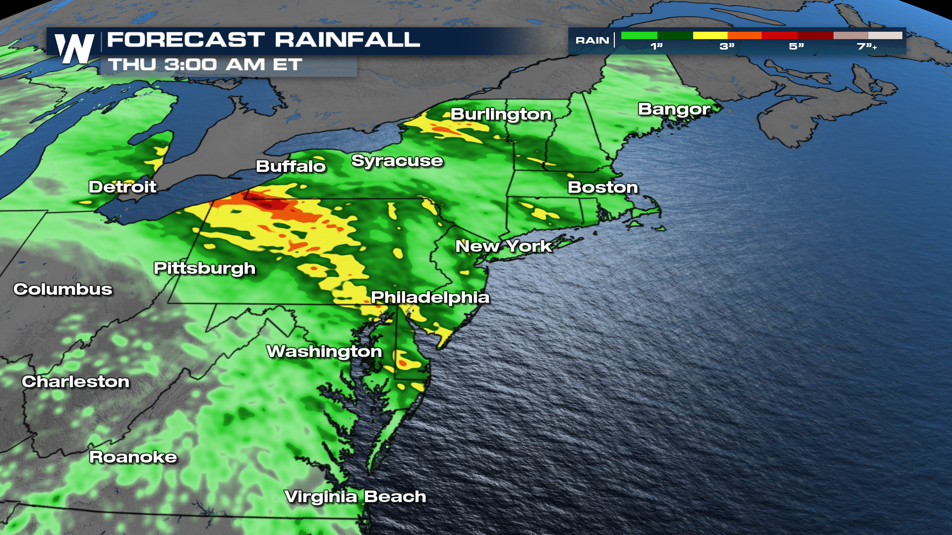
Western PA and Western NY are sticking out on some of the model data. However, anywhere that picks up an inch or two in some of the urban corridors around I-95 will be problematic.
SEVERE
As these systems dive southeast out of the Great Lakes, they will have a few ingredients to turn storms severe, potentially. Right now, the timing looks a little later than usual for severe weather events. Generally favoring the afternoon and evening on any one of Tuesday, Wednesday, or Thursday. However, data continues to point more toward the early overnight hours, with storms holding together even into daybreak. With a slow-moving system, this is all subject to change so keep up with the latest on the forecast over the next few days.
With all of the rain in recent weeks, trees will have an easier time toppling. So even if winds don't quite reach the severe threshold, we are still expecting pretty widespread damage.


