Ridge Riding Thunderstorms in the Western Plains

A ridge of high pressure has been responsible for the quiet and warm days across the central U.S., but on the western periphery of this ridge, a trough will attempt to slide in and ignite severe weather chances across the High Plains. The storms that are steered between these two upper-level systems are what we often refer to as "ridge-riding" thunderstorms.
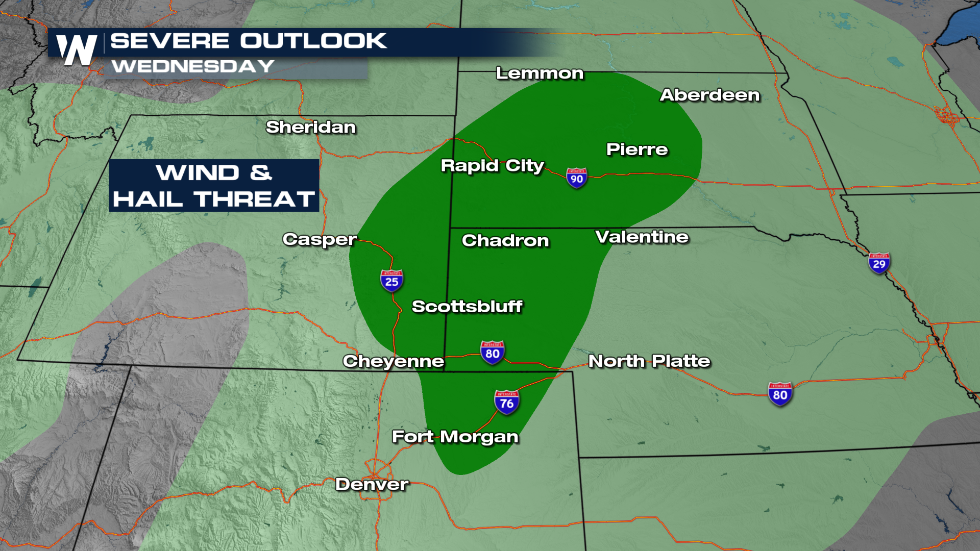
The Storm Prediction Center has issued MARGINAL (level 1 out of 5) risks for both Wednesday and Thursday. On Wednesday, the outlook includes cities such as Rapid City, SD, and Scottsbluff, NE.
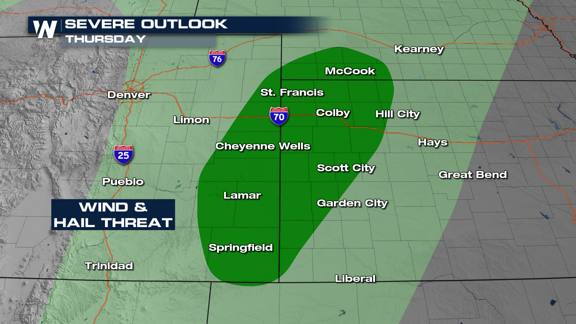
On Thursday, the risk shifts with the cold front down into eastern Colorado and western Kansas. It's also MARGINAL, but includes cities such as Hays, KS, and Lamar, CO.
 The timing of these storms appears to intensify as temperatures rise. We can expect some rain to start for the western Plains as early as midday, but the severe component will be higher during the peak of afternoon heating. By Thursday, the cold front will move through this region, providing lift for thunderstorm development.
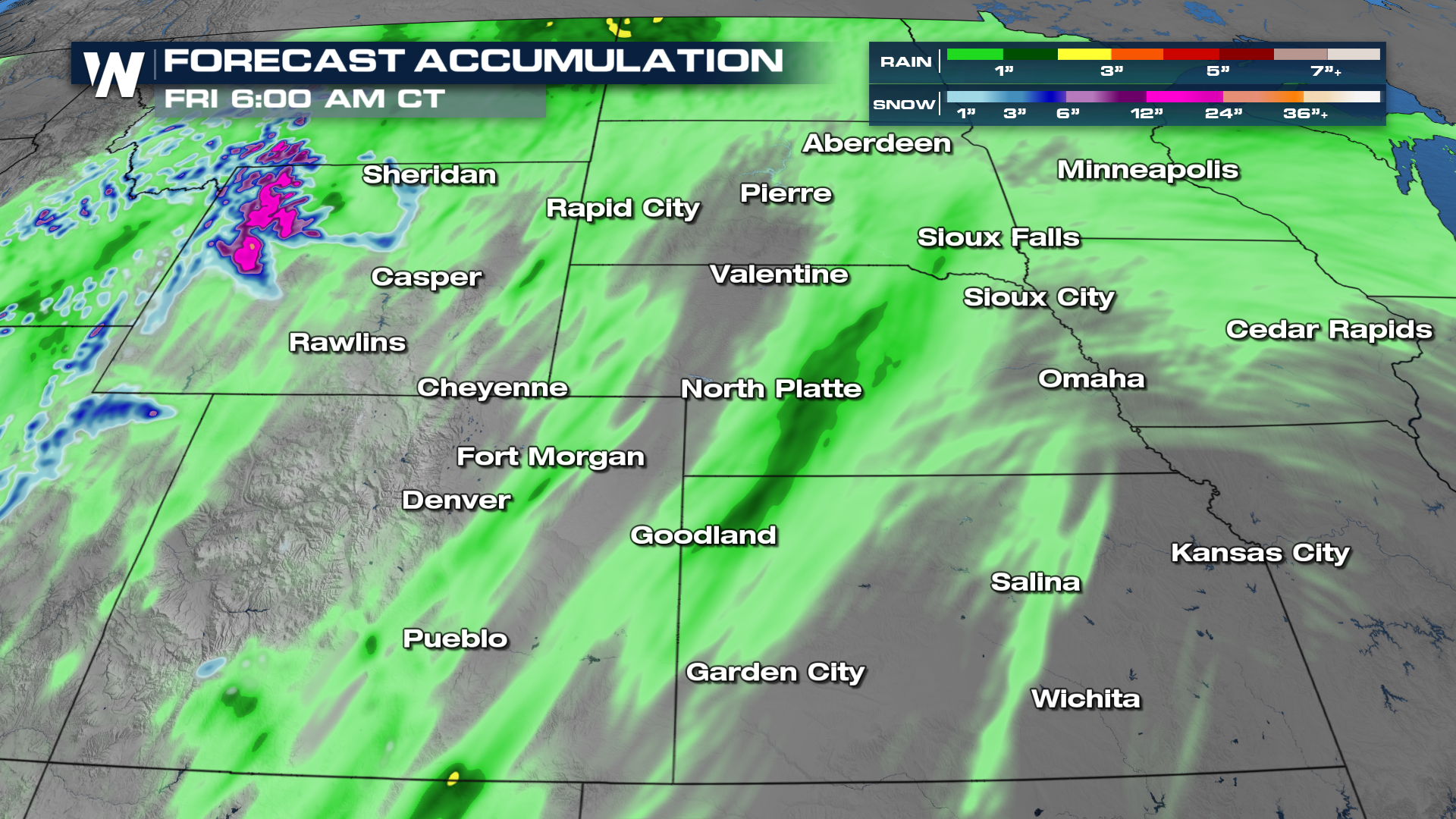
Forecasted rainfall totals look to be highest across central Nebraska, where some may receive 1-1.5" of rainfall with isolated higher amounts.
 Be sure to join us at :30 past the hour to see how this will impact your temperature forecast too!


