Bitter Temperatures and Wind Chills from the Plains to the Tennessee Valley
Special Stories
15 Jan 2018 4:28 PM
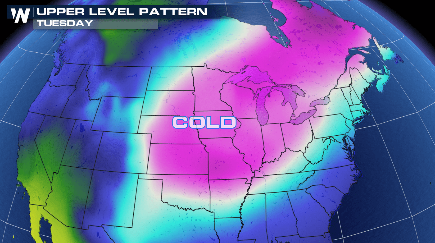
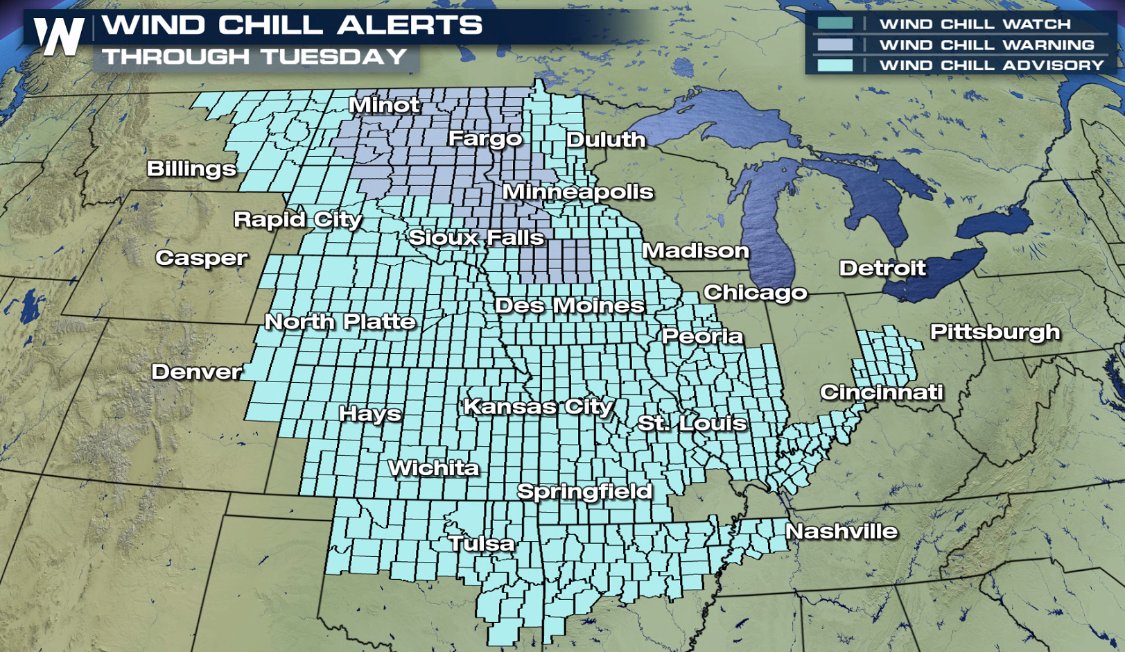
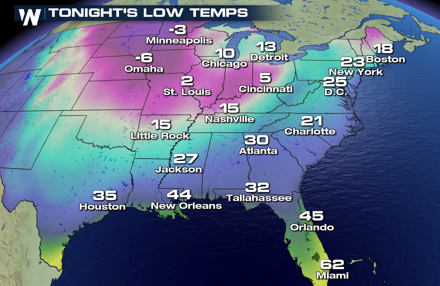
Bitter wind chills are once again being felt from the Upper Midwest through the Tennessee Valley as cold temperatures plummet to the south and east. Wind Chill Warnings are in effect for portions of Minnesota, Iowa, North Dakota and South Dakota. Wind Chill Advisories include more than a dozen states from the Northern Plains into the Ohio Valley.
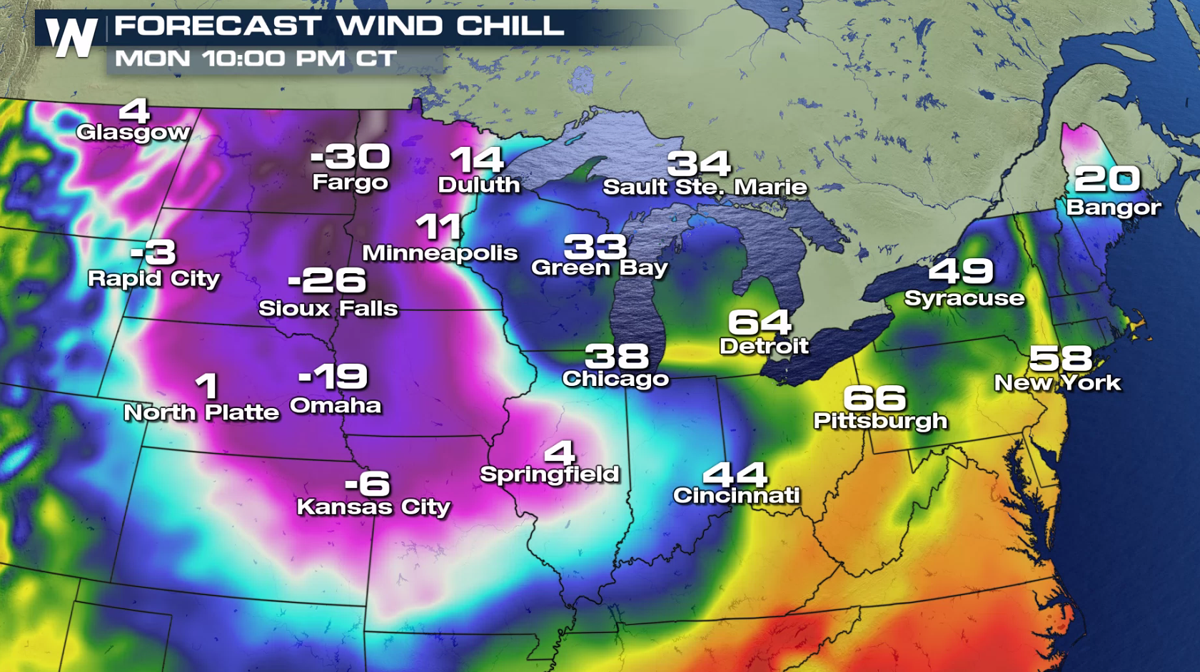
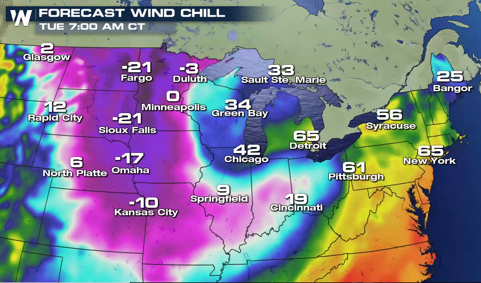
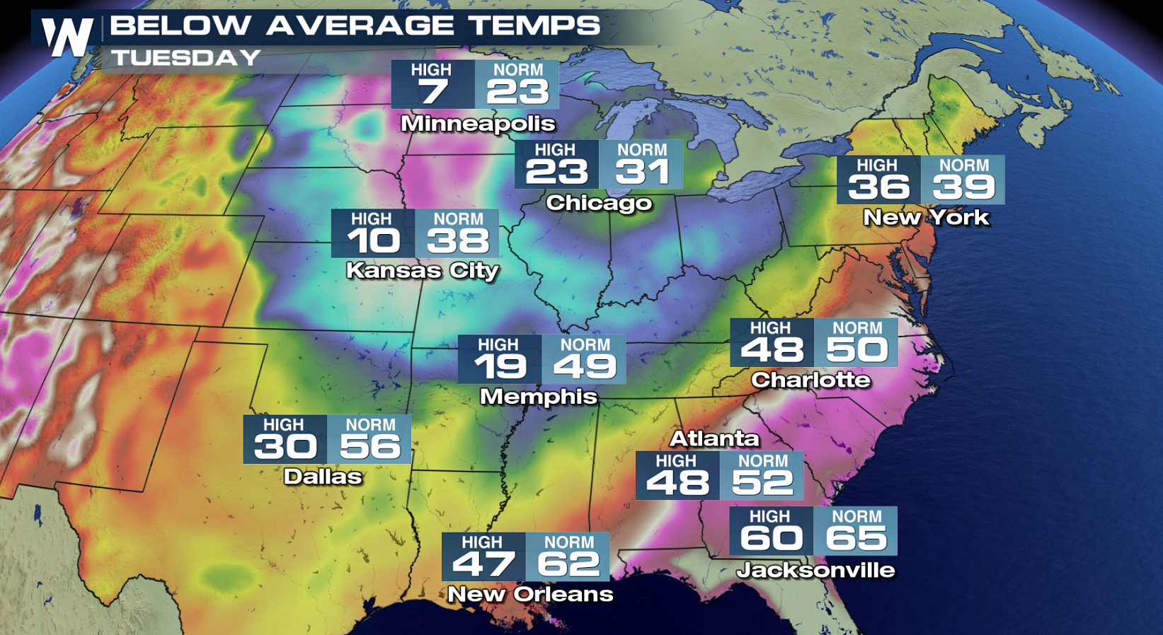
 Wind Chills will dip to near 40 below in the Upper Midwest and fall below zero through most of the Central Plains. Low temperatures will drop below zero through most of the Northern Plains. Temperatures will be well below average over most of the East and South on Tuesday.
 For WeatherNation: Meteorologist Mace Michaels
Wind Chills will dip to near 40 below in the Upper Midwest and fall below zero through most of the Central Plains. Low temperatures will drop below zero through most of the Northern Plains. Temperatures will be well below average over most of the East and South on Tuesday.
For WeatherNation: Meteorologist Mace MichaelsAll Weather News
More
Spring Snow on the Horizon in Colorado
Snow is on the way for the mountains of Color
26 Apr 2024 3:00 AM
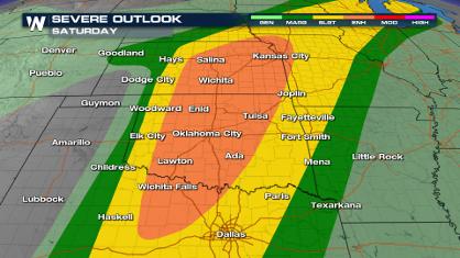
Weekend Forecast: More Severe Weather
We are looking at the threat of another sever
26 Apr 2024 2:45 AM
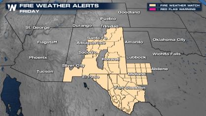
Critical Fire Risk in West Texas, New Mexico
A critical fire risk is in place for west Tex
26 Apr 2024 2:40 AM

National Park Week: Get Out and Explore
National Park Week started Saturday, April 20
25 Apr 2024 9:30 PM

NOAA Debuts "HeatRisk" Tool Nationwide
More people die from heat every year than ALL
25 Apr 2024 9:00 PM

Double Trouble: Cicadas Take to the Skies this Spring
It’s the soundtrack to the summer. Nature’s n
25 Apr 2024 8:45 PM