Another Day of Storms for the Plains & Front Range

Several rounds of severe weather have been rolling off the Front Range into the Great Plains this week! A mid-level trough sparked severe weather Friday afternoon, bringing damaging winds and hail. At the Denver International Airport, wind gusted up to 72 mph.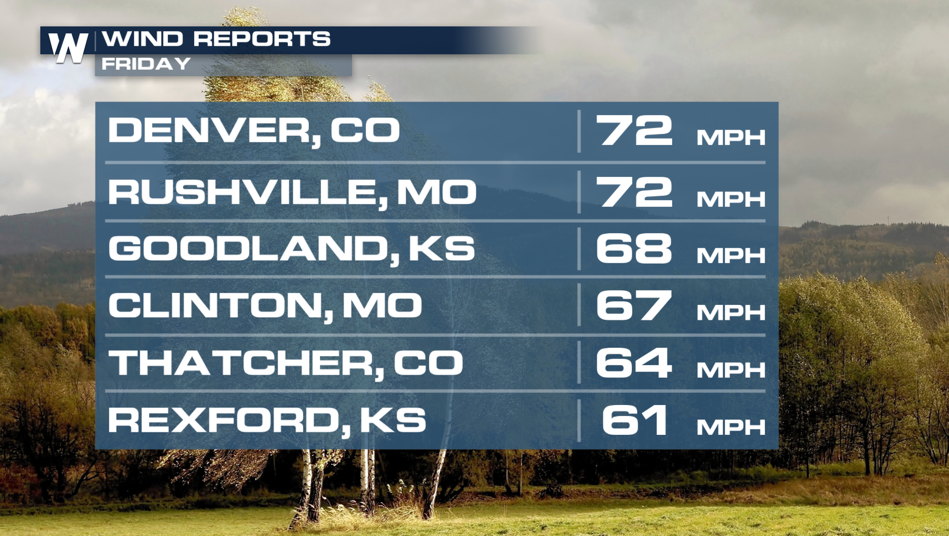
FRIDAY:
Damaging winds will be the primary threat along the Front Range and east into the Plains. Large hail is possible as well.
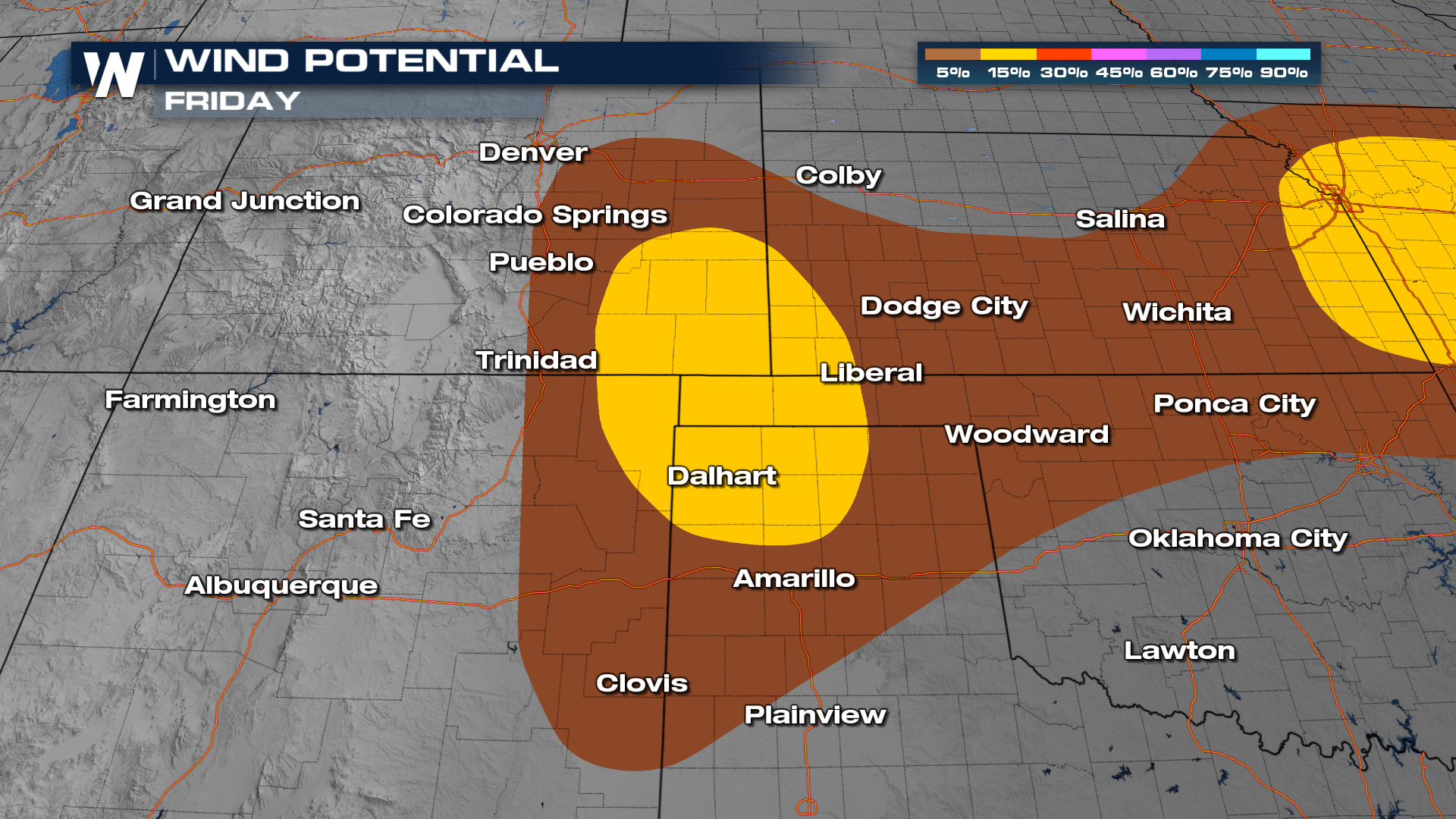
Timing
Storms continue to push eastward into the Kansas, Oklahoma, and Texas for the late hours. Storms should fizzle out by daybreak Saturday morning.
A few locations could get hit a couple of times by thunderstorms this week, which means that some areas may see some locally heavier rainfall totals. Keep an eye on flood alerts in your area. With repeated rounds of storms, you may be at risk for flash flooding.
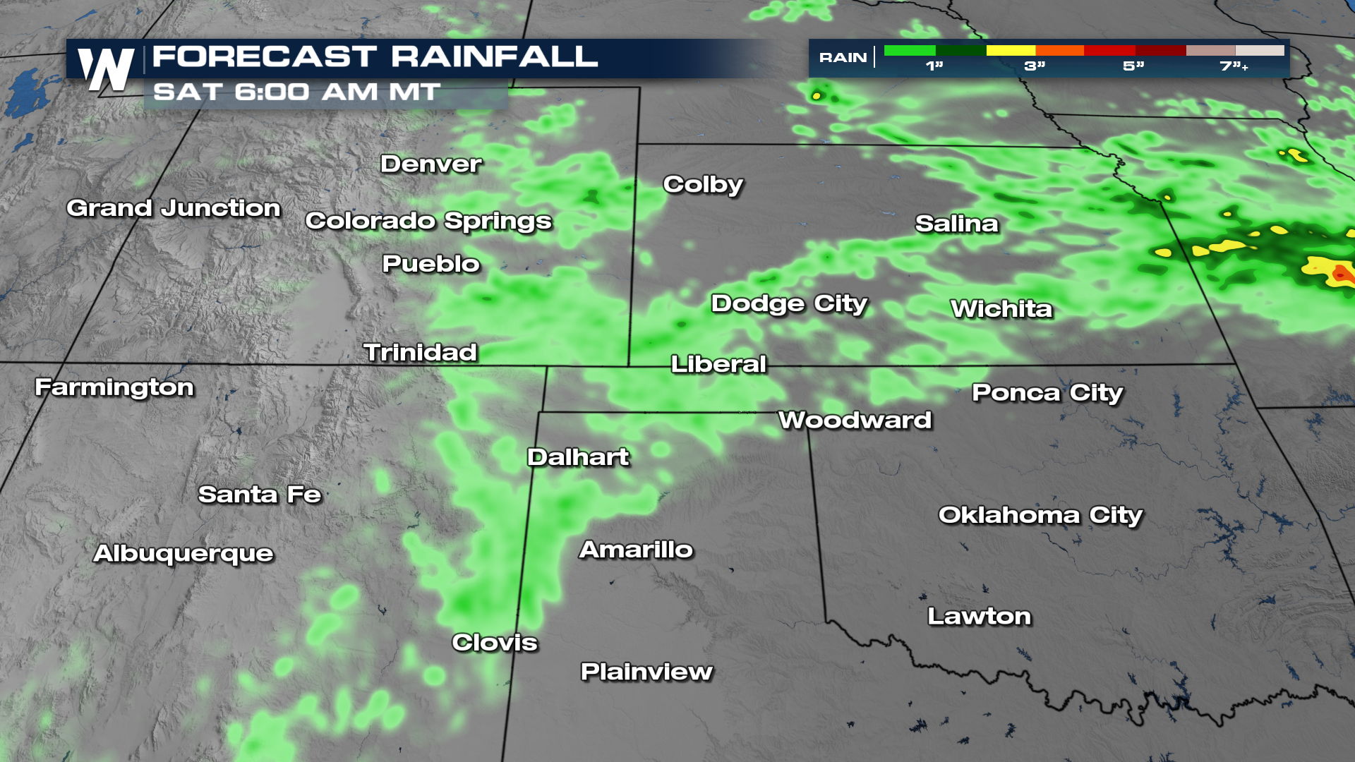 Flash flooding will be possible for many areas, though it will be more likely for some than others. Areas in dark green in the Excessive Rainfall Outlook (below) will have better chance to see scattered flash flooding incidents.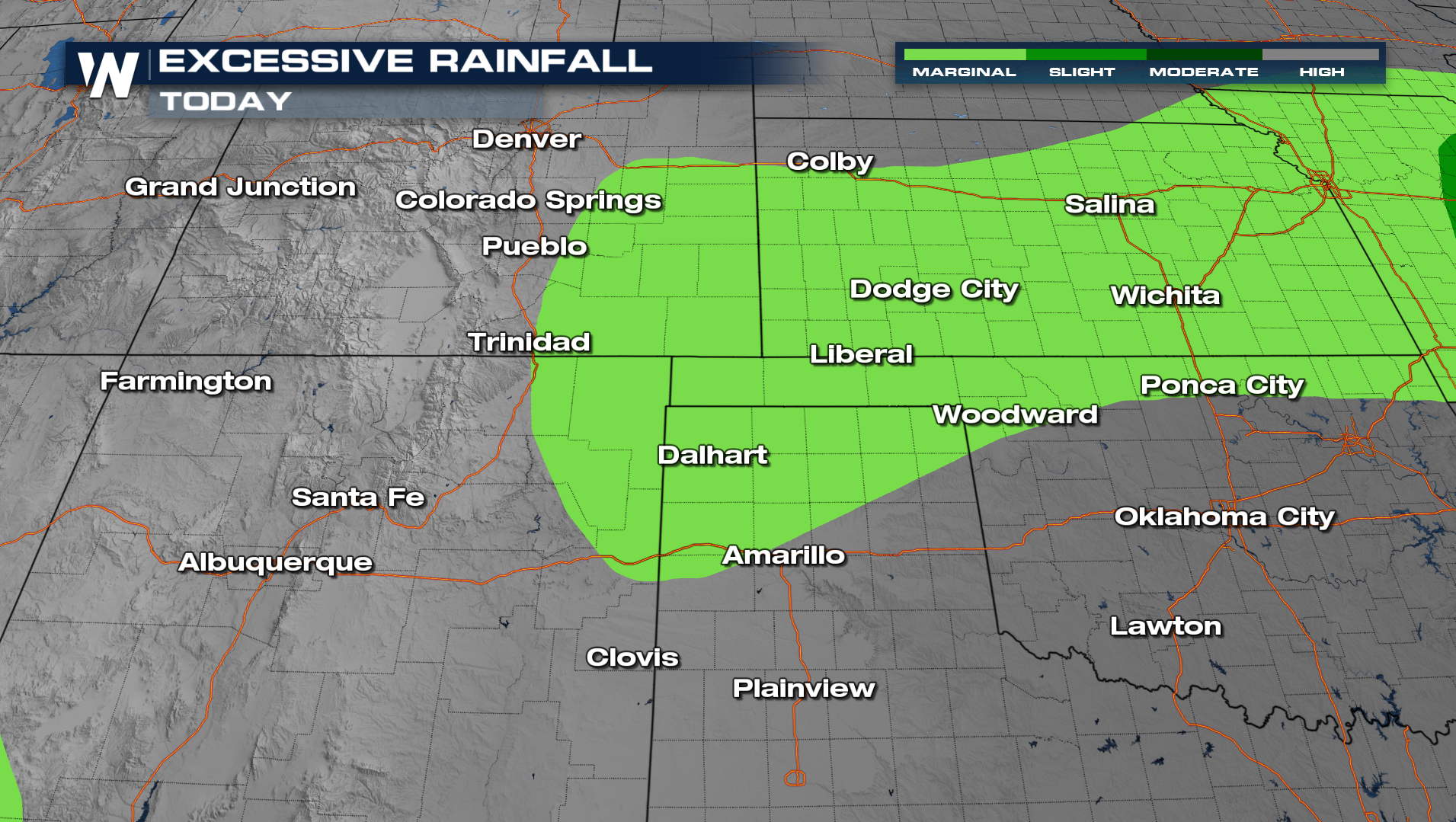
For more on this active forecast, be sure to join us on WeatherNation!


