Active Pattern Takes Shape Across the Plains

Top Stories
15 Sep 2026 10:00 AM
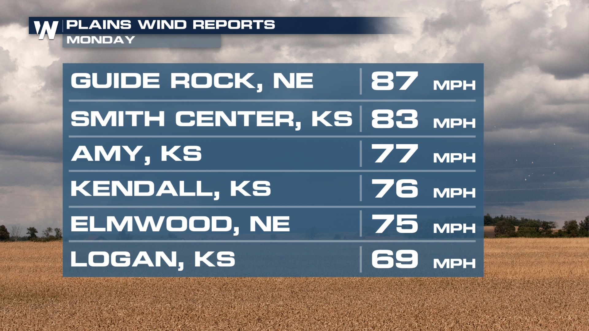
Monday proved to be an active severe weather day for the plains. The significant wind threat definitely materialized across this region, giving us wind reports out of Nebraska, close to 90 mph!
Tuesday, another marginal threat for severe weather stretches all the way from Texas to Southern Michigan. Cities in the risk include Kansas City, Chicago, and Indianapolis. Damaging winds will be the main concern on Tuesday.
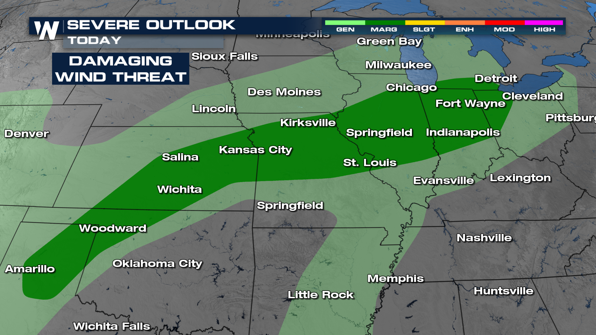
These storms are expected to form and roll on through around dinnertime. This is also when we'll see the highest likelihood for some of these severe storms.
Stay with WeatherNation TV for the latest forecast, severe weather alerts and updates throughout the weekend.
All Weather News
More
Flooding & Severe Storms Target the Southwest
A low pressure system coming across the Weste
23 Oct 2026 2:05 AM

Tropical Storm Vance Forms In The Pacific
Isaias ended the late-season streak of no hur
23 Oct 2026 2:00 AM

Warmer Than Average: Above-Normal Temperatures Across the Central U.S. This Week
WHAT TO EXPECTA ridge of high pressure will b
23 Oct 2026 1:45 AM


Several Fires Break Out in SoCal Last Week Amid Santa Ana Wind Event
Santa Ana winds helped several fires grow qui
19 Oct 2026 1:25 PM

Another Cold Morning Before Things Warm Back Up
Across portions of the Ohio Valley through th
19 Oct 2026 10:15 AM

Severe Risk Diminishing Saturday Morning for the Northeast
Severe Storm PotentialSevere risk is decreasi
16 Oct 2026 10:20 AM