California In The Cone, Rachel Heads Toward the Southwest

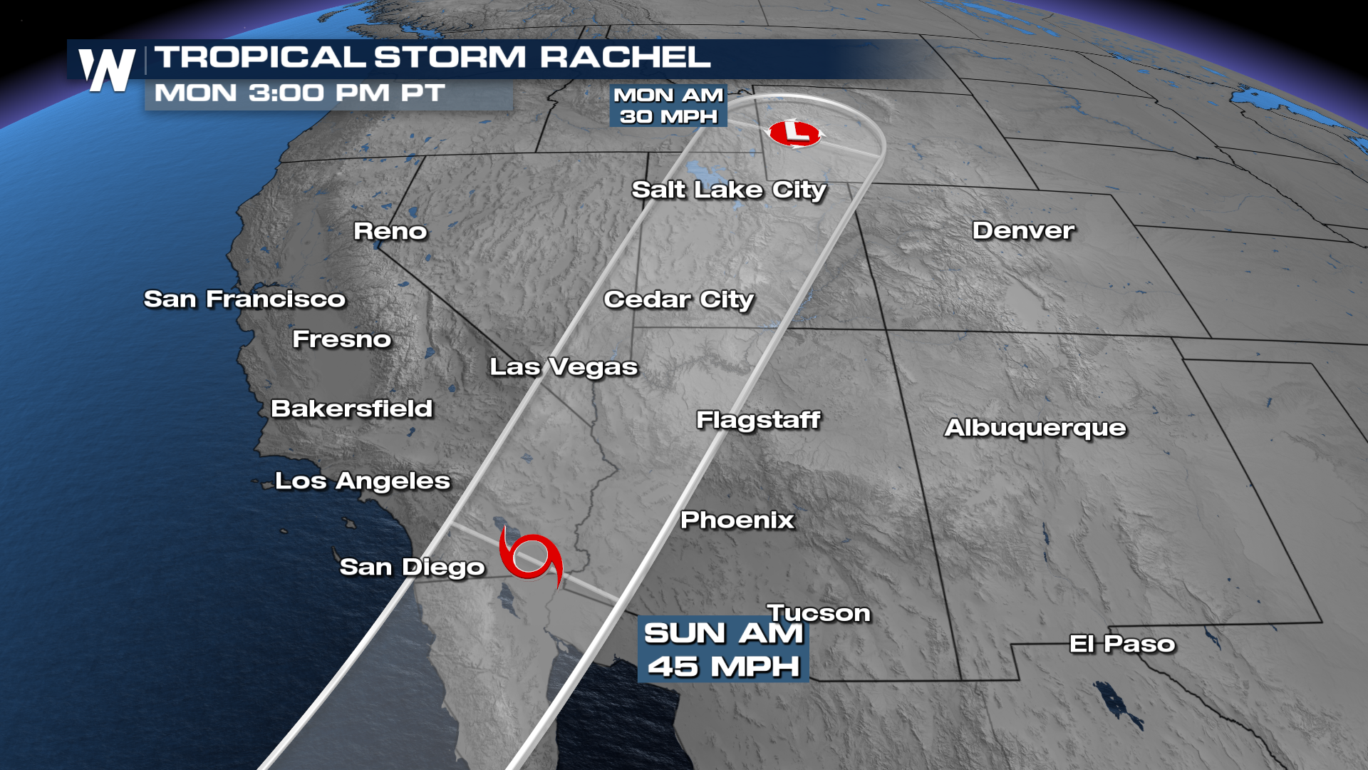
Heavy rain and gusty winds are looking more likely for the Southwestern United States this weekend as tropical storm Rachel takes aim at the region. Rachel has been weakening for some time and will continue to do so as it moves over cooler waters, but impacts from even weak tropical systems can be significant.
Track & Wind Potential
Hurricane Hilary made headlines in 2023 as it nearly made landfall in California as a hurricane, with heavy rain impacting the deserts and mountains. This system won't have the same wind energy, but could still bring some gusty winds to the region that could cause damage, especially in mountainous terrain.
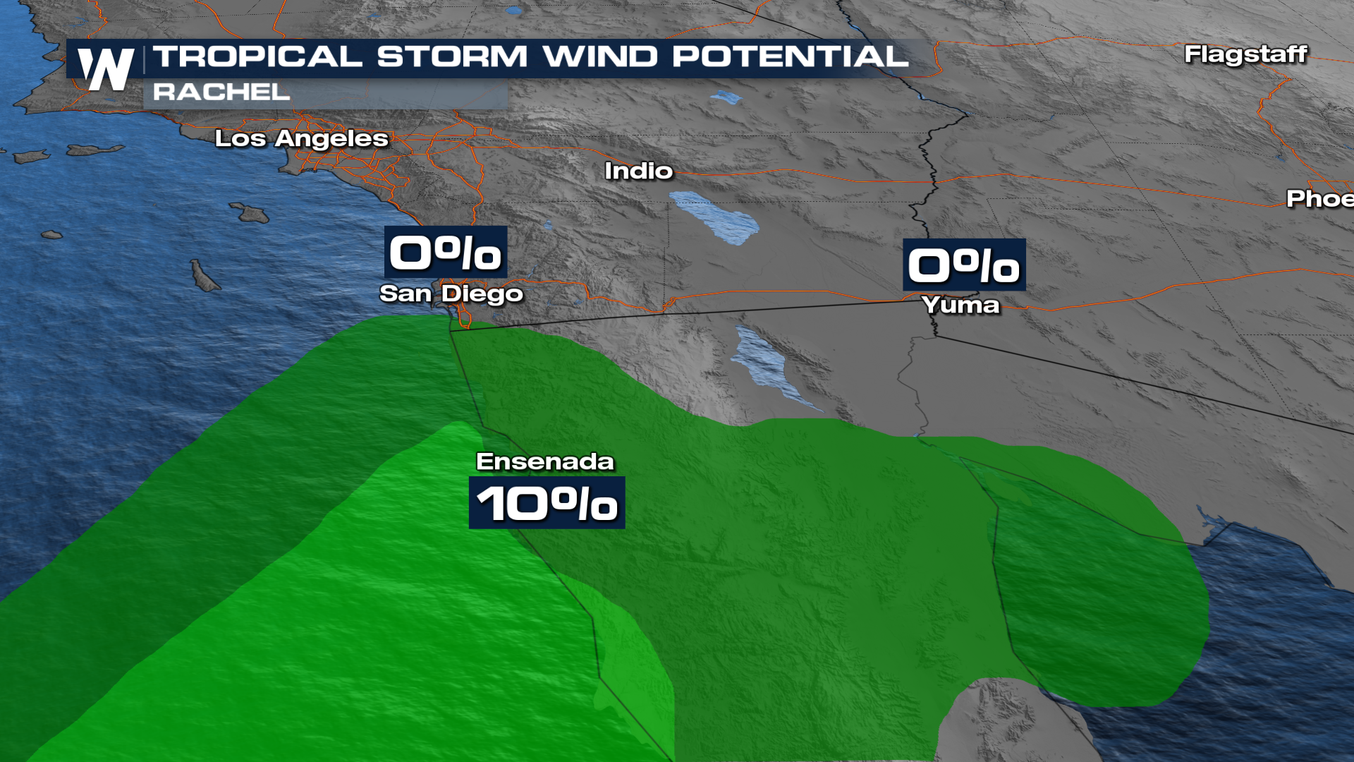
 The latest from the National Hurricane Center shows most of the tropical storm wind potential staying south of San Diego, but some tropical storm force winds could impact southern sections of San Diego County, near Tijuana.
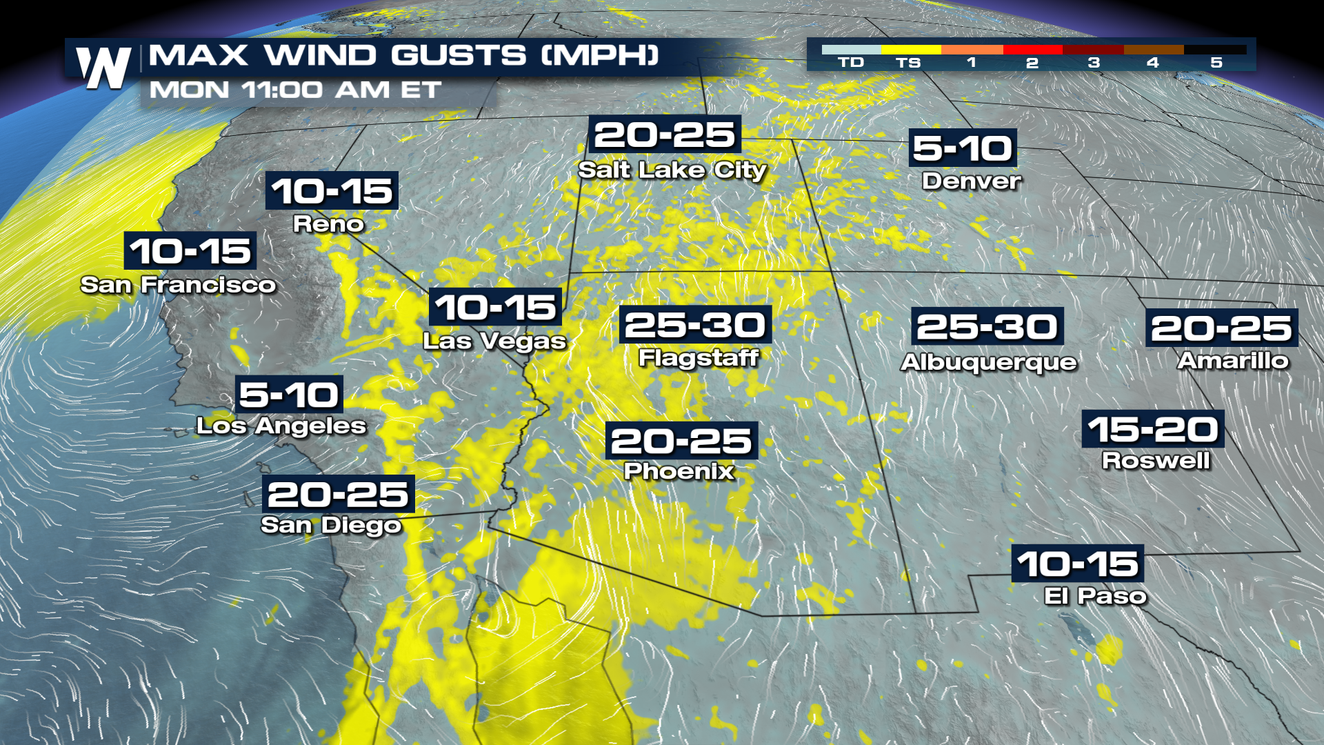
 Desert areas can expect gusts to 35-45 mph on Sunday. The fast forward movement could bring those strong gusts north in Utah or even parts of Wyoming and Idaho. Widespread power outages are not anticipated but a few isolated outages are possible.
Rain & Flood Forecast
Flooding will likely be the biggest impact from Rachel in the West, and even heavy snow! As moisture is pulled into the west, a cold trough from Canada will help usher the moisture north, sending it through Montana where temperatures will be dropping quickly.
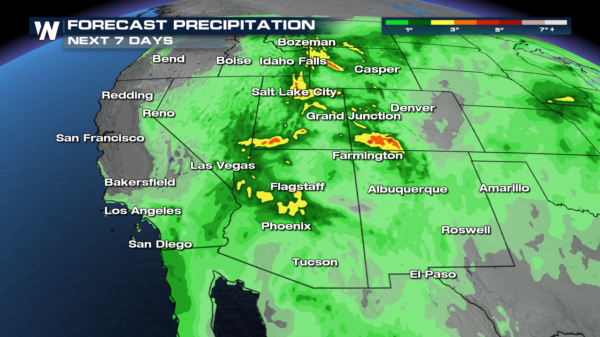 Flood potential begins on Saturday but ramps up Sunday for areas in dark green, as the bulk of Rachel's moisture moves in. Isolated flooding is possible for several southern California cities like Los Angeles and San Diego, while scattered flash flooding is more likely in the deserts and mountain regions to the east of the coast.
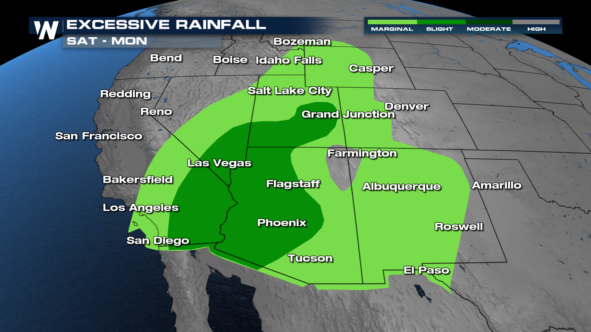 Moisture begins spreading into the region late Saturday, but the bulk of the impacts will be felt Sunday and Monday as heavy rain and the remnant core of the storm quickly move north. Flooding rain could close roads and impact travel in desert and mountain regions - stay vigilant and limit travel if possible!


