Flash Flood Threat Return in the Sunshine State

Florida is gearing up for yet another active setup this week. However, we've definitely seen this before, and not too long ago. This same KIND of setup with this upper level low sinking through the Sunshine State is the same setup that brought us the catastrophic flooding across Melbourne.
WHAT TO EXPECT
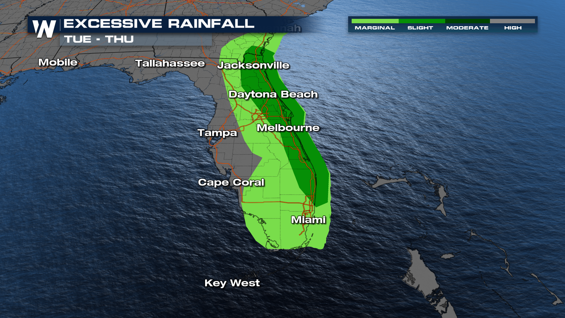
While the setup is similar, we have a decent chance of spreading this moisture out. If we're able to pick up 7" of rain over the course of a week, we'll be alright out into Florida. The issues arise when we pick up those totals in 24 hours time. Regardless, we know how it goes down into Florida, and for those areas that potentially see those conditions, we've got multiple excessive rainfall outlooks going through this work-week.
TIMING
Those chances for rain are going to be in the forecast daily through Friday. The higher probability for the precipitation will likely be on the east coast of Florida.
TOTALS
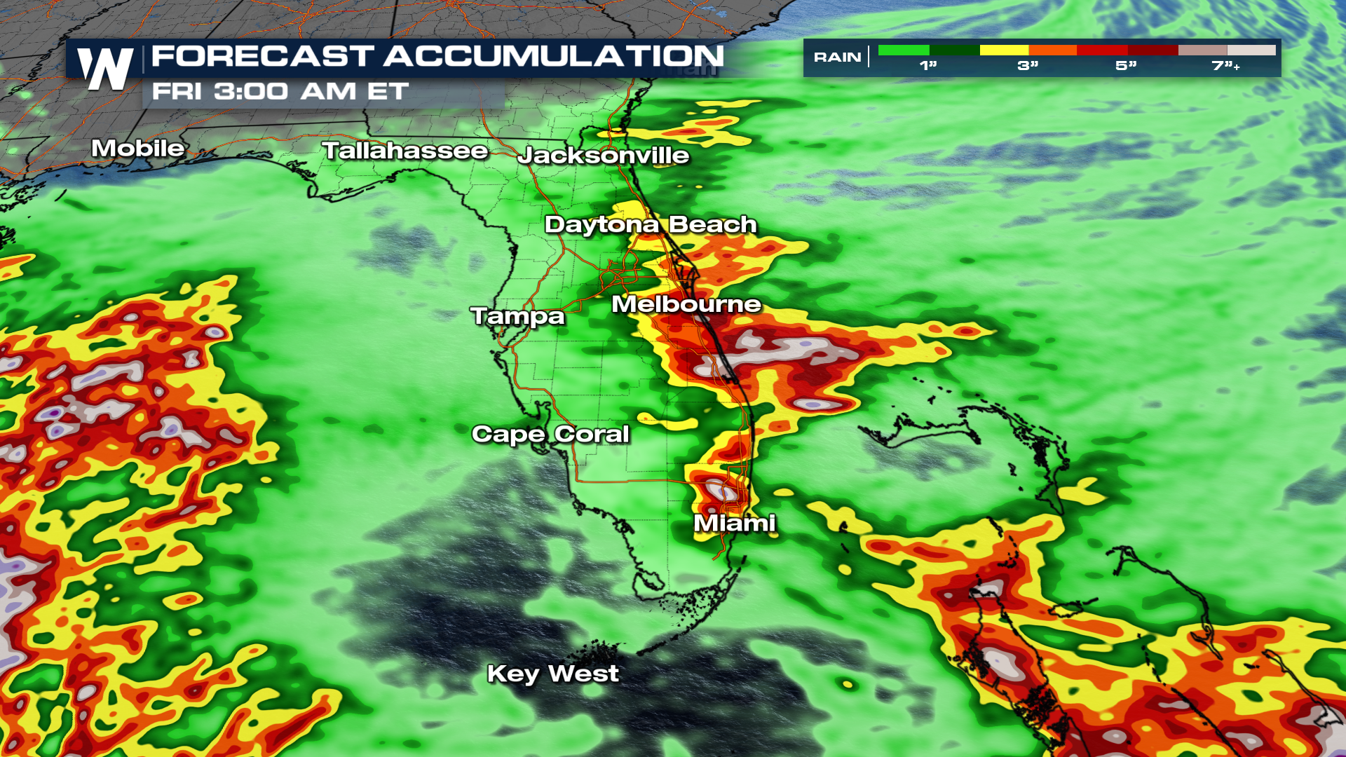
With most of the coverage being along the I-95 corridor, that's also where the heaviest totals are likely to be. We could get up to 6"-7" of rain across the Sunshine State. Again, if we space it out, the flooding threat will decrease.
Join us on WeatherNation at :10 past the hour for your full eastern U.S. breakdown!


