Atmospheric River Setup for the Northwest

The calendar has now turned to month of November and that means the beginning of the wet season for cities like Seattle and Portland. An atmospheric river setup is likely for the West Coast for the next several days. So for a refresher, what is an atmospheric river? An atmospheric river is a large plume of moisture being transported from deep tropical Pacific moisture northward to the West Coast.
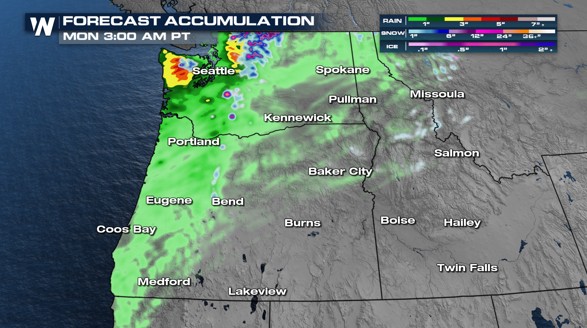
Over the next few days, several lows forming near Alaska are sliding south and slamming into SW Canada and NW Washington State. Through Monday, the Olympia Peninsula and Northern Washington is expecting to see rainfall totals between 3-6 inches. The Portland Metro will see up to an inch with most of the moisture missing them to the north. The Cascades will see some heavier snow this weekend too!
LONG TERM WEST
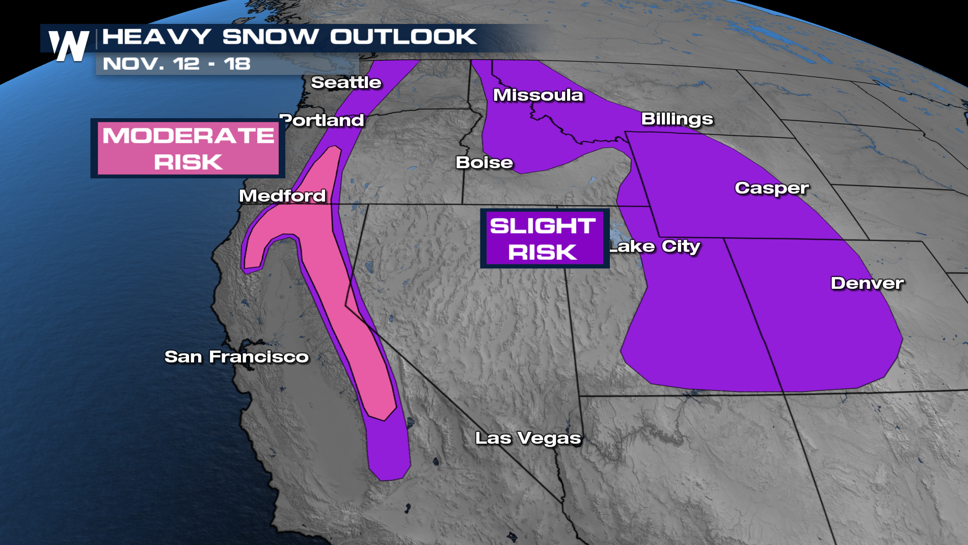
Long range models are hinting at some of these Pacific waves finally diving south into California and for the Four Corners by the end of next week. The Weather Prediction Center's 6-10 Day Outlook is showing very deep green over the western third of the country. Heavy rain, snow, and strong winds could be a possibility as we move into the middle of November.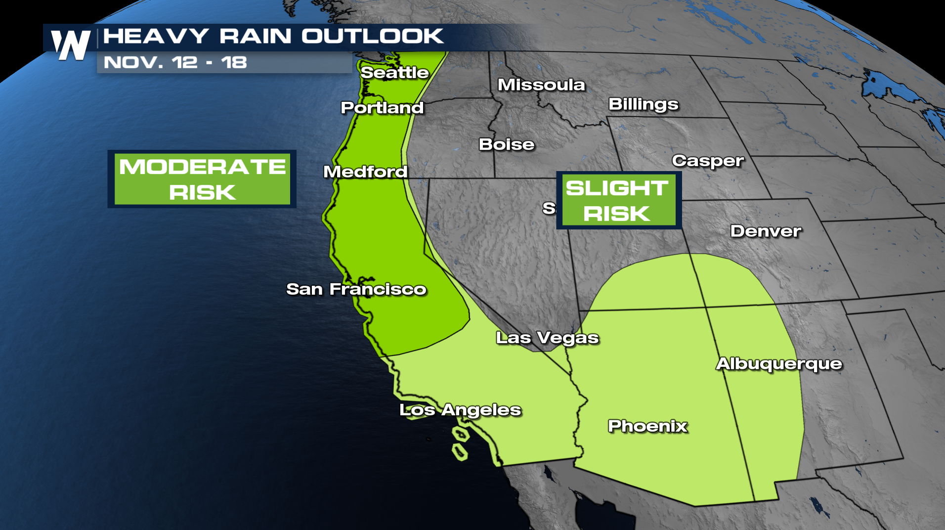
This is a developing story and we will be here following the latest for you on WeatherNation!


