Severe Storms Target the Plains & South to Start the Week

Secondary severe weather season is getting started now that cold air masses are diving into the south to meet warm and moist air from the Gulf. A strong trough will move out of the Rockies on Monday, leading to the development of a surface low and cold front, which will help focus strong and severe storms in the Plains and Midwest to start the week.
Forecast
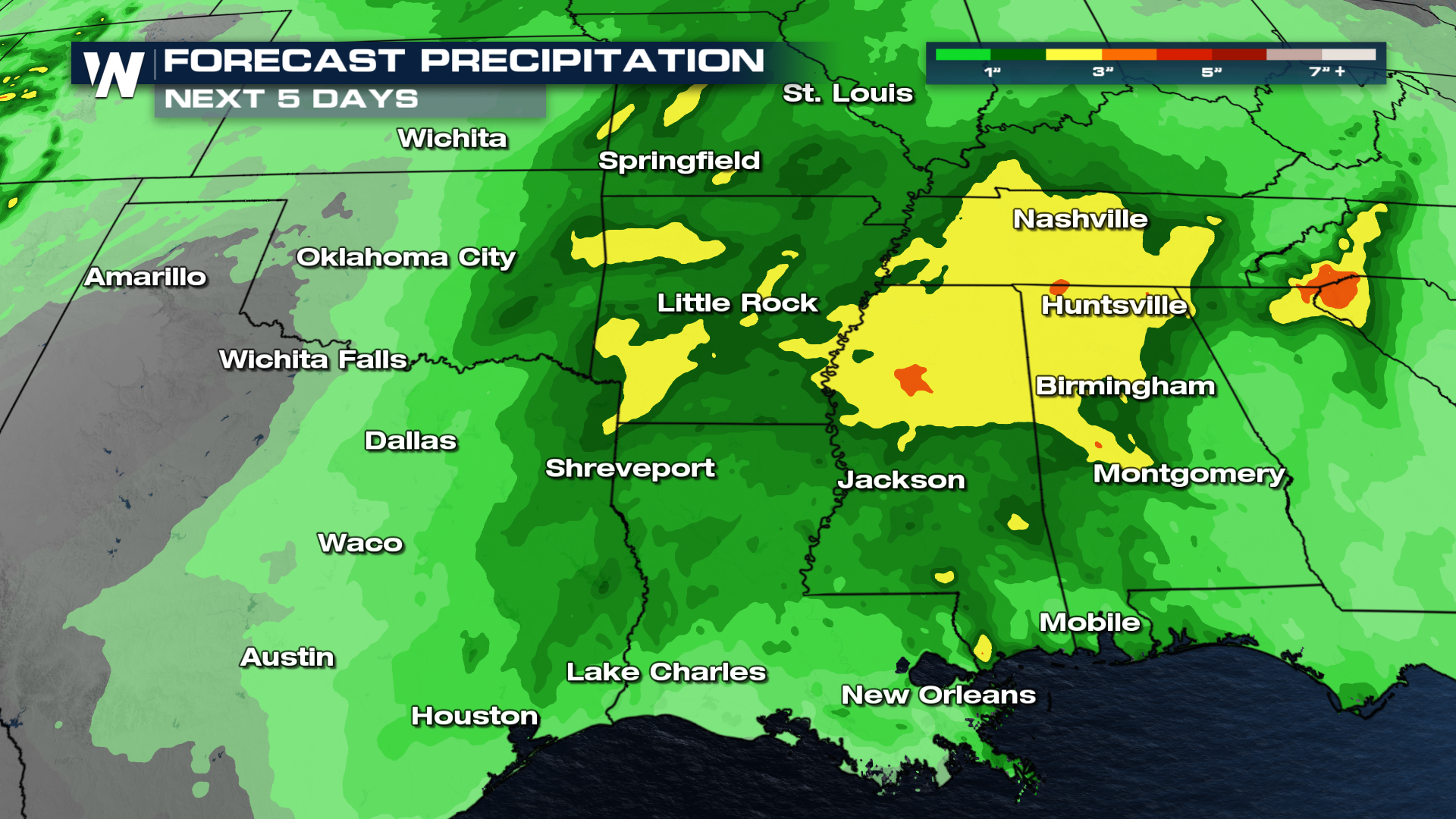
Isolated severe storms are possible on Sunday in New Mexico and into far western Texas. Those strong storms could still be moving through the panhandles early Monday, before the severe threat moves over to the I-35 corridor by the afternoon. Severe storm chances ramp up from Oklahoma City to Kansas City through the afternoon, shifting slightly east into the evening. Storms could develop farther south into Texas late in the evening, with a squall line that could drop across Texas into the morning hours on Tuesday. Heavy rain and strong storms continue to shift east Tuesday, toward the South and Central Gulf.
Outlooks
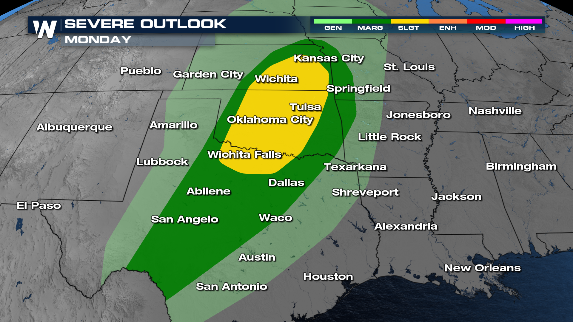
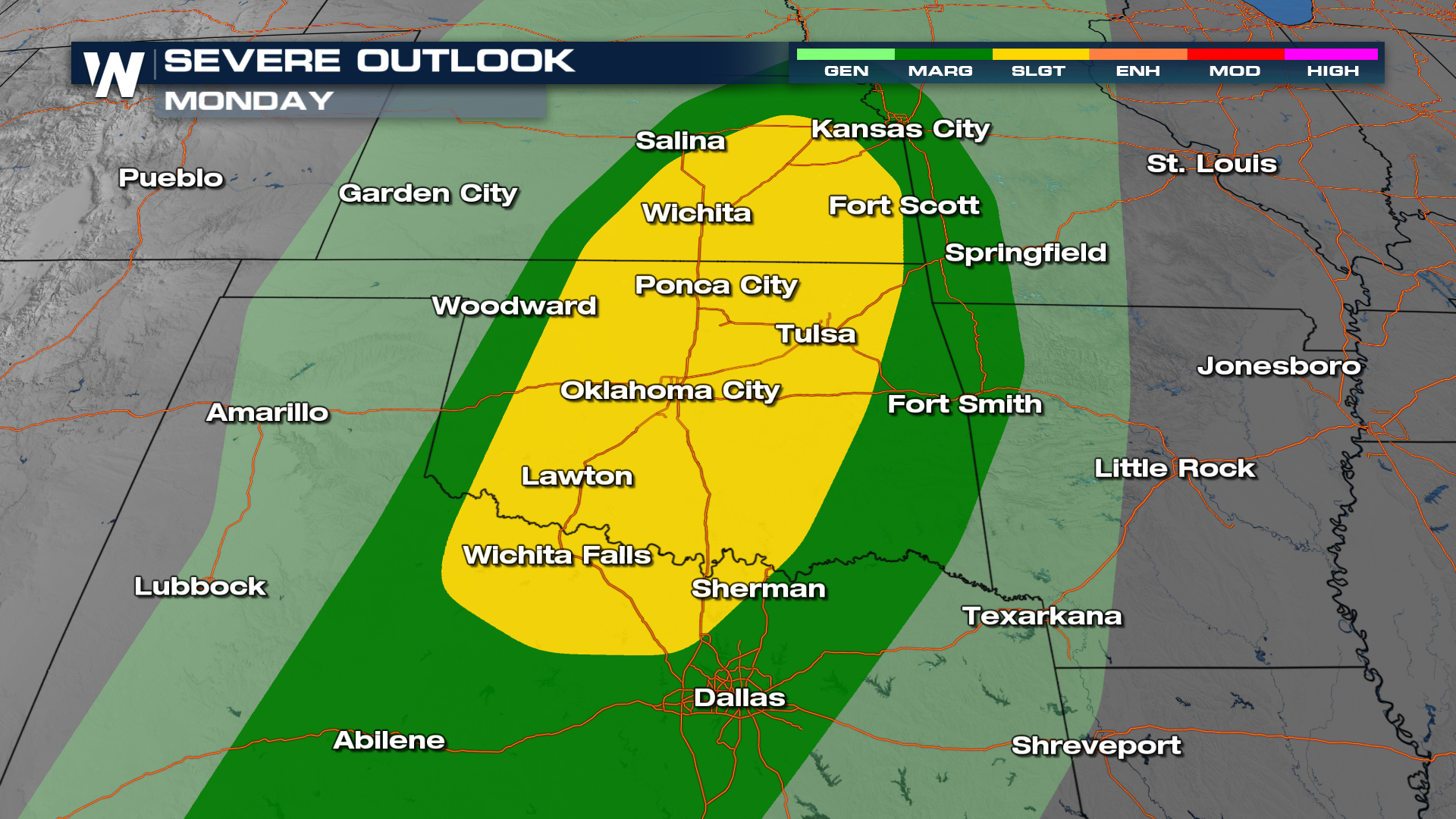
A slight risk has been issued into the Central and Southern Plains, with a marginal risk draped down to the Rio Grande in the Big Bend region. All modes of severe weather (hail, wind, tornadoes) are possible.
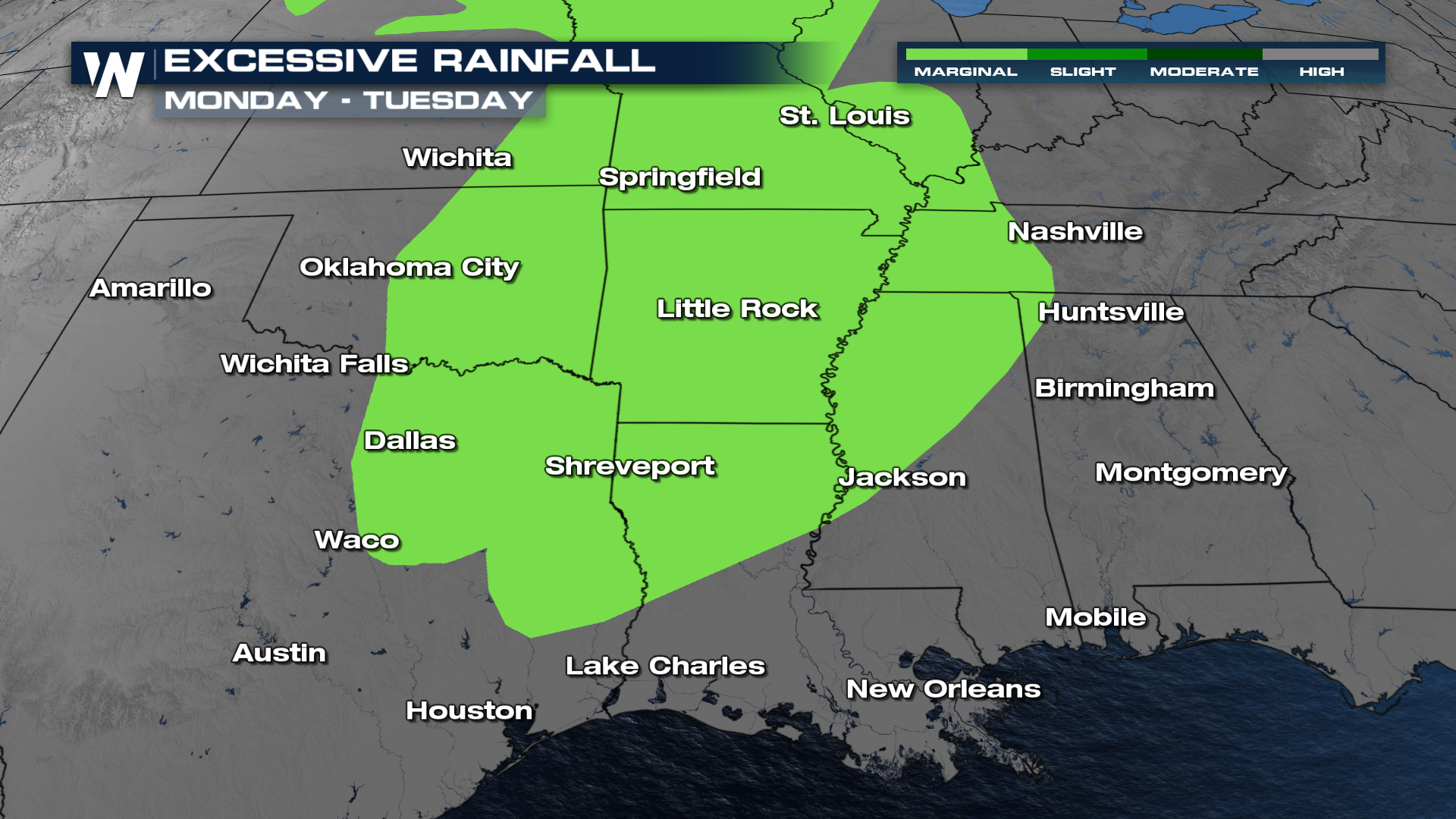
 Heavy rain could lead to isolated or scattered flash flooding. Areas around the Lower Mississippi Valley certainly need some rainfall, as extreme and exceptional drought have expanded recently, but rainfall rates could lead to drainage systems getting overwhelmed.