Skiing Opens in the Rockies, Heavy Snow on the Way

Time to wax the skis and grab the winter gear, skiing is back for the season in the United States. Arapahoe Basin became the first major ski area in the country to open for the season on October 28th, with Keystone just behind, opening on Friday the 30th.
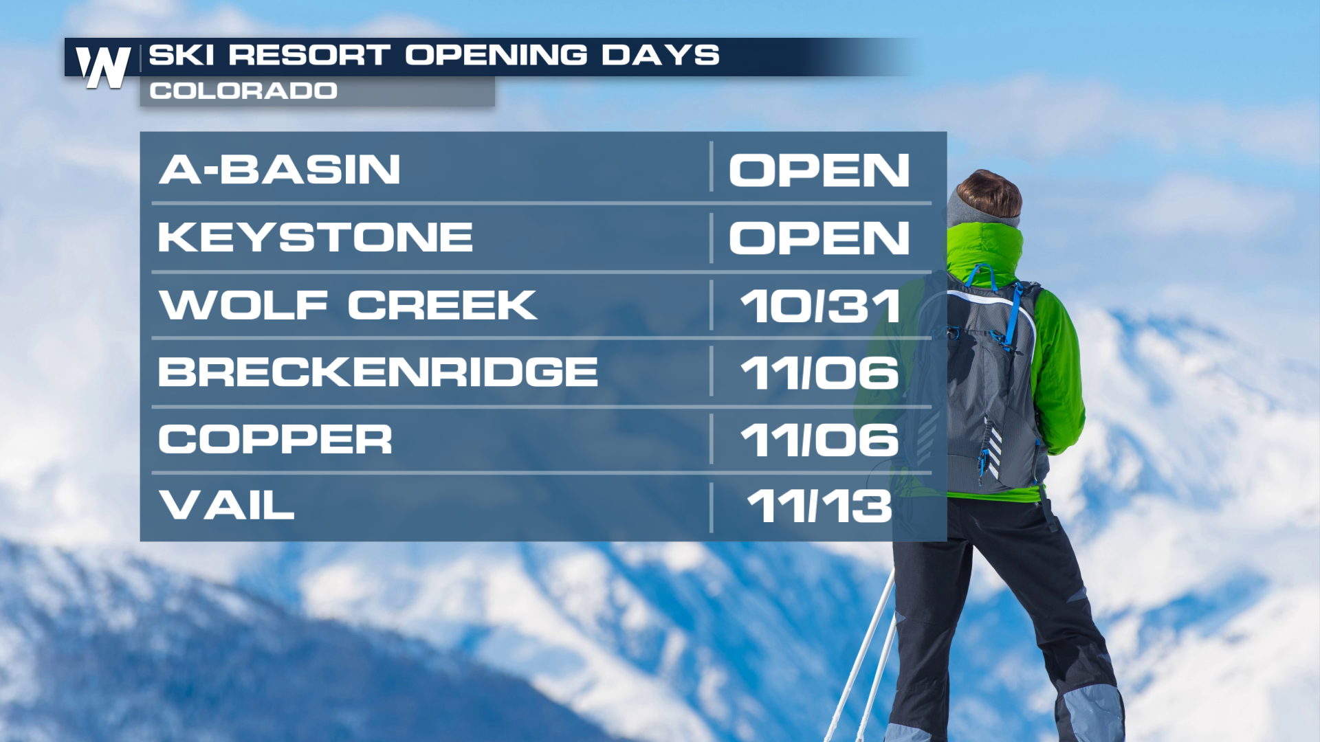
While the snow guns have had some help from mother nature so far this fall, a big storm system will roll through this weekend with heavy snow and gusty winds, but also with warm temperatures that will limit snow to high elevations.
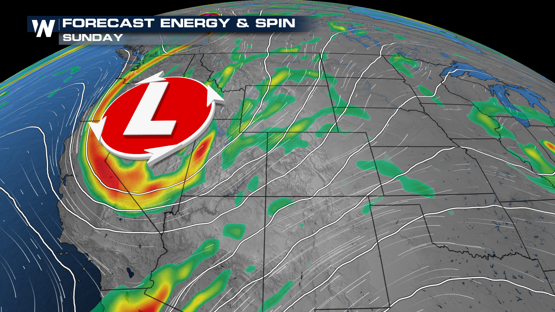
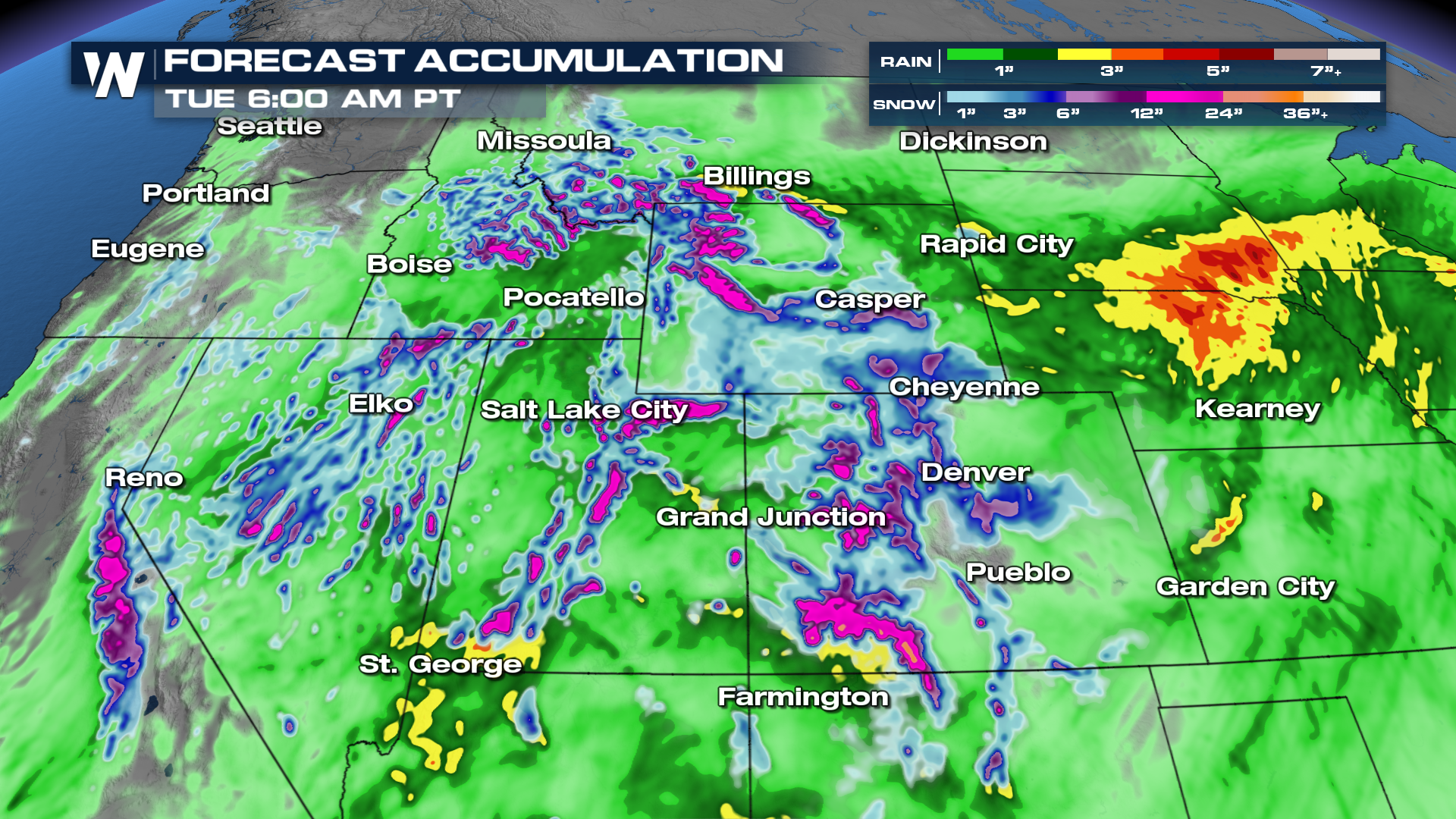
A big trough will spin through the Rockies Saturday through Monday before ejecting into the Plains with severe weather potential. Pacific moisture will be pumped in from a storm system farther south, allowing for flooding around the Four Corners, but also heavy snow above 9,000-10,000 feet. You read that right, snow levels will still be WAY up there, but where it will snow, it will be heavy.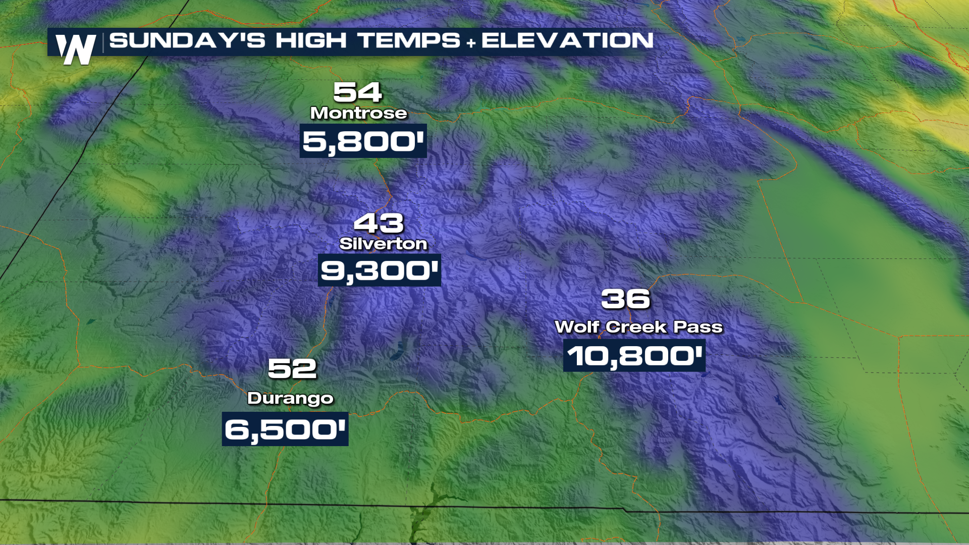
Thankfully for the ski areas open this weekend, they have very high base elevations, with Keystone around 9,300 feet, but A-Basin and WOlf Creek are even higher, over 10,000 feet! Snow will start coming down heavily through Sunday morning, persisting well into Monday. Gusty winds could cause issues, however, with gusts over 40-50 mph possible at higher elevations. Chair lifts may need to be shut down for the gustiest of times.
Heavy snow will fall where ski resorts and areas have yet to open, but it will provide a nice base for higher elevation areas. Mountain travel could be difficult at times this weekend, especially in higher elevations.