Coastal Low Brings Flooding Threat to the East Coast

Heavy rain, gusty winds, and coastal impacts are expected through the weekend on the East Coast, thanks to a developing low pressure system near the state of Florida.
Forecast Factors
The system is being monitored by the National Hurricane Center for tropical development, which could increase impacts if a tropical low forms. The National Hurricane Center decreased chances of formation slightly from the day before, as models have shifted the Florida low to the west (inland).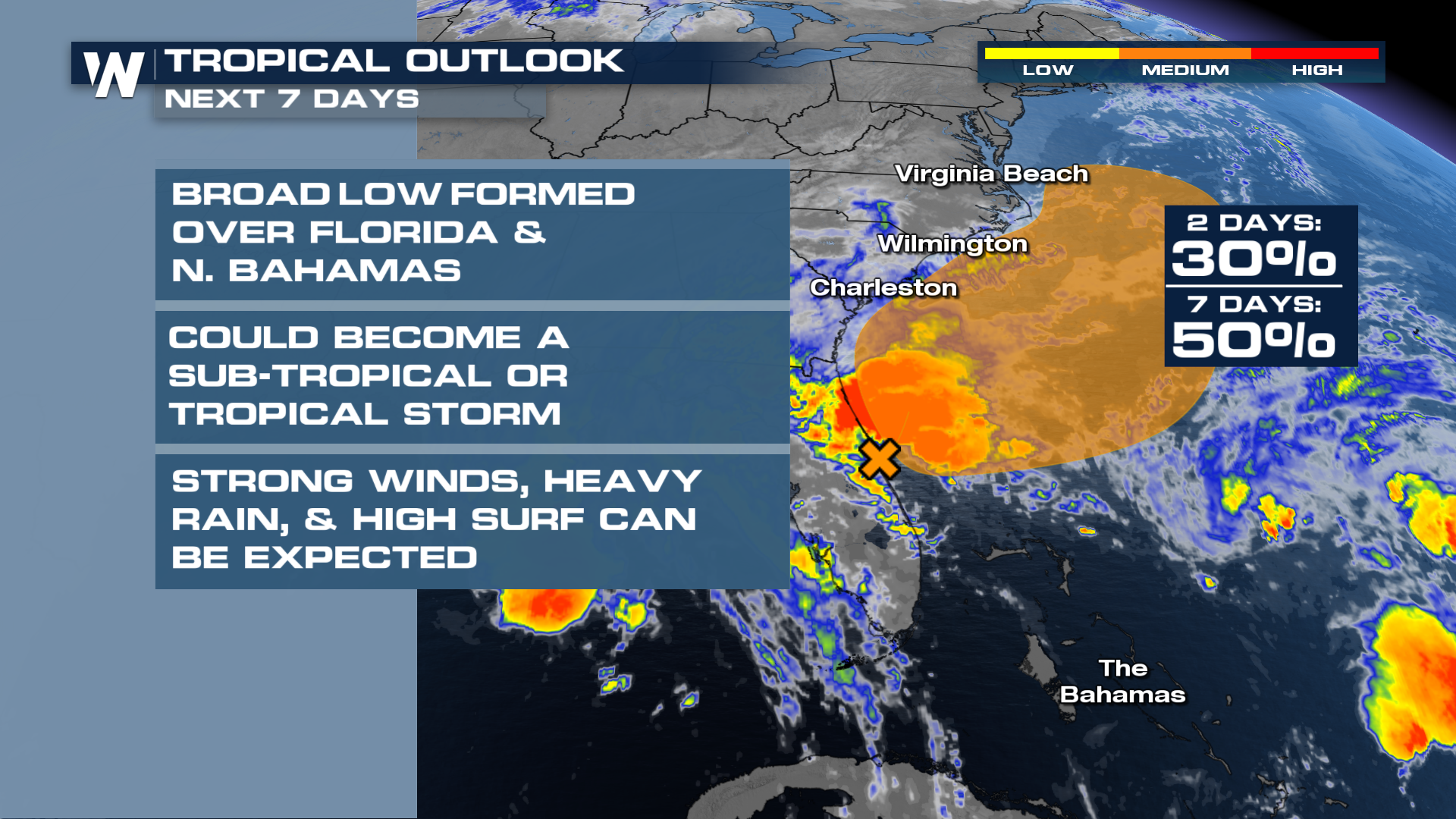
Models have been slowly coming into better agreement about the development of a second low pressure system, as the first low lingers in Florida, before moving north. This second low will likely become the stronger of the two, packing the stronger winds and heavier rain.
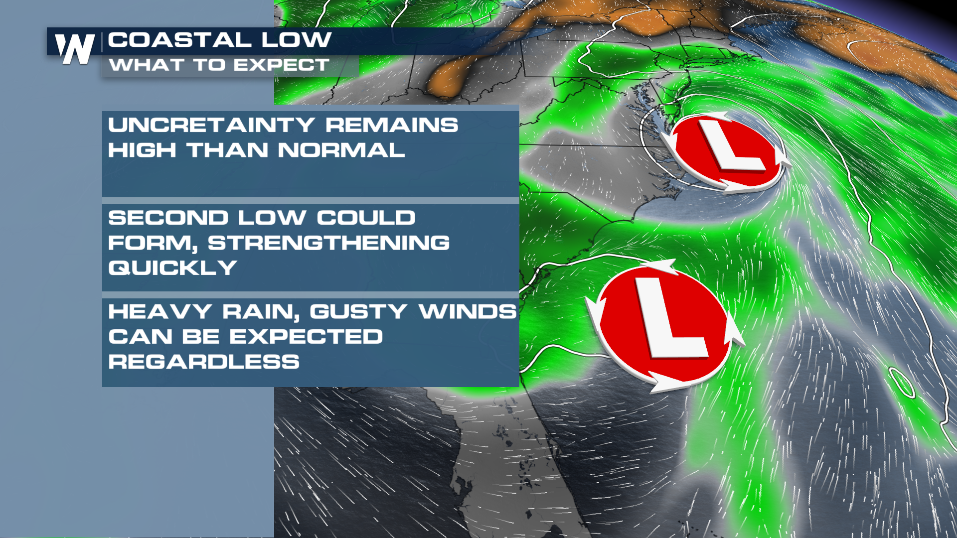
Some details still differ slightly from forecast models, but most solutions show a compact low pressure system moving up the Mid-Atlantic Coast before moving into the New England region Sunday into Monday morning. Thankfully this system looks to move quickly, which should help to limit the flood threat.
Flood Threat
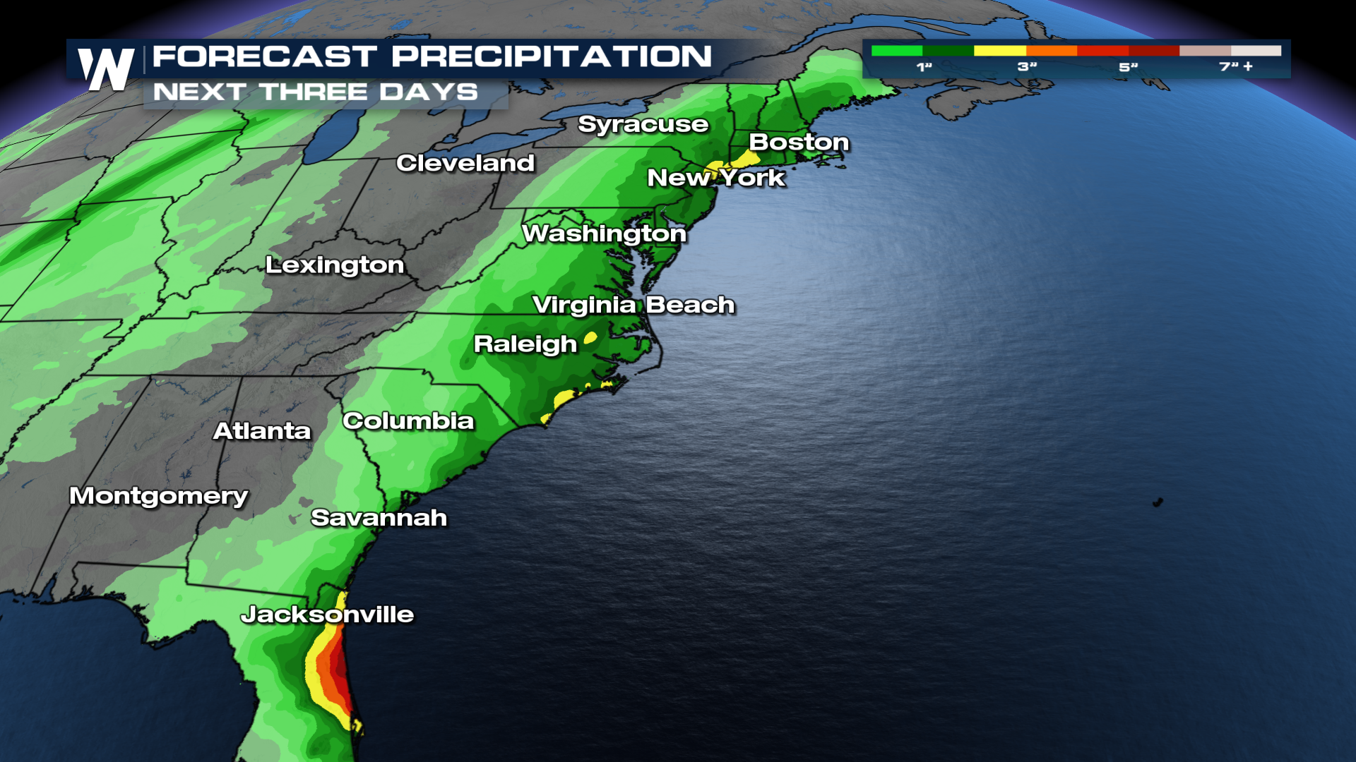
Heavy rain is likely from the pair of lows, with 1-3 inches expected up most of the East Coast. Isolated totals could top 4-5", but this system will be moving quickly, limiting time spent under the heaviest rain.
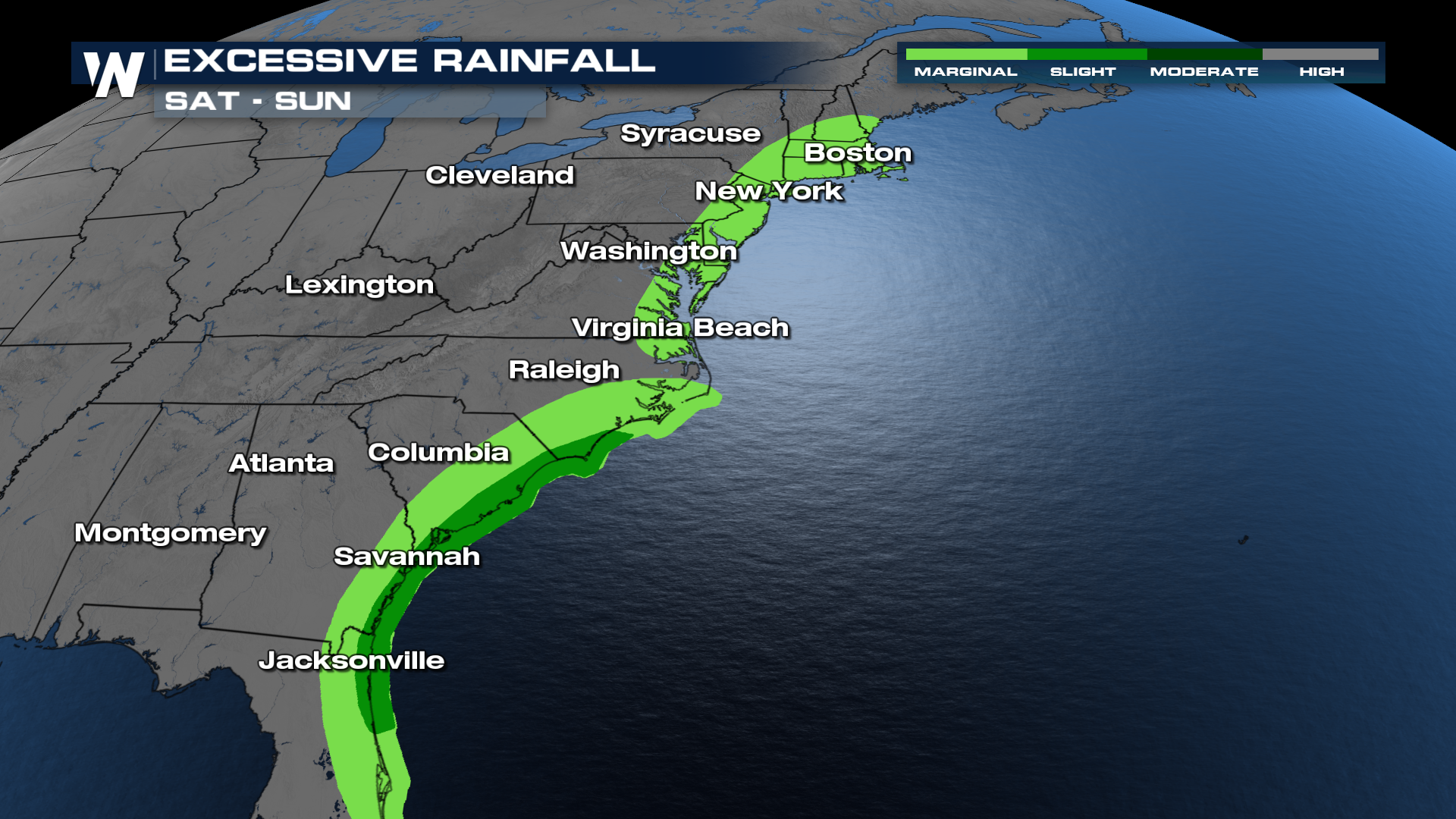
Heavy rainfall rates are still expected to lead to flash flooding, with a level two threat on Saturday from the coast of Northern Florida into the coast of North Carolina. A level one excessive rainfall outlook continues Monday as the low moves north, from Virginia through Southeastern Maine.
Forecast
While the second low may create strong winds and heavy rain, the broad low over Florida will still pack its own precipitation. Showers and thunderstorms will continue around Florida and the Southeast, while the second get organized offshore. Both systems will bring the rain up the SE Coast through Saturday, before quickly moving up the coast toward New England Sunday into Monday morning. Winds will be gusty around this system as well, generating increased surf and rip current hazards.
We're still fine tuning this forecast, so be sure to check back on air and online for the latest!


