Torrential Downpours Batter the Sunshine State

Florida is going to be a hotspot for some pretty heavy rainfall to start the work week. A cut-off low and a ridge to our north, is going to create quite the active setup. All the while, tapping into some rich tropical moisture. All of this, increasing the flash flooding risk.
Since midnight heading into Monday, reports of over 5" of rain have been pouring in across Florida.
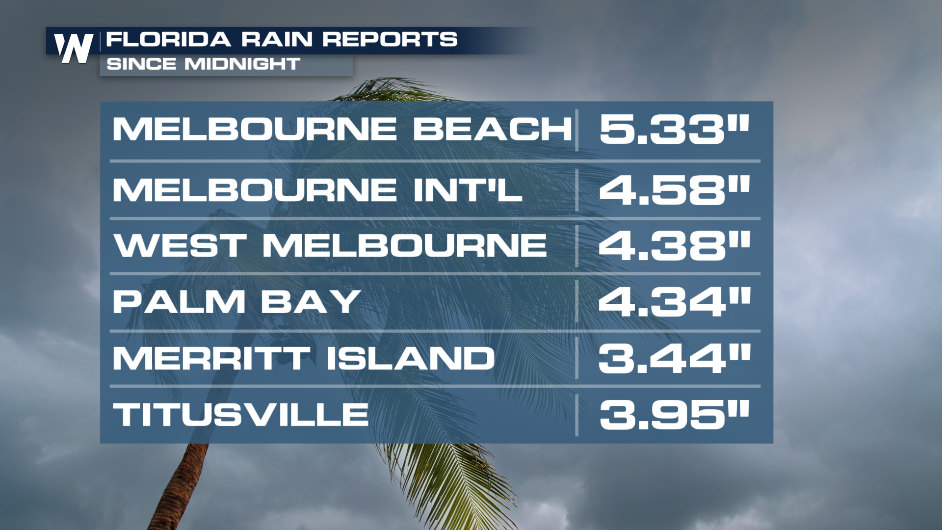
Overall, we've already seen totals well over that. In fact, in Brevard County, a flash flood emergency was issued on Monday morning. These exceedingly rare advisories are especially dangerous. If one is ever issued in your area, you need to seek higher ground immediately.
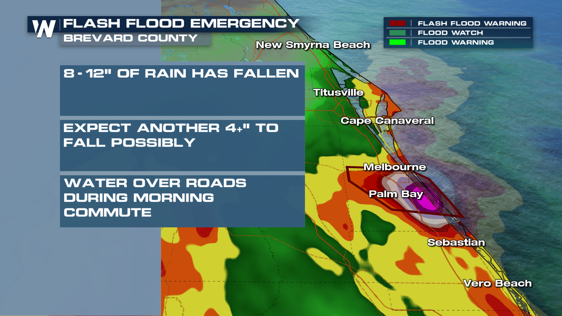
The forecast itself will stay active for Florida, where some of the same areas can pick up another 4-5" of rain going through Monday. A MODERATE (level 3 out of 4) risk for rain will be in place for your Monday, while a SLIGHT (level 2 out of 4) risk will extend along that I-95 corridor.
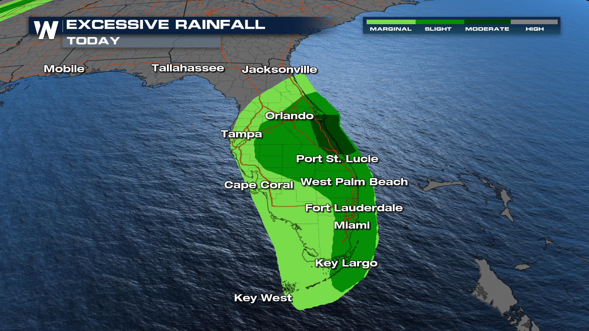
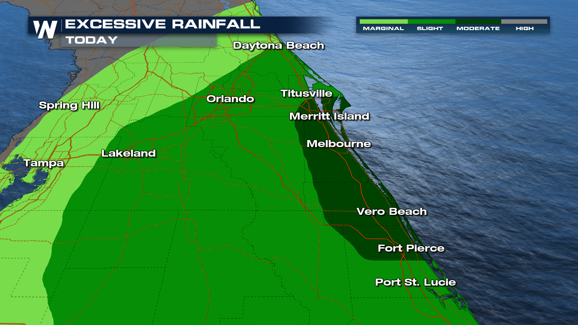
Coverage through Monday is expected to stay decently widespread throughout most of Florida. Anywhere south of Orlando has a decent shot of picking up some downpours.
Check in with us on WeatherNation at :10 past the hour for your full eastern U.S. breakdown!


