First HD Images of Alaska, Hawaii and the Pacific from GOES-17
Special Stories
15 Nov 2018 9:24 AM
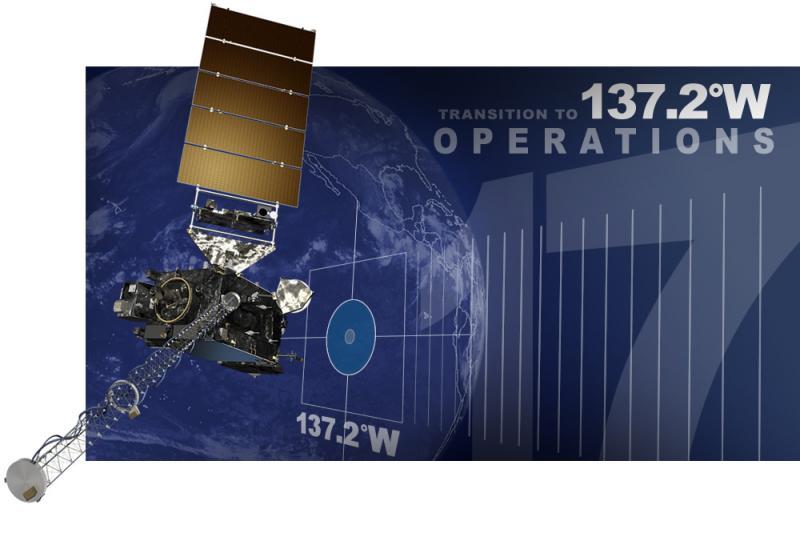
[NOAA] The GOES-17 satellite has reached an exciting new milestone: On Tuesday, the satellite began transmitting its first high-definition images of Alaska, Hawaii, and the Pacific Ocean. The new imagery became available shortly after GOES-17 finished moving to its new orbital position at 137.2 degrees west longitude, where it will become NOAA's operational GOES West satellite on December 10.
With GOES-17's coverage area now centered over the Pacific Ocean, we now have high-resolution geostationary satellite coverage of Alaska, Hawaii and much of the Pacific Ocean for the very first time.
Launched March 1 from NASA's Kennedy Space Center, GOES-17 is the second in a series of NOAA's next-generation geostationary weather satellites. Like GOES-16, its sister satellite operating as GOES East, GOES-17 is designed to provide advanced imagery and atmospheric measurements of Earth from 22,300 miles above the equator.
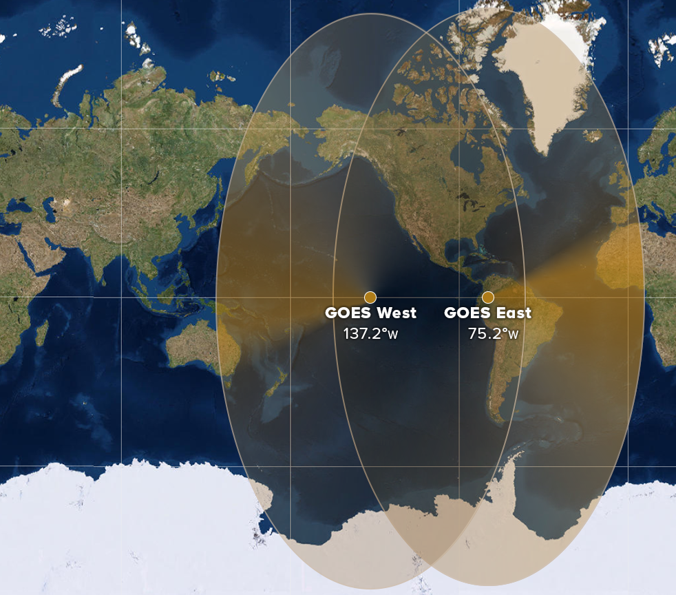 [This maps shows the geographical coverage area of the GOES East and West satellites. (NOAA)]
The Advanced Baseline Imager (ABI) on-board GOES-17 is identical to the instrument on GOES-16. The GOES-17 ABI will offer the same high-resolution visible and infrared imagery in GeoColor and 16 different channels, allowing us to track and monitor cloud formation, atmospheric motion, convection, land surface temperatures, fire and smoke, volcanic ash, sea ice, and more.
GOES-17 will significantly enhance our ability to forecast the weather in the western United States, especially in Alaska and Hawaii. With its expanded satellite coverage at high latitudes, GOES-17 will provide a significantly clearer view of the state of Alaska, where it will improve our ability to track environmental conditions, such as sea ice, volcanic ash, snow cover and wildfires. GOES-17 will also provide more and better data over the northeastern Pacific Ocean, where many weather systems that affect the continental U.S. begin.
Now that GOES-17 is broadcasting data from its permanent home at 137.2 degrees West, look out for some spectacular new satellite imagery from the Last Frontier and the Aloha State. Here are the first stunning new images GOES-17 shared with us this week:
[This maps shows the geographical coverage area of the GOES East and West satellites. (NOAA)]
The Advanced Baseline Imager (ABI) on-board GOES-17 is identical to the instrument on GOES-16. The GOES-17 ABI will offer the same high-resolution visible and infrared imagery in GeoColor and 16 different channels, allowing us to track and monitor cloud formation, atmospheric motion, convection, land surface temperatures, fire and smoke, volcanic ash, sea ice, and more.
GOES-17 will significantly enhance our ability to forecast the weather in the western United States, especially in Alaska and Hawaii. With its expanded satellite coverage at high latitudes, GOES-17 will provide a significantly clearer view of the state of Alaska, where it will improve our ability to track environmental conditions, such as sea ice, volcanic ash, snow cover and wildfires. GOES-17 will also provide more and better data over the northeastern Pacific Ocean, where many weather systems that affect the continental U.S. begin.
Now that GOES-17 is broadcasting data from its permanent home at 137.2 degrees West, look out for some spectacular new satellite imagery from the Last Frontier and the Aloha State. Here are the first stunning new images GOES-17 shared with us this week:
 GOES-17's Advanced Baseline Imager (ABI) captured this GeoColor view of high-level clouds moving over low clouds above the Hawaiian Islands on Tuesday. Convective clouds can be seen forming on the windward side of the mountain slopes of the islands.
 This GOES-17 GeoColor imagery shows an area of clouds streaming over a thick plume of brown smoke from the Woolsey Fire in southern California from Tuesday.
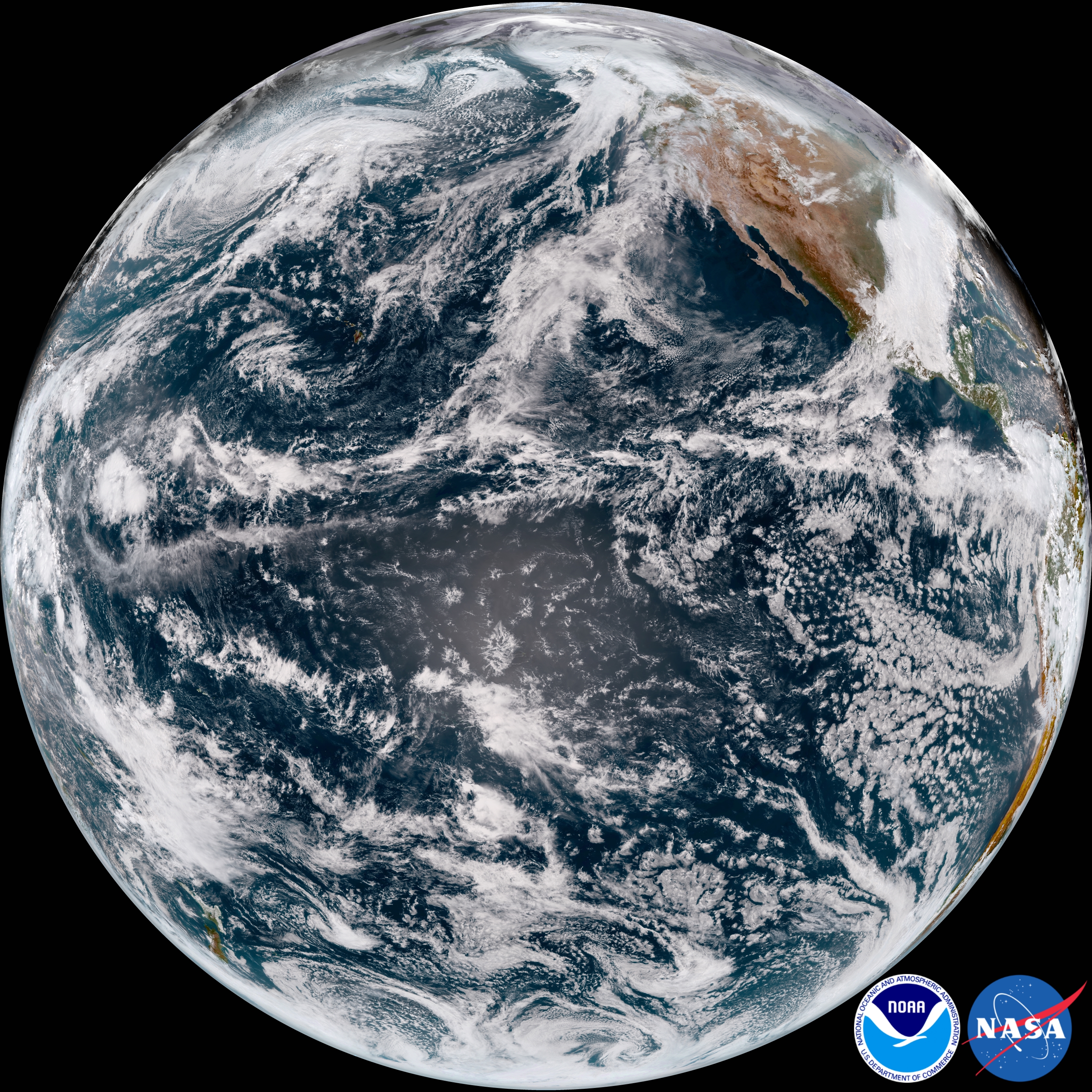 This GeoColor view of Earth, seen from more than 22,000 miles out in space, was captured by the GOES-17 ABI at 4 p.m. ET on Tuesday.
 This infrared imagery, from GOES-17's ABI Channel 13, shows a broad area of low pressure over the Gulf of Alaska from Tuesday.
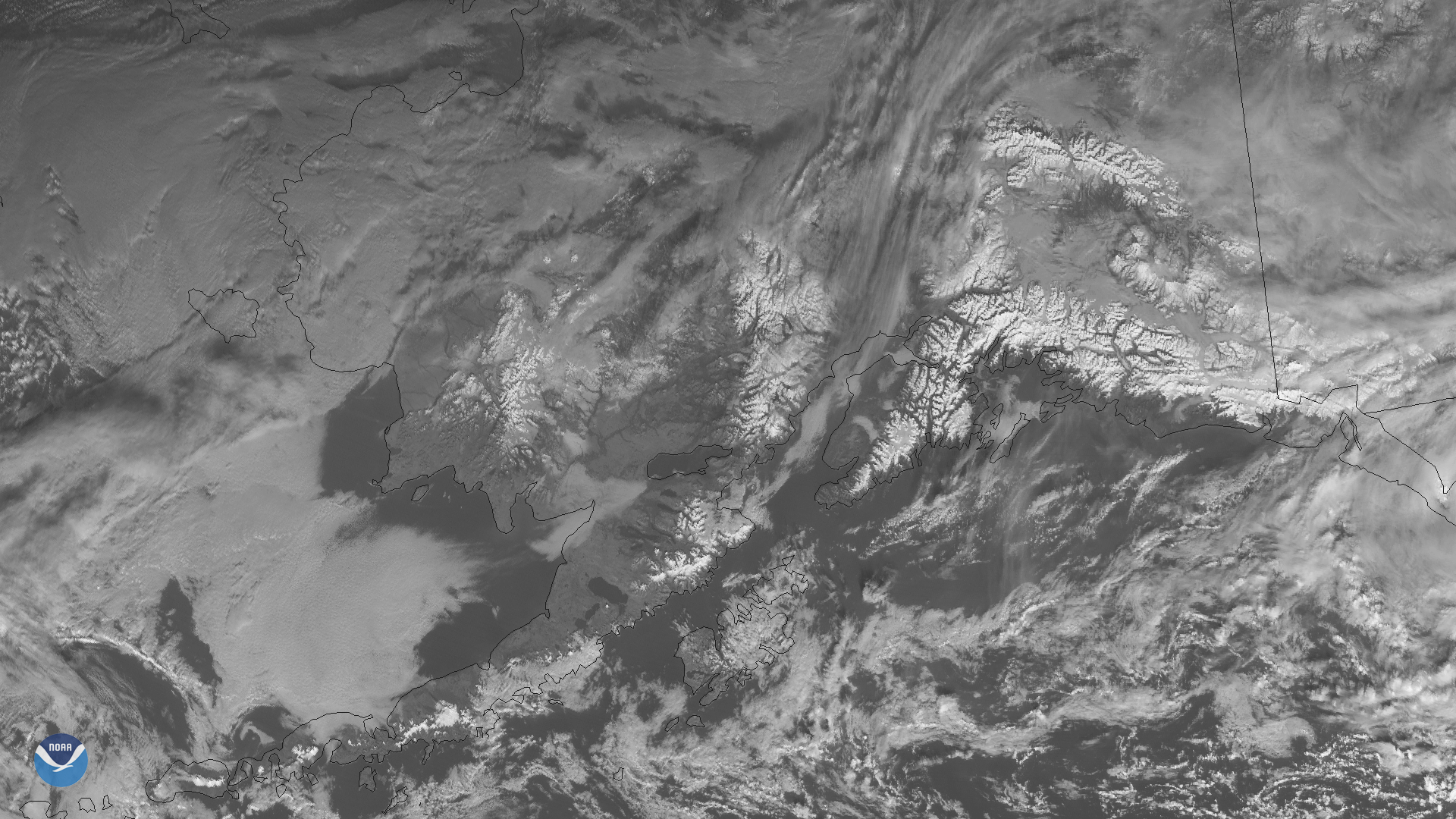 GOES-17 saw the snow-covered peaks of southern Alaska, in this image from Wednesday, seen at 4 p.m. ET, from the satellite’s “red visible” channel (ABI Band 2).
 This 16-panel image shows a snapshot of northeastern Pacific Ocean and western U.S. on Tuesday, seen from the 16 channels on GOES-17's Advanced Baseline Imager. Clouds and atmospheric moisture can be seen stretching from the central Pacific toward the U.S. West Coast.
Edited for WeatherNation by Meteorologist Mace Michaels
This 16-panel image shows a snapshot of northeastern Pacific Ocean and western U.S. on Tuesday, seen from the 16 channels on GOES-17's Advanced Baseline Imager. Clouds and atmospheric moisture can be seen stretching from the central Pacific toward the U.S. West Coast.
Edited for WeatherNation by Meteorologist Mace Michaels
[This maps shows the geographical coverage area of the GOES East and West satellites. (NOAA)]
The Advanced Baseline Imager (ABI) on-board GOES-17 is identical to the instrument on GOES-16. The GOES-17 ABI will offer the same high-resolution visible and infrared imagery in GeoColor and 16 different channels, allowing us to track and monitor cloud formation, atmospheric motion, convection, land surface temperatures, fire and smoke, volcanic ash, sea ice, and more.
GOES-17 will significantly enhance our ability to forecast the weather in the western United States, especially in Alaska and Hawaii. With its expanded satellite coverage at high latitudes, GOES-17 will provide a significantly clearer view of the state of Alaska, where it will improve our ability to track environmental conditions, such as sea ice, volcanic ash, snow cover and wildfires. GOES-17 will also provide more and better data over the northeastern Pacific Ocean, where many weather systems that affect the continental U.S. begin.
Now that GOES-17 is broadcasting data from its permanent home at 137.2 degrees West, look out for some spectacular new satellite imagery from the Last Frontier and the Aloha State. Here are the first stunning new images GOES-17 shared with us this week:
GOES-17's Advanced Baseline Imager (ABI) captured this GeoColor view of high-level clouds moving over low clouds above the Hawaiian Islands on Tuesday. Convective clouds can be seen forming on the windward side of the mountain slopes of the islands.
This GOES-17 GeoColor imagery shows an area of clouds streaming over a thick plume of brown smoke from the Woolsey Fire in southern California from Tuesday.
This GeoColor view of Earth, seen from more than 22,000 miles out in space, was captured by the GOES-17 ABI at 4 p.m. ET on Tuesday.
This infrared imagery, from GOES-17's ABI Channel 13, shows a broad area of low pressure over the Gulf of Alaska from Tuesday.
GOES-17 saw the snow-covered peaks of southern Alaska, in this image from Wednesday, seen at 4 p.m. ET, from the satellite’s “red visible” channel (ABI Band 2).
This 16-panel image shows a snapshot of northeastern Pacific Ocean and western U.S. on Tuesday, seen from the 16 channels on GOES-17's Advanced Baseline Imager. Clouds and atmospheric moisture can be seen stretching from the central Pacific toward the U.S. West Coast.
Edited for WeatherNation by Meteorologist Mace MichaelsAll Weather News
More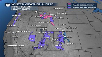
Spring Snow on the Horizon in Colorado
Snow is on the way for the mountains of Color
26 Apr 2024 3:00 AM
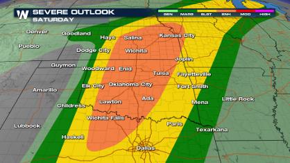
Weekend Forecast: More Severe Weather
We are looking at the threat of another sever
26 Apr 2024 2:45 AM
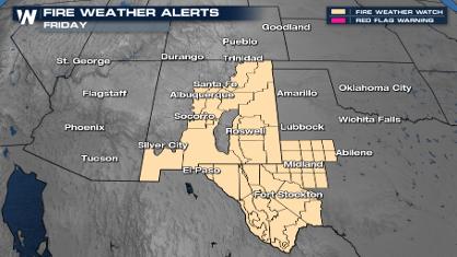
Critical Fire Risk in West Texas, New Mexico
A critical fire risk is in place for west Tex
26 Apr 2024 2:40 AM
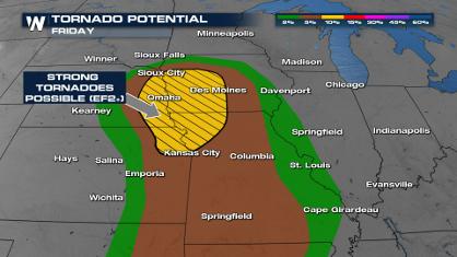
Significant Storm Threat Tonight, Friday
The spring season often means rounds of inten
26 Apr 2024 2:35 AM

National Park Week: Get Out and Explore
National Park Week started Saturday, April 20
25 Apr 2024 9:30 PM

NOAA Debuts "HeatRisk" Tool Nationwide
More people die from heat every year than ALL
25 Apr 2024 9:00 PM

Double Trouble: Cicadas Take to the Skies this Spring
It’s the soundtrack to the summer. Nature’s n
25 Apr 2024 8:45 PM