Another Cold Night for Residents of the Southeast

Following a historic winter storm last weekend, another round of wintry weather moved across the Carolinas earlier on Thursday morning. Perhaps the biggest impact from the front will be another round of cold temperatures, which will further delay snowmelt across the region and continue to impact people in Mississippi, who have been without power for nearly two weeks following an ice storm.
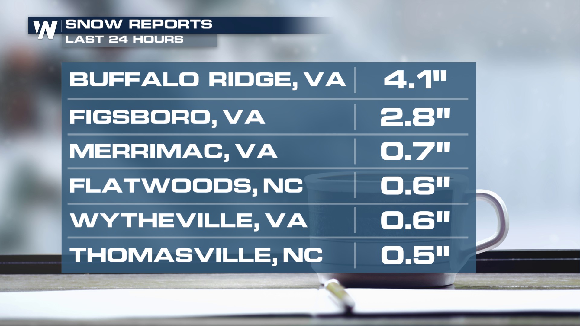
Carolina Snow and Ice:
Although the snow and ice threat diminished earlier this evening, isolated slick spots will still be around through the morning on Friday. Here is a look at some of the snowfall that took place this morning.
South Cold
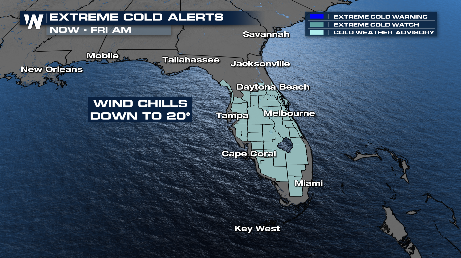
Another round of frigid temperatures will follow the front. Cold weather advisories have been issued for wind chills down into the low 20s on Friday morning.
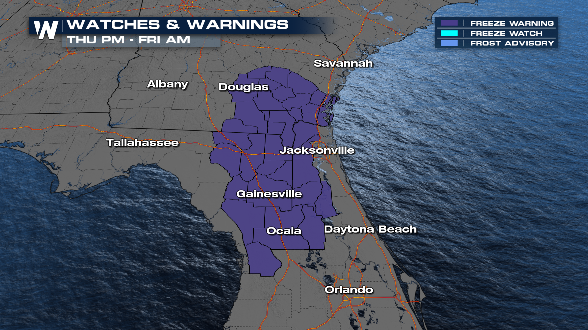
Overnight and through Friday morning, freeze warnings have been issued for Florida and southern Georgia. However, temperatures won't be as cold as those we experienced last weekend in the South.
Make sure to stay tuned to WeatherNation, as we'll continue to track this system for you!


