NASA Testing Airborne Lasers To Touch The Wind
Special Stories
17 Jun 2019 3:51 AM
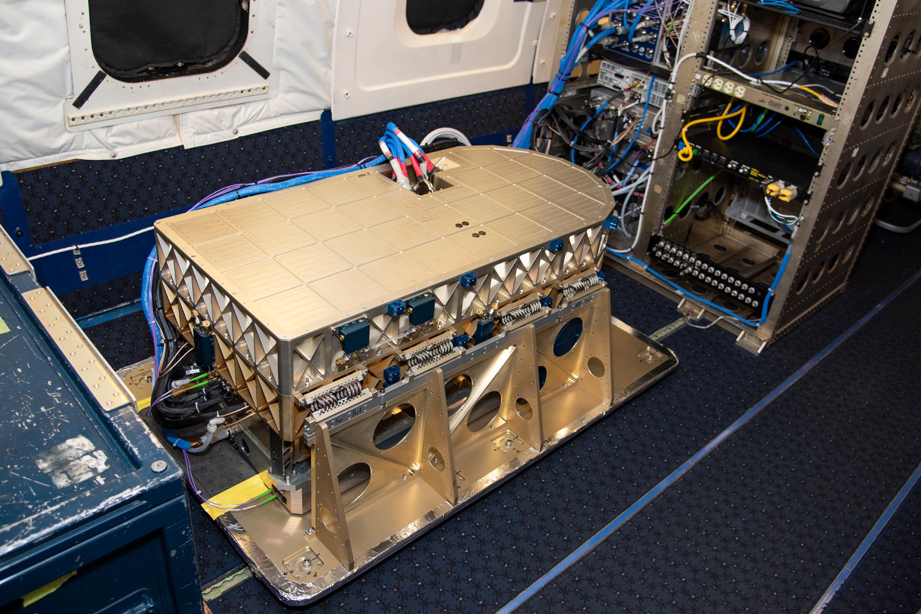
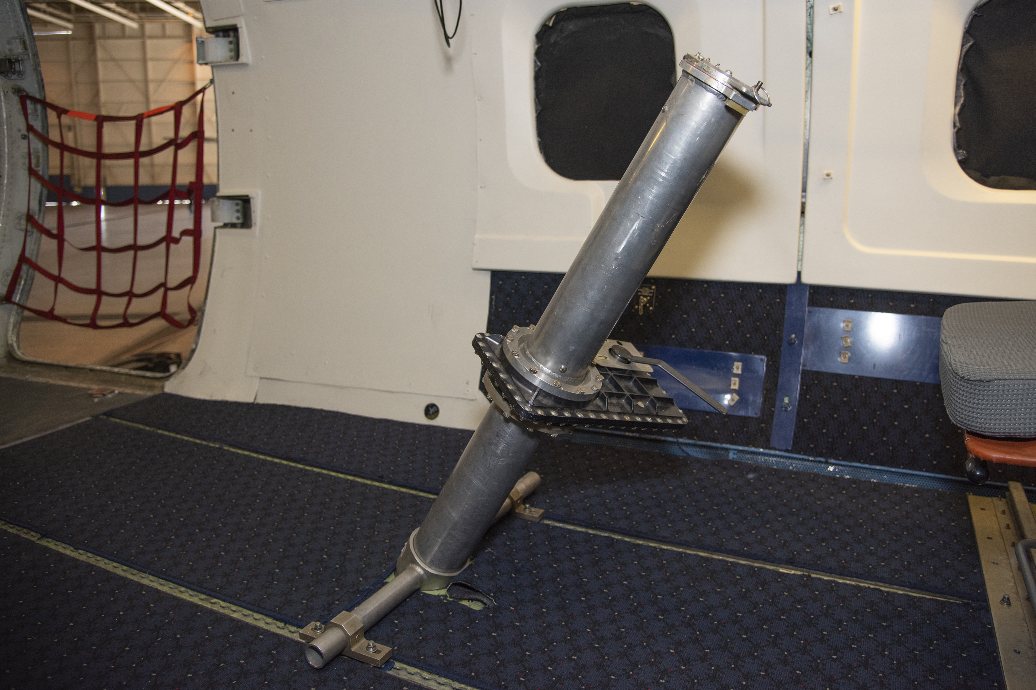
[Aerosol data from the High Altitude Lidar Observatory (HALO), pictured here, will give mission scientists a better sense how DAWN is working and what its strengths and weaknesses are. Credits: NASA/Lauren Hughes]
[NASA] A group of NASA researchers could soon be blown away by data they collect during an airborne science campaign that will span from the Pacific coast to Hawaii. While in the sky, they'll be shooting lasers at the wind to advance technology that could help improve climate and weather predictions.
The researchers, from NASA's Langley Research Center in Hampton, Virginia, are at NASA's Armstrong Flight Research Center Building 703 in Palmdale, California, this month to test Doppler Aerosol Wind Lidar (DAWN), an airborne instrument that uses pulsed lasers at varying scan angles to detect the movement of atmospheric aerosols such as dust or sea salt. In detecting those movements, it can profile wind vector — both speed and direction.
DAWN has been used in previous airborne campaigns, most recently the 2017 Convective Processes Experiment, which looked at convective clouds in the North Atlantic, Gulf of Mexico and Caribbean. Several improvements have been made to the instrument since that mission.
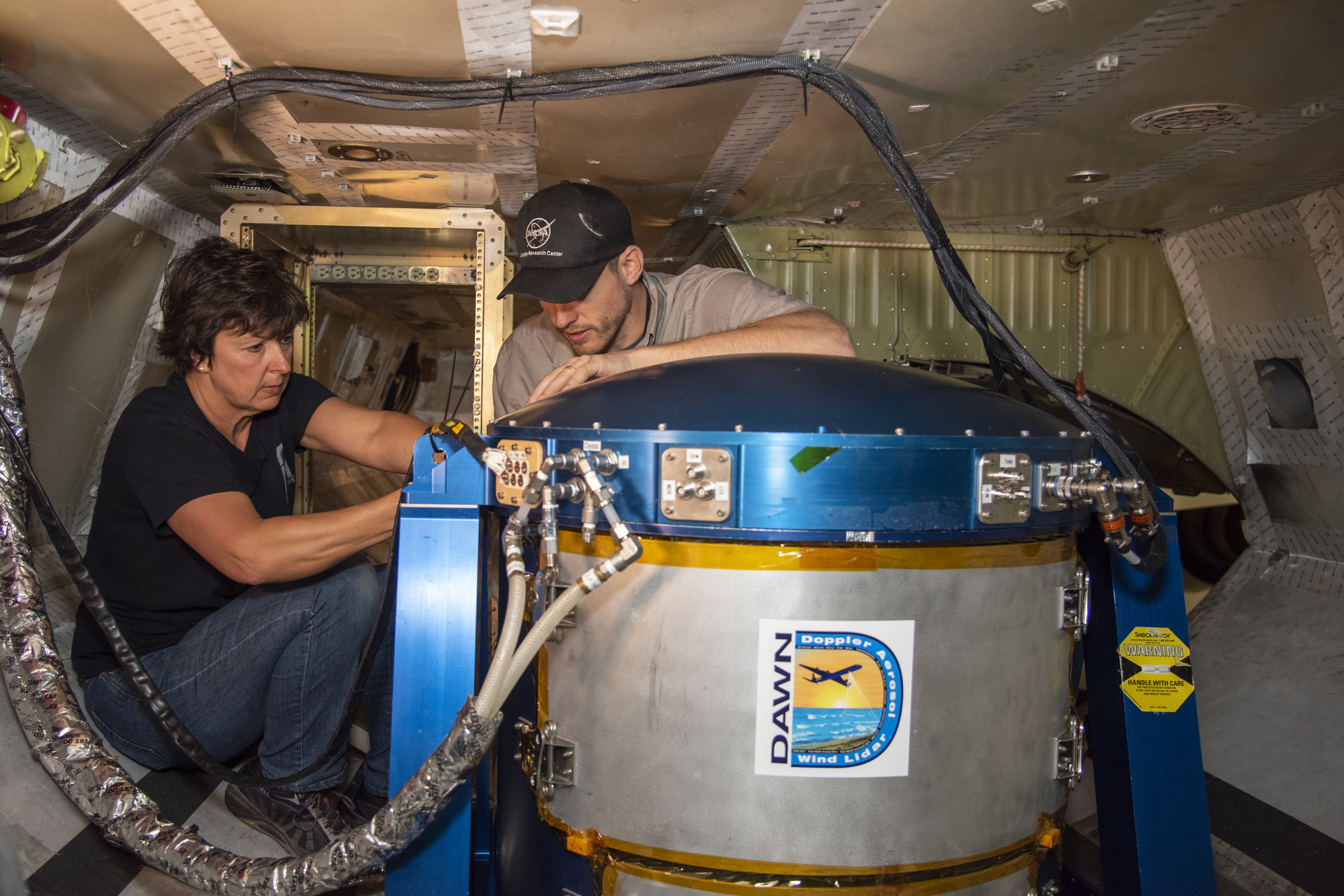 [Researchers Anna Noe and Eric Altman check out the Doppler Aerosol Wind Lidar (DAWN), an airborne instrument that uses pulsed lasers to detect the movement of atmospheric aerosols such as dust or sea salt. In detecting those movements, it can profile wind vector — both speed and direction. Researchers are testing DAWNs capabilities during flights over the eastern Pacific. Credits: NASA/Lauren Hughes]
As they're testing the new, improved DAWN, the researchers are also aiming to validate measurements from Atmospheric Dynamics Mission Aeolus (ADM Aeolus), a European Space Agency (ESA) satellite that also uses doppler lidar to measure wind profiles.
ADM Aeolus, which launched Aug. 22, 2018, works by shooting laser beams in the ultraviolet wavelength down at the Earth. The scattered light that bounces back to the orbiting instrument allows it to "see" atmospheric particles, aerosols and molecules as wind carries them through the atmosphere.
"You can process these data to retrieve a wind profile — a vertical profile of the wind projected along the path the laser beam shoots," said Kristopher Bedka, an atmospheric scientist at Langley and the lead for this mission. "To do this from space is an unprecedented capability."
It's unprecedented because researchers have limited methods for measuring winds. Commercial aircraft capture wind information. Weather balloons can make wind measurements. Meteorologists can also determine wind fields using sequential satellite images that show the movement of clouds and water vapor patterns.
[Researchers Anna Noe and Eric Altman check out the Doppler Aerosol Wind Lidar (DAWN), an airborne instrument that uses pulsed lasers to detect the movement of atmospheric aerosols such as dust or sea salt. In detecting those movements, it can profile wind vector — both speed and direction. Researchers are testing DAWNs capabilities during flights over the eastern Pacific. Credits: NASA/Lauren Hughes]
As they're testing the new, improved DAWN, the researchers are also aiming to validate measurements from Atmospheric Dynamics Mission Aeolus (ADM Aeolus), a European Space Agency (ESA) satellite that also uses doppler lidar to measure wind profiles.
ADM Aeolus, which launched Aug. 22, 2018, works by shooting laser beams in the ultraviolet wavelength down at the Earth. The scattered light that bounces back to the orbiting instrument allows it to "see" atmospheric particles, aerosols and molecules as wind carries them through the atmosphere.
"You can process these data to retrieve a wind profile — a vertical profile of the wind projected along the path the laser beam shoots," said Kristopher Bedka, an atmospheric scientist at Langley and the lead for this mission. "To do this from space is an unprecedented capability."
It's unprecedented because researchers have limited methods for measuring winds. Commercial aircraft capture wind information. Weather balloons can make wind measurements. Meteorologists can also determine wind fields using sequential satellite images that show the movement of clouds and water vapor patterns.
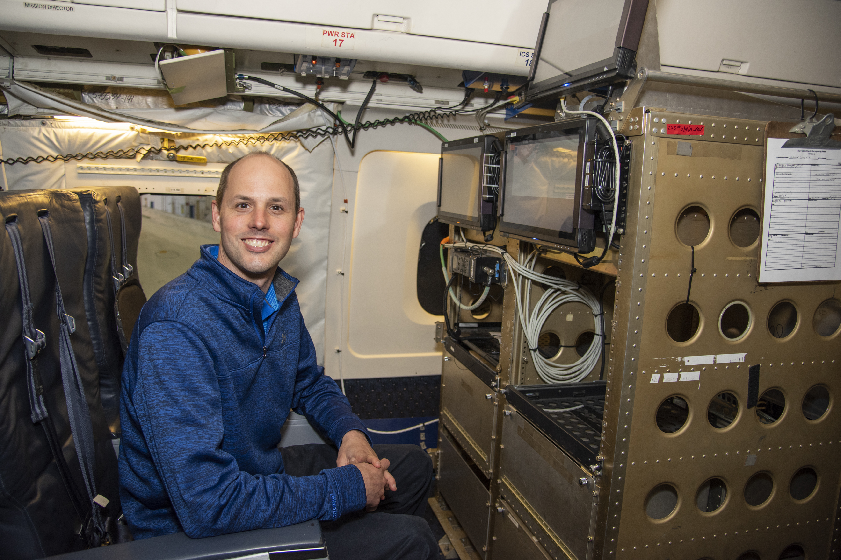 [Langley's Kris Bedka, pictured here on the DC-8 flying laboratory, is the lead for a mission that is advancing laser-based technologies for measuring winds in the lower atmosphere. Credits: NASA/Lauren Hughes]
"But that's only at the levels where cloud or water vapor gradients are located," said Bedka. "Above the cloud, below the cloud — you really don't have any information about the winds. And so wind lidar allows you to basically see the unseen."
Flights on NASA's DC-8 flying laboratory began April 15 and will continue when ADM Aeolus makes passes over the eastern Pacific.
Michael Kavaya, DAWN's principal investigator, is looking forward to seeing how his refined instrument performs. "DAWN's accuracy and sensitivity will not only allow us to make direct comparisons of our measurements against Aeolus's, it will also allow us to look at the underlying wind structure to further interpret Aeolus’s wind measurements,” he said.
The team is also bringing along another Langley instrument called the High Altitude Lidar Observatory (HALO). HALO uses a combined Differential Absorption Lidar (DIAL) and High Spectral Resolution Lidar (HSRL) to profile atmospheric aerosols and water vapor.
[Langley's Kris Bedka, pictured here on the DC-8 flying laboratory, is the lead for a mission that is advancing laser-based technologies for measuring winds in the lower atmosphere. Credits: NASA/Lauren Hughes]
"But that's only at the levels where cloud or water vapor gradients are located," said Bedka. "Above the cloud, below the cloud — you really don't have any information about the winds. And so wind lidar allows you to basically see the unseen."
Flights on NASA's DC-8 flying laboratory began April 15 and will continue when ADM Aeolus makes passes over the eastern Pacific.
Michael Kavaya, DAWN's principal investigator, is looking forward to seeing how his refined instrument performs. "DAWN's accuracy and sensitivity will not only allow us to make direct comparisons of our measurements against Aeolus's, it will also allow us to look at the underlying wind structure to further interpret Aeolus’s wind measurements,” he said.
The team is also bringing along another Langley instrument called the High Altitude Lidar Observatory (HALO). HALO uses a combined Differential Absorption Lidar (DIAL) and High Spectral Resolution Lidar (HSRL) to profile atmospheric aerosols and water vapor.
 [Langley's Kris Bedka, pictured here on the DC-8 flying laboratory, is the lead for a mission that is advancing laser-based technologies for measuring winds in the lower atmosphere. Credits: NASA/Lauren Hughes]
That level of detail is just icing on the cake. The real key this time out is to take another step toward advancing the science community's ability to measure winds. Indeed, Bedka hopes this mission will "continue to prove that laser-based wind measurement is a great thing to do from aircraft."
That hope is directly in line with the 2017 Earth Science Decadal Survey, which recommended close observation of winds in the lower atmosphere because of their fundamental role in the Earth system.
So it's important work Bedka and his cohorts are doing, and work they'd likely tell you is anything but a breeze.
Edited for WeatherNation by Meteorologist Mace Michaels
[Langley's Kris Bedka, pictured here on the DC-8 flying laboratory, is the lead for a mission that is advancing laser-based technologies for measuring winds in the lower atmosphere. Credits: NASA/Lauren Hughes]
That level of detail is just icing on the cake. The real key this time out is to take another step toward advancing the science community's ability to measure winds. Indeed, Bedka hopes this mission will "continue to prove that laser-based wind measurement is a great thing to do from aircraft."
That hope is directly in line with the 2017 Earth Science Decadal Survey, which recommended close observation of winds in the lower atmosphere because of their fundamental role in the Earth system.
So it's important work Bedka and his cohorts are doing, and work they'd likely tell you is anything but a breeze.
Edited for WeatherNation by Meteorologist Mace Michaels
[Researchers Anna Noe and Eric Altman check out the Doppler Aerosol Wind Lidar (DAWN), an airborne instrument that uses pulsed lasers to detect the movement of atmospheric aerosols such as dust or sea salt. In detecting those movements, it can profile wind vector — both speed and direction. Researchers are testing DAWNs capabilities during flights over the eastern Pacific. Credits: NASA/Lauren Hughes]
As they're testing the new, improved DAWN, the researchers are also aiming to validate measurements from Atmospheric Dynamics Mission Aeolus (ADM Aeolus), a European Space Agency (ESA) satellite that also uses doppler lidar to measure wind profiles.
ADM Aeolus, which launched Aug. 22, 2018, works by shooting laser beams in the ultraviolet wavelength down at the Earth. The scattered light that bounces back to the orbiting instrument allows it to "see" atmospheric particles, aerosols and molecules as wind carries them through the atmosphere.
"You can process these data to retrieve a wind profile — a vertical profile of the wind projected along the path the laser beam shoots," said Kristopher Bedka, an atmospheric scientist at Langley and the lead for this mission. "To do this from space is an unprecedented capability."
It's unprecedented because researchers have limited methods for measuring winds. Commercial aircraft capture wind information. Weather balloons can make wind measurements. Meteorologists can also determine wind fields using sequential satellite images that show the movement of clouds and water vapor patterns.
[Langley's Kris Bedka, pictured here on the DC-8 flying laboratory, is the lead for a mission that is advancing laser-based technologies for measuring winds in the lower atmosphere. Credits: NASA/Lauren Hughes]
"But that's only at the levels where cloud or water vapor gradients are located," said Bedka. "Above the cloud, below the cloud — you really don't have any information about the winds. And so wind lidar allows you to basically see the unseen."
Flights on NASA's DC-8 flying laboratory began April 15 and will continue when ADM Aeolus makes passes over the eastern Pacific.
Michael Kavaya, DAWN's principal investigator, is looking forward to seeing how his refined instrument performs. "DAWN's accuracy and sensitivity will not only allow us to make direct comparisons of our measurements against Aeolus's, it will also allow us to look at the underlying wind structure to further interpret Aeolus’s wind measurements,” he said.
The team is also bringing along another Langley instrument called the High Altitude Lidar Observatory (HALO). HALO uses a combined Differential Absorption Lidar (DIAL) and High Spectral Resolution Lidar (HSRL) to profile atmospheric aerosols and water vapor.
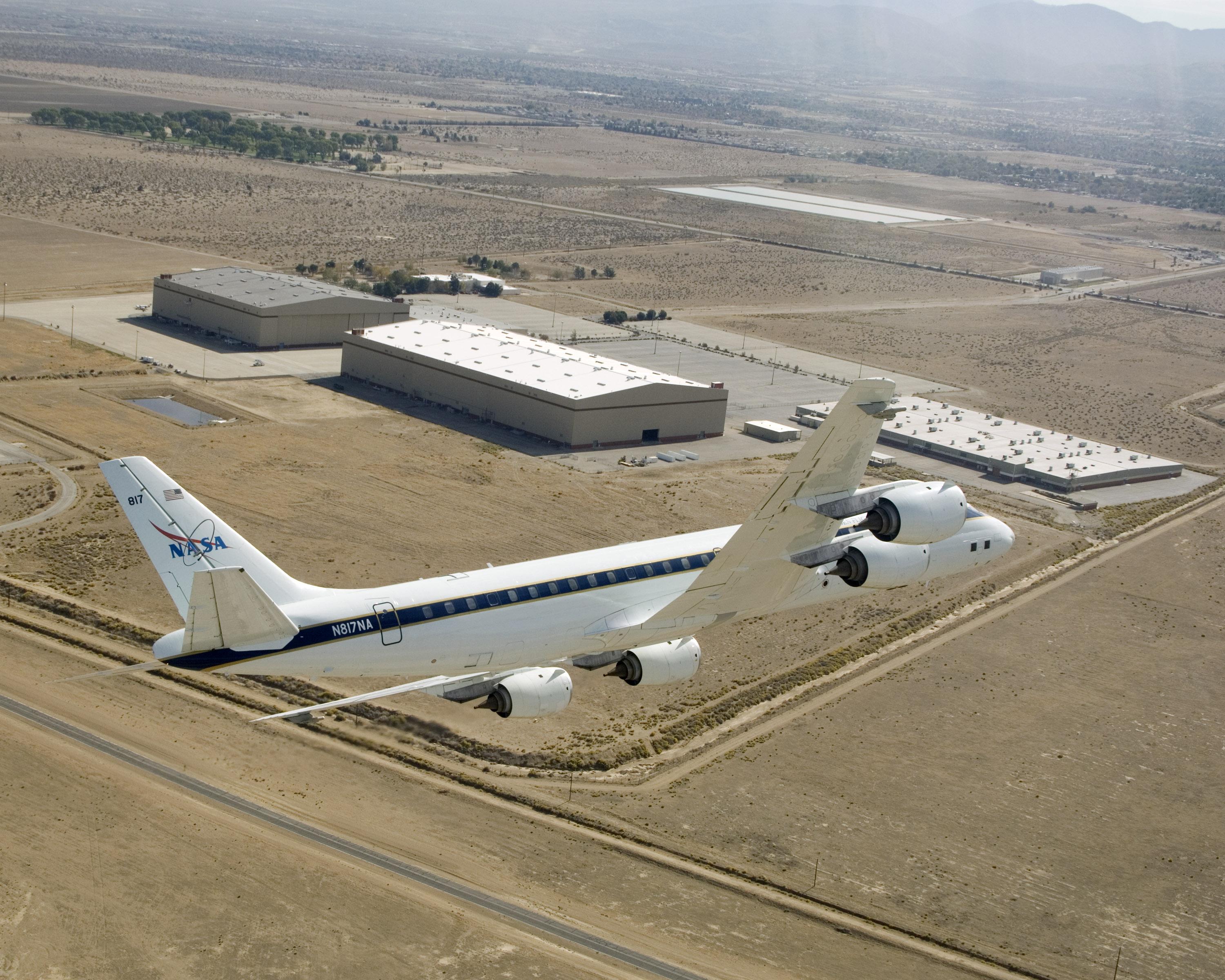
[The DC-8 airborne science laboratory flies over the NASA Armstrong Flight Research Center facility in Palmdale, California. Credits: NASA Photo]
"We'll be able to pair the aerosol information together with the wind information and truly understand the capabilities of DAWN and what its strengths and weaknesses are, and also to evaluate Aeolus's aerosol and wind measurements," said Bedka.
In addition, HALO's water vapor measurements will give the scientists a more comprehensive view of what's happening in the atmosphere around them and set the stage for future airborne campaigns focused on atmospheric dynamic processes.
"Clouds ingest water vapor and particulates and then transport them throughout the atmosphere," said Bedka. "And so being able to put this picture together, this four-dimensional picture of the atmospheric state, can help us really understand atmospheric processes with extremely high detail."
[Langley's Kris Bedka, pictured here on the DC-8 flying laboratory, is the lead for a mission that is advancing laser-based technologies for measuring winds in the lower atmosphere. Credits: NASA/Lauren Hughes]
That level of detail is just icing on the cake. The real key this time out is to take another step toward advancing the science community's ability to measure winds. Indeed, Bedka hopes this mission will "continue to prove that laser-based wind measurement is a great thing to do from aircraft."
That hope is directly in line with the 2017 Earth Science Decadal Survey, which recommended close observation of winds in the lower atmosphere because of their fundamental role in the Earth system.
So it's important work Bedka and his cohorts are doing, and work they'd likely tell you is anything but a breeze.
Edited for WeatherNation by Meteorologist Mace MichaelsAll Weather News
More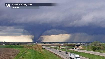
Tornado Touches Down in Nebraska and Iowa on Friday
A tornado touched down in Lincoln, NE, just b
27 Apr 2024 2:00 AM
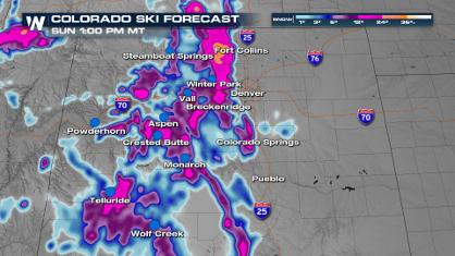
Spring Snow on the Horizon in Colorado
Snow is on the way for the Intermountain West
27 Apr 2024 1:50 AM
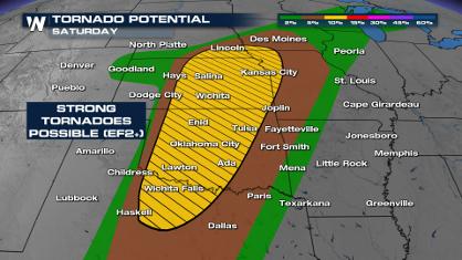
Weekend Forecast: More Severe Weather, Flash Flooding
If it seems like April has been particularly
27 Apr 2024 1:45 AM
From frosty temps to Record Warmth in the Northeast
Temps are climbing in the Northeast, and by e
27 Apr 2024 1:40 AM

NOAA Debuts "HeatRisk" Tool Nationwide
More people die from heat every year than ALL
27 Apr 2024 1:15 AM

Double Trouble: Cicadas Take to the Skies this Spring
It’s the soundtrack to the summer. Nature’s n
27 Apr 2024 1:05 AM
Critical Fire Risk in West Texas, New Mexico
A critical fire risk is in place for west Tex
26 Apr 2024 2:15 PM