Rounds of Severe Storms Target the Plains

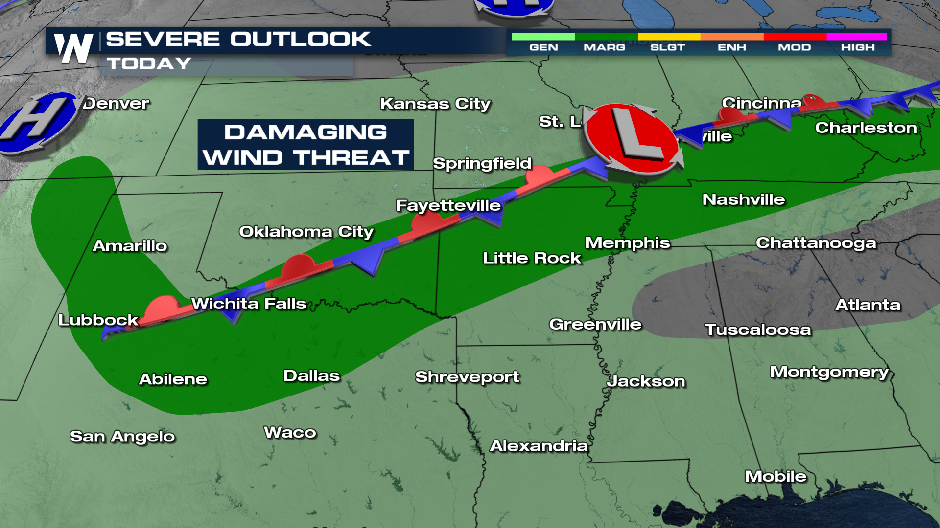
The plains have had an active summer. Severe storms on Wednesday clocked in winds above 70 mph across portions of the plains. The risk for severe weather remains through the overnight (above). As Deep Moisture from the Gulf work north and meet this slow moving front across the southern plains, some much needed rain will be expected across the South.
THURSDAY
A Marginal risk for severe weather remains through cities like Fort Smith, AR and Paducah, KY through Thursday. Damaging winds are the primary threat. As you move farther west, closer to the Front Range, hail will also be a concern.
 TIMING
Some storms will hold together overnight, and as the frontal boundary dips south, more storms will develop once again on Thursday. There is an isolated threat for severe weather including damaging winds and hail.
FLOOD THREAT
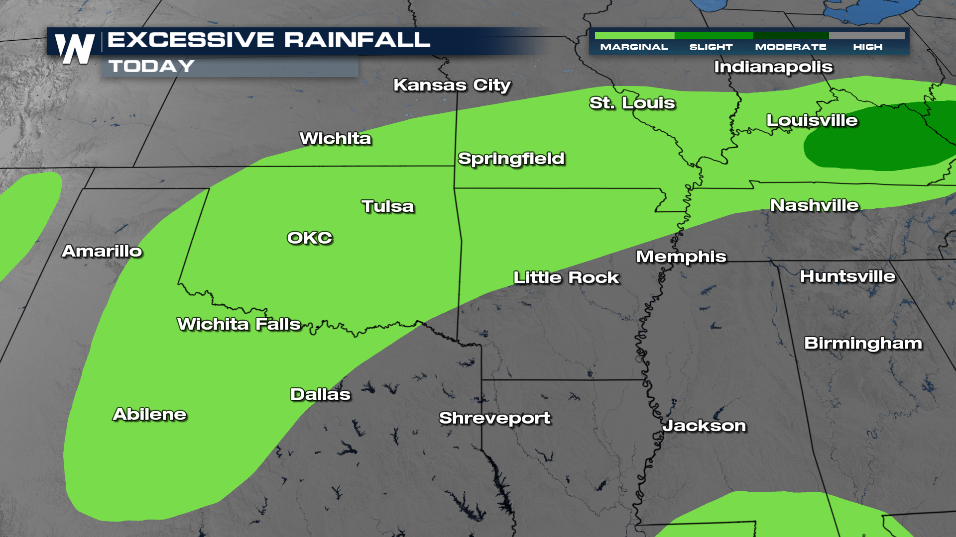
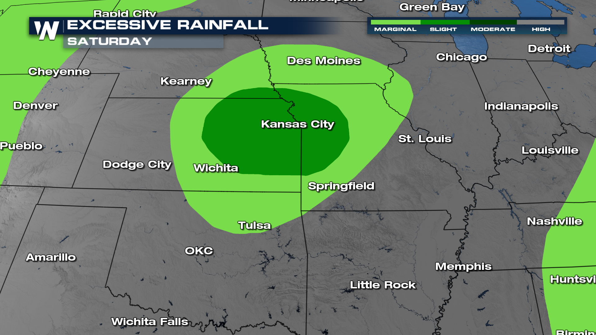
Rounds of severe storms are expected across much of the Plains and Northeast. As a result, the risk for flash flooding will be on the table Thursday & again Saturday with a second system working through.
Make sure to tune in at :10 and :30 past the hour for your full Eastern and Central U.S. breakdown!


