Francine's Remnants Keep the Heavy Rain Around

Francine made landfall in southern Louisiana as a Category 2 Hurricane with sustained winds of 100 mph and a central pressure of 972 mb. This system will continue to bring heavy rainfall and gusty winds to the central U.S. and southeast into the weekend. RELATED ARTICLE: Francine's Gulf Coast Impacts
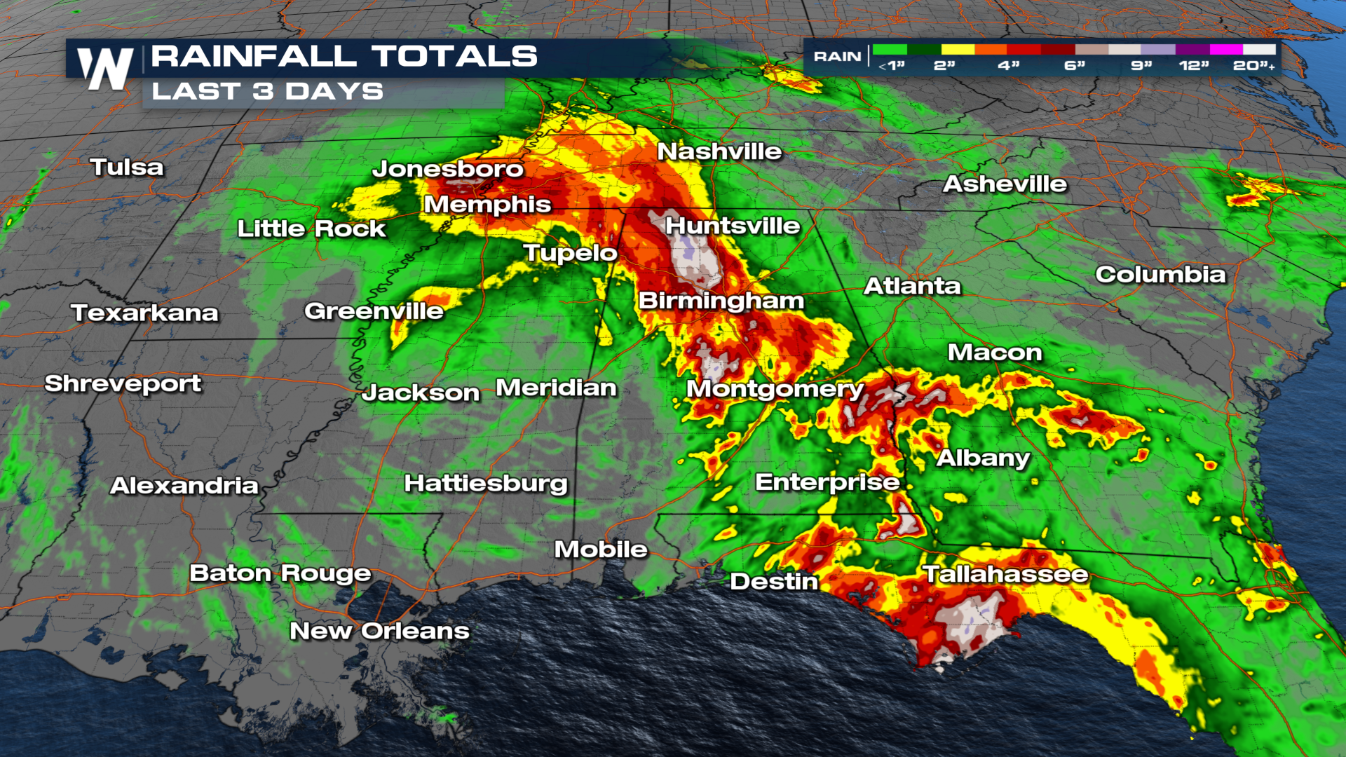 The central low pressure of Francine will continue to meander around the Ohio Valley and Mid South with storms still lingering in the Mississippi Delta. Columbus, GA broke a record for the amount of rainfall that the area received Friday at 3.22". Between Friday and Saturday, Kentucky picked up over 3.50" inches of rainfall. There will still be a decent amount of rain that makes it to the northern tier of the country.
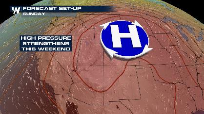
The remnants Francine's will move closer to the south over the next couple of days. From the Mississippi Valley to the East Coast there will be heavy rain, which will lead to a flooding threat. Though, the heaviest rain is already finished.
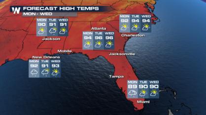
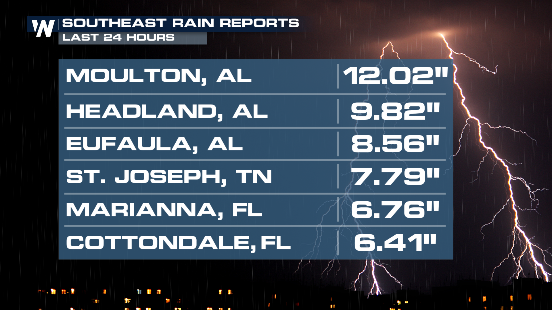
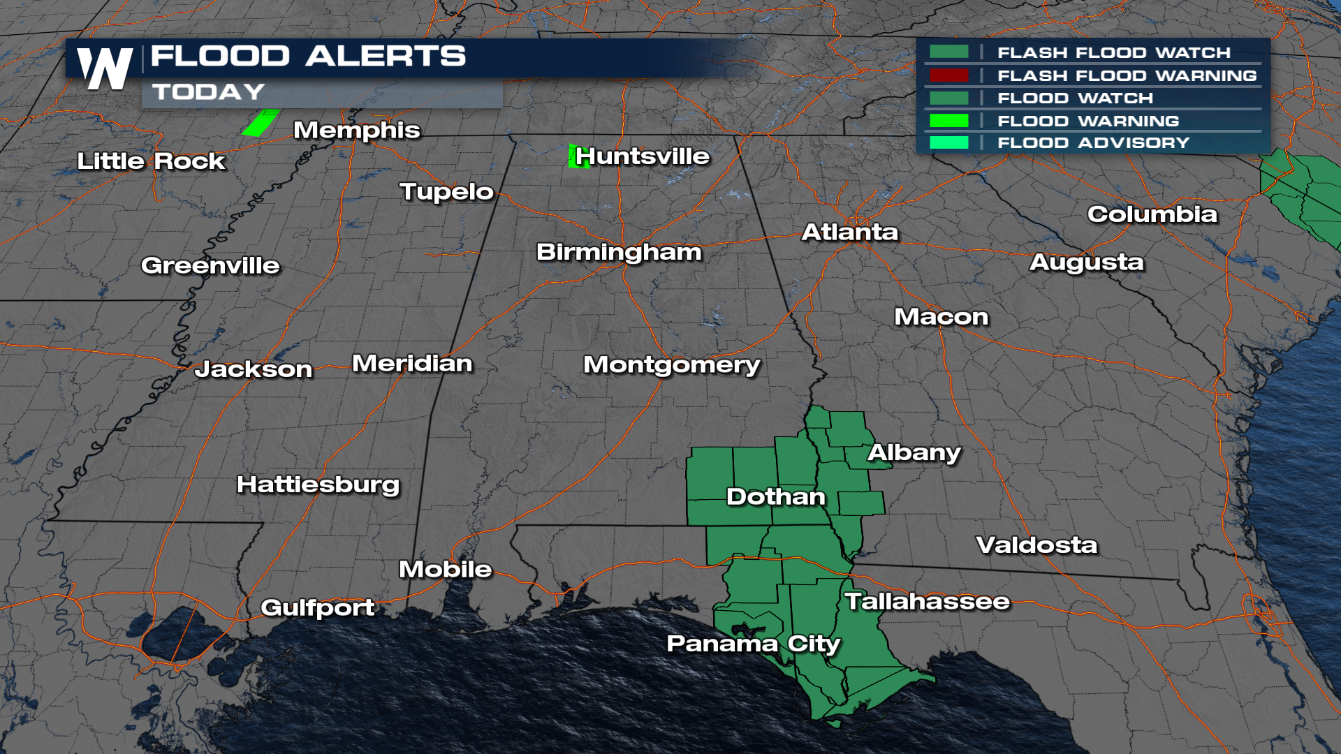
Additional rainfall amounts of 1-3" will be likely across parts of Mississippi, Alabama, Tennessee, Georgia, and Florida. Isolated rainfall tallies of 4 or 5 inches will be possible in parts of Georgia, Florida, and Alabama.The chance of flooding will continue Sunday in Georgia, Alabama, and Florida, pushing southwest into Mississippi on Sunday. Due to this increased flood threat, Flood Watches have been issued across the southeast into Sunday.
 The Southeast will likely stay a bit wetter for the end of September, too. We'll bring you that part of the story as we get closer.