Power Outages Fall Below 100k After Francine
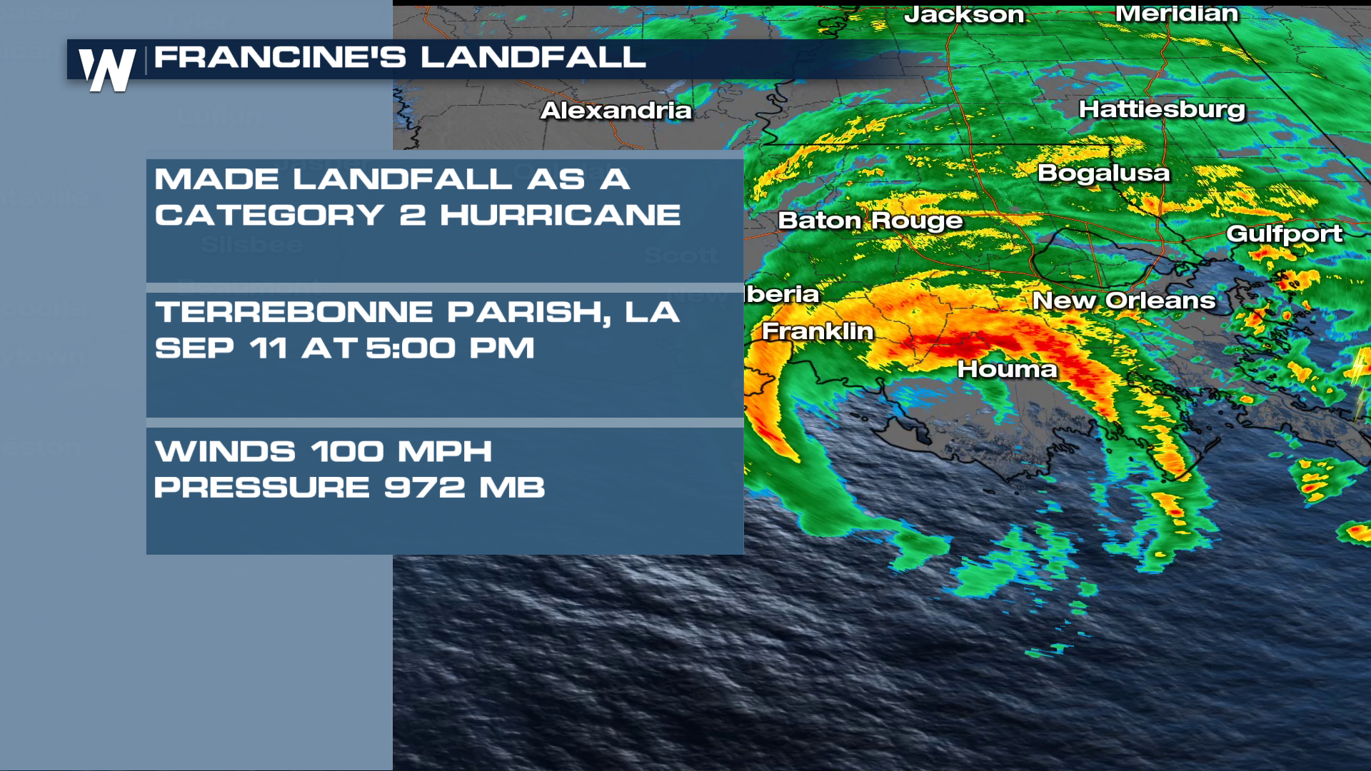
Francine made landfall in southern Louisiana as a Category 2 Hurricane with sustained winds of 100 mph and a central pressure of 972 mb. The specific landfall location was in Terrebonne Parish, Louisiana, 30 miles south of Morgan City. This system will continue to bring heavy rainfall and gusty winds to the south and southeast into the weekend.
Related article: Francine Moves North
What started as Potential Tropical Cyclone Six in the Gulf of Mexico, a developing area of low pressure only took a few days to strengthen to a hurricane and impact the U.S. coast. Francine was upgraded from a Tropical Storm to a category one hurricane Tuesday. After working through shear and dry air, Hurricane Hunter aircraft found that Francine was able to organize and drop its central pressure. Francine was upgraded to a category 2 with winds of 100 mph, just off of the Louisiana coast. It maintained that strength through landfall Wednesday afternoon.
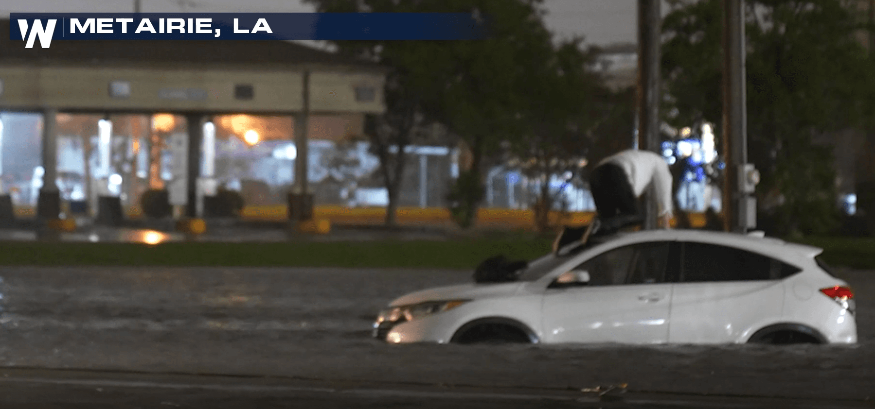
Our field correspondents were on the ground as at least nine inches of rain inundated Metairie, Louisiana late Wednesday evening. Close to a foot of rainfall fell in the greater New Orleans/southeast Louisiana area. 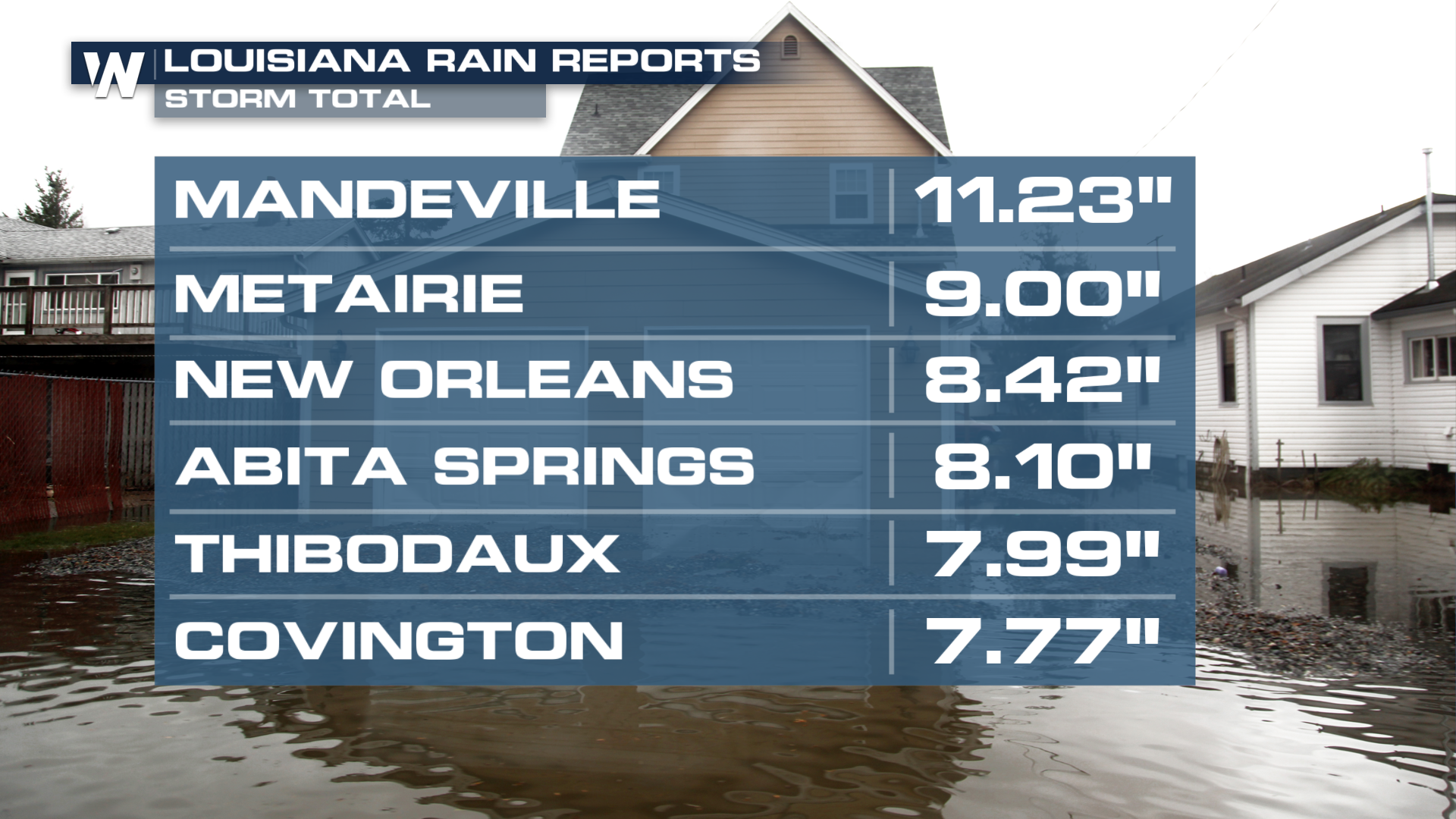

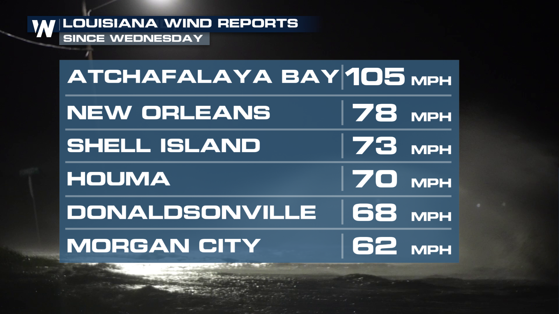
The National Hurricane Center issued this update with wind reports as Francine was making landfall:
Francine has made landfall in southern Louisiana in the Parish of
Terrebonne, about 30 miles south-southwest of Morgan City, as a
Category 2 hurricane.  Maximum sustained winds are estimated to be
near 100 mph (155 km/h).

A NOS station located on Eugene Island recently reported a peak gust
of 105 mph (169 km/h).  The minimum pressure measured at that
location was 976 mb (28.82 inches).
Hundreds of thousands of customers in southeast Louisiana were still without power as of Friday morning. The number of customers without power approached 400,000 in Louisiana Thursday morning, but thankfully has since dropped to around 100,000. 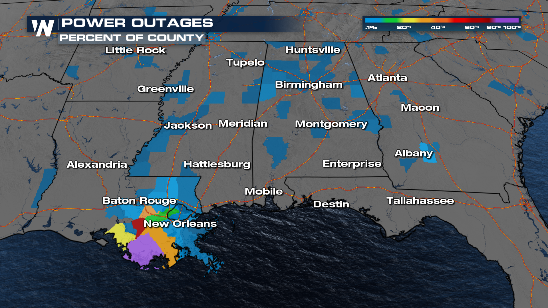
President Biden approved an Emergency Declaration for the state knowing that extra resources would be needed in the wake of storm damage. According to FEMA:
"The President’s action authorizes FEMA to coordinate disaster relief efforts to alleviate the hardship and suffering caused by the emergency on the local population and to provide appropriate assistance to save lives, to protect property, public health and safety and to lessen or avert the threat of a catastrophe in the designated areas.
Specifically, FEMA is authorized to identify, mobilize and provide, at its discretion, equipment and resources necessary to alleviate the impacts of the emergency. Emergency protective measures, limited to direct federal assistance and reimbursement for mass care including evacuation and shelter support, will be provided at 75% federal funding for the parishes of Acadia, Allen, Ascension, Assumption, Avoyelles, Calcasieu, Cameron, Concordia, East Baton Rouge, East Feliciana, Evangeline, Iberia, Iberville, Jefferson, Jefferson Davis, Lafayette, Lafourche, Livingston, Orleans, Plaquemines, Pointe Coupee, St. Bernard, St. Charles, St. Helena, St. James, St. John the Baptist, St. Landry, St. Martin, St. Mary, St. Tammany, Tangipahoa, Terrebonne, Vermilion, Washington, West Baton Rouge and West Feliciana.
Emergency protective measures, limited to direct federal assistance, will be provided at 75% federal funding for the parishes of Beauregard, Bienville, Bossier, Caddo, Caldwell, Catahoula, Claiborne, De Soto, East Carroll, Franklin, Grant, Jackson, LaSalle, Lincoln, Madison, Morehouse, Natchitoches, Ouachita, Rapides, Red River, Richland, Sabine, Tensas, Union, Vernon, Webster, West Carroll and Winn."
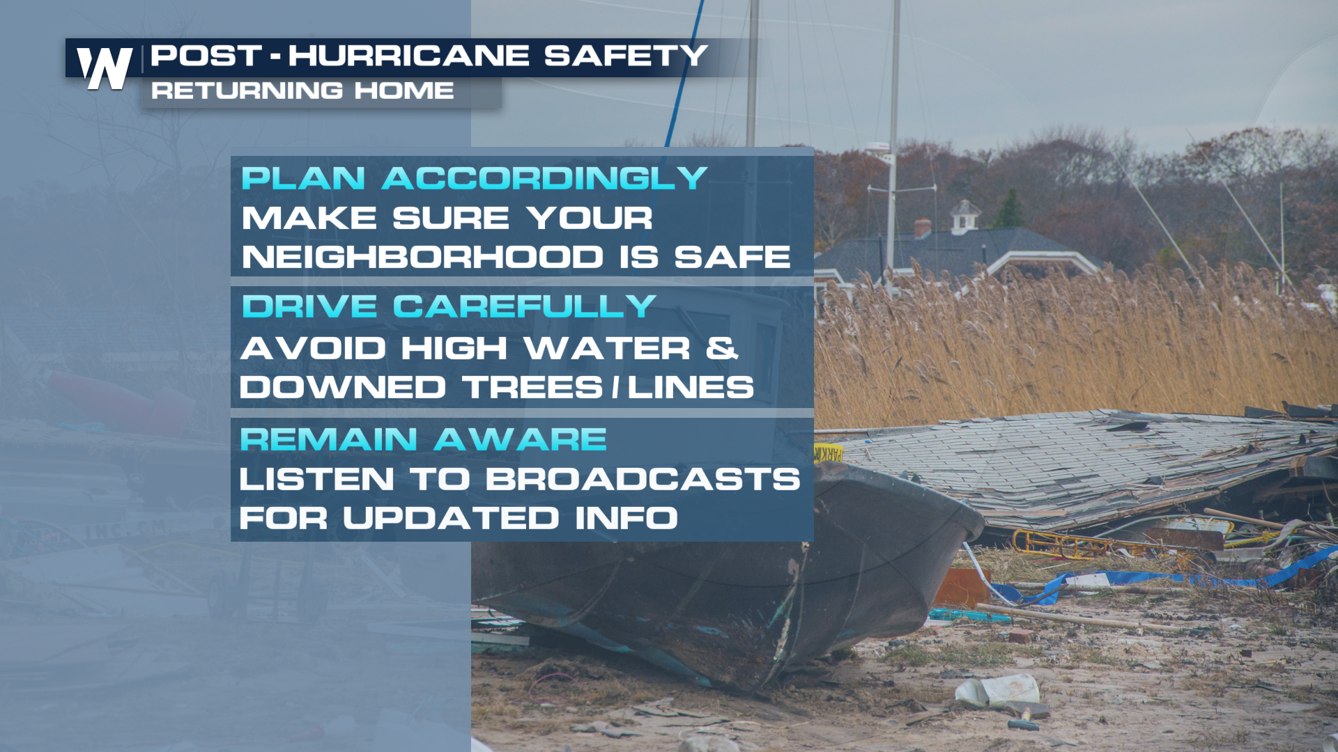
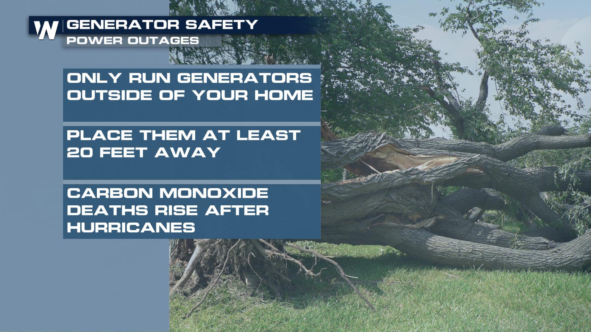
TIPS FOR RETURNING AND LIVING AT HOME IN THE AFTERMATH