Severe Storms Target the Midwest Overnight

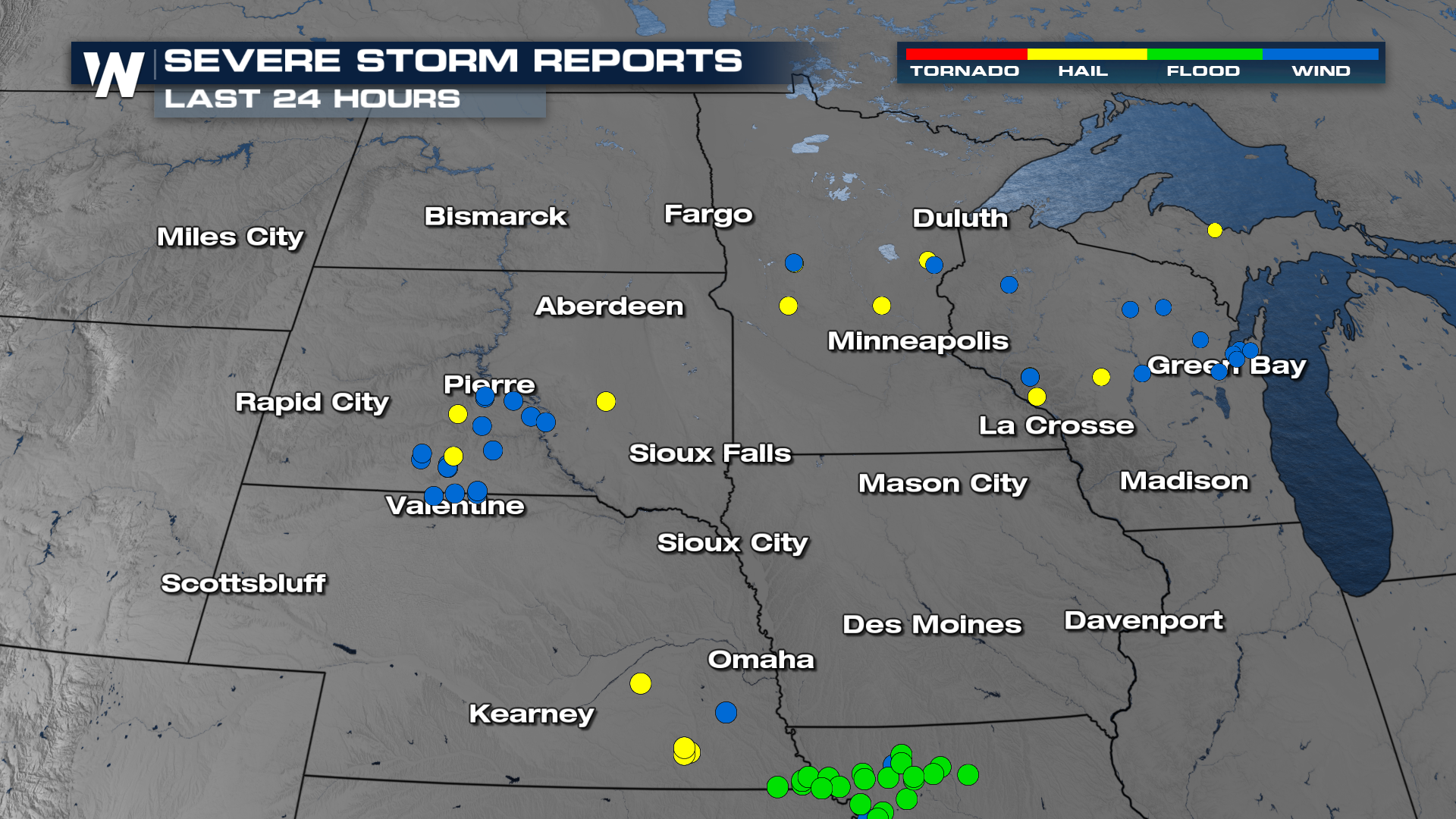
Strong storms have been surging across the Plains and Midwest this week, producing lots of hail and strong winds, with a tornado or two. The threat continues through the overnight hours as the low-pressure system continues to slide farther east toward the Great Lakes.
The SLIGHT risk for severe storms extends from Nebraska to Illinois, with another SLIGHT risk for storms moving across Wisconsin. The significant severe potential sticks around, too. Damaging winds over 75 mph and even hailstones that are 2" in diameter or larger are possible!
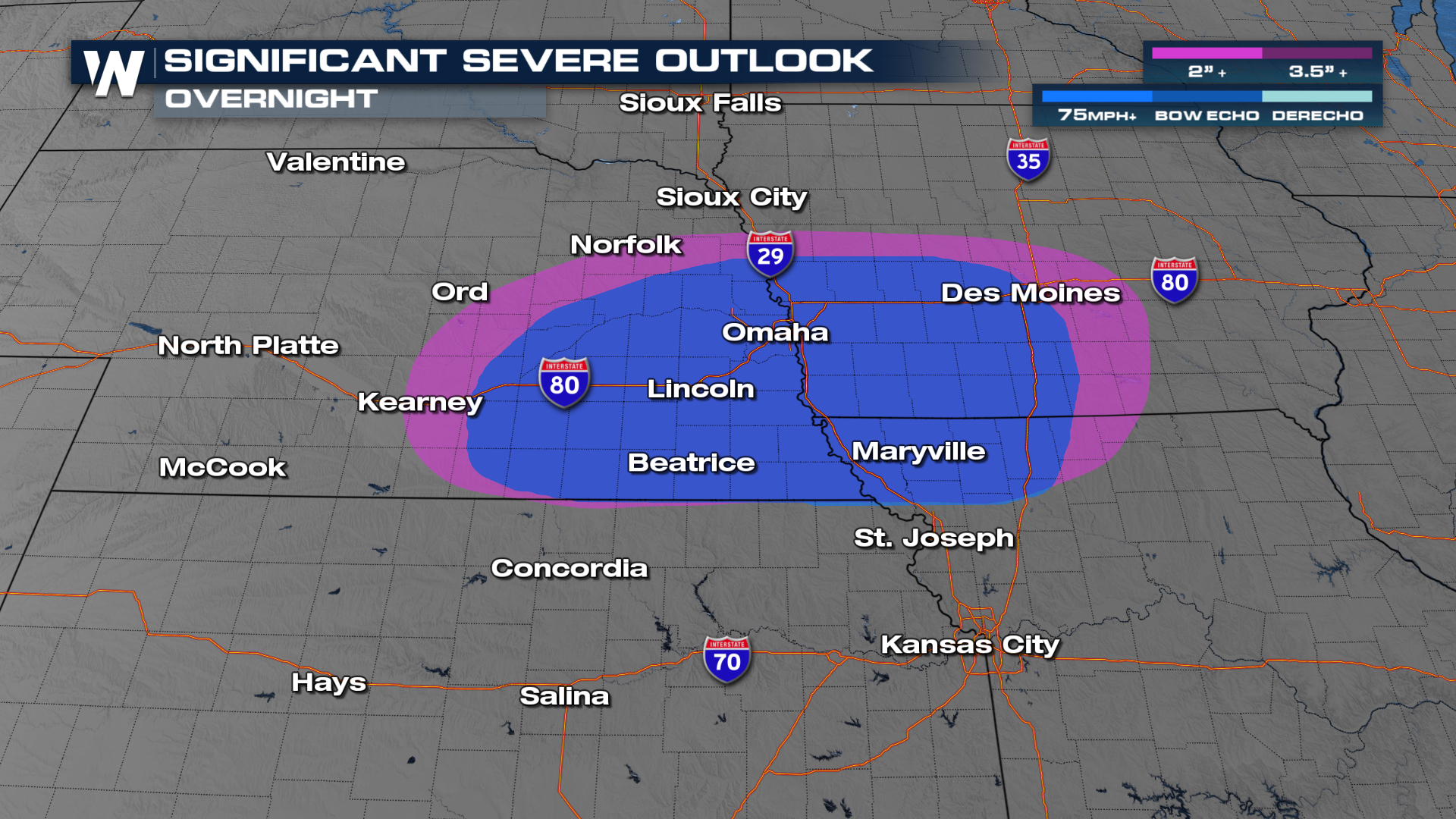
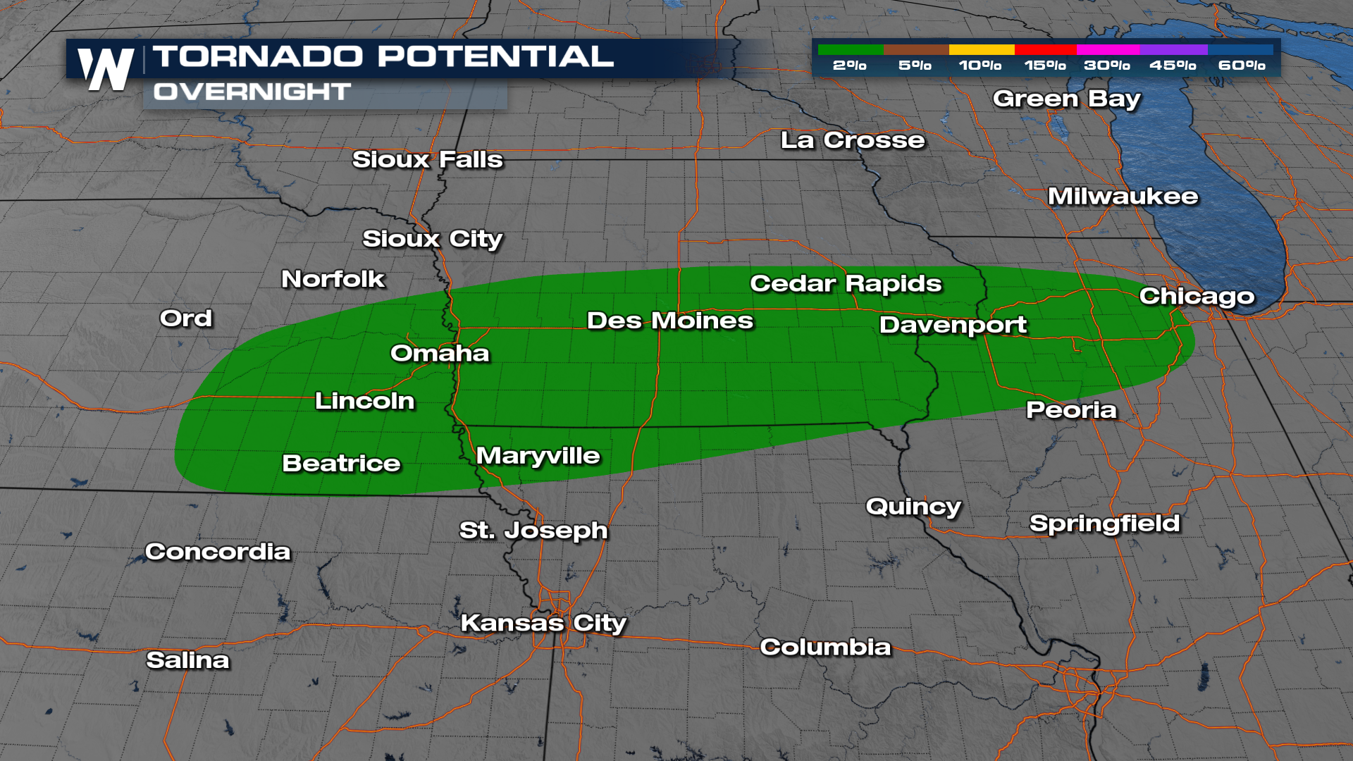
An isolated tornado is possible as well, particularly for areas around the I-80 corridor.
Timing
Storms are persisting through the overnight hours, so make sure to have a few ways to receive alerts in case warnings are issued.
Tune into your full Central U.S. breakdown on WeatherNation at :30 past the hour every hour.


