First Tropical Storm of the Season Forms

It's Hurricane Prep Week on WeatherNation for the first week of the Atlantic Hurricane season!
The Atlantic Basin is starting on the quiet side, while the Eastern Pacific has multiple disturbances. One of which is becoming the first named storm of the year and others that could have impacts to land this weekend.
Atlantic
The Atlantic is starting the season with no activity expected through the first week. A big burst of Saharan Dust is providing plenty of dry air, which could impact air quality and visibility in the Caribbean and parts of Florida through the week ahead.
Eastern Pacific
The first tropical storm of the season formed in the Eastern Pacific on Wednesday morning. The basin could have its second system of the season this weekend, with impacts in Mexico possible. The NHC gives the southern wave near Mexico a high chance to develop. Another outlook region, also with high development potential, has been added along the SW coast of Mexico. We'll be monitoring this region closely and will provide updates.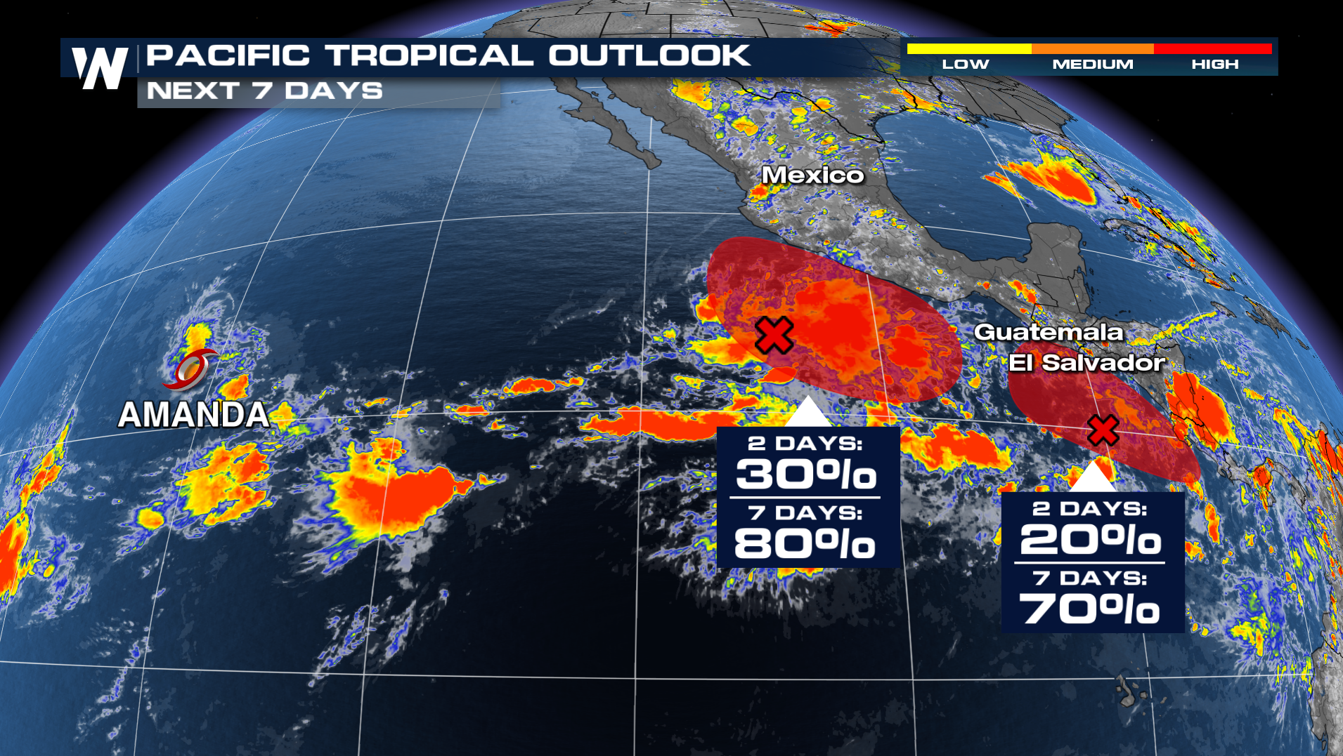
Amanda
Tropical Storm Amanda has formed in the eastern Pacific Ocean, becoming the first named storm of the 2026 eastern Pacific hurricane season. The National Hurricane Center designated Amanda as a tropical storm on Wednesday. At this time, the storm poses no threat to land.
As of the latest advisory, Amanda was packing maximum sustained winds of 45 mph while moving northwest over the open Pacific. Forecast guidance indicates the storm should strengthen somewhat during the next couple of days before encountering less favorable environmental conditions and weakening later this week into the weekend.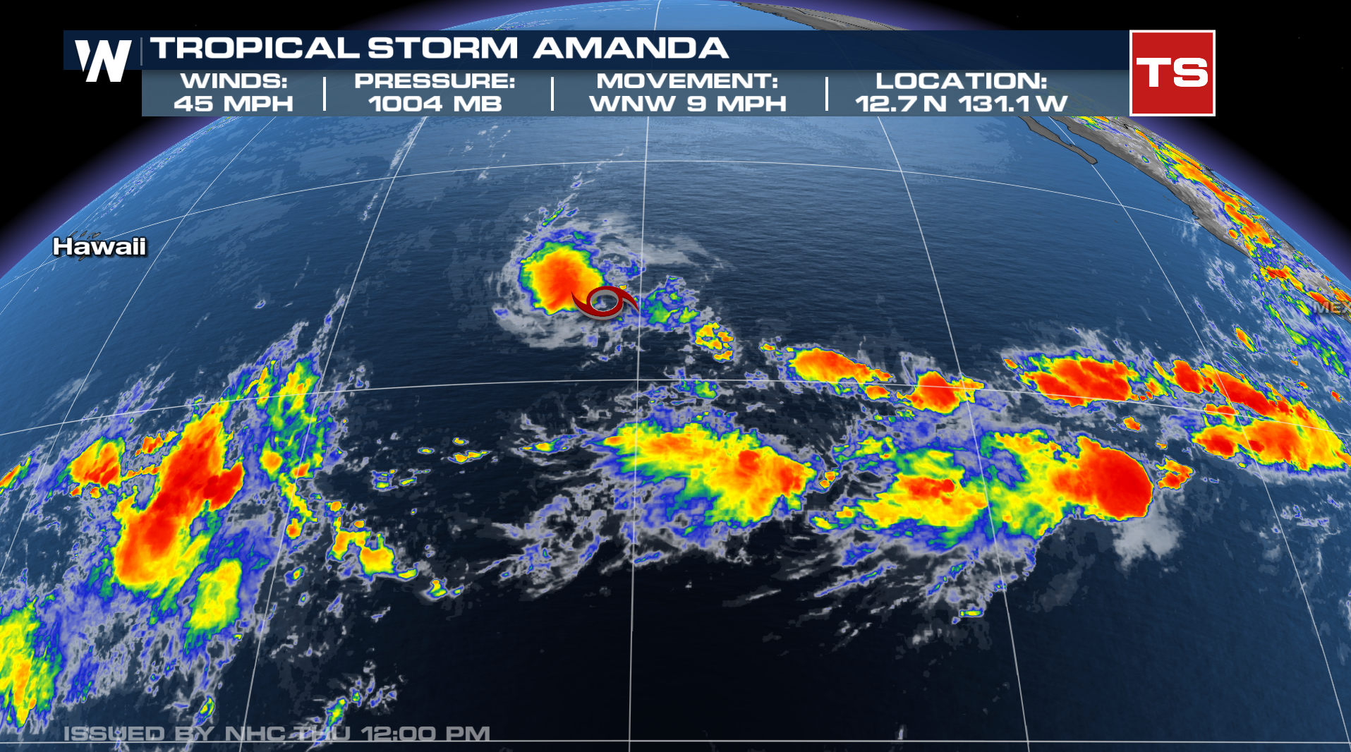
Amanda is currently moving over sufficiently warm ocean waters that can support tropical cyclone development. In the short term, manageable wind shear and ample tropical moisture should allow for some additional organization and strengthening.
However, as the storm tracks farther northwest, it is forecast to move into cooler sea surface temperatures and increasing atmospheric stability, which should gradually weaken the storm.
Amanda's development comes as forecasters continue to monitor unusually warm waters across portions of the eastern Pacific and the ongoing development of El Nino conditions. El Nino years often favor increased tropical cyclone activity in the eastern Pacific basin, and
That means Amanda is likely just the first chapter in what could become a busy season across the eastern Pacific.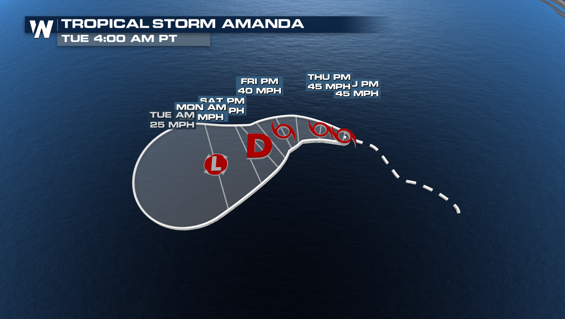
The names for the Eastern Pacific are as follows. Tropical storm Boris could form this weekend near Mexico.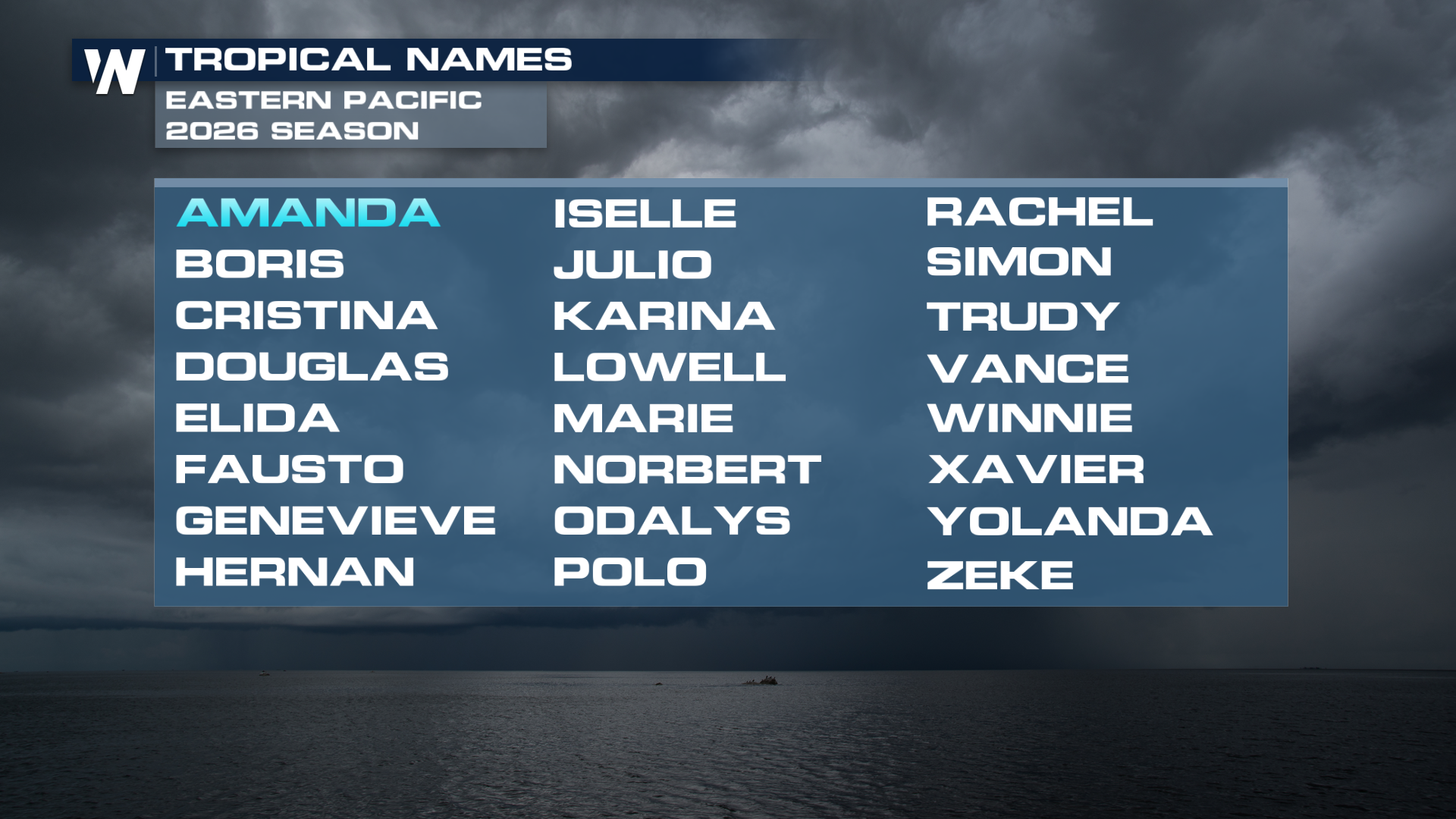
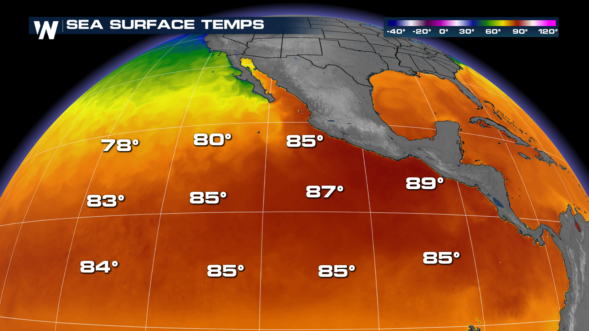
Sea surface temperatures for the Pacific are already very warm for the start of the season. The El Niño pattern showcases the potential for higher activity across the Eastern Pacific. NOAA's seasonal outlook calls for an above-average eastern Pacific hurricane season with 15 to 22 named storms, including as many as 9 hurricanes and up to 9 major hurricanes. On the other hand, NOAA Predicts a Below Normal 2026 Season for the Atlantic basin.
 Stay With WeatherNation This Hurricane Season
Whether storms threaten land or remain over open waters, WeatherNation is your destination for around-the-clock tropical coverage. Our meteorologists track every tropical wave, depression, storm, and hurricane with the latest forecast models, expert analysis, and live updates whenever conditions warrant.


