Severe Storms for the Northeast This Weekend

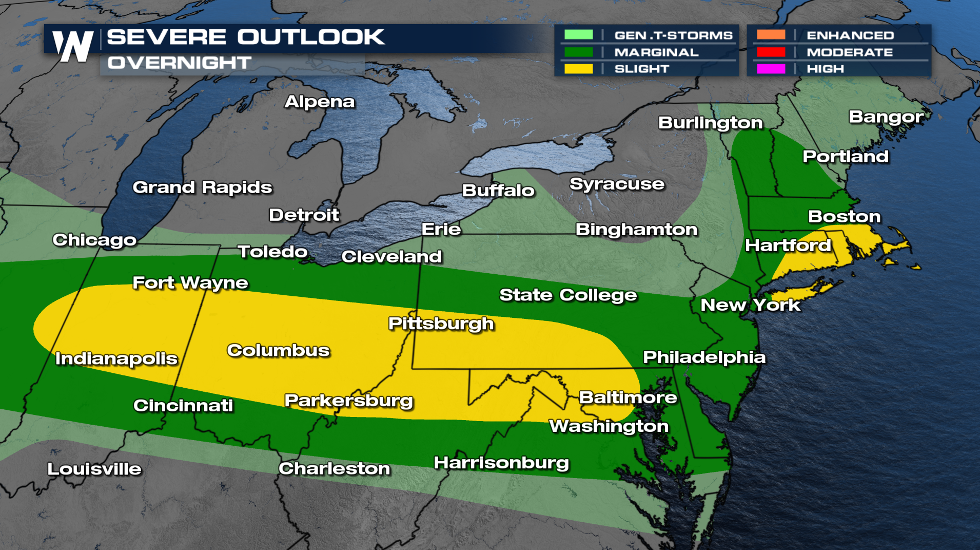
The Storm Prediction Center has issued a severe risks for Saturday and Sunday. Scattered storms capable of producing large hail and damaging winds are possible for portions of the Great Lakes and Ohio Valley into the Northeast. Today, wind guts did reach up to 60-70 mph. Storms should gradually weaken now that we are past sunset. 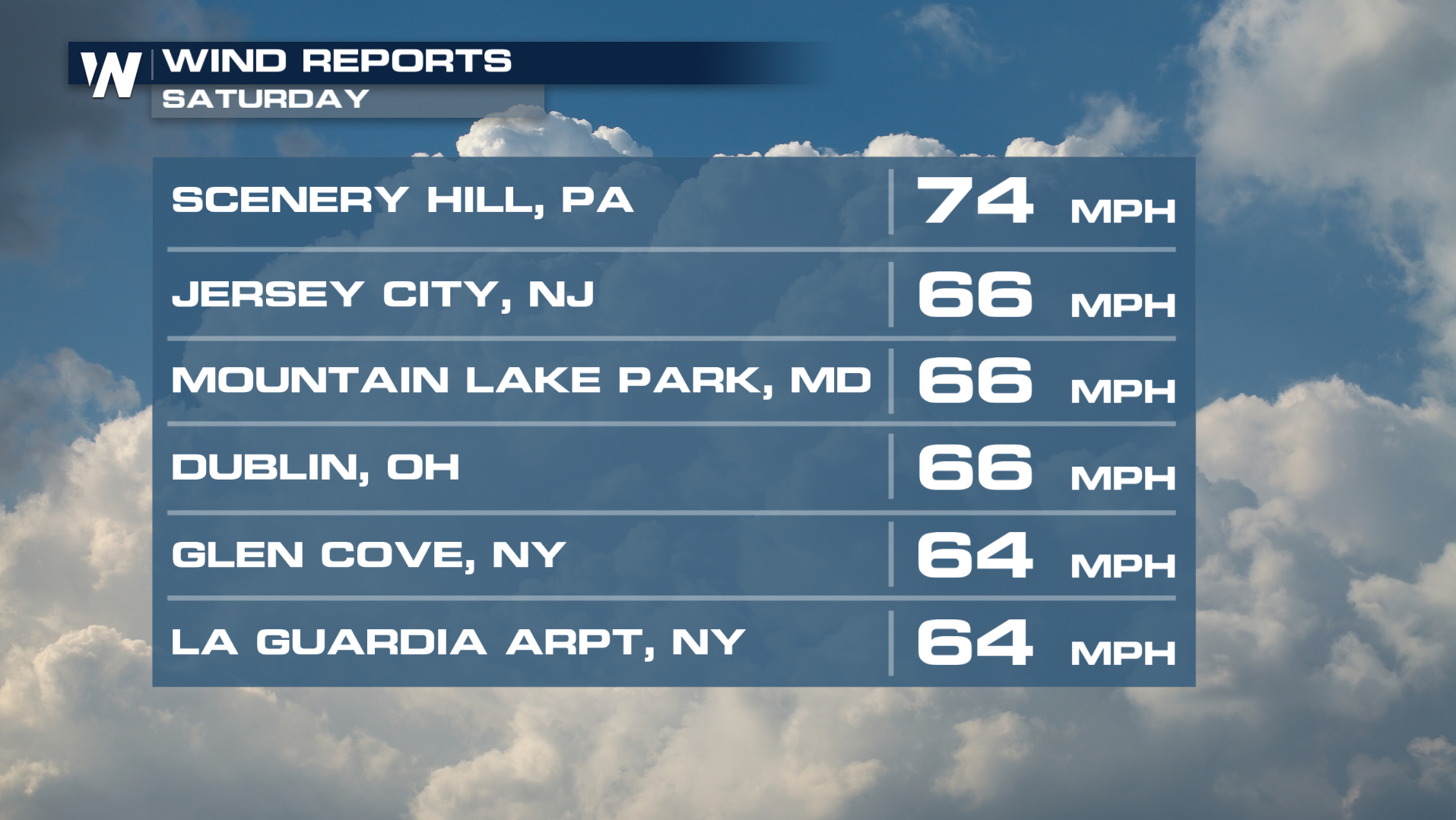
Already on Saturday, strong winds caused some injuries at a college baseball game in Morgantown, WV where the strong winds threw around some tents. Check out the video below!
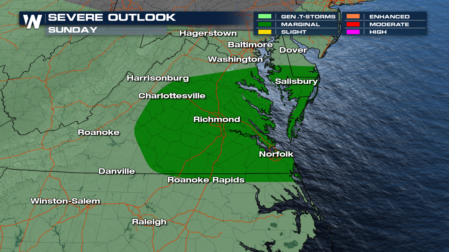
Tonight, storms will weaken after midnight. The front slides southward into West Virginia and Virginia where more storms will be possible and a few could be severe Sunday afternoon and evening. Some rainfall could be heavy in spots.
Behind the system, cooler air will return early next week, bringing temperatures back closer to seasonal averages. However, the cooldown will be short lived with high heat returning by the end of next week!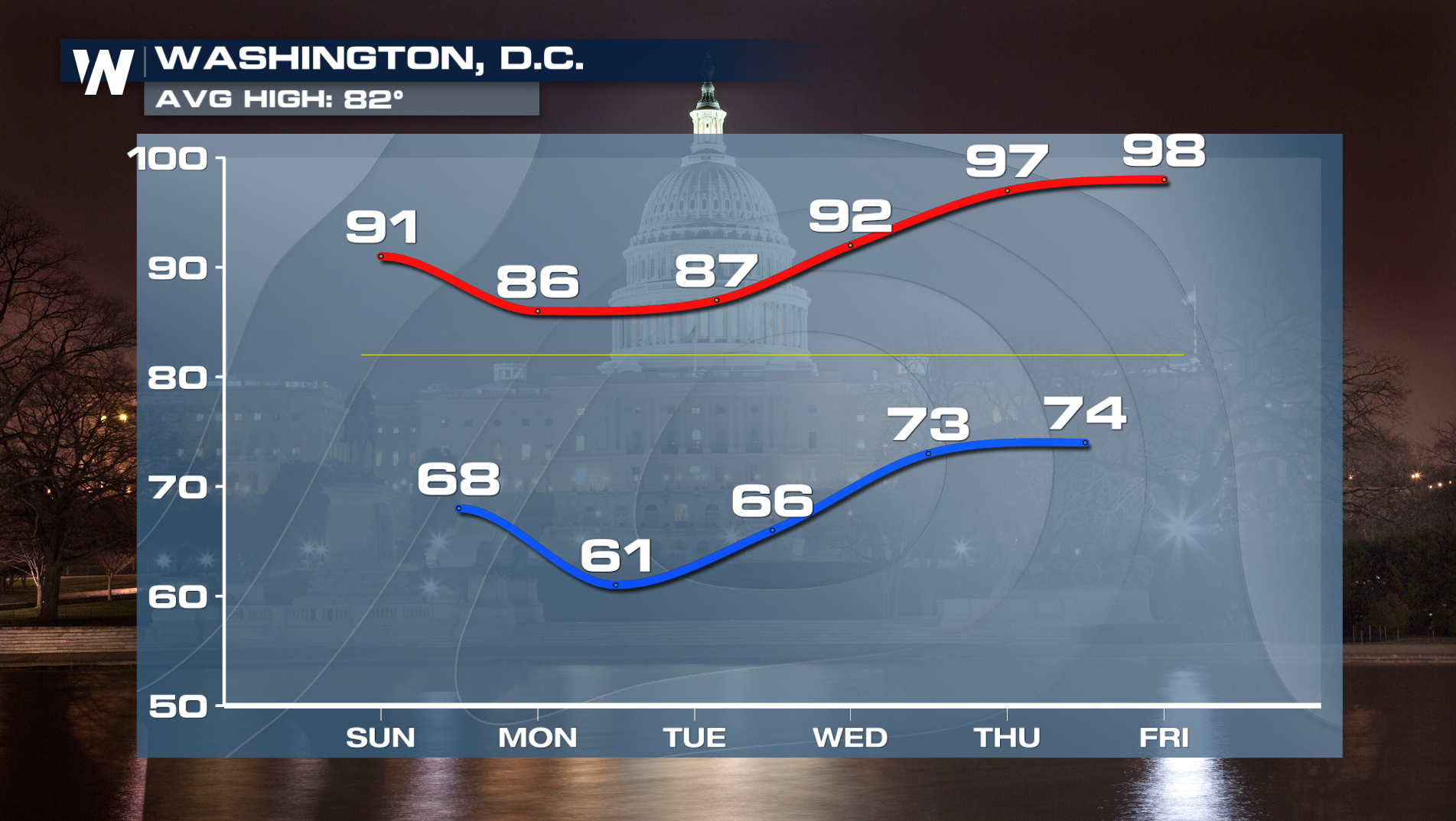
Tune into WeatherNation TV on YouTube for the latest.


