Major River Flooding Causes Damage; Another Day of Storms in New Mexico

A powerful low pressure system has been moving through the Southwest since Wednesday, producing numerous flash flood events and severe weather. A tornado hit a few homes in Heber-Overgaard (Arizona) on Wednesday, causing significant damage, while hailstones larger than golf balls have been falling at times. The heavy rainfall rates have led to several significant flash flood events, like the one below, including several calls for swift water rescues.
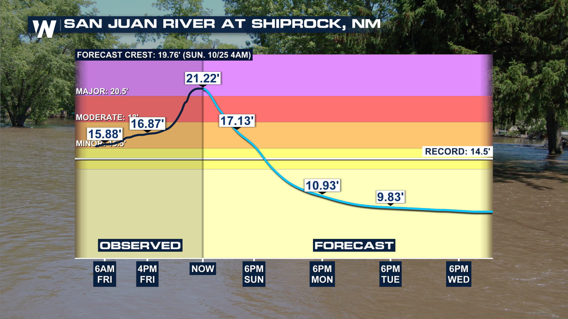
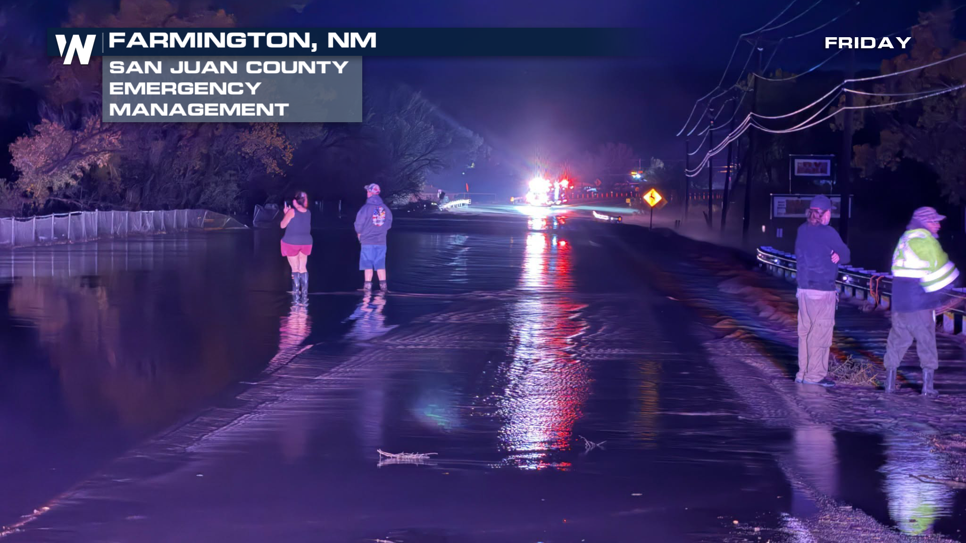 Unfortunately, the San Juan River has caused damage in multiple areas, from Pagosa Springs down through northern New Mexico. The River hit record flood stage in Farmington and Ship Rock. The river is expected to get back below action stage by Monday.
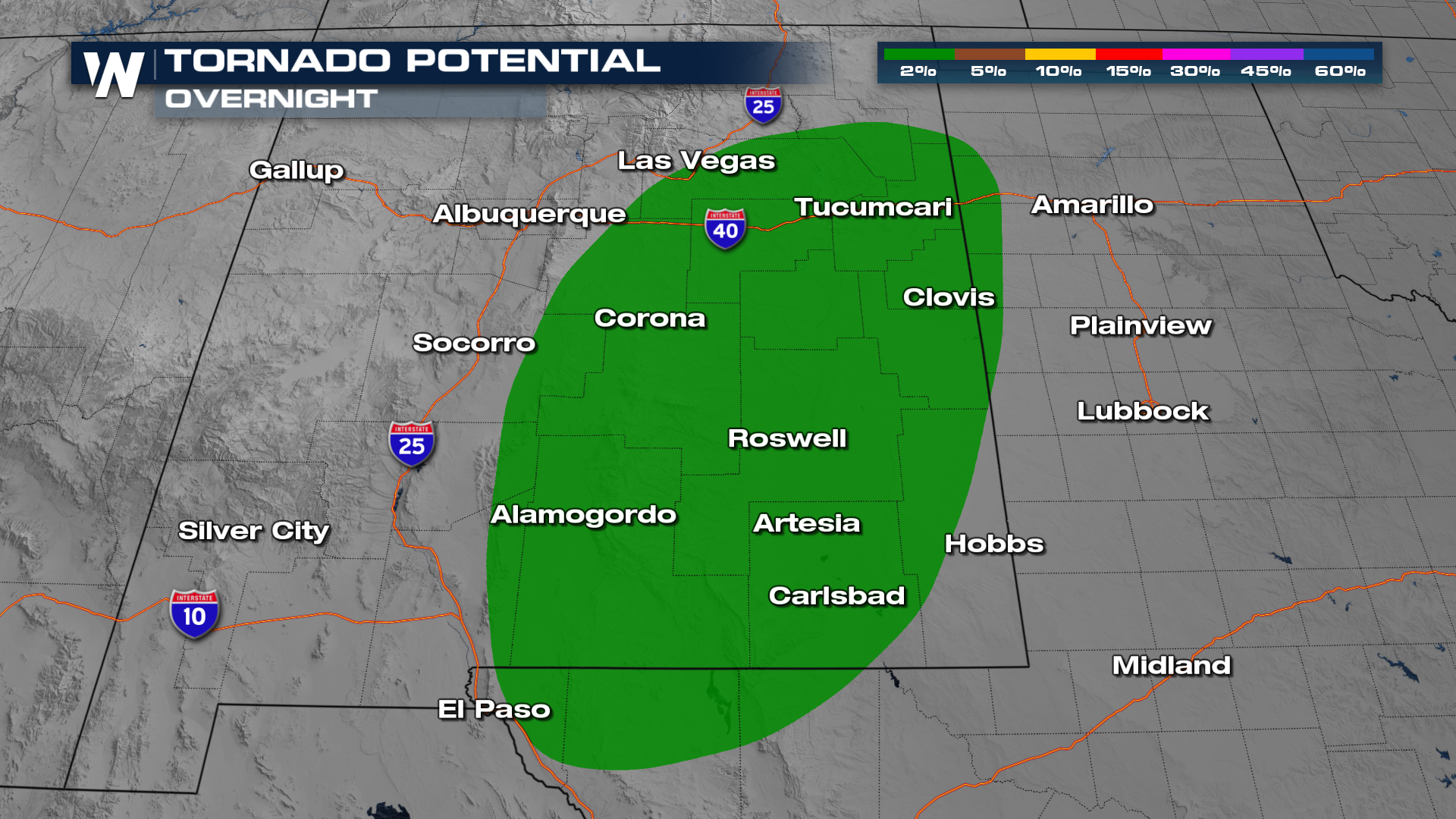
SEVERE THREAT
Severe storm outlooks have been issued throughout the weekend across portions of New Mexico, Texas, and Colorado. The primary threats will be hail damage, strong winds, and an isolated tornado or two. Threats will linger through the overnight hours into Monday before dissipating.
RAINFALL & FLOOD POTENTIAL
The Weather Prediction Center (WPC) is highlighting areas from New Mexico out into the Southern Plains that could see additional flash flooding. The corridor of heaviest rain looks to aim at southeast Colorado and the Panhandle of Texas.
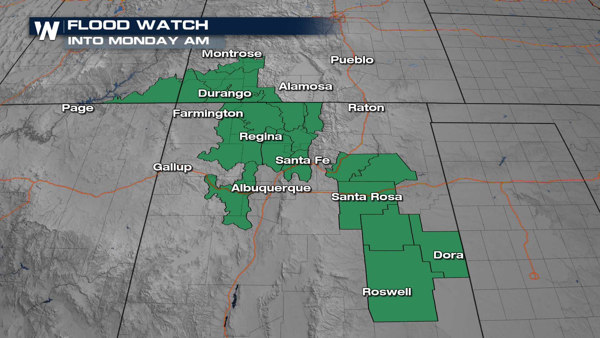
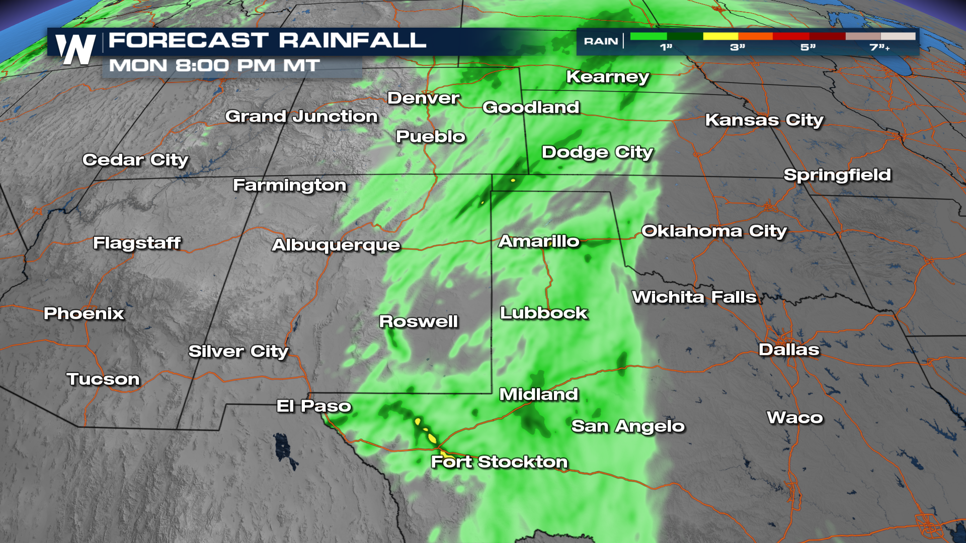 A few flood watches will remain in place through Monday morning.
 As always, if you encounter water over a road, especially at night, turn around and find another way around!


