No Hurricanes Yet in the Atlantic, A New Record

For the first time in the satellite era (since 1966), no hurricanes have formed in the Atlantic Basin to date, breaking the record for the latest date in the season. Two seasons previously held the record, with both Gustav (2002) and Humberto (2013) becoming the first hurricanes of their respective seasons at 8 am on September 11th.
For the real nerds and weather historians out there, 1907 and 1914 did not have hurricanes either, but records in these years relied on observations from ships in the ocean or if a hurricane made landfall. Hurricanes could have formed in these years, but may have been missed due to a lack of satellites.
While there have been five named storms to date, they've all been tropical storms, producing limited energy. ACE (Accumulated Cyclone Energy) measures total energy released by tropical cyclones and can be a good way to compare seasonal activity. So far, the Atlantic has produced less than 10% of its average ACE, while the Pacific has been nearly doubling what's expected.
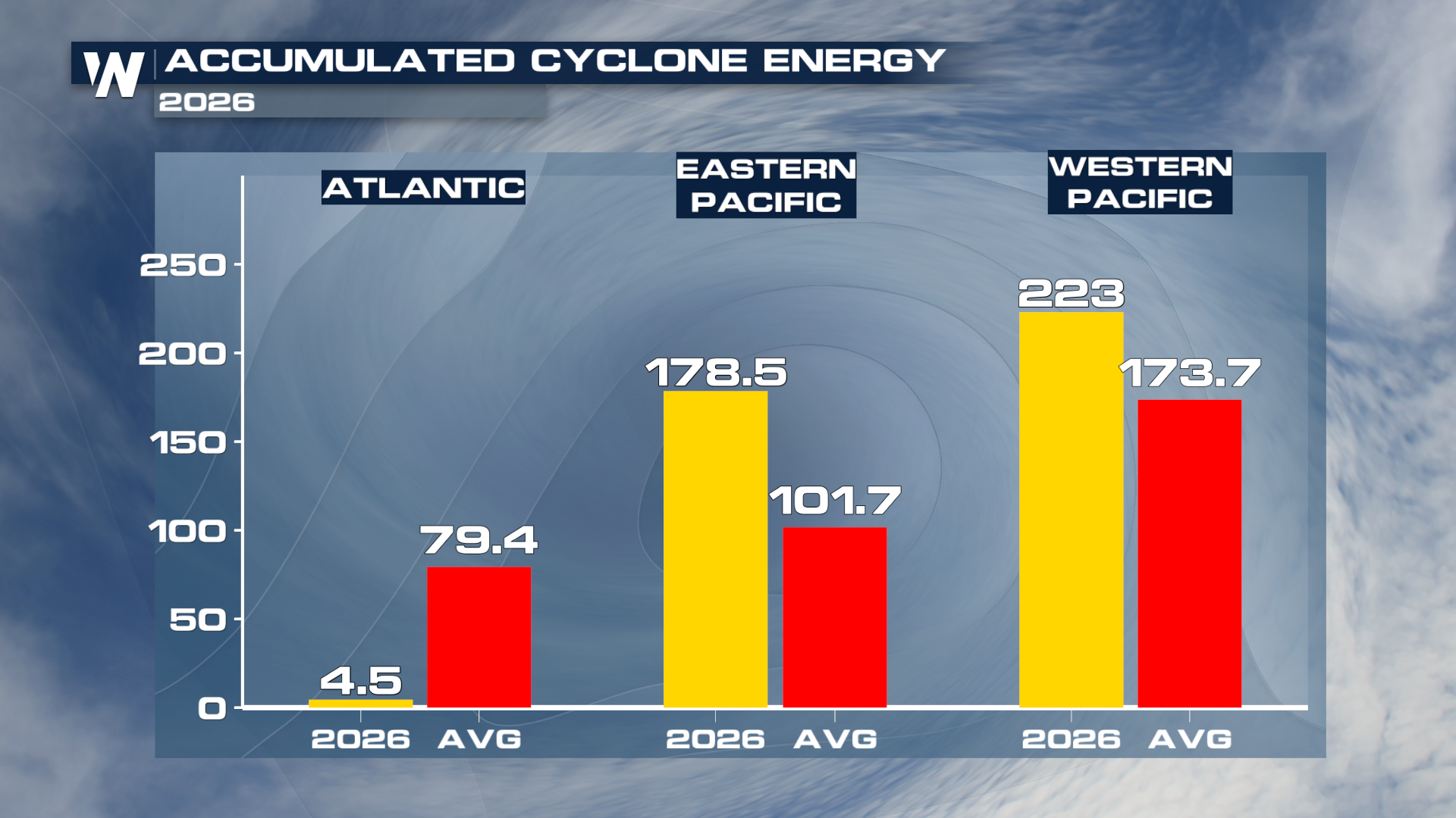
El Niño Continues to Crush Atlantic Activity, Set To Break Records
It's not surprising the Atlantic has been quiet while activity in the Pacific has been exploding. El Niño continues to break records and is expected to be the strongest on record as it peaks from the fall into the winter. El Niño is a global weather pattern, characterized by a shift in wind direction which pushes warm water east across the equator toward South America. These warmer water temperatures fuel tropical cyclone activity in the Pacific, but the warm water also alters the behavior of trade winds in the Atlantic. The increased wind shear from the trades often tears apart tropical systems as they try to get organized.
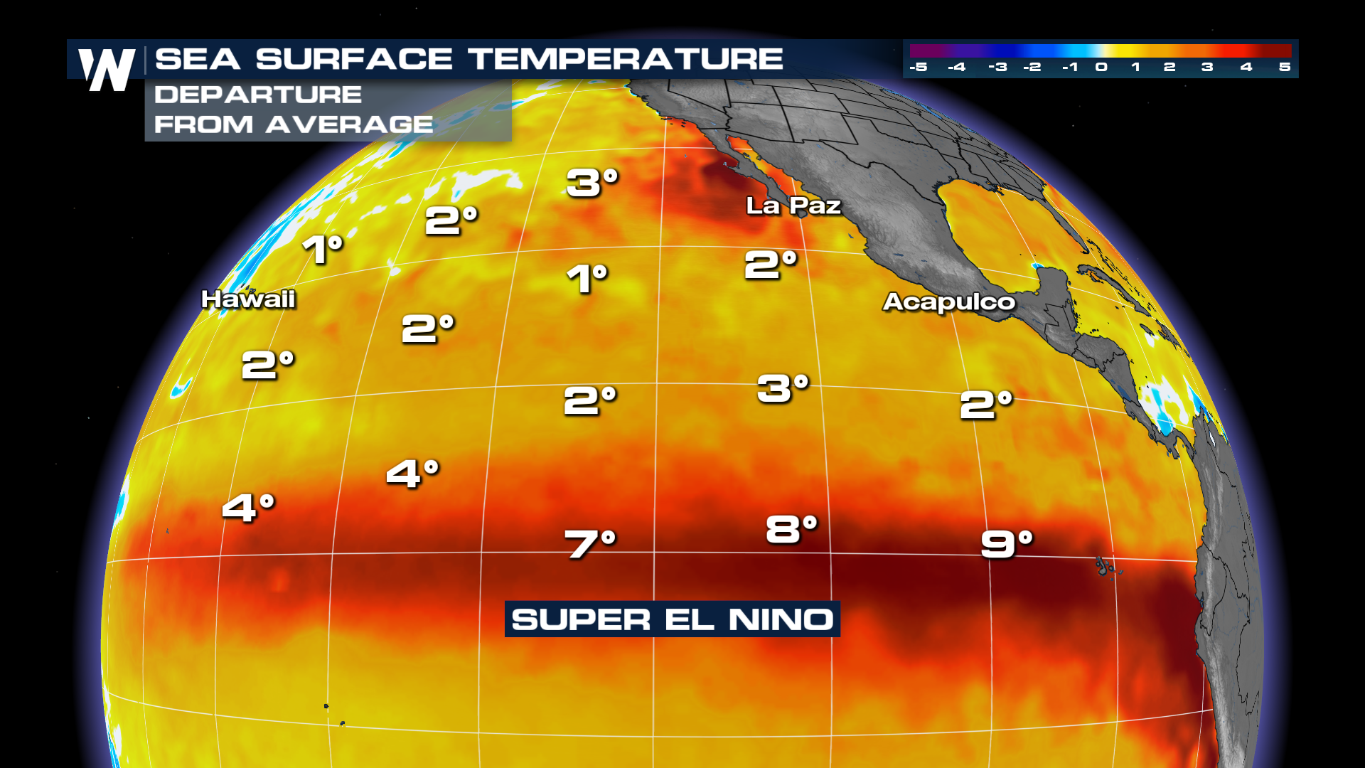
El Niño is expected to continue to intensify through the end of hurricane season, with a gradual wind down through the late winter and spring months. This should continue to limit tropical activity in the Atlantic, but that doesn't mean additional systems can't form and hit the United States. Remember, while wind shear increases over most of the Atlantic during strong El Niño events, the Gulf and western Atlantic (off the east coast of the US) can have less shear, leading to a better chance of systems forming closer to the coast. We've already experienced that several times this season with tropical storms.


