Deadly Tornadoes Rip Through The Midwest
Numerous, violent tornadoes touched down across Kansas, Missouri, Indiana, Illinois, and Ohio since Wednesday night, leaving damage and destruction across multiple states. Above is damage in Indian Lake, OH about 75 miles NW of Columbus, where several fatalities have been reported. The threat continues on Friday across the Southeast.
Watch this dramatic video of a tornado touching down just yards away from this man's home. This was the cell that went on to create extensive damage in Logan County seen above.
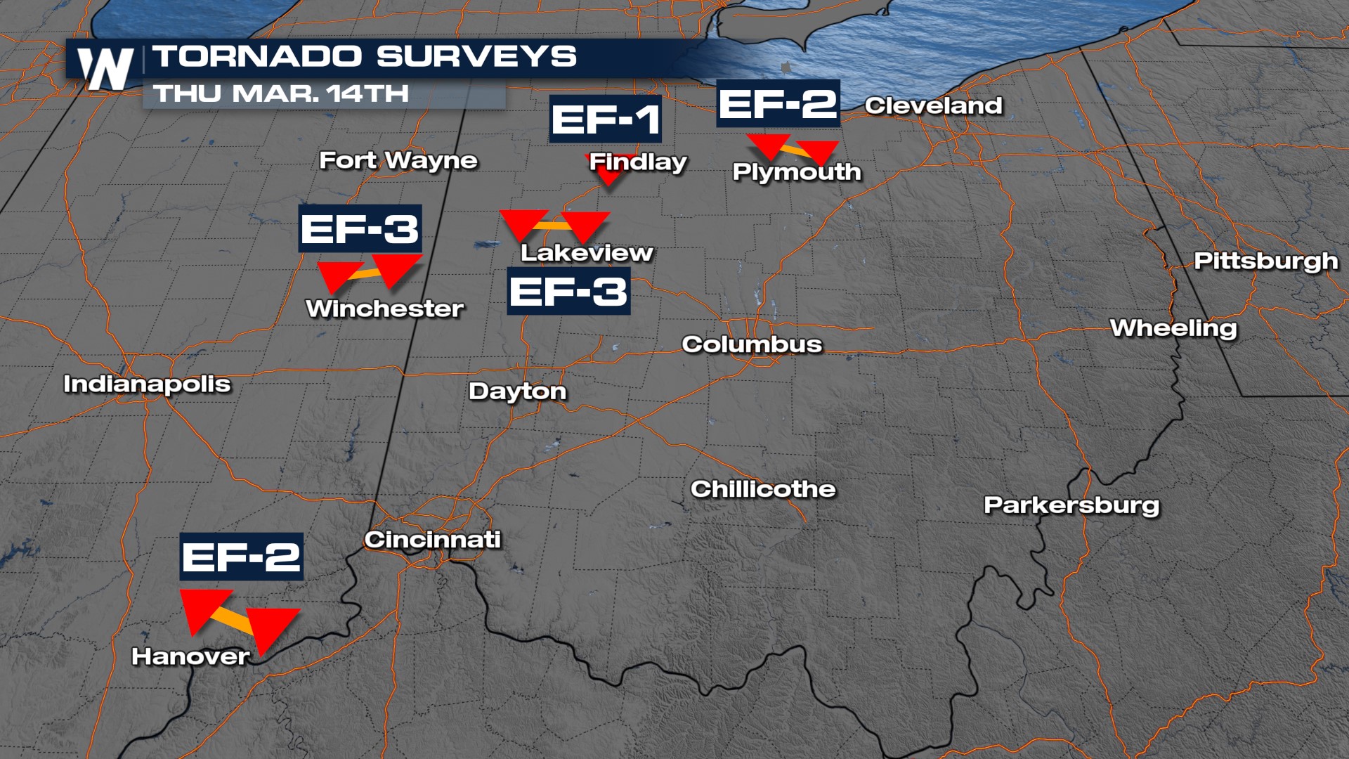
Numerous tornado warnings were issued around the St. Louis metro area as funnels were spotted and at times, tornadoes were reported to be on the ground. Surveys will be conducted in the coming days to determine the strength of the tornadoes. Outside of Indianapolis, an EF-3 tornado touched down producing widespread damage in the town of Winchester.
In Arkansas, severe weather ripped through the suburbs of Little Rock, producing EF-2 damage in the community of Hot Springs Village.
Here is a preliminary map of the tornadoes and the storm surveys so far.
 Giant hail ripped through the Midwest, with many reports of hail stones larger than baseballs! This hit the Midwest and Southern Plains with 4" in Ada, OK and 2" hail in the northern suburbs of Fort Worth.
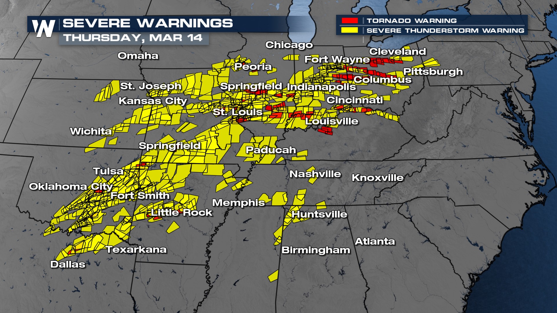
 Look at how many warnings were issued on Thursday alone. Every red box was a tornado warning and every yellow box was a severe thunderstorm warning. Many of these alerts were "confirmed" meaning a tornado was observed on the ground or a record of 2" hail and 75 mph winds.
 This comes after numerous confirmed tornadoes in Kansas on Wednesday, outside of Topeka. Our field correspondent Erik Fox was monitoring those storms that thankfully were over generally rural regions of the state. NWS Topeka surveyed the tornado damage near Alta Vista and Rosswell, KS and the tornado was rated EF-2 with winds between 115-120 mph.
Stay with WeatherNation for the latest on current storms and damage surveys as they come in.