Storms Wrapping Up In The Plains

The plains have had an active summer with severe storms, and in the past 24 hours, things were busy once again. Damaging winds, hail, and flooding were all reported. It was active today, but things are calming down overnight.
OVERNIGHT
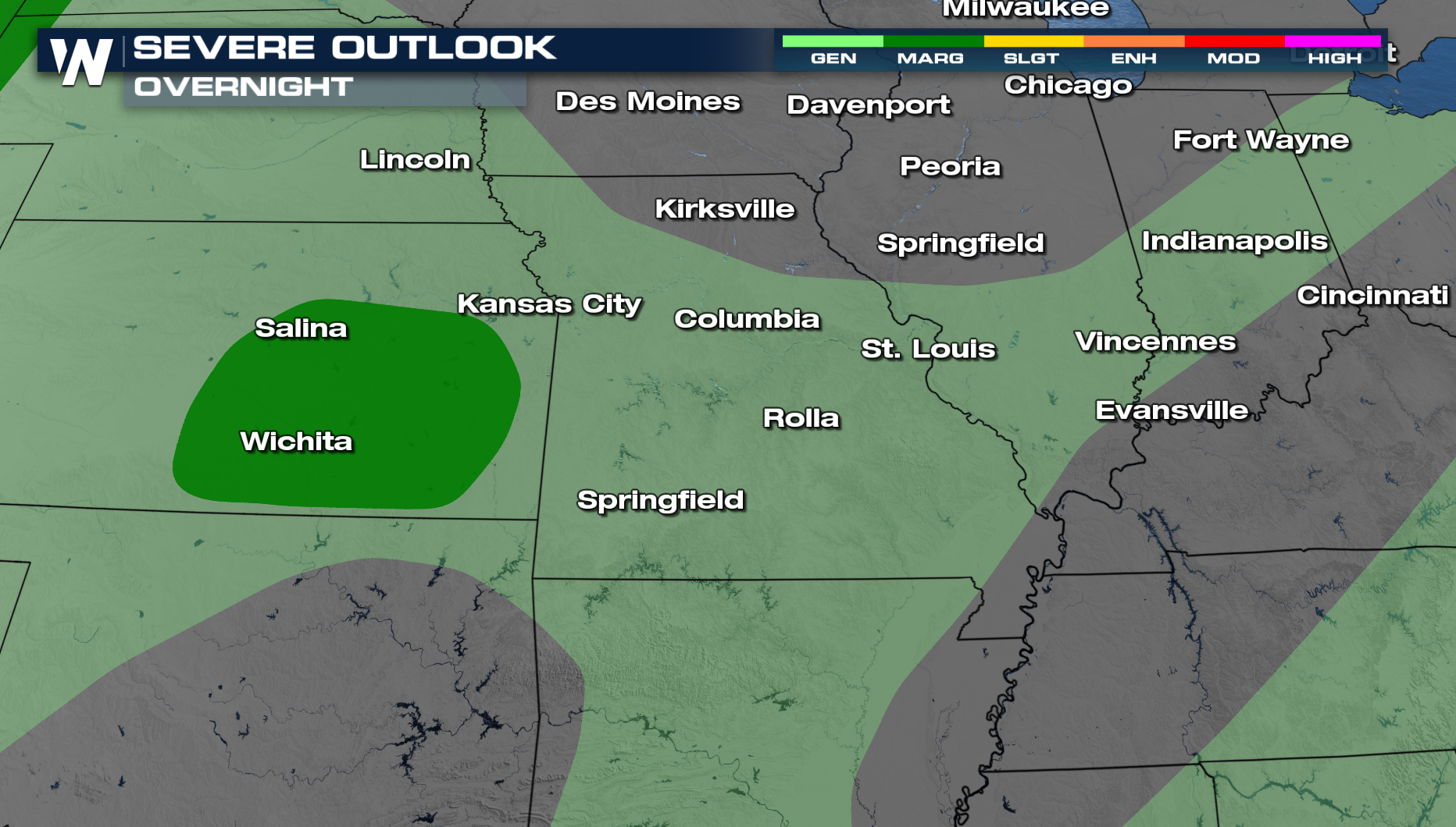
The Storm Prediction Center has issued a marginal risk for severe storms overnight for a small portion of Kansas, including the cities of Salina and Wichita. The main threat with any severe storms that develop will be damaging winds and hail. For the rest of the plains and Midwest, there is a general risk of thunderstorms overnight with a low severe threat.
 OVERNIGHT
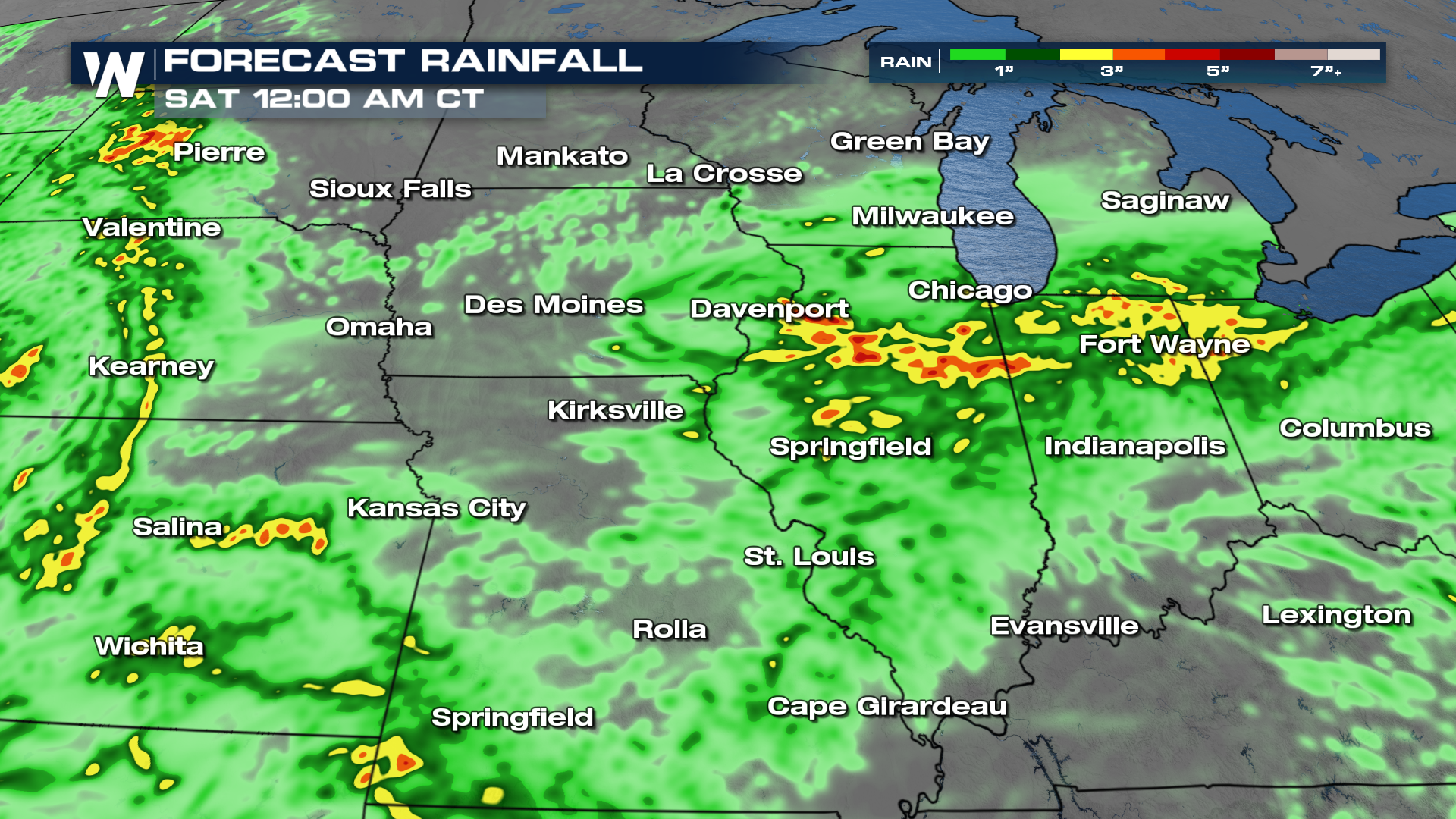
As the low lingers, strong to severe storms with heavy rain will be possible in eastern Kansas overnight. Precipitation will become more limited on Thursday morning for Kansas, Missouri, and Illinois.
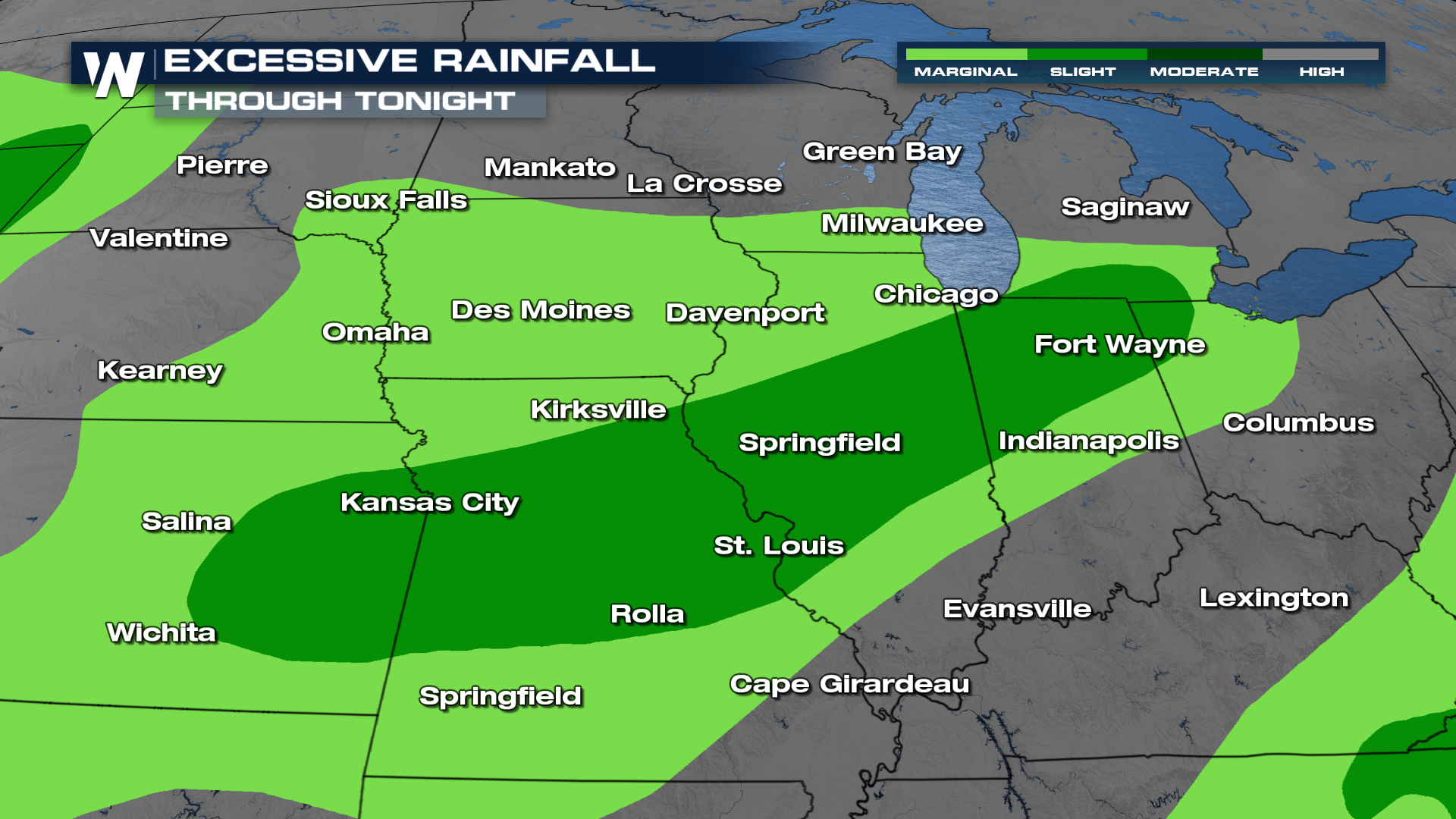
Flooding
Watch for isolated to scattered flooding threats over the next few days as these storms continue to move through the region. The Weather Prediction Center has this region under a level 2 (SLIGHT) risk for flooding for at least the next two days.
 There are isolated to scattered risks for flooding through tonight.