Henriette & Ivo Spinning in the Pacific

The Eastern and Central Pacific have had an interesting start to the season, with plenty of named storms (11 combined). This is above the average of 7, but the energy generated by these systems is only about 80% of what's typical for this time of year. Long story short, this region has had many systems, but they've been on the weaker side.
That trend has continued this week with Henriette and Ivo which could bring minor impacts to nearby landmasses.
Henriette
On Friday, Henriette was downgraded to a remnant low as it continues to struggle in the Pacific. However, it is forecast to miss Hawaii and the strengthen again back to a tropical storm by next week.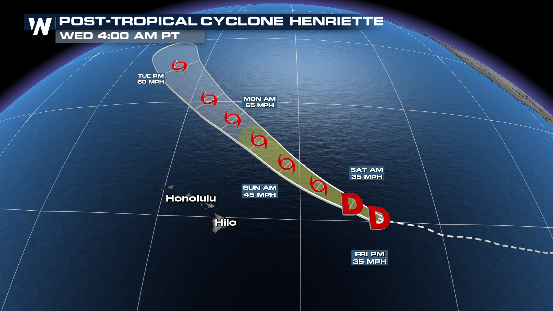
IVO
Ivo is expected to remain a tropical storm as it moves away from Cabo San Lucas and Mexico. It should weaken by early next week to a depression.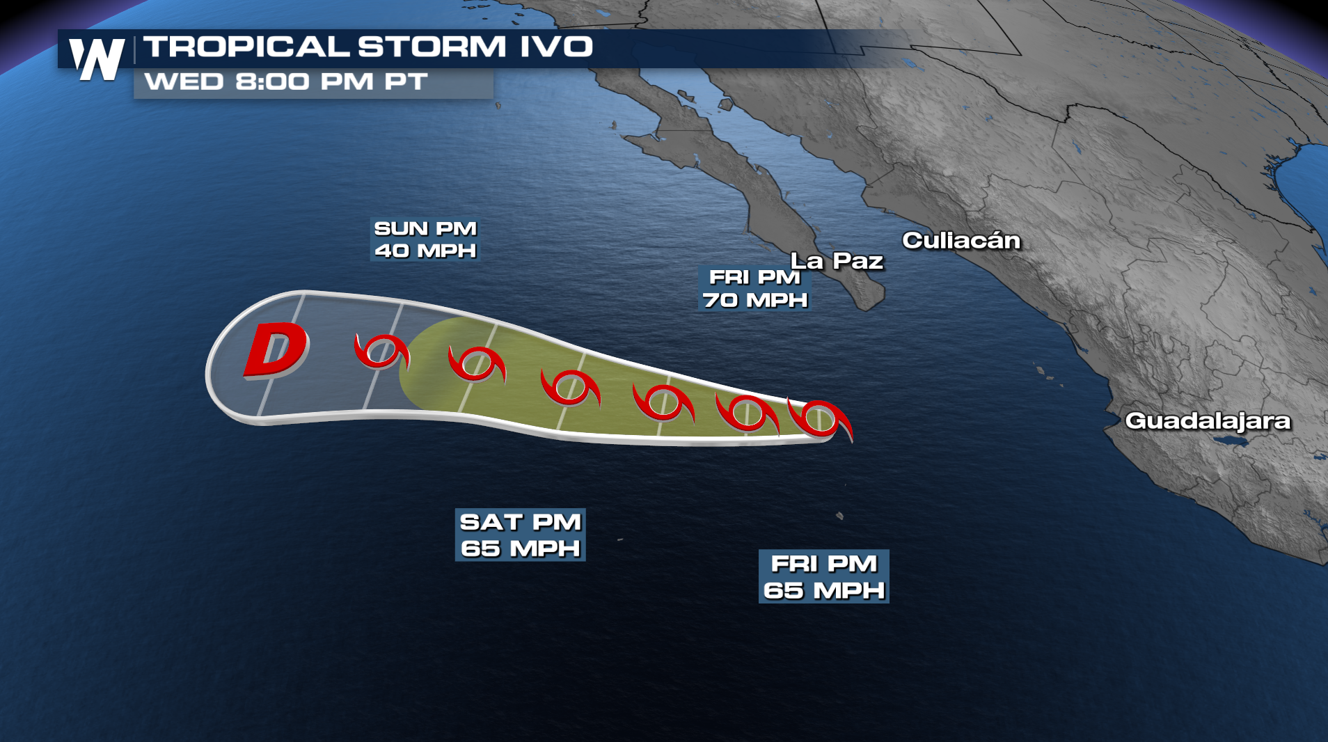
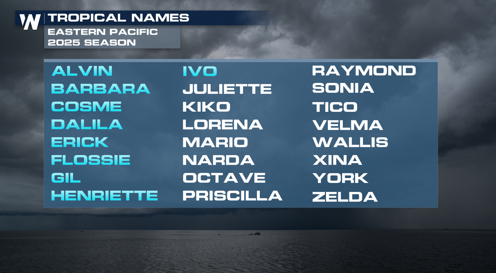
Now that we have Ivo, up next on the list in the Pacific will be Juliette.
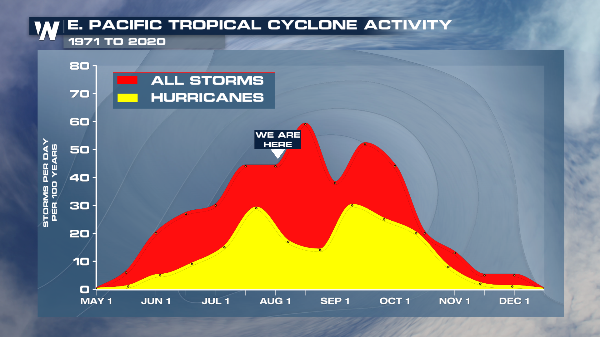
 We're far from the end of the Pacific Hurricane Season, with a secondary peak occurring later in September.