Record Heat Across the Central U.S.

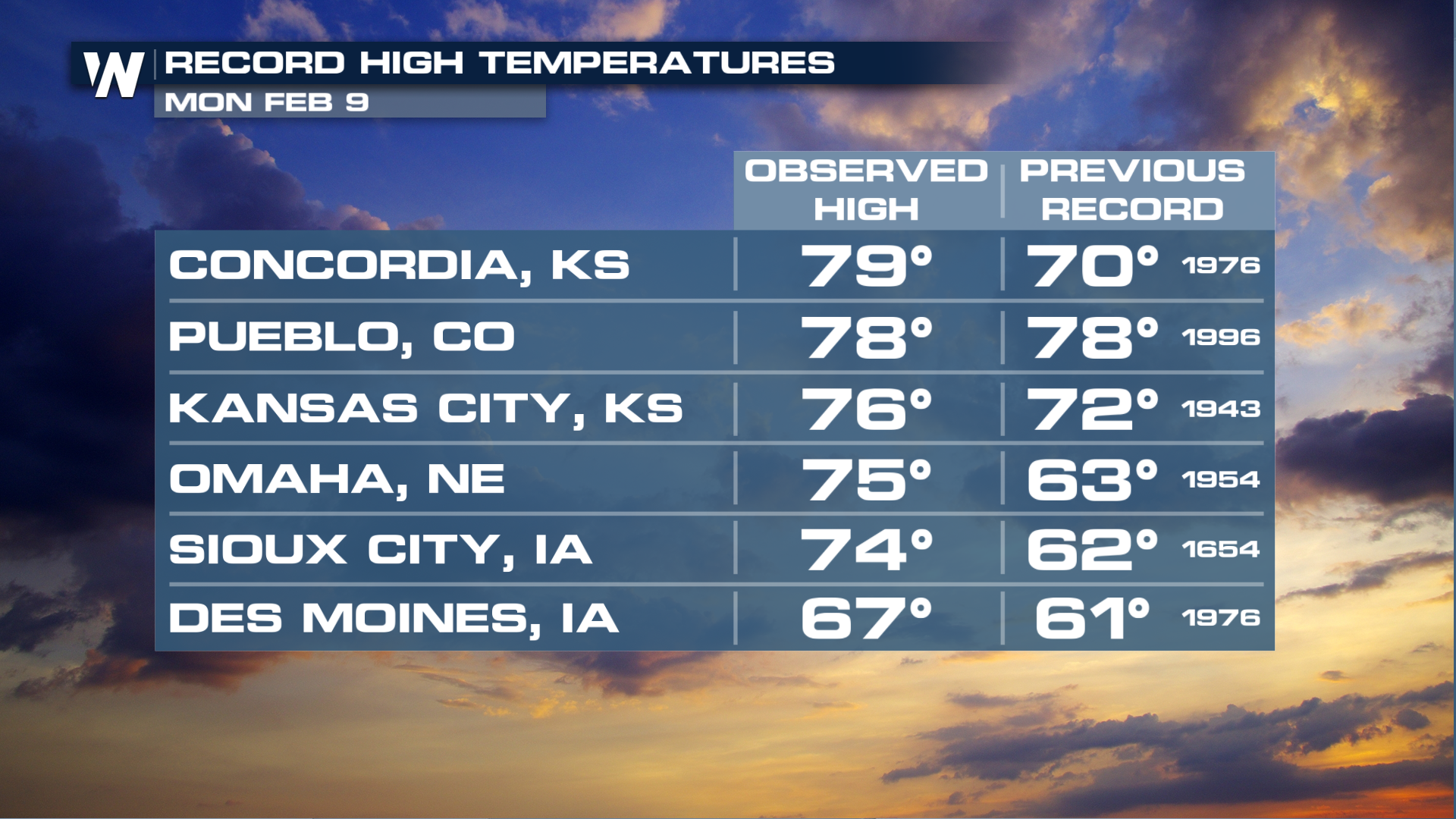
It was a hot day on Monday, February 9th in the Central Plains with many locations breaking record high temperatures for this date in time. Some of these locations include spots like Sioux City, Iowa, which not only broke a daily record high, but they also had their warmest temperatures this early in the year.
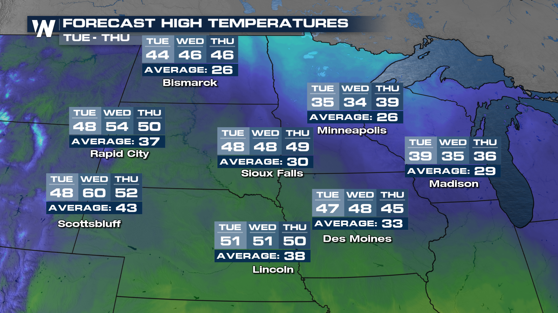
Temperatures are expected to drop on Tuesday but they'll still be above-average across the northern Plains.
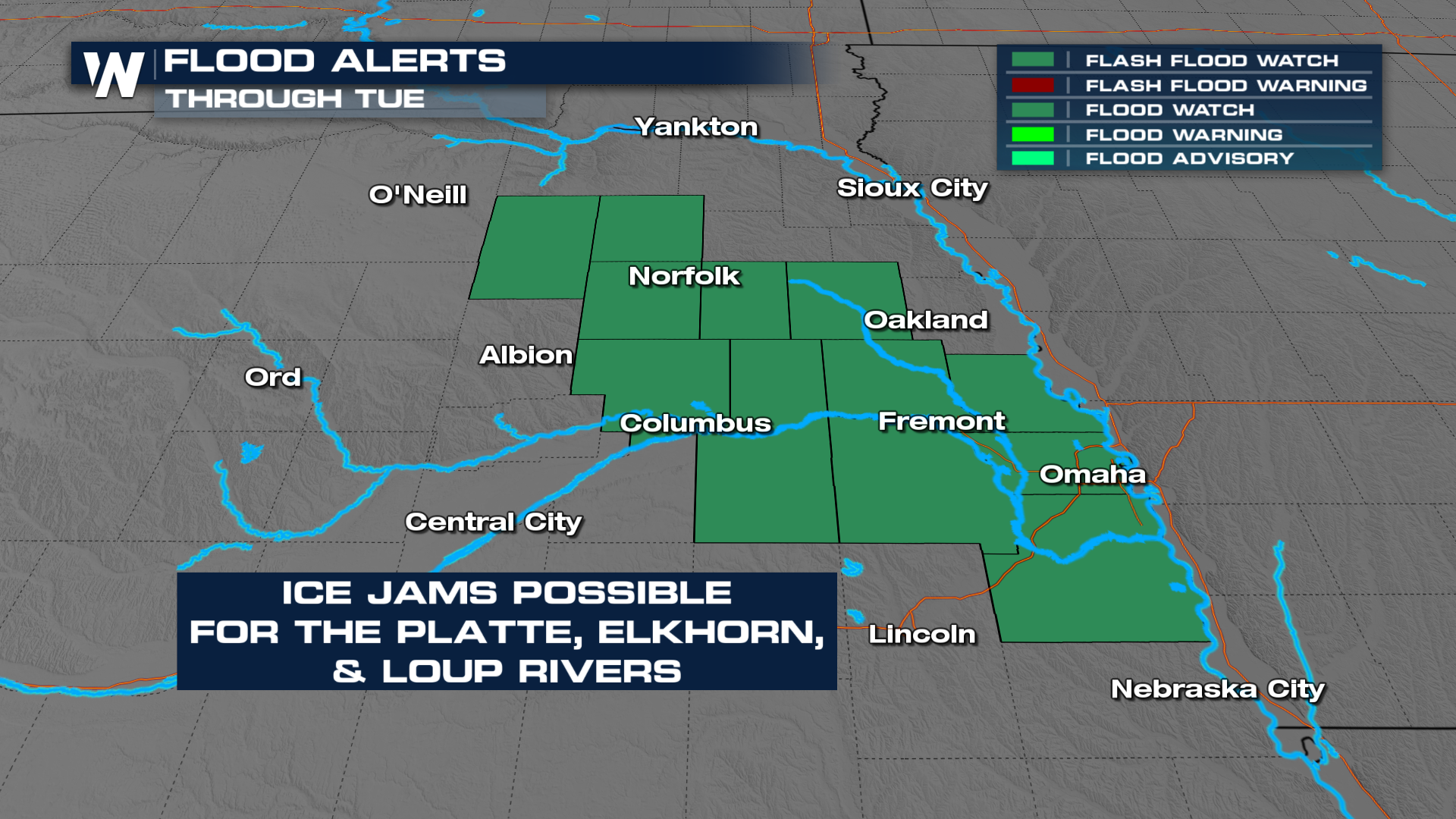
The warming temperatures will mean impacts from melting snow and ice, particularly where ice jams become a hazard. A flood watch remains in effect for eastern Nebraska for ice jam flood potential.
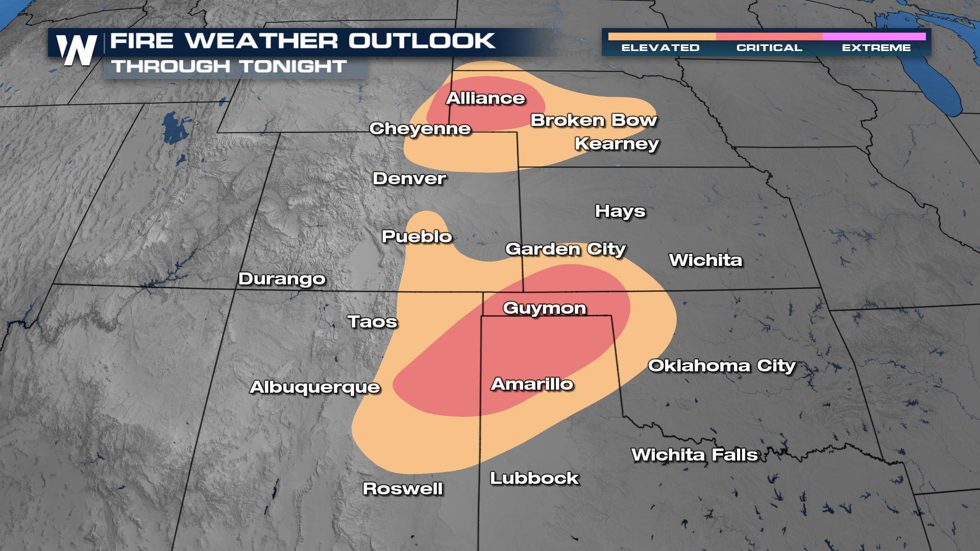
 Another side-effect of the warmer weather is wildfire concerns. As winds kick up to 20-30 mph, areas of eastern New Mexico and the panhandles of Oklahoma and Texas need to be mindful of grass fire ignitions. Anything that gets going could spread quickly, as dry as this area has been recently. The Storm Prediction Center is highlighting these areas with CRITICAL fire weather conditions overnight.
For the latest forecast in your region, head to the WeatherNation app to watch anytime, or tune in at :10, :30, and :50 past the hour from east to west!


