Blizzard Warnings Expire Tonight
Top Stories
15 Jan 2021 8:00 AM
A strong storm system is bringing widespread precipitation to the North Central states and the Upper Midwest. Here is the very latest.
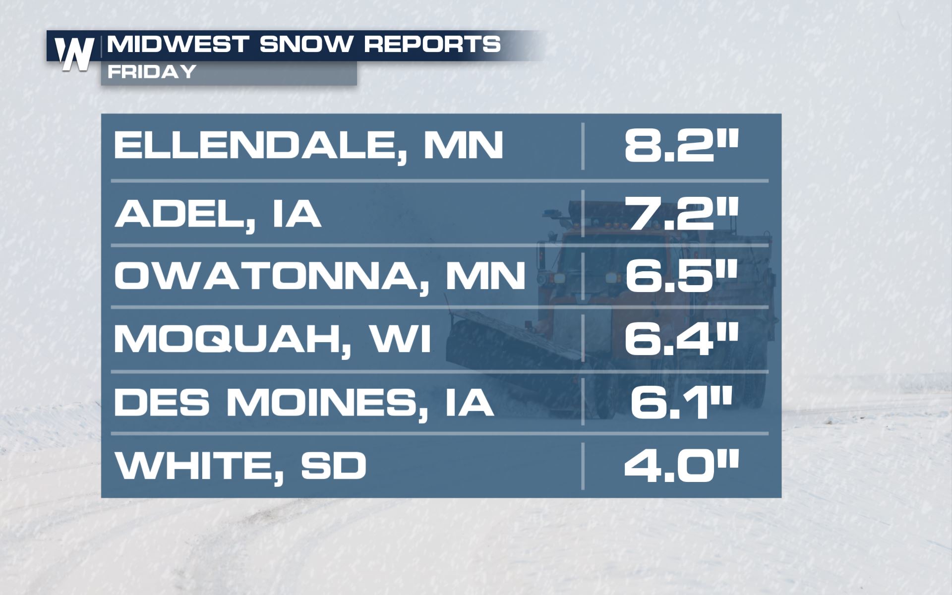
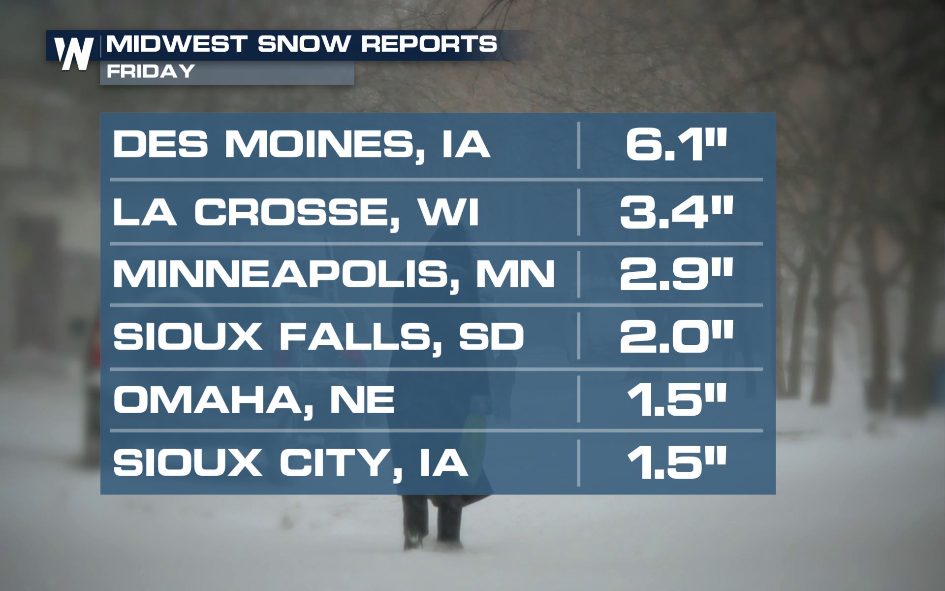 Snowfall totals have been in the 2" to 6" range across most of the region, with the heaviest amounts so far in southern Minnesota and northern Iowa.
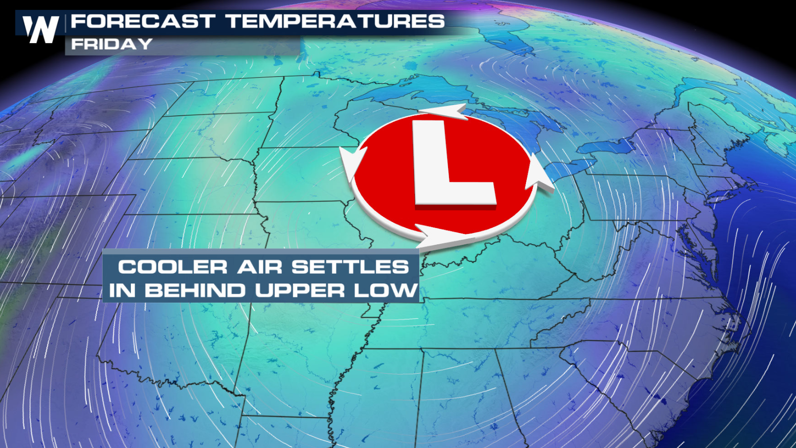
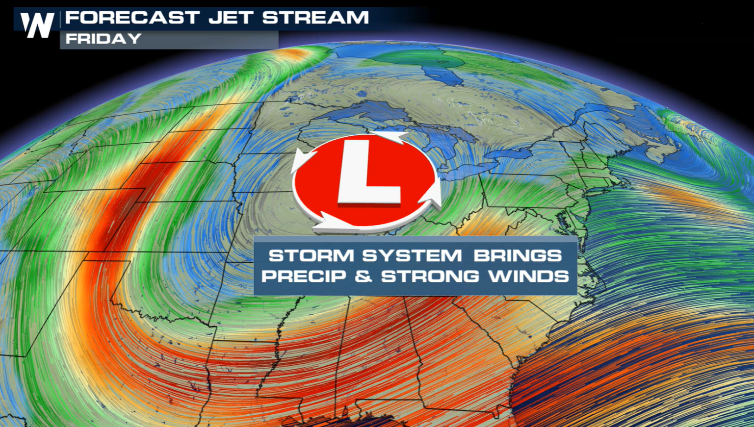 The upper-level trough has been digging out of southern Canada. At the surface, a cold front will help to trigger some scattered rain showers. As the cold air settles into the region as the system moves east, precipitation will transition to snow.
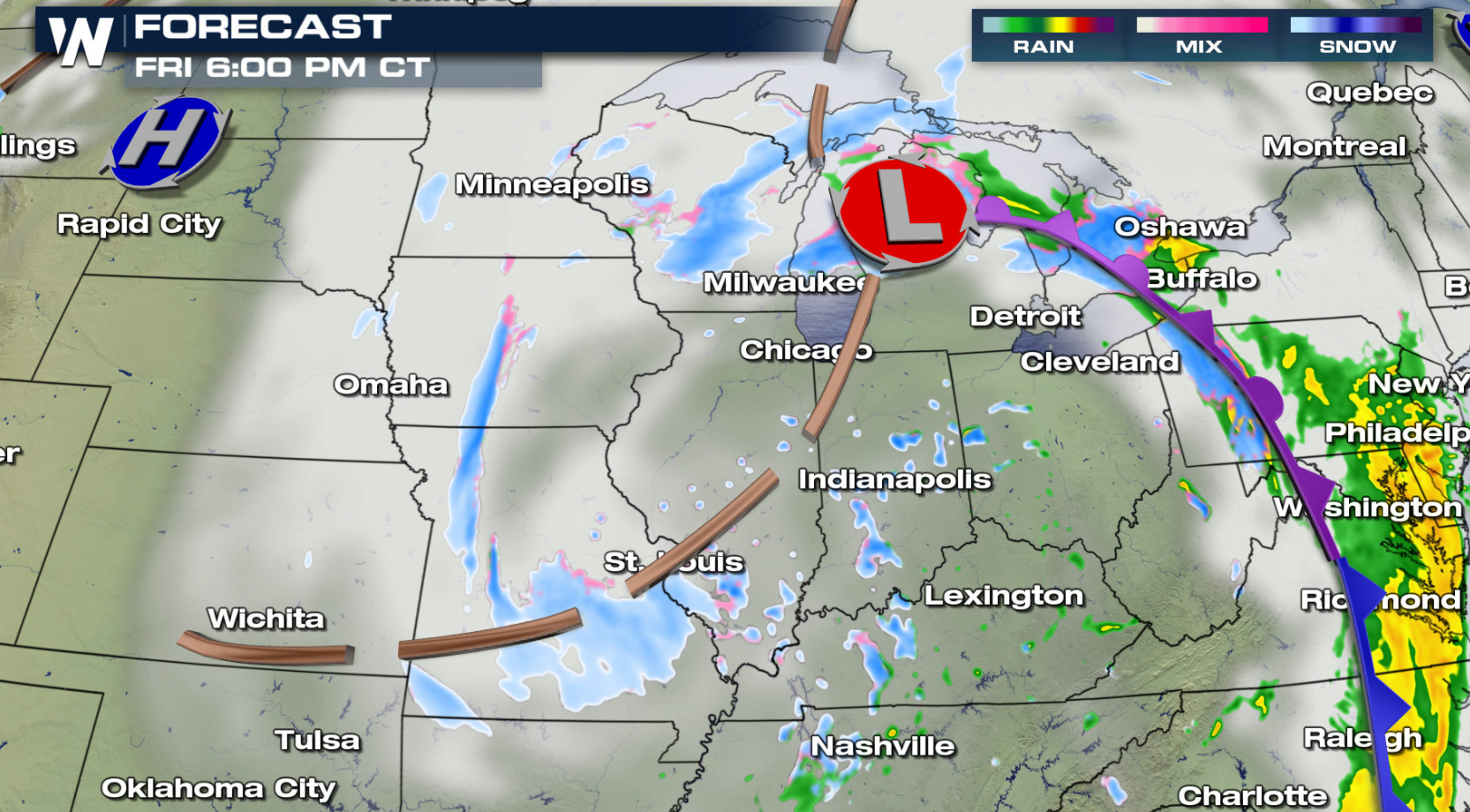
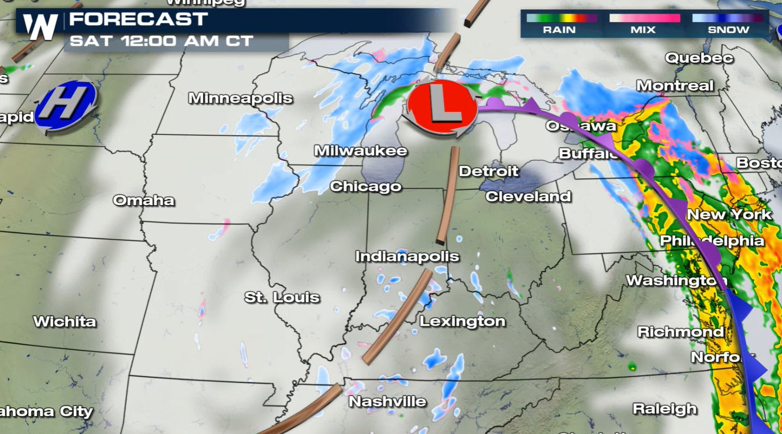 Here is a look at the forecast as the cold air catches up to change any areas of rain to snow. As the low intensifies, the wind will increase further with gusts to near 40 mph. . A secondary wave of energy wraps around the main low, providing more moisture and energy for additional snow into this evening (Friday evening).
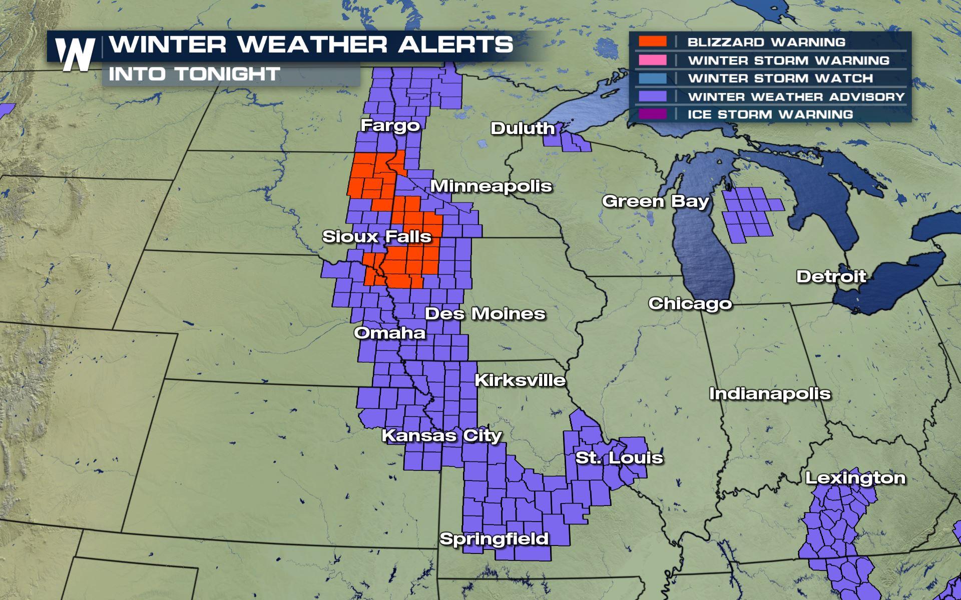
 Winter alerts have been issued across most of the Upper Midwest, including Blizzard Warnings. A few inches of snow along with wind gusts over 40 mph will create white-out conditions and dangerous travel.
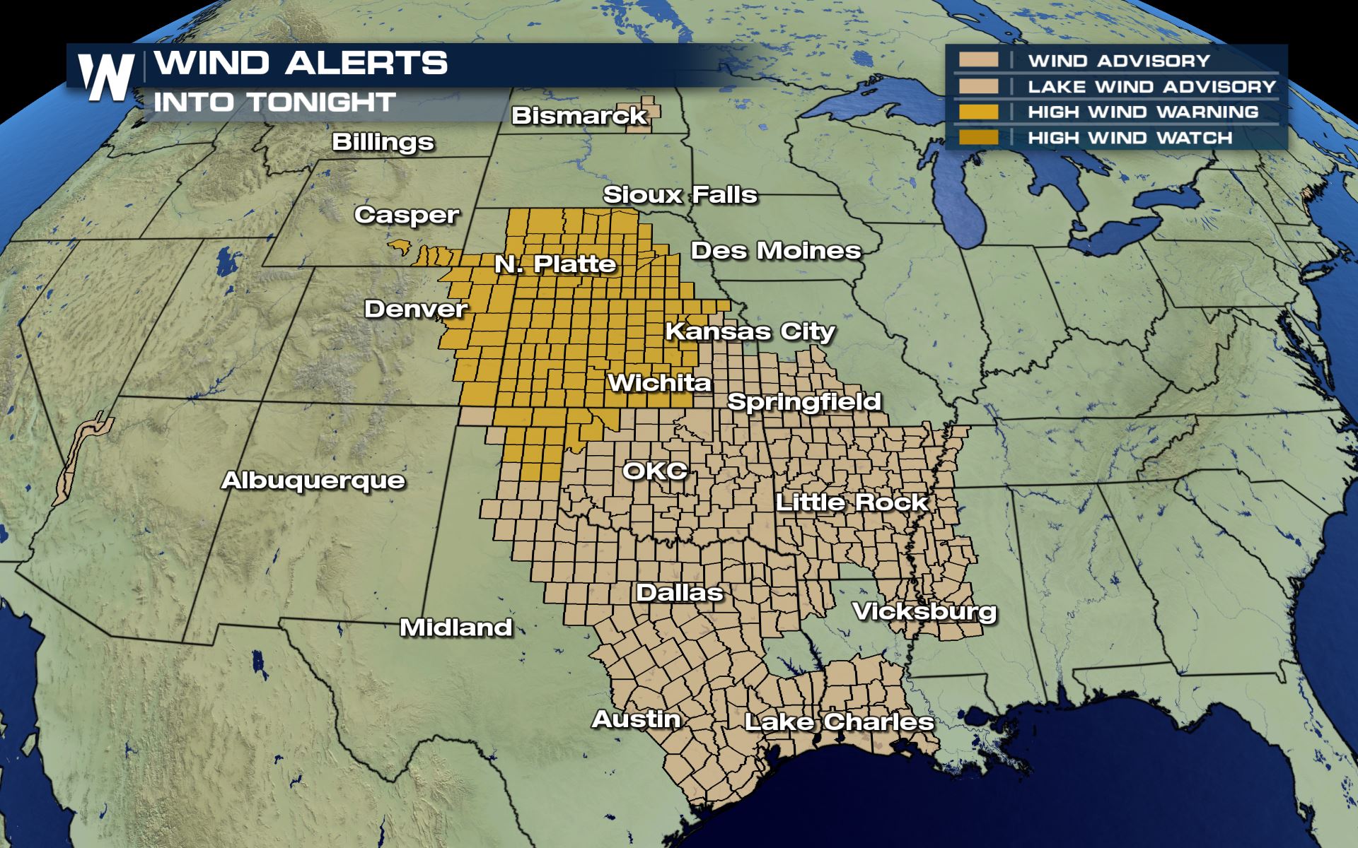
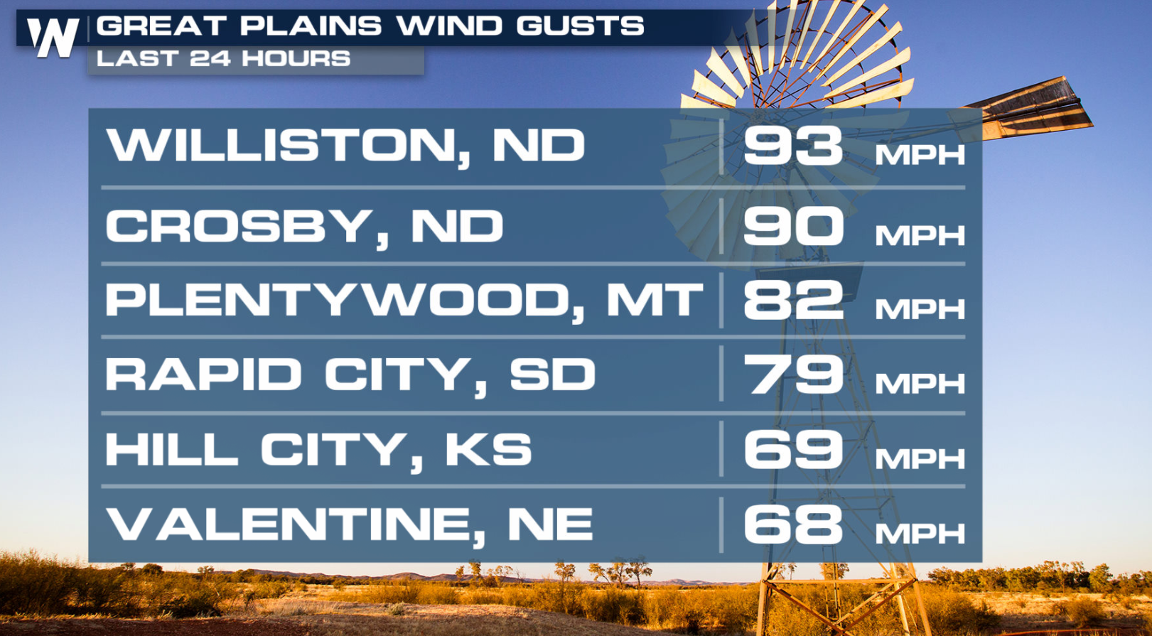 Strong wind gusts and areas of snow will create travel issues later this week. Wind alerts have been issued for gusts higher than 50-75 mph.
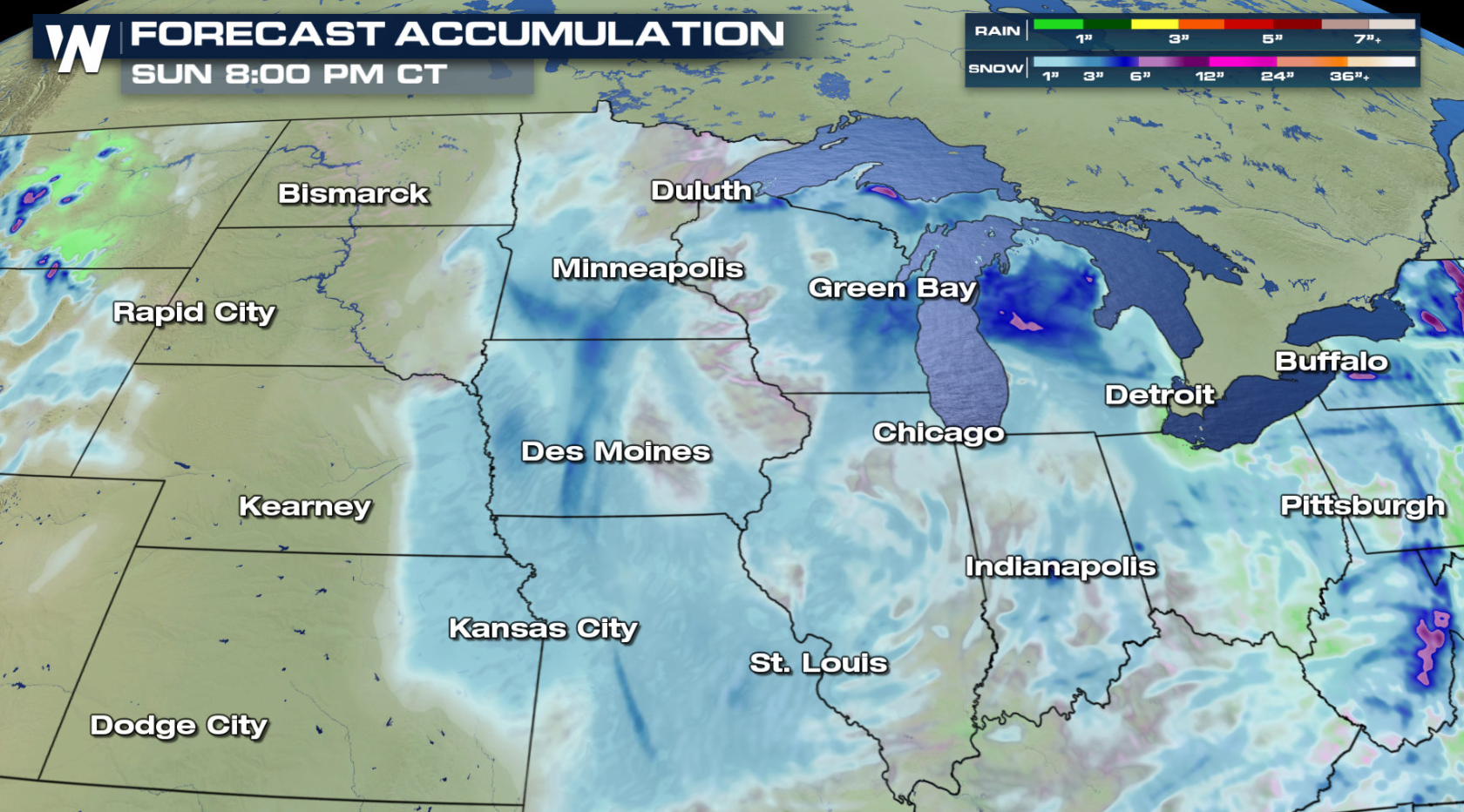 Additional snowfall amounts look to be in the 1" to 3" range.
Keep checking with WeatherNation for more updates on the snowy weather on the way to the northern U.S..
Additional snowfall amounts look to be in the 1" to 3" range.
Keep checking with WeatherNation for more updates on the snowy weather on the way to the northern U.S..
Accumulations So Far
Snowfall totals have been in the 2" to 6" range across most of the region, with the heaviest amounts so far in southern Minnesota and northern Iowa.
Set-Up
The upper-level trough has been digging out of southern Canada. At the surface, a cold front will help to trigger some scattered rain showers. As the cold air settles into the region as the system moves east, precipitation will transition to snow.
Forecast
Here is a look at the forecast as the cold air catches up to change any areas of rain to snow. As the low intensifies, the wind will increase further with gusts to near 40 mph. . A secondary wave of energy wraps around the main low, providing more moisture and energy for additional snow into this evening (Friday evening).
Alerts
Winter alerts have been issued across most of the Upper Midwest, including Blizzard Warnings. A few inches of snow along with wind gusts over 40 mph will create white-out conditions and dangerous travel.
Strong wind gusts and areas of snow will create travel issues later this week. Wind alerts have been issued for gusts higher than 50-75 mph.
Snowfall Forecast
Additional snowfall amounts look to be in the 1" to 3" range.
Keep checking with WeatherNation for more updates on the snowy weather on the way to the northern U.S..All Weather News
More

Severe Storms Target the Midwest to the Northeast This Week
Extreme heat will be a big story this week ac
27 Jul 2026 1:50 AM


Tropics: Fausto Heads to Hawaii; Genevieve Rapidly Intensifying
Atlantic BasinBertha has dissipated after mov
27 Jul 2026 1:40 AM

Southeast Flood Risk Lingers Near Stalled Front
A stalled boundary over the Southeast will ke
25 Jul 2026 10:55 AM

Another Round of Storms Targets the Northeast
Tuesday brought severe weather again across p
23 Jul 2026 1:15 AM

Another Round of Severe Weather for the Upper Midwest and Great Lakes
The upper-level low train continues to keep t
21 Jul 2026 1:45 AM