Strong Winds, Temperature Changes, and Severe Storms

Top Stories
29 Oct 2025 10:00 PM
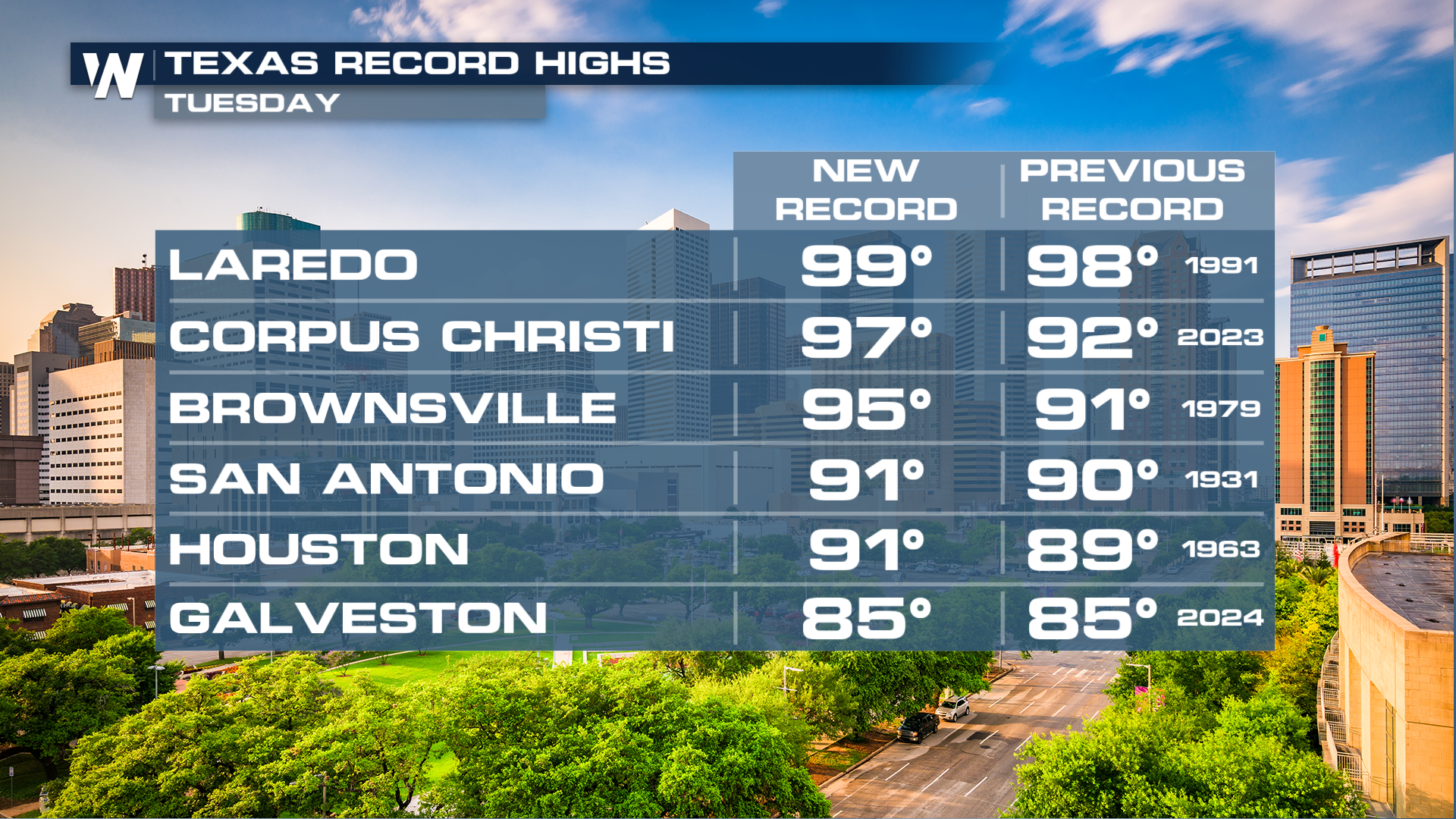
Monday in Texas brought us record-breaking heat, and Tuesday, more records could fall.
Wind alerts have been issued through tonight across the central U.S. Gusts up to 50 mph.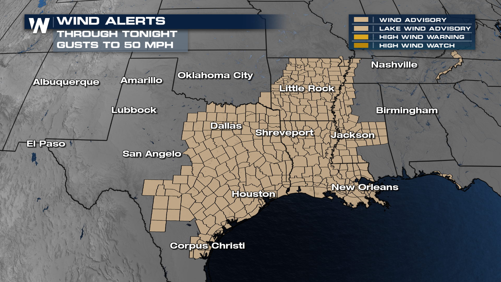 Here's a look at some of the forecasted wind gusts across the Plains and into the Gulf Coast.
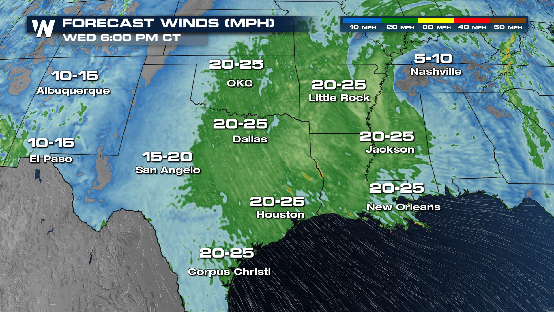
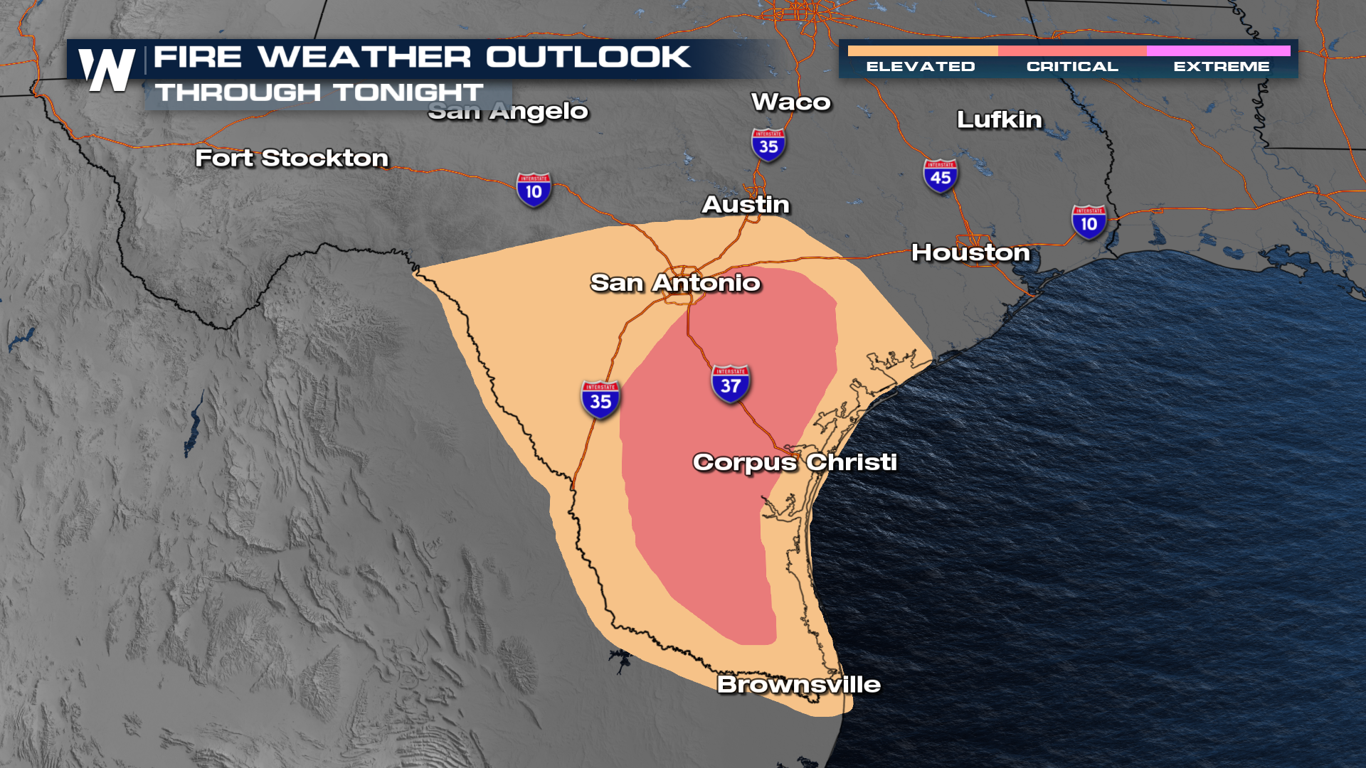
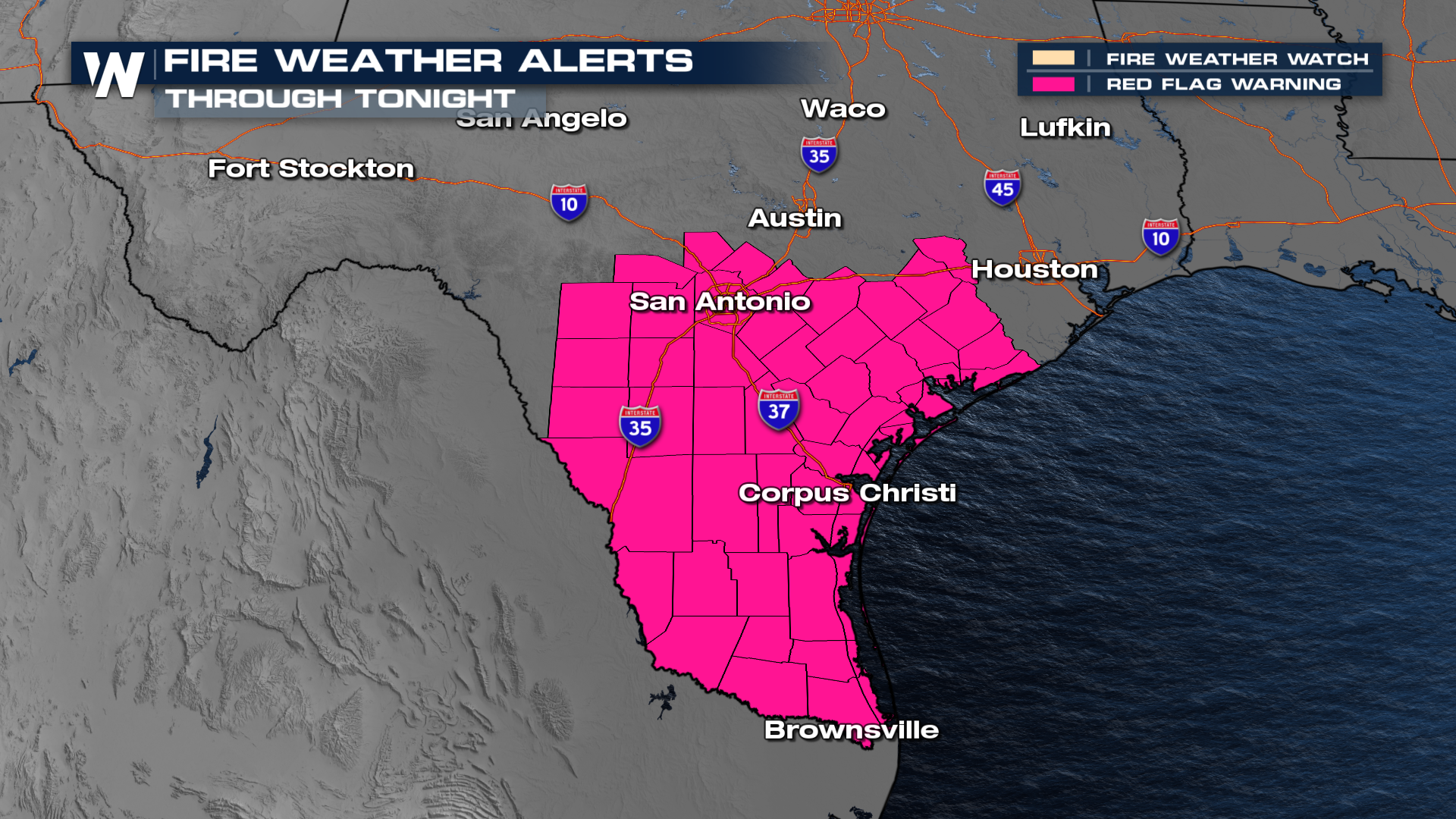
With strong winds, ongoing drought, and low relative humidity, there is critical fire danger across south Texas. There is also a red flag warning for these regions too. So be sure to avoid outdoor burning.
 Check in on this region during :30 past the hours.
All Weather News
More

Severe Storms, Flash Flooding Overnight In Midwest
WHAT TO EXPECTIt was a very active day across
22 Jun 2026 1:50 AM


Summer Solstice Kicks Off Father's Day Sunday
Fathers across the country will have to share
21 Jun 2026 5:20 PM

Flood Risk Continues This Weekend for the Gulf Coast States
Numerous flash flood warnings were issued as
21 Jun 2026 1:15 PM

Dry T-Storms & Fire Danger in the West
A weak low-pressure system moving through the
20 Jun 2026 1:40 PM

Tornadoes Tear Through The Midwest, Isolated Severe Storms in the South
EARLIER THIS WEEKMONTROSE, IL - A dangerous t
20 Jun 2026 1:30 AM