Nolo Moving West; Flooding Still Possible on Kauai

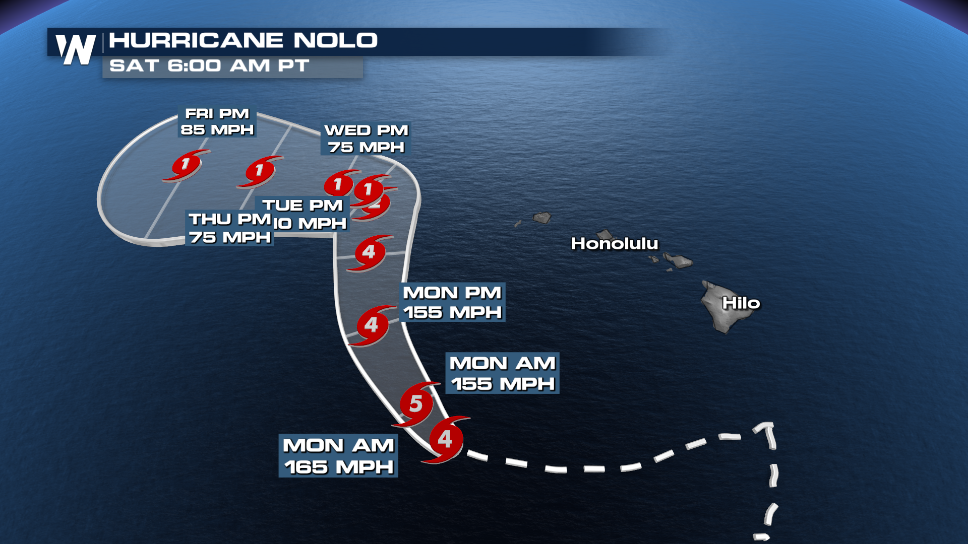
Hurricane Nolo spared the Hawaiian Islands from another direct impact this season, instead stalling about 150 miles south of the Big Island before heading west. Heavy rain and wind still impacted the islands, and will continue through the middle of the week as Nolo swings past Kauai. Field correspondent Jonathan Petramala was on the Big Island to bring us those impacts over the weekend.
Forecast / Impacts
Nolo's impacts, including flooding, are not done with yet for the Hawaiian Islands. As Nolo heads north through the midweek, heavy rain on it's eastern side will hit the western Hawaiian Islands. 3-5 inches of rain could fall on Kauai, bringing flooding to the region. Kauai sustained a lot of damage just a few weeks back as Hurricane Lowell passed the island barely to the west.
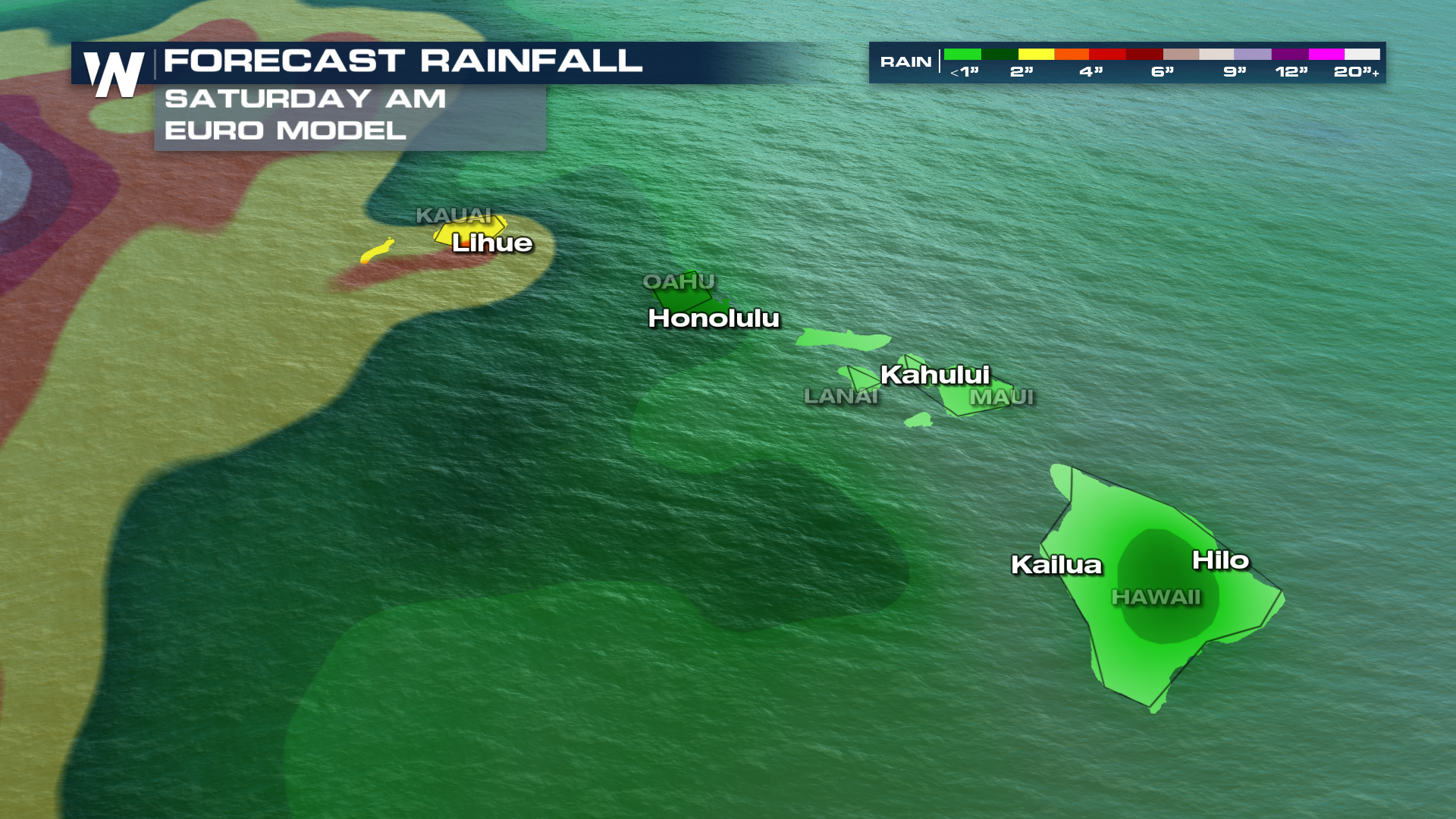
Nolo looks to stall for a day as it then slowly heads farther west, keeping some rain and wind impacts around through at least Thursday.
Wind / Waves
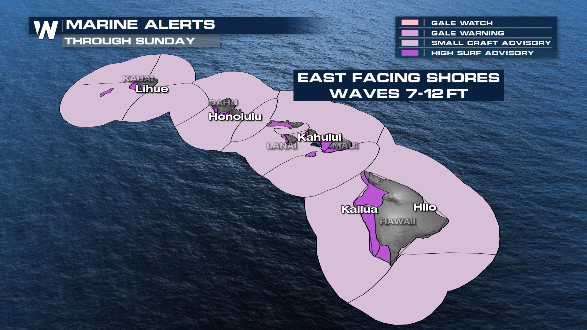
As Nolo tracks west, wave heights will still be on the high side, bringing hazards to boaters and beach goers. Southward-facing beaches can see increased swell and surf over the next few days.
 Stay with us on WeatherNation for the latest updates.


