Severe Threat Continues In The Southeast

Top Stories
22 Sep 2026 1:20 PM
WHAT TO EXPECT
Severe storms developed Monday afternoon and evening as a surface cold front combined with instability. More storms will redevelop along this boundary this afternoon, capable of damaging winds and some small hail again.
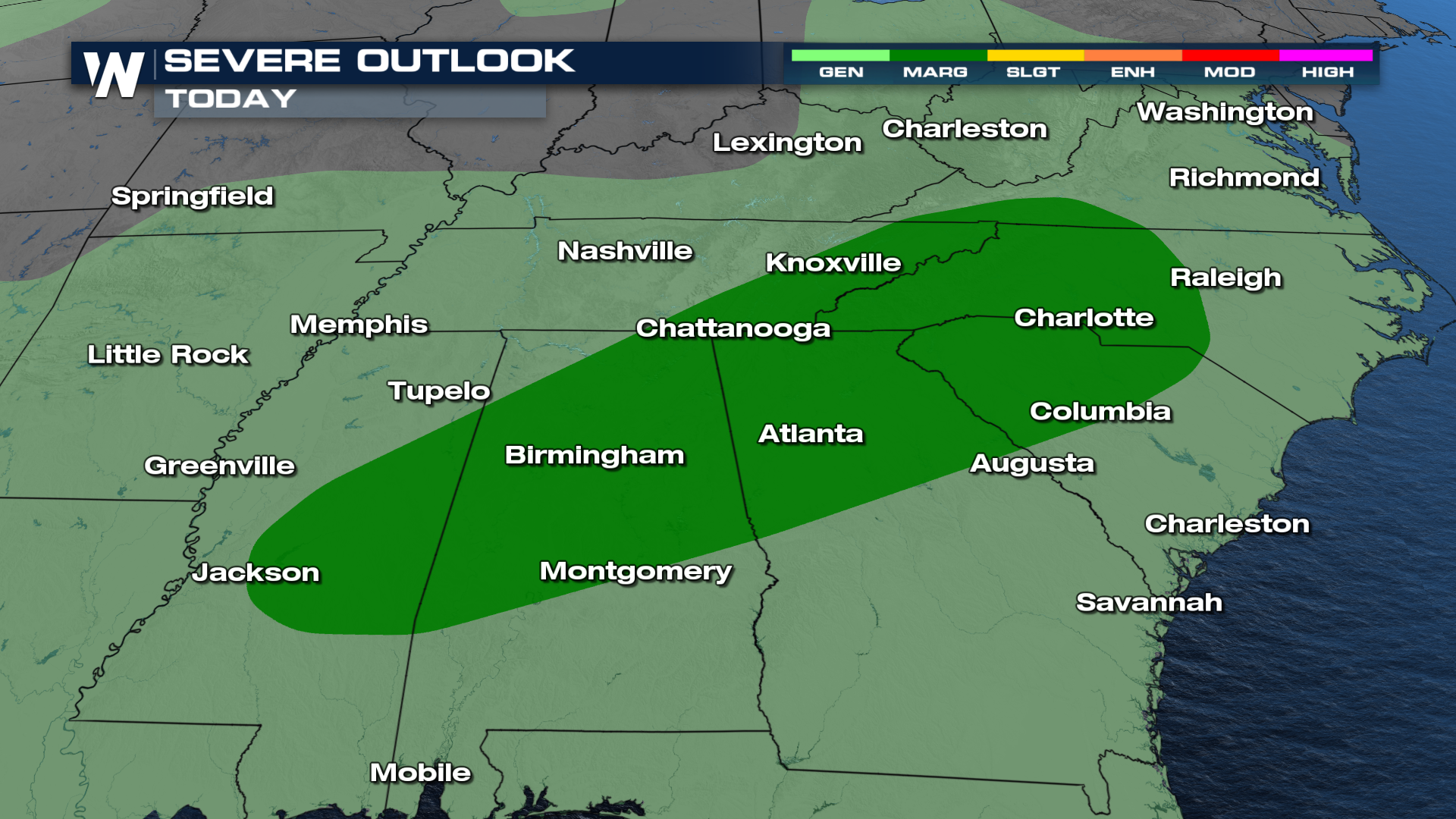
TIMING
As a front continues to linger more storms will continue. Things will taper off overnight, but more storms will pick up again on Wednesday afternoon.
Raleigh will potentially see some of the heaviest rainfall, with multiple inches possible. That could add a flooding concern onto a damaging wind threat today.
All Weather News
More
Warmer Than Average: Above-Normal Temperatures Across the Central U.S. This Week
WHAT TO EXPECTA ridge of high pressure will b
21 Oct 2026 12:50 AM


Severe Weather & Heavy Rainfall Aims for the West This Week
Looking ahead to this week, a low-pressure sy
21 Oct 2026 12:40 AM

Nor'Easter Riles up the Waves This Week
SETUPAn upper-level low broke off from the fl
21 Oct 2026 12:25 AM

Several Fires Break Out in SoCal Last Week Amid Santa Ana Wind Event
Santa Ana winds helped several fires grow qui
19 Oct 2026 1:25 PM

Another Cold Morning Before Things Warm Back Up
Across portions of the Ohio Valley through th
19 Oct 2026 10:15 AM

Severe Risk Diminishing Saturday Morning for the Northeast
Severe Storm PotentialSevere risk is decreasi
16 Oct 2026 10:20 AM