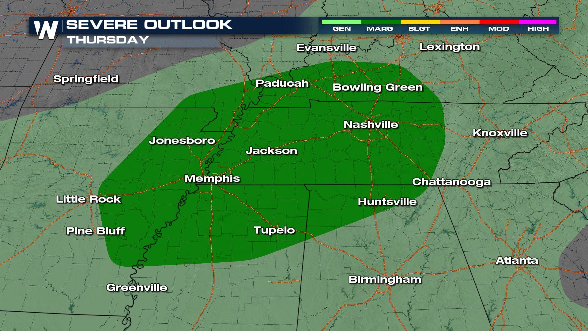
Severe Storms for the Tennessee River Valley Today
Top Stories
18 Aug 2021 4:55 AM
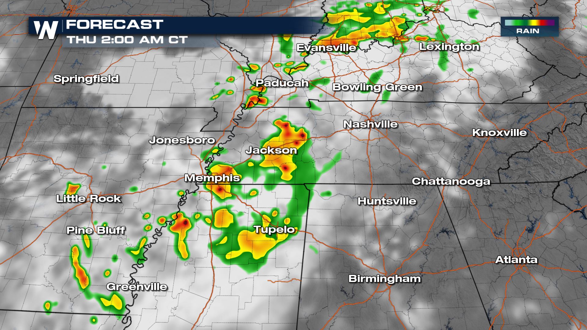
Storms are developing today across the Tennessee River Valley and mid-Mississippi River Valley. Some storms will reach severe criteria, with 1" hail and 58+ mph gusts possible.
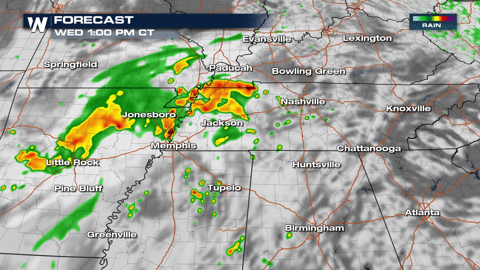
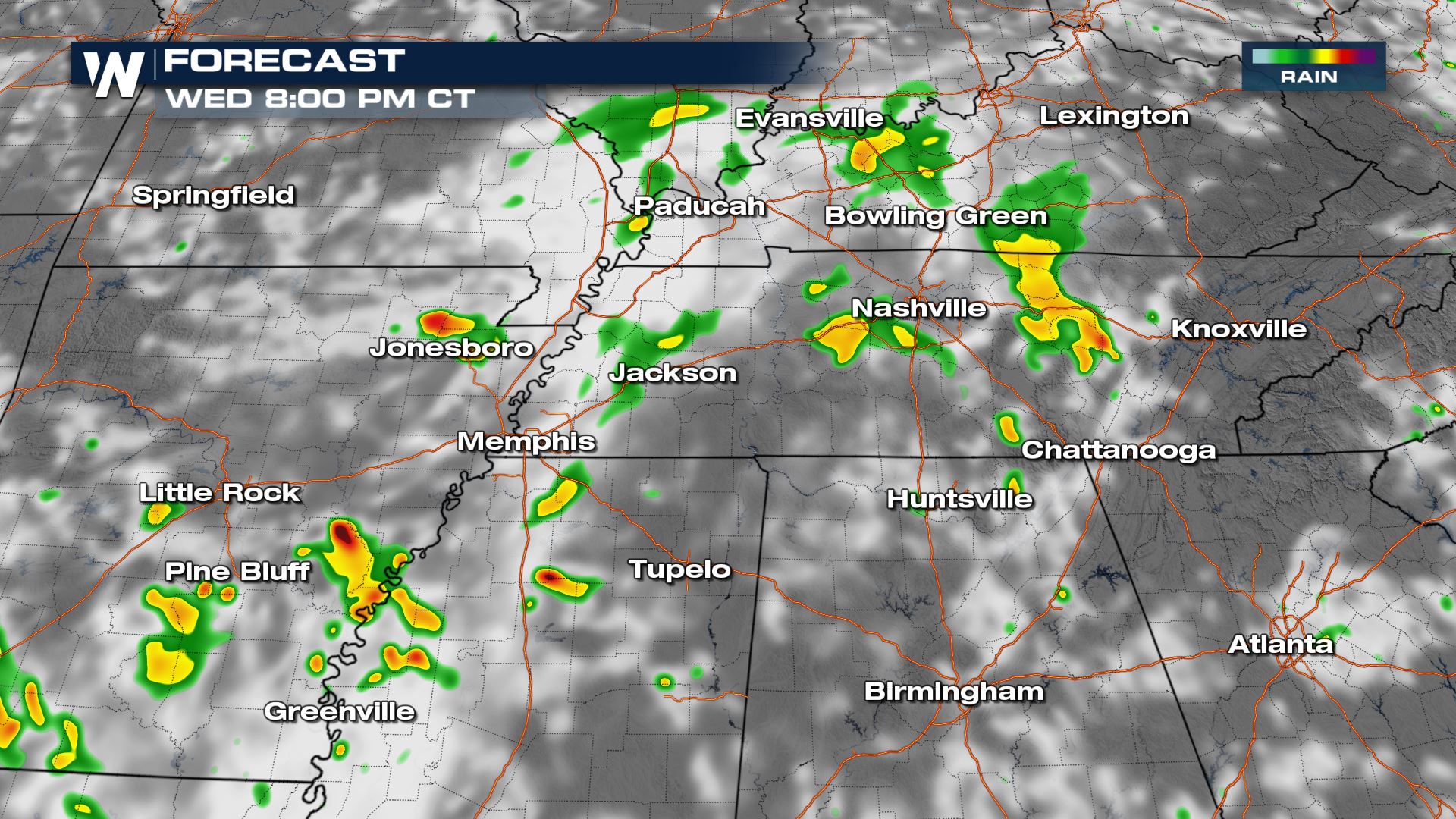
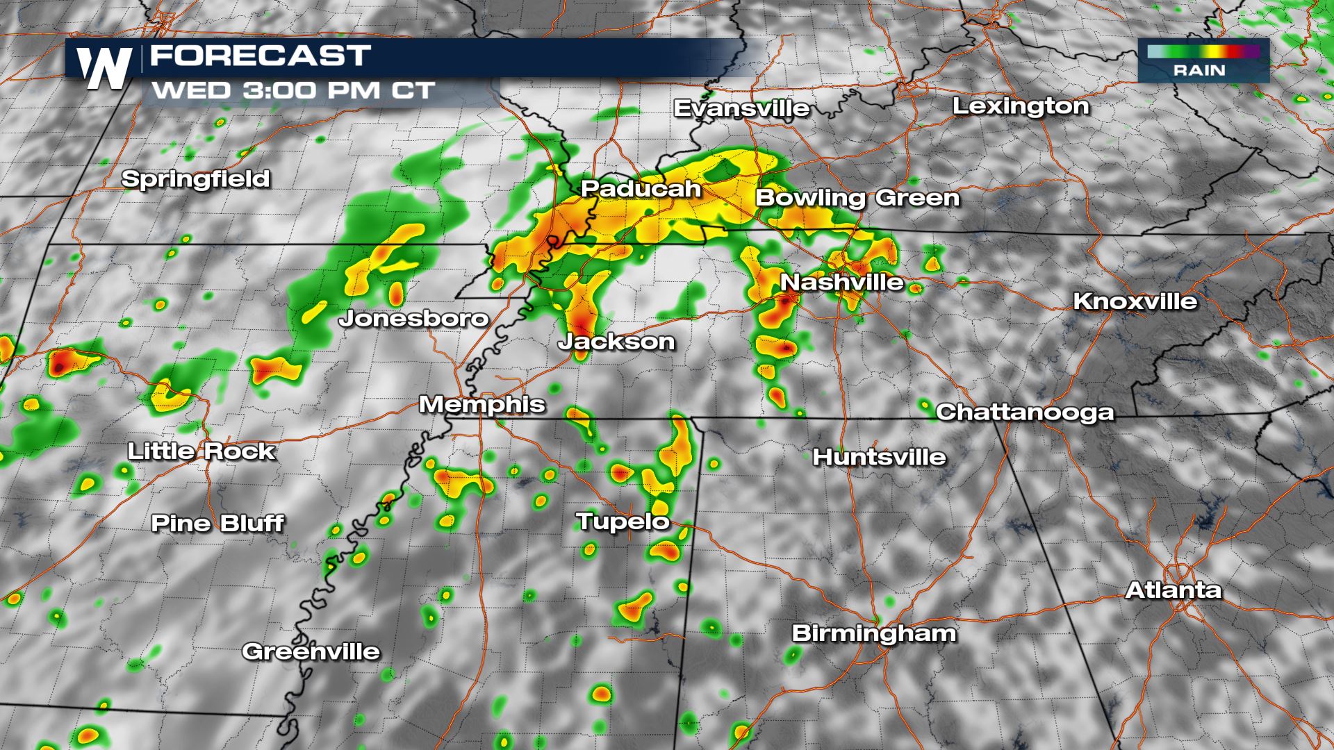 Storms will continue into the first part of the evening hours with a few storms surviving into the overnight, but our severe weather potential will diminish after dark.
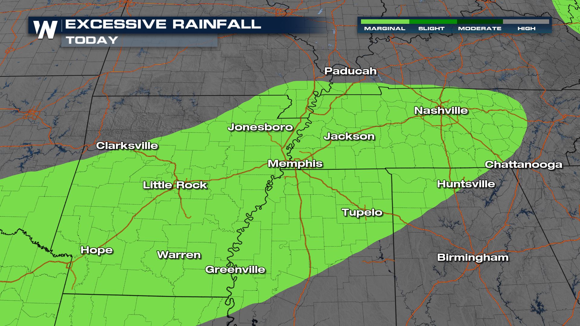
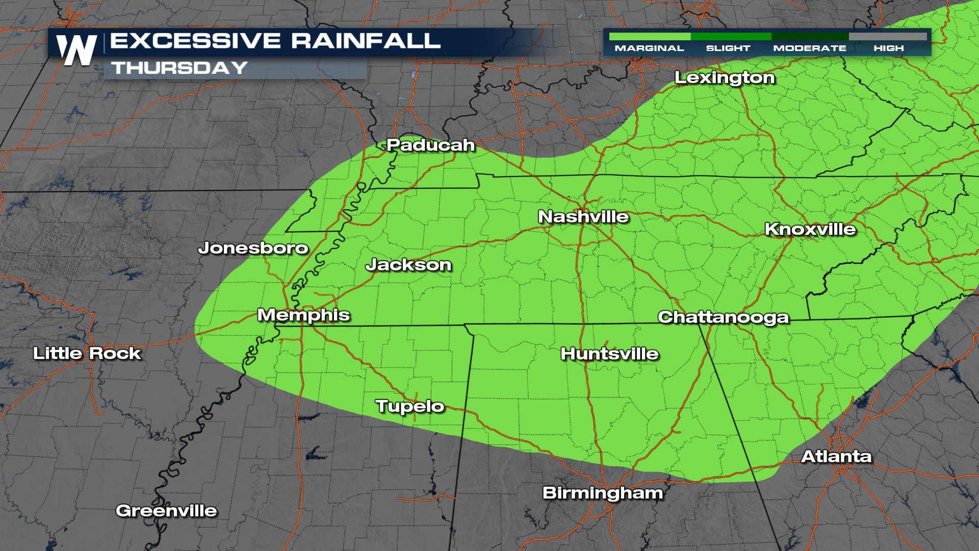
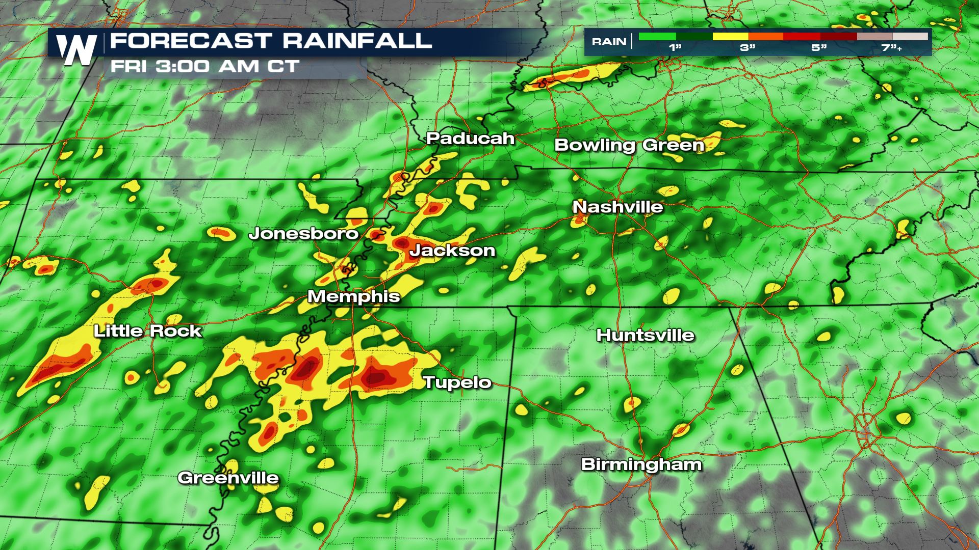 We have the potential for flooding across the mid-Mississippi river valley through the end of the week. The compiled days of heavy rain will amplify our flooding concern.
 For more on the heavy rain and flood potential, join WeatherNation :10 after the hour for your eastern regional forecast.
Forecast
We are anticipating a few strong and severe thunderstorms through the afternoon and evening. Heavy rain will be our primary threat with any thunderstorm, but we could also have a few pockets of gusty winds and small hail.
Storms will continue into the first part of the evening hours with a few storms surviving into the overnight, but our severe weather potential will diminish after dark.
Rainfall
We have the potential for 2-4" of rain across west Tennessee and the mid-Mississippi River Valley through the end of the week. Watch out around rivers and creeks, along with low-lying areas for ponding and flooding.
We have the potential for flooding across the mid-Mississippi river valley through the end of the week. The compiled days of heavy rain will amplify our flooding concern.
For more on the heavy rain and flood potential, join WeatherNation :10 after the hour for your eastern regional forecast.All Weather News
More
Gulf Coast Faces Flood Risk from Potential Tropical Cyclone One
TEXAS - Heavy rain has already led to issues
17 Jun 2026 2:05 AM


PTC ONE: First Forecast Cone of the Atlantic Basin
Potential Tropical Cyclone OneThe National Hu
17 Jun 2026 1:40 AM

Heat Alerts & Fire Concerns For Central & West U.S.
A ridge of high pressure continues to dominat
17 Jun 2026 1:25 AM

Welcome To Monsoon Season - Here's What to Expect
WELCOME TO THE NORTH AMERICAN MONSOON SEASON.
15 Jun 2026 8:00 PM

El Niño Forms, Very Strong El Niño Likely Late 2026
El Niño has arrived! It didn't take long for
15 Jun 2026 8:00 AM

Confirmed Tornadoes in Ohio and Pennsylvania on Sunday
A cold front on Sunday brought severe weather
15 Jun 2026 1:50 AM